Eifel Aqueduct: Roman Water Supply to Cologne


Site at a Glance
- Rating
- 4.3
- Popularity
- Very Low
- Country
- Germany
- Primary era
- Classical
- External website
- Open
- Eras represented
- Classical
- Civilizations
- Roman
- Site type
- Infrastructure
- Remains
- Aqueduct
On this page15 sections
History
The Eifel Aqueduct is a Roman water-supply conduit in Germany, built around AD 80 to carry spring water to Colonia Claudia Ara Agrippinensium, the Roman city that developed into modern Cologne. It replaced an earlier supply from the Ville region, whose springs and streams no longer provided enough water of suitable quality and sometimes dried during summer. The aqueduct operated for about 180 years and became an exceptionally important archaeological and technical monument for understanding Roman surveying, engineering, construction organization, and infrastructure.
Roman construction and operation
The earlier water system probably developed in several sections around AD 30, before the settlement of the Ubii became a Roman colonia, a formally established Roman colonial settlement often populated partly by Roman citizens. The Eifel Aqueduct created a more dependable supply from the Eifel and was later connected to additional suitable springs along its route.
No literary or inscriptional record names the builders. The Roman army is considered the likely construction force because it possessed the organization, labour, and materials required for a project of this scale. Sextus Iulius Frontinus, a military commander and governor of the frontier district at the time, has been associated with the work, but his direct responsibility remains unproven. The aqueduct’s route, surveying, construction sections, and carefully controlled gradient reflect the planning expected of a large Roman infrastructure project.
Earthquakes damaged parts of the line during its period of use, and those sections were repaired. Around AD 260, Germanic forces destroyed the aqueduct during the first sack of Cologne. The conduit never returned to service. Cologne then relied again on the earlier supply that followed the route of the Duffesbach from Hermülheim.
Medieval reinterpretation and reuse
After the aqueduct ceased operating, knowledge of its purpose and construction methods gradually faded. It remained buried for roughly five centuries. Renewed building activity in the Rhine valley during the Carolingian period, the era of the Frankish ruling dynasty associated with Charlemagne and his successors, led to its dismantling for building material. Above-ground sections and much of the underground structure were quarried, and fragments were incorporated into medieval buildings, including the city wall of Rheinbach.
The hardened limestone deposits that formed inside the conduit were also reused. Cut and polished into a brown or reddish decorative stone called “Eifel marble,” the material was employed across the Rhineland and reached Paderborn, Hildesheim, Roskilde, and Dalby. It became part of columns, window surrounds, altars, gravestones, and other architectural elements.
Medieval tradition misunderstood the aqueduct as an underground passage between Trier and Cologne. A legend associated with Cologne Cathedral claimed that the Devil built the passage in a contest with the cathedral architect, whose death supposedly delayed the cathedral’s construction. Medieval writings, including the Gesta Treverorum and the Hymn to Saint Anno, also described the conduit incorrectly as a carrier of wine rather than water.
Archaeological investigation and protection
Archaeological investigation resumed in the nineteenth century. In 1867, C. A. Eick, a cartographer and Mechernich mining official, identified Grüner Pütz near Nettersheim as the aqueduct’s most distant source from Cologne.
Waldemar Haberey carried out systematic research from 1940 to 1970 and published a major study in 1971. From 1980, the archaeologist Klaus Grewe mapped the complete course onto the official German topographic map. His Atlas of the Roman Water Supplies to Cologne became a standard work in the study of Roman aqueducts.
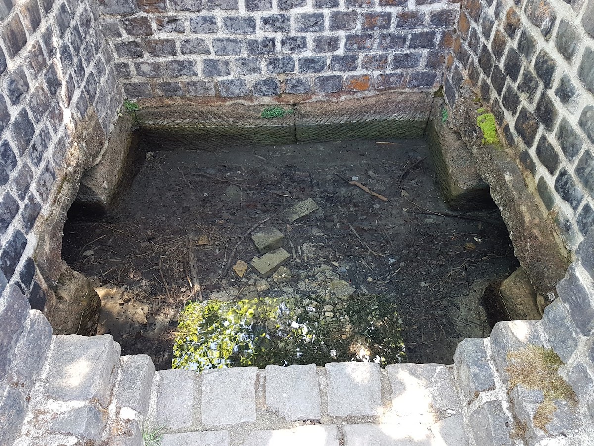
Modern archaeological reconstruction and protection have preserved selected remains. The spring chamber at Klausbrunnen was reconstructed after excavation and enclosed within a protective structure, while the state protects the site. A partial reconstruction of the aqueduct bridge at Vussem has also helped communicate the form of the Roman structure. In 1938, workers seeking a drinking-water source for Mechernich discovered the feeder line at Hausener Benden. Its water was connected to the modern network, and excavation around the spring was avoided to protect it.
Remains
Route and underground conduit
The main line extended about 95.4 kilometres from the Eifel to Cologne, while feeder lines from additional springs brought the full system to roughly 130 kilometres. It began at Grüner Pütz in the Urft valley near Nettersheim, followed the Urft toward Kall, crossed the watershed between the Maas and Rhine drainage basins, and continued along the northern Eifel. From there it crossed the Erft near Kreuzweingarten and the Swist between Rheinbach and Meckenheim, passed through the uplands near Kottenforst and Buschhoven, and continued through Brühl and Hürth to Cologne.
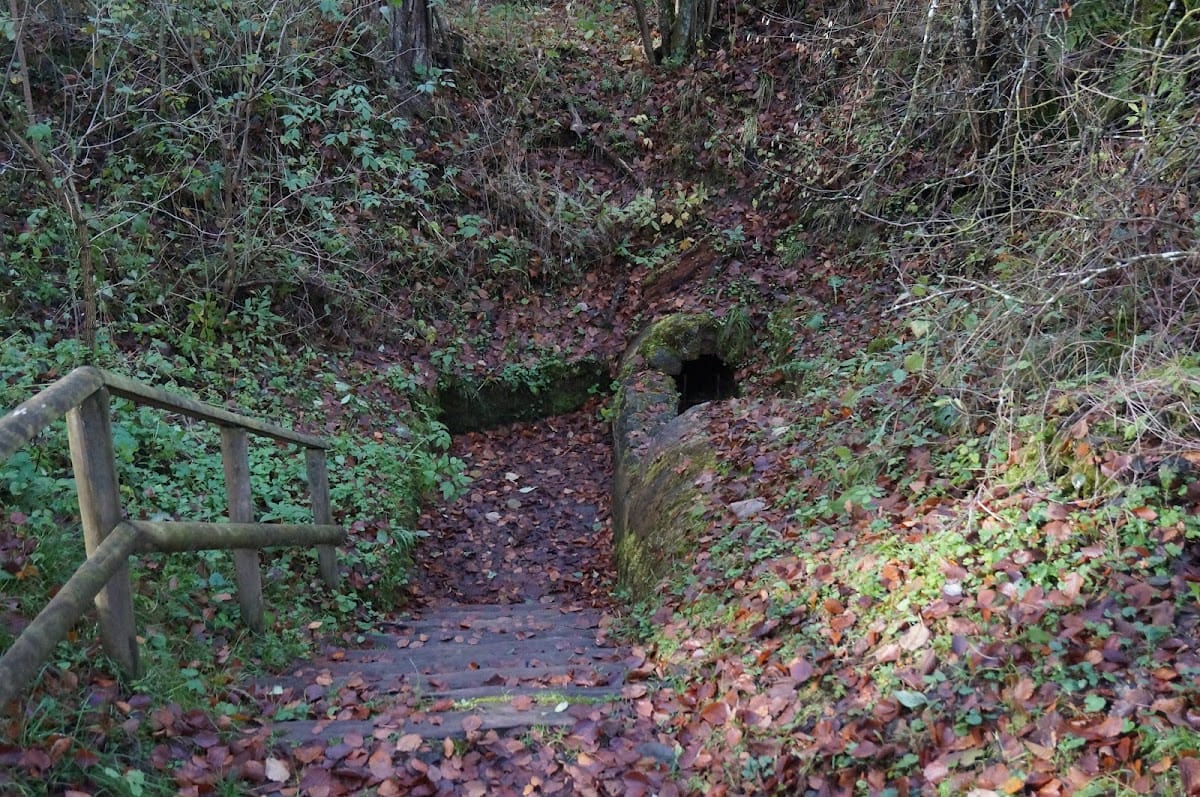
The line was designed as a gravity-fed conduit. At Kall, the terrain allowed it to cross the watershed without a tunnel, pump, or pressurized conduit. Its gradient remained approximately 0.1 percent, or about one metre of fall per kilometre. Most of the conduit lay about one metre below the surface, where the soil protected the water from freezing, physical damage, and deliberate destruction during wartime while helping maintain a moderate temperature.
A typical section consisted of a loose stone foundation, a U-shaped channel made from opus caementicium, Roman hydraulic concrete containing lime, aggregate, and water, or from masonry, and a protective arch of carefully cut stones set in abundant mortar. The inner channel was about 70 centimetres wide and one metre high, allowing maintenance workers to enter. Timber boards served as formwork for the channel and arch, and their grain impressions remain visible in the concrete.
The outer surface received plaster to keep dirty or infiltrating water away from the conduit. Drainage channels diverted groundwater and seepage in places, while small streams crossed above it through culverts. The inner surface was sealed with opus signinum, a waterproof Roman plaster made with lime and crushed brick. This coating hardened in contact with water and reduced leakage. During the initial filling of the conduit, small cracks and joints were sealed with wood ash.
Construction was divided into sections approximately 4,400 metres long, equivalent to 15,000 Roman feet. Boundaries between several sections have been identified, and archaeological study has shown that surveying was conducted separately from construction. Each metre required an estimated three to four cubic metres of excavation, 1.5 cubic metres of masonry and concrete, and about 2.2 square metres of sealing plaster. Total labour has been estimated at approximately 475,000 worker-days. Under an assumption of 180 workable days per year, about 2,500 workers would have needed at least 16 months, excluding surveying and the production and transport of materials.
After completion, the trenches were refilled and levelled. A maintenance road followed the route, giving inspectors access to the conduit and defining a protected strip where agriculture was prohibited. Inspection shafts allowed workers to descend into the channel. Other shafts marked repair locations and construction boundaries, while open basins allowed workers to monitor points where several spring branches joined. Small calming basins reduced the force of falling water where one section arrived too high for the next while preserving the overall gradient.
Spring areas and water deposits
Principal spring areas
Four principal spring areas supplied the system. They were Grüner Pütz near Nettersheim, Klausbrunnen near Mechernich-Kallmuth, the spring area at Mechernich-Urfey, and Hausener Benden near Mechernich-Eiserfey. Their spring chambers were adapted to local conditions and incorporated technical solutions that would meet modern requirements. The chamber at Klausbrunnen was reconstructed after excavation and protected by an enclosure.
Limestone deposits
Mineral deposits accumulated inside the channel during operation and formed a dense limestone-like layer. In some sections, these deposits reached approximately 20 to 30 centimetres thick. The material was later cut and polished as “Eifel marble,” whose vein-like patterns could appear when it was worked. Columns, window surrounds, altars, gravestones, and other architectural features across the Rhineland and farther afield incorporated this aqueduct material.
Bridges and culverts
Swist aqueduct bridge
The largest above-ground structure was the arched bridge over the Swist near Rheinbach. It extended approximately 1,400 metres and reached up to 10 metres in height. Archaeologists estimate that it contained 295 arches, each with a clear width of about 3.56 metres. A low rubble strip survives from the structure.
Erft aqueduct bridge
A second major bridge crossed the Erft between Euskirchen-Rheder and Euskirchen-Stotzheim. It was approximately 500 metres long and was demolished in the post-antique period for building material.
Vussem aqueduct bridge
At Mechernich-Vussem, the aqueduct crossed a side valley on a bridge approximately 80 metres long and 10 metres high. The archaeological remains were sufficiently clear to permit a partial reconstruction of the Roman bridge.
Smaller crossings
Smaller bridges and culverts carried the conduit over minor streams and valleys. The one-arch bridge at Mechernich-Vollem is well preserved. At Kall-Urft, a culvert crossed a dry valley that did not always carry water, while a culvert near Grüner Pütz remains well preserved. After the line crossed the Ville, arches carried it over the earlier Hürth water conduit. A surviving section can be seen near the Duffesbach in Hürth.
Cologne distribution system
During the final kilometres before Cologne, the conduit emerged from the ground onto a bridge approximately 10 metres high. This elevation allowed water to reach higher parts of the city through pressurized pipes. Urban distribution lines were made from lead sheets rolled into rings and joined by soldering or flanges. Bronze fittings functioned as shut-off taps.
The water first supplied Cologne’s numerous public fountains, which operated continuously. Residents were generally no more than 50 metres from a public water source. The network also served public baths, private houses, and public toilets. Wastewater entered underground sewers and was discharged into the Rhine. A section of this Roman sewer system survives beneath Budengasse in Cologne and remains accessible for inspection as part of the wider water-management infrastructure associated with the aqueduct.
Nearby sites