Roman Sites in Morocco: Explore Mosaic Houses, Ancient Towns and River Forts
Roman sites in Morocco include towns with paved streets and public squares, houses with figured mosaics, fish-processing installations and forts beside river routes. Volubilis preserves an extensive urban area; smaller settlements at Banasa and Thamusida reveal different combinations of markets, homes, military buildings and water supply.
Several sites developed over earlier Mauretanian or Phoenician settlements, and some continued to be occupied long after Roman rule. At Chellah, the Roman town of Sala lies within a much later enclosure. The examples below identify the ancient structures within those changing settings.
Primary Function: All
Type: All
Popularity: All
Rating: All
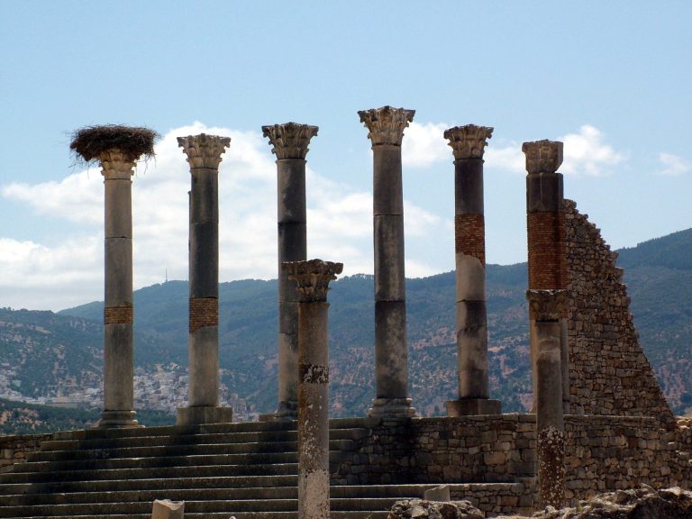
Volubilis developed from a Mauretanian urban settlement into an important Roman city, later becoming an Idrisid center before its decline and partial…
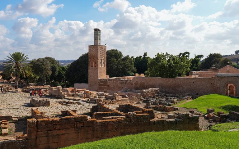
Chellah in Rabat preserves the remains of Sala, a Mauretanian and Roman port settlement, alongside a Marinid royal necropolis established in the…
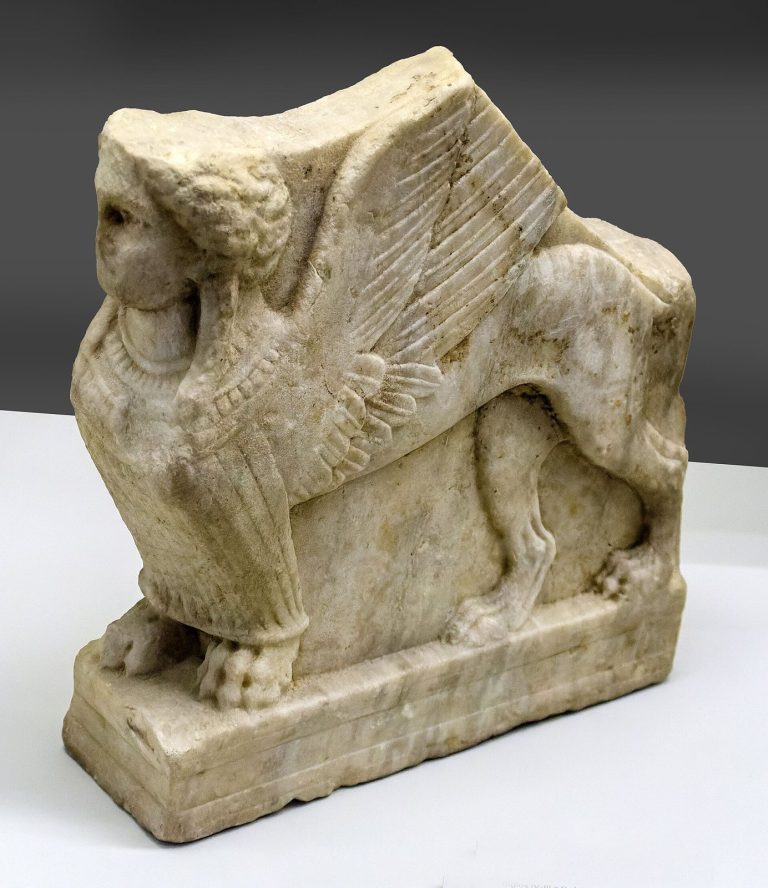
The Museum of History and Civilizations in Rabat traces Moroccan history from the Paleolithic through the Islamic period through archaeological…
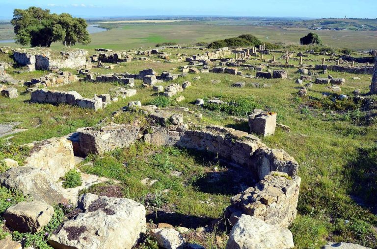
Lixus, near Larache in Morocco, developed from a Late Bronze Age settlement into a Phoenician trading community, a Mauretanian royal center, and a…
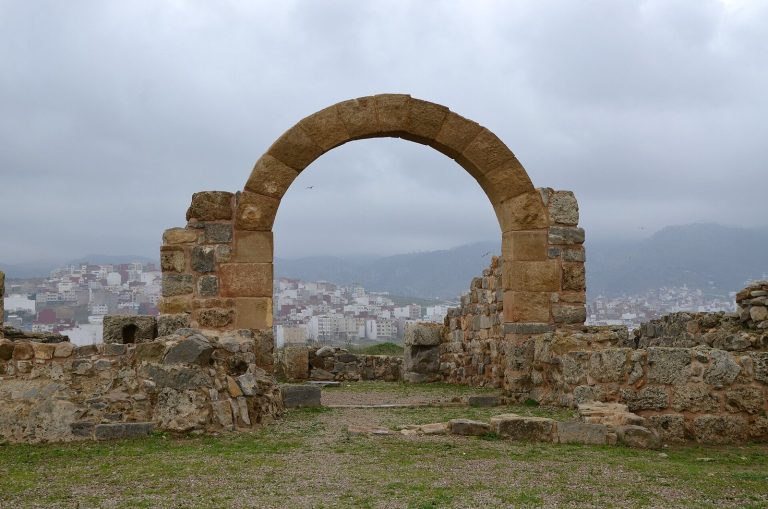
Tamuda near Tetouan developed from a Mauretanian Berber city into a Roman military center in Mauretania Tingitana. Its remains include a planned…
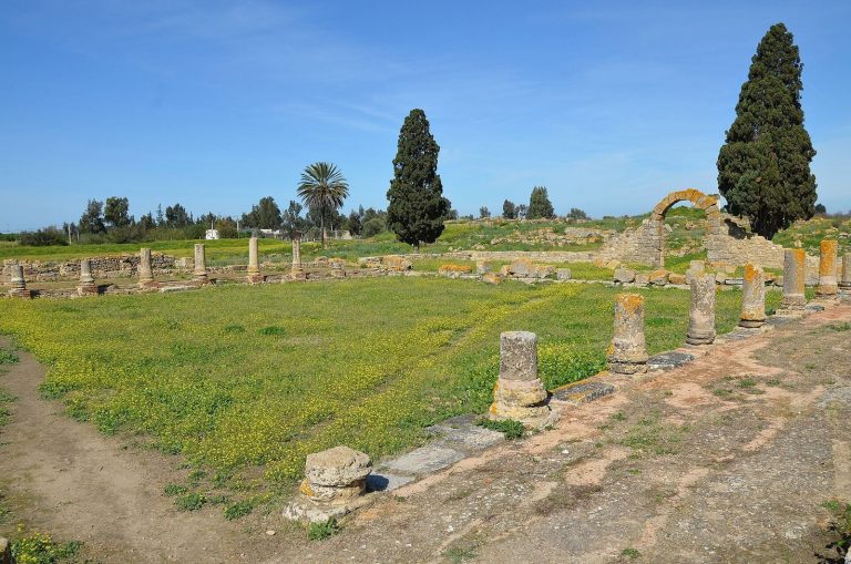
Banasa preserves the remains of a pre-Roman settlement and the Roman colony of Iulia Valentia Banasa, founded by Octavian between 33 and 25 BC. Its…
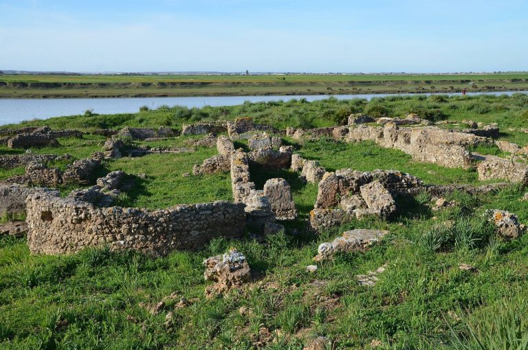
Thamusida preserves evidence of a Punic river port, a Berber settlement, a major Roman camp and town, and later Islamic occupation on the Sebou River…
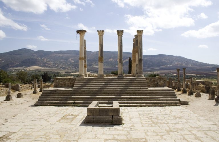
The Capitoline Temple at Volubilis was rebuilt around AD 217 to honor Emperor Macrinus and the Capitoline Triad. Its remains reveal how Roman…
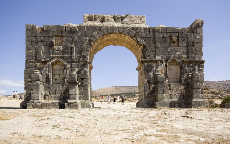
The Arch of Caracalla at Volubilis was dedicated in 216–217 to commemorate the emperor’s remission of taxes. Its remains mark the western end of the…
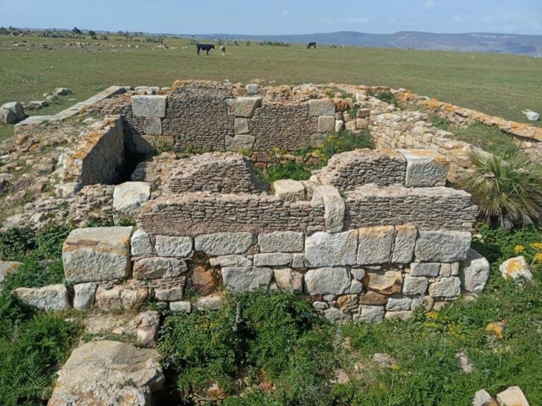
Iulia Constantia Zilil was an ancient settlement at Dchar Jdid in northern Morocco, with Phoenician, Mauritanian, Roman, and early Christian phases.…
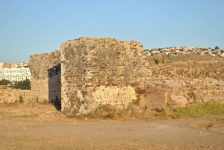
The Roman Walls of Tangier stand at Kasbah Ghaïlan within the ancient setting of Tingis, a Carthaginian, Mauretanian, and Roman port whose history…
For details on how to use the maps, which sites are included, how popularity and ratings are determined, and how sites are classified, see the help page.
On this page7 sections
Volubilis’s streets and mosaic houses
Volubilis spreads across an elevated ridge beneath Jebel Zerhoun. Its principal street ran between the Tingis Gate and the Arch of Caracalla, with porticoes, shops and a main sewer along the route. Public buildings clustered around the forum, including a basilica for civic and legal business and the raised Capitoline Temple. Twentieth-century reconstruction contributes to the standing forms of the arch, temple and basilica.
The houses preserve a different level of detail. In the House of Orpheus, a circular mosaic shows the musician playing his lyre among animals, birds and trees. Other residences contain scenes of Hercules, Bacchus and marine figures within geometric borders. Reception rooms, private baths and commercial spaces occupied different parts of these large properties. Oil-processing installations in some houses also connect decorated interiors with the productive work of an estate.
Banasa’s market and public square
At Banasa, the forum occupied low ground between two built-up areas. Porticoes framed its paved surface, with a basilica to the north and a temple complex raised above the southern side. The surrounding streets led into residential and commercial districts.
A covered market occupied a block west of the forum. Excavations also exposed bakeries, shops and several public baths, alongside private bathing rooms. Mosaic floors decorated some of these buildings, although important examples were transferred to museums and others were lost. The site is therefore best read through the streets and building plans, with the surviving decoration and recorded finds supplying more detail about particular rooms.
Fish-processing tanks and the theatre at Lixus
Lixus rises above the Loukkos River near Larache. Large processing installations at the foot of the hill prepared fish products and sauces for trade, supported by water-storage facilities. Their position connects the industrial district with the river and the former shoreline, which lay closer to the settlement than it does today.
The entertainment building combined a curved seating area with a stage and was used for both theatrical performances and arena spectacles. Its theatrical use ended in the third century, when material from the stage wall was reused in a bathing complex. Higher on the hill, religious buildings belong to several periods, including phases earlier than Roman rule.
Tamuda’s gates and corner towers
Near Tétouan, Tamuda preserves a compact Roman fort built within the remains of an earlier town. Its nearly square enclosure had gates facing the cardinal directions. Towers reinforced the entrances and corners, with semicircular additions made during later strengthening of the defences.
Two principal streets crossed inside the fort, near a large cistern supplied by a canal. Small baths stood towards the southern gate, with brickwork and arches among their remains. The fort’s plan differs from the earlier settlement districts around it, where rectangular houses and a public square belonged to the pre-Roman town.
Thamusida’s headquarters and granary
Thamusida stood on the Sebou River, with a landing area serving the settlement. Its military camp contained barrack blocks, service rooms and a central headquarters arranged around a colonnaded courtyard. A raised platform in the headquarters probably supported the shrine for the military standards.
The granary had a ventilated space beneath a raised wooden floor, helping keep stored supplies away from ground moisture. Openings in the substructure allowed air to circulate. Pottery kilns, imported ceramics and amphorae record production and trade around the military buildings, while the river linked the town with other settlements and the coast.
Sala’s Roman streets inside Chellah
At Chellah in Rabat, the excavated Roman district of Sala occupies terraces on sloping ground. A paved forum, street junctions and public-building remains form its civic centre. Workshops nearby preserve olive-pressing beds, settling basins and bakery installations.
The enclosure walls, mosque and royal burial buildings that frame much of Chellah’s standing appearance are medieval Marinid construction. They belong to the site’s later funerary and religious use. The lower Roman streets and working spaces preserve a separate urban phase within that enclosure.
Explore the collection
Explore sites on the map or in the grid. Map icons reflect each site’s primary function, helping you identify different kinds of places at a glance. Narrow the results by primary function, site type or era, with additional filters for popularity and rating. Select a map marker to view the site’s details and open its article, or open the article from its grid entry.