Roman Forum Lahnau: A Planned Roman Settlement in Germany


Site at a Glance
- Rating
- 4.3
- Popularity
- Very Low
- Country
- Germany
- Primary era
- Classical
- External website
- Open
- Eras represented
- Classical
- Civilizations
- Roman
- Site type
- City
On this page23 sections
History
Roman Forum Lahnau is a fortified Roman settlement in Germany, near modern Waldgirmes in the municipality of Lahnau. Built during the early imperial period, it was founded no later than 4 BC as a planned center for trade with Germanic communities, the supply of Roman troops, and the development of civilian infrastructure east of the Rhine. Its ancient name is unknown. The settlement is regarded as the earliest known evidence of stone-built architecture in Germania magna, the Roman term for the lands east of the Rhine and north of the Danube.
A planned settlement east of the Rhine
Roman Forum Lahnau formed part of Augustus’ wider policy in Germania. Augustus, Rome’s first emperor, supported settlement foundations, population relocations, interventions among individual tribes, and the construction of roads and other infrastructure beyond the Rhine frontier. The urban character of Waldgirmes suggests that Rome temporarily intended to establish direct and lasting rule in the region, although the precise organization of a future province remained unsettled.
The settlement appears to have been designed for more than military supply or short-term exchange. Its unusually large central forum may indicate that planners expected it to become the principal center of a civitas, a Roman-administered civic community or territory. Excavations later established that the site was a planned civilian settlement rather than simply a temporary military trading station. Large parts of the layout remained undeveloped, however, and the town was never fully completed. Roman and handmade Germanic pottery show that people from different cultural backgrounds probably lived alongside one another.
Timber from a well was felled in the winter of 4 to 3 BC, placing construction within the earliest phase of the settlement. Coins indicate activity from the late first century BC into the early first century AD, while the settlement’s foundation was underway by 4 BC at the latest. Two buildings in the western area probably housed soldiers during this foundation phase. The military presence was not necessarily maintained for the whole period of occupation.
Destruction and abandonment
Most of the excavated buildings and the defensive works were destroyed by fire. Five buildings or building sections escaped burning, while Buildings 5, 9, and 13 had already been dismantled before the settlement’s final phase. After the wall collapsed or burned, the defensive ditches were filled with fire debris from inside the settlement. Large basin-shaped excavations beyond both gates also received burned material, indicating activity after the destruction or abandonment.
The fragments of an equestrian statue were placed in a well no earlier than AD 9. The statue probably represented Augustus. Its destruction belongs to the period of the Roman defeat under Publius Quinctilius Varus, the commander defeated in the AD 9 disaster traditionally called the Battle of the Teutoburg Forest. Activity continued after the statue was destroyed, since clearing or construction work followed. The settlement was eventually abandoned after AD 9. A final abandonment around AD 16 has been proposed, during the period associated with the end of Germanicus’ campaigns and the retreat from Rome’s plans for a province east of the Rhine. Germanicus was the Roman general who led campaigns in Germania from AD 14 to 16.
A temporary camp east of the settlement may belong either to the period before the town was founded or to the years after its abandonment. Its date and relationship to the settlement remain uncertain.
Excavation and protection
Roman and Germanic pottery discovered during Gerda Weller’s field surveys in the late 1980s led to systematic investigation. A special excavation by the Roman-Germanic Commission of the German Archaeological Institute followed in late 1993, with geophysical survey in 1994. Further excavations took place in 1994 and 1995 under a German Research Foundation priority program. Since 1996, investigations have been carried out jointly by the Roman-Germanic Commission and the Hessian State Office for Monument Protection.
By 2009, excavations had exposed 24 house plans and two wells. The remains are legally protected under the Hessian Monument Protection Act. Archaeological investigation and deliberate collection of finds require official permission, and accidental discoveries must be reported to the monument authorities.
Remains
Fortifications and settlement plan
The settlement occupied about 7.7 hectares on a flood-free terrace approximately 1,300 metres north of the Lahn. It stood on a defensible spur between the Längenbach and Metzebach valleys. The slightly trapezoidal enclosure had rounded corners and was surrounded by a 3.2-metre-wide timber-and-earth wall. Two rows of posts, about 0.9 metres apart, supported planks fixed to their inner faces. Soil dug from the defensive ditches filled the space between the planks. The wall probably rose 2 to 3 metres and carried a parapet about 1.5 to 1.8 metres high.
Two V-shaped ditches protected the outer side of the wall. They reached 2.3 metres in depth and together measured about 8 metres across. At the eastern gate, burned remains survived for 27 metres, including charcoal traces of posts up to 2.5 metres long and about 0.15 metres wide. At least three gates served the settlement. The eastern entrance was 11.8 metres wide, with a single passage flanked by two towers set back behind the wall. The western gate had a similar arrangement, while a southern gate is certain and lies beneath later construction.
The northern side was strengthened by a 7-metre-wide intermediate tower supported on six posts. A southeastern corner tower also originally had six posts. Five other identified towers were 3.5 metres wide and stood on four posts each. The arrangement provided a fortified boundary while leaving the settlement’s interior organized around streets and public buildings.
Streets, water channels, and civic layout
Two main streets structured the interior. One ran east to west between the eastern and western gates. Another branched south from its center. Water channels followed the middle of both streets and divided the settlement into four sectors. The two larger northern sectors remained only partly built up. Most excavated buildings faced the streets, and many structures along the wider east-west route had porticoes, roofed walkways supported by columns. This arrangement differed from contemporary Augustan military camps and from the narrow plots typical of Roman vici, smaller roadside settlements.
The central forum
The central forum measured 54 by 45 metres. Its stone foundations were 40 to 45 centimetres wide, survived in places to three courses, and retained traces of their original mortar. A timber-framed superstructure stood on them. Three wings, each 6 metres wide, surrounded the eastern, southern, and western sides of a courtyard measuring 32 by 24 metres. A hall 45 metres long and 12 metres wide closed the courtyard on the north. Ten substantial posts ran along the hall’s central axis. Four stood in postholes, while the others rested on square stone foundations measuring 0.5 metres across.
The northern annexes
Three annexes stood along the hall’s northern side. The central annex was a square hall of about 100 square metres, flanked by two apses, rounded-ended rooms measuring 6 metres in both width and depth. The arrangement resembles early imperial forum complexes in which a basilica, a large public building used for civic, legal, and commercial purposes, dominates one side of the square. The central annex may have served as a curia, a council house, or an aedes Augusti, a room associated with the imperial cult of Augustus. The apses may have been administrative rooms or tribunals, official platforms or courtrooms.
The equestrian statue
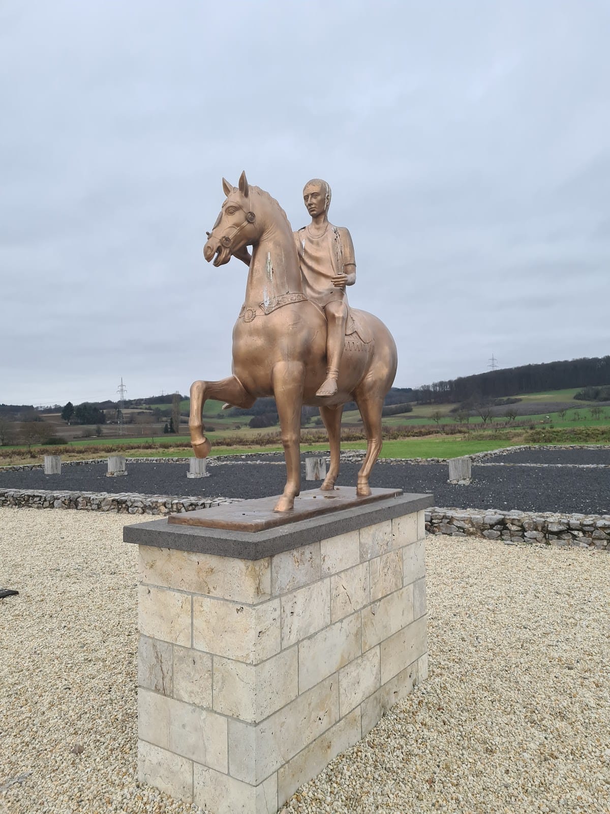
An approximately life-sized gilded bronze equestrian statue stood in the central courtyard. At least 17 mostly small fragments were recovered from a well, including part of the horse’s right hind leg and pieces of its breast harness. The largest surviving fragment, a gilded bronze horse head, was found in 2009 below the well casing inside a Roman wine barrel, together with a nearby foot from the rider. The horse’s leg fragment is about 40 centimetres long and bears a vine ornament with regularly emerging flowers. Its one-sided finishing indicates a principal viewing direction, while the torn hoof suggests that it belonged to an attached right hind leg.
Wells and water supply
Street channels and conduits
The channels along the two principal streets were each up to 1.2 metres deep and 1.7 metres wide. A shallow overflow linked them at the center. A retaining facility and overflow show that the east-west channel served more than one purpose. Its eastern section may also have carried utility water rather than functioning solely as an open sewer. A narrowing may have marked a point where water was drawn, possibly for pottery production near Building 2c. In the northeast, a shallow channel extended for 32.5 metres and may have held a wooden water conduit. A fragment of lead pipe provides evidence for a fresh-water supply.
The timber-lined wells
The first excavated well stood in the southwestern part of the settlement. It measured 1.2 by 1.2 metres and reached nearly 8 metres deep. Four lower courses of its timber lining survived in the groundwater zone. The construction wood was felled in the winter of 4 to 3 BC, providing an early date for building activity. A second well reached about 11 metres deep and contained fragments of the equestrian statue, including the horse head and rider’s foot.
Residential and military buildings
Houses and social differences
The southeastern quarter contained Buildings 1a to 1c and Buildings 2 to 4 in a block-like arrangement reminiscent of urban insulae, city blocks. The southwestern quarter included Buildings 10, 14, 15, 16, 18, and 19. Buildings 1a to 1c, 5, 18, and 19 were substantial houses. Their entrances opened between two equal rectangular rooms and led to a large, almost square central room flanked by narrower rooms. A rear row of rooms completed each plan. Building 18 was larger and had a portico on all four sides, indicating differences in the status of the inhabitants.
Storage buildings and sheds
Buildings 3 and 12 were used for storage, while Buildings 9 and 13 were sheds. Three buried barrels in and near Building 13 point to craft activity. Building 9 was later partly overbuilt by Building 8. In the western part of the settlement, Building 10 stood mainly on individual posts and was rebuilt at least once. Its southern extent is occupied by a modern building-material depot.
Street-facing workshops
Buildings 2a to 2c, 4, 8a to 8b, 10, 11b, 14, 15, and 17 contained rooms open toward the streets and have been compared with tabernae, street-facing shops or workshops. Buildings 8a and 15 were similar in size, had gabled roofs, and presented their gable ends to the street. Building 8b may have been linked to pottery kiln T1.
Building 2
Building 2 measured about 60 by 12 metres and had porticoes along its northern and western sides. It was divided into at least three sections. The western part contained a pottery kiln and regularly spaced posts. The eastern section, Building 2a, rested on massive deeply embedded posts and opened toward the street. Building 2b faced south, while Building 2c was arranged in relation to pottery kiln T2. No clearly residential rooms have been identified in the building. Its foundations may indicate a second storey over all or part of the structure. An embedded barrel and several pits point to craft work in the central section, while the broad street-facing rooms in the east may have accommodated carts or transport activity.
Building 14 and complex 11
Building 14 was 32 metres long and at least 12 metres wide, with a northern portico. Its eastern section stood on individual posts, while its western section contained three rooms opening toward the street. A pit cut through a wall trench and demonstrates at least one rebuilding phase. The southern extent and the division of the interior into one or two adjoining houses remain uncertain.
Building complex 11 had an unburned northern section, Building 11a, and a burned southern section, Building 11b. Large courtyards in the northern part may indicate agricultural use, perhaps as a garden. That use was later abandoned, and the structure was demolished or reduced to Building 11b, which measured about 22 by 20 metres.
The western barracks
Buildings 20 and 21 in the western area probably formed a military barracks with a separate head building south of the street. The accommodation section has the width of double barracks known from Oberaden, Dangstetten, and Rödgen. The head building was dismantled without burning, while the accommodation section remained until the settlement fire. A fence or palisade later separated this area after Building 20 had been dismantled.
Objects and evidence of daily activity
Glass and personal ornaments
Glass finds include part of a multicolored mosaic-glass bowl, a blue balsamarium fragment, gaming pieces, four glass beads, and a multicolored glass gem. The gem depicts Chloris, one of the Niobids, holding one of her dead brothers. An unusual mosaic-glass bead, about 1.5 centimetres across, came from the latest fill of the east-west water channel. Its light-blue opaque body contains three images of Apis, the Egyptian sacred bull deity associated with Memphis and royal and funerary traditions. Each spotted bull stands within a yellow frame beneath a solar disk and before a small censer or altar. The exceptionally well-preserved images were partly distorted during manufacture and resemble a shrine scene.
An intact silver disc brooch measured about 3 centimetres in diameter. Eight raised lotus petals made from thin silver sheet were fixed to its base by a central rivet. A red stone, probably amber, covered the rivet on the front, while blue and green glass inlays decorated the petals. A second silver pendant was 1.8 centimetres long, with an elongated pyramidal body, smooth sides, and an eye separated by a small horizontal bar. Its eye carried faint transverse punched decoration.
Buried barrel and imported goods
A buried barrel contained an amber bead, a ring-shaped bronze bead, and a dark-blue glass bead decorated with applied gold strips. The strips formed a lattice containing circular eye motifs. Manufacturing traces show that the glass was wound onto a wet rod made from white and blue glass strips, after which gold leaf strips were pressed into the still-soft surface.
Bronze coins from the settlement are dominated by asses from the first altar series of Lugdunum, probably minted between 7 and 3 BC. They make up about 70 percent of the relevant coin assemblage. Coins carrying the countermark of Publius Quinctilius Varus belong to the final phase and connect the settlement chronologically with the abandonment of Haltern and the events surrounding the Varus defeat. Pottery was mainly Roman, including wheel-made ceramics, while about one-fifth consisted of simple handmade Germanic vessels. Other finds include Roman and Germanic ceramics, jewelry, unworked amber, and imported transport vessels associated with wine and oil from Italy and Hispania.