Château de Jasseron: A Medieval Fortress in France
Site at a Glance
- Rating
- 4.4
- Popularity
- Very Low
- Country
- France
- Primary era
- Medieval
- Eras represented
- Medieval
- Civilizations
- Unclassified
- Site type
- Military
- Remains
- Castle
On this page12 sections
History
Château de Jasseron is a medieval fortress in Jasseron, France, founded around the tenth century on the western edge of the Jura Mountains. It stands in the historic county of Revermont, a borderland shaped during the Middle Ages by the competing spheres of Burgundy and Savoy. The region was formally incorporated into France only at the end of the seventeenth century. An earlier feudal manor occupied a site about 2 kilometres southwest of the present château, on a small hill beside the Jugnon stream and its springs.
Early lordship and Saint-Claude Abbey
The earliest fortress was probably a horseshoe-shaped residential and defensive tower. It was later used as a prison, although its precise connection with the Coligny lineage remains uncertain because the descent of the Coligny knights from the tenth-century lord Manassès has not been securely established.
Around 980–990, Richier de Coligny, the son of Manassès de Coligny, entered Saint-Claude Abbey and gave Jasseron, with its land and dependencies, to the monastery. Saint-Claude was a wealthy Benedictine house founded in the Jura during the fifth century. It retained Jasseron as part of its estate until the opening years of the thirteenth century.
In 1188, the marriage of Humbert II de Thoire to Alix de Coligny transferred her inheritance, including possessions in Revermont, to the Thoire-Villars family. Around 1212, Saint-Claude’s abbot Bernard III de Thoire granted Jasseron to his nephew Étienne II, lord of Thoire-Villars, but Étienne held it for only a few years.
The Coligny reconstruction
By 1231, Étienne had yielded Jasseron to Amé de Coligny, lord of Andelot. Amé probably rebuilt the castle around 1230, establishing the principal enclosure in substantially the form it later retained. An agreement between Amé and Saint-Claude Abbey also provided for a monastic residence and chapel in the lower bailey, the enclosed area adjoining the main fortified core. Part of the castle and probably part of its lands remained under the abbey’s administration.
In 1265, Guillaume de Coligny, lord of Jasseron, and the abbot of Saint-Claude agreed that the lord would maintain the castle as an abbey stronghold. In 1283, the Coligny lords granted the inhabitants of Jasseron a franchise charter. This allowed the local community to administer the castle and estate under specified conditions and payments.
Around 1300, Saint-Claude Abbey surrendered its rights to half of Jasseron to the Coligny family. In 1304, Étienne de Coligny, acting with Abbot Guillaume de Villars, granted the inhabitants further liberties and usage rights over half of his possessions at Jasseron, apparently including half the castle. He sold the other half to Amédée V, count of Savoy and lord of Bâgé and Coligny, provoking opposition among the Burgundians.
Military administration and decline
The lord of Thoire-Villars attacked the castle in 1307 during a dispute connected with demands for reparations. The garrison consisted of six officers, or knights, two guards, and one assistant in 1308, when annual maintenance cost 55 livres. It fell to three officers and one guard in 1315 and 1321, then to two officers in 1335 and 1350. The corresponding costs declined from 30–35 livres to 25 livres. Each knight normally had his own retinue and assistants.
In 1355, Jasseron belonged administratively to the Bourg centre within the Bresse castellany. That castellany then comprised ten castellanies organized around the two centres of Bâgé and Bourg. The wider political setting remained unsettled, with Jasseron positioned in a region where Burgundian and Savoyard interests met.
On 29 June 1586, Charles-Emmanuel I, duke of Savoy, alienated Jasseron to Joachim de Rye. De Rye attached it to his marquisate of Treffort, but Ferdinand de Longwy, archbishop of Besançon, rejected his rights and transferred them to François de Bonne de Créquy, duke of Lesdiguières. The castle was finally abandoned during the sixteenth century and was already a ruin by 1601.
Later ownership and preservation
On 22 April 1648, the duke of Lesdiguières transferred the land of Jasseron to Rostain d’Urre, lord of Aiguebonne. Rostain’s daughter Marie brought the property into the Perrachon family through her marriage to Pierre Perrachon, a royal councillor, who took possession of the fief in 1671.
Jacques-Marie-Alexandre Perrachon, count of Bury, sold Jasseron on 7 February 1735 to Antoine-Philibert de Grollier, knight and lord of Grand-Pré. Pierre-Louis de Grollier was lord of Jasseron when the Estates-General were convened in 1789.
During the nineteenth century, the monastic chapel and presbytery in the lower bailey were demolished. Treasure seekers also broke through the northwest wall of the first, partly underground level. The ruins were listed as historic monuments by decree on 22 February 1927, and the property remains privately owned.
In 2018, deliberate dismantling damaged the castle walls, and selected dressed stones were thrown into a nearby pile. Before this, local volunteers had spent nine years carrying out summer restoration work under the direction of local history teacher Jean-François Genevois, who also produced a reconstruction image showing the castle at its greatest extent.
Remains
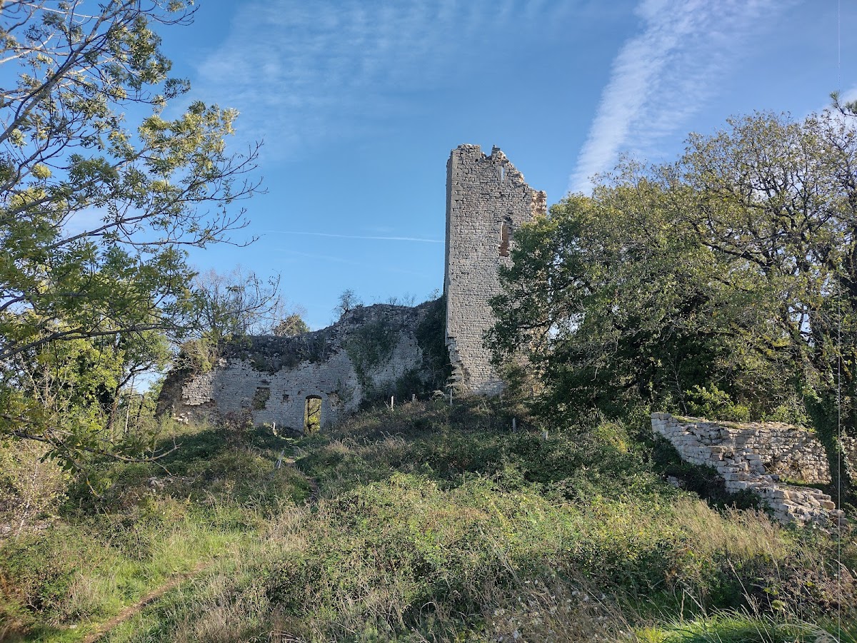
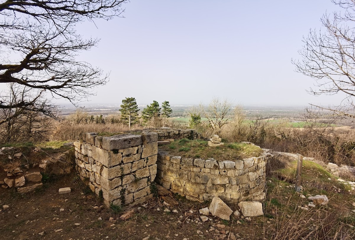
Château de Jasseron occupies the edge of a gently sloping ridge about 1 kilometre northeast of Jasseron church. The site lies at the southwestern end of an elongated hill running southwest to northeast, with the western Bresse plain visible from the main tower. Its plan follows the bipartite motte-castle type, in which an upper fortified area and an adjoining bailey form two distinct parts. Here, the smaller upper castle has a roughly trapezoidal plan, while the larger lower bailey extends to the southwest.
Upper castle and lower bailey
Upper castle
The upper castle’s corners are oriented toward the cardinal directions. Its northeastern side was originally separated from the rest of the ridge by a ditch. A quadrangular enclosure surrounded the upper castle, with steep slopes protecting its northwest and southeast sides. The ground became gentler toward the southwest, where it formed a gradually descending plateau.
The upper enclosure was built of limestone. A defensive wall ran northwest from the donjon along the edge of the ditch and carried a wooden parapet linked to the tower entrance on the second floor. A small pedestrian gate opened on the ditch side. The main entrance was probably on the northwest side near the western corner, where a gate tower is thought to have stood.
Lower bailey
The larger lower bailey contained service buildings, a monastic residence, and a chapel. It was enclosed by surrounding walls and a lower gate structure. Five irregularly placed, six-sided defensive towers strengthened its perimeter. The towers did not provide flanking fire and may date from the fourteenth century; their positions are known from surviving foundations.
The lower bailey also contained the medieval priory or monastic residence, a vaulted barn or cellar, and the foundations of the chapel. The chapel and presbytery were levelled during the nineteenth century. Most of the lower bailey’s defensive works now survive as buried foundations, while the relationships between its religious, residential, and service buildings remain visible chiefly through the surviving archaeological fabric.
Donjon and residential range
Horseshoe-shaped donjon
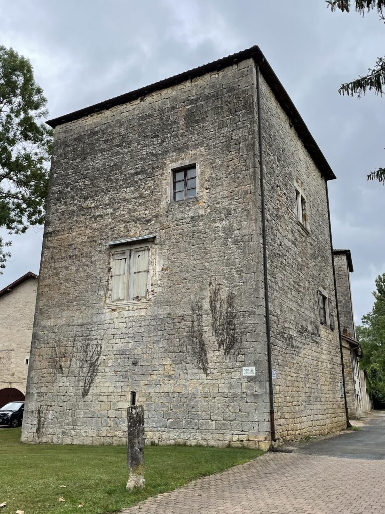
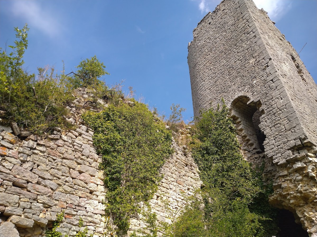
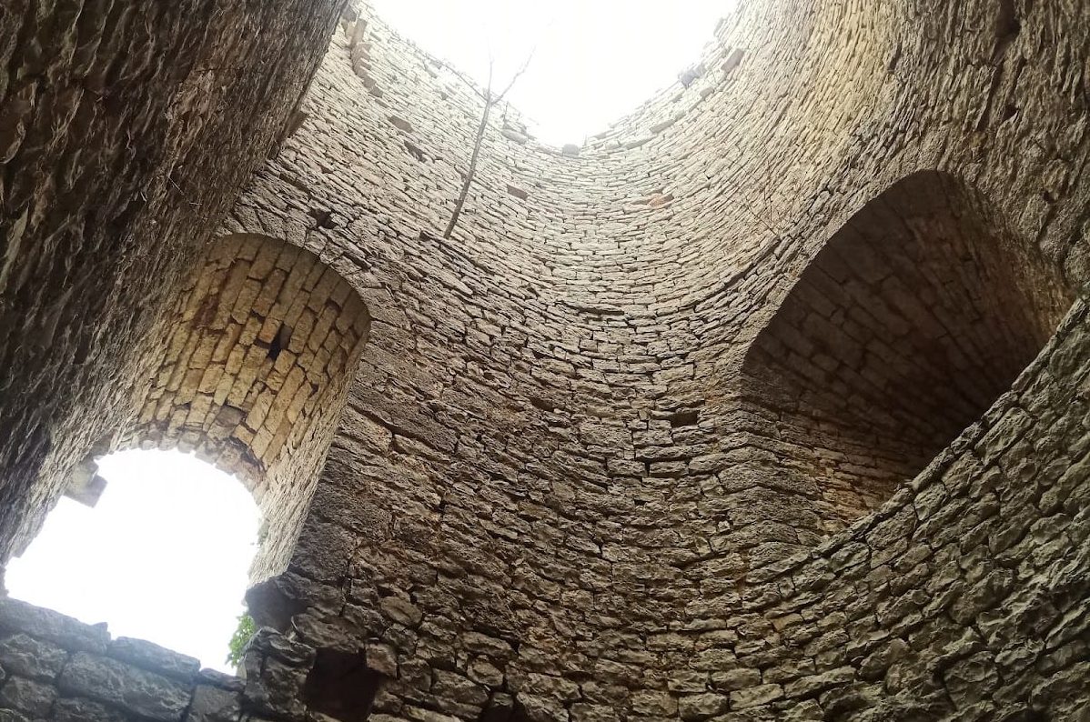
The horseshoe-shaped donjon, the principal fortified tower of the castle, stood on the side facing the direction of attack and commanded the upper enclosure. It was a thick-walled main watchtower of at least five storeys, and possibly six. Narrow loopholes provided defensive openings, while wooden beams formed the floors.
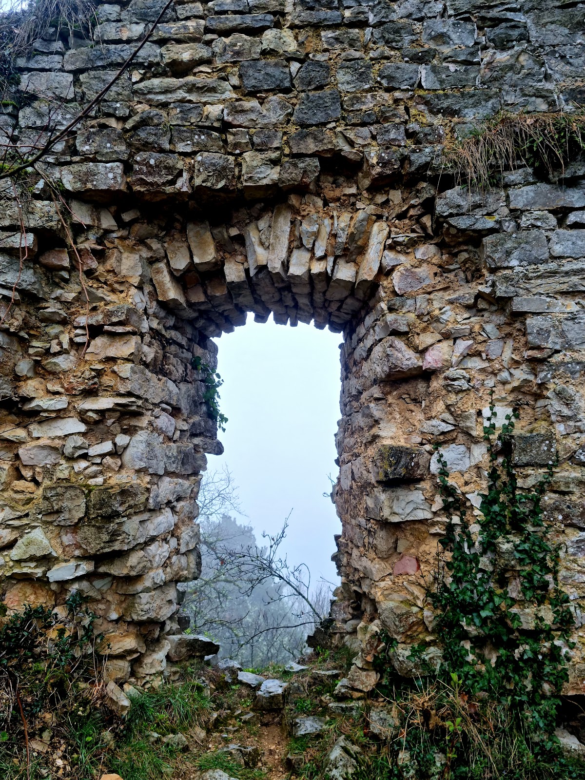
The tower walls used carefully selected and dressed limestone on their inner and outer faces. Between these faces, the core was 4–5 metres thick and consisted of rubble mixed with mortar. The entrance was on the second floor, where the arched doorway survives. Access to the first floor was through the second floor, and the lower level may have served as a storeroom or prison. A loophole on the second floor faced the ditch.
The third floor has a courtyard-facing window and a corner fireplace. A small window, wall niches, and a water channel occur on the fourth floor. The channel passed through the wall toward the ditch and ended in a spout, probably to drain rainwater. Beam sockets indicate a fifth floor. At this level, two exterior corbels supported a projecting structure over the ditch, perhaps a defensive wooden projection or a latrine. Further corbels over the ditch survive on the wall extending southeast from the tower.
Southeastern building range
The most extensive building range stood along the southeast side of the upper castle. Its outer defensive wall preserves evidence of three storeys. The second floor, above a partly underground level, has evenly spaced windows indicating a residential block. The walls on the other sides of the upper castle survive mainly at foundation level.
The surviving complex consists principally of the northeastern wall of the upper castle, the roofless and floorless donjon, and part of the external wall of the long southeastern building. The donjon is the best-preserved element, although its southern outer corner and the lower part of its northwest side have collapsed. This damage exposes the rubble-and-mortar core of its exceptionally thick masonry.