Château de Couzan: A Medieval Fortress in France




Site at a Glance
- Rating
- 4.3
- Popularity
- Very Low
- Country
- France
- Primary era
- Medieval
- External website
- Open
- Eras represented
- Medieval, Early Modern
- Civilizations
- French
- Site type
- Military
- Remains
- Castle
On this page13 sections
History
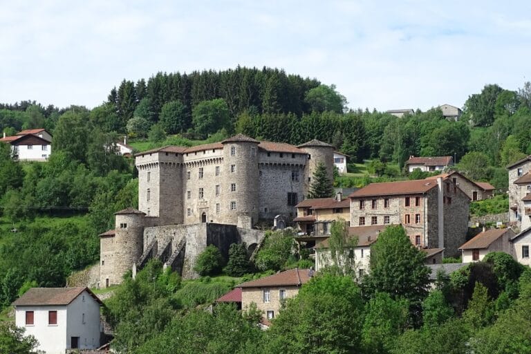
Château de Couzan is a medieval fortress in France above Sail-sous-Couzan, founded in the eleventh century on a strategic route between Auvergne and Forez. Its exact construction date and original builder are unknown, but a charter from 1075–1076 already mentions a chapel within the castle. Radiocarbon dating places the oldest surviving building fabric between 1025 and 1084. Excavations in 2016 also showed that the rocky hill had been occupied during the Carolingian period.
The Damas lordship
Couzan became the principal seat of the Damas family in Forez, a cadet branch of the powerful Semur family of Burgundy. During the twelfth century, the family’s feudal allegiance was disputed by the counts of Forez and the lords of Beaujeu. Treaties in 1222 and 1224 changed Beaujeu’s rights, and in 1227 Renaud Damas recognized Couzan as a fief held directly from the counts of Forez. He nevertheless remained a vassal of the counts of Chalon and Nevers. Humbert V of Beaujeu abandoned his claim in 1229 after the conflict with Count Guigues IV of Forez.
The counts of Forez sought to restrain the growing power of the Damas family by surrounding Couzan with allied or newly founded strongholds. These included Rochefort, Chalmazel, Cervières, and probably Marcilly. Couzan itself served as the seat of the Couzan châtellenie, a territorial lordship administered from a castle and including jurisdiction, dependent settlements, and associated lands. It was described as the most important châtellenie in the former province of Forez. A settlement existed below the fortress around the former parish church, although much of it had been deserted by the middle of the sixteenth century as habitation gradually focused on the Cluniac priory of Sail.
Territorial expansion in the fourteenth century
The Damas lords reached the height of their territorial and political power in the fourteenth century. In 1380 they acknowledged possession of Couzan, four additional castles at Sauvain, Chalain, Nervieux, and Urbise, and three fortified houses, including Boën. Marriage alliances and service to the prince increased their territory and wealth. In 1326, the marriage of Hugues Damas and Alice de La Perrière brought the couple half of the castle of Roanne and a dowry of 2,000 livres tournois. Guy de Damas became Grand Chamberlain of France in 1401.
The fortress was enlarged and strengthened during this period, probably as the family’s lands and resources expanded. Building works authorized by King Philip VI and the counts of Forez in 1320 included a third enclosure and further fortifications. Construction continued until 1410 under the younger Hugues Damas. These works produced much of the layered defensive arrangement that survives in fragmentary form.
Transfer to the Lévis family and decline
Through the marriage of Eustache de Lévis and Alize, or Alice, Damas in 1428, the fortress passed to the Lévis family. Alice was the last Damas heiress, and her successors used the name Lévis-Couzan. The Damas line is also described as having ended in the male line with the death of Guy de Damas in 1423.
From the sixteenth century, the Lévis-Couzan family normally preferred to live at Chalain-d’Uzore rather than Couzan. Claude de Lévis-Couzan remodelled that residence in the Renaissance style and provided it with gardens. A castellan and other officers continued to administer Couzan, although some lived elsewhere. With its residential role diminished, the fortress gradually declined and was used mainly for grain storage. Vines were cultivated on the castle hill.
During the Hundred Years’ War, the residential building of the upper castle was destroyed. The Hundred Years’ War was a prolonged series of conflicts between the English and French crowns from the fourteenth to the fifteenth century. In 1622, the castle was sold to Louis d’Urgel de Saint-Priest, who carried out repairs around 1634. By 1656, however, it was already partly ruined when Jean de Luzy, Marquis of Pélissac, acquired the estate. The Luzy family adopted the titles Marquis of Couzan and First Baron of Forez.
Revolutionary use and preservation
From the seventeenth century, ownership passed through the Saint-Priest, Luzy, and Thy de Milly families. The Luzy branch died out late in the eighteenth century, after which Marthe de Luzy-Couzan inherited the castle and married Antoine François de Thy de Milly. The Thy de Milly family retained the estate until 1932.
During the French Revolution, the abandoned fortress was used as a prison. Afterward, local inhabitants quarried its stone, and much of the Saint George Gate in the lower bailey disappeared. The castle has been uninhabited since the Revolution. Château de Couzan was classified as a French monument historique in 1890, a heritage-protection status for historically or architecturally valued buildings, ruins, sites, and landscapes. The entire castle hill received additional registered protection in 1947.
In 1932, La Diana, a historical and archaeological society devoted to Forez, purchased the castle from the Thy de Milly family and began major restoration and safeguarding work. The society has organized annual summer work campaigns since 1995, while scientifically supervised excavations have taken place regularly since the late 1990s. In 2015, several parts of the ruin were found to face immediate collapse, leading to a long-term programme of structural stabilization.
Remains
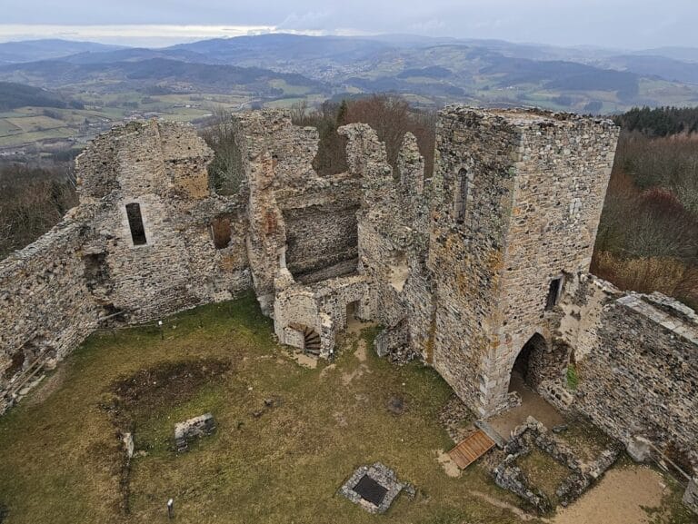
Château de Couzan occupies a granite outcrop about 600 metres above sea level and more than 200 metres above Sail-sous-Couzan. The rock drops steeply on the southern and eastern sides. The Lignon du Forez runs to the east, while its tributary, the Chagnon, surrounds the hill to the north and west. The fortress controlled the surrounding valleys, and the summit extends over the Forez plains, nearby hills, the Lignon valley, and the Lyonnais mountains.
Enclosures and lower bailey
The original castrum consisted of an upper castle with a keep, from which three successive enclosure systems descended. A wider reconstruction of the medieval fortification identifies four staggered enceintes, or fortified wall circuits, enclosing more than 3.5 hectares. More than 700 metres of walling survive around a little over one hectare.
Outer enceinte
The outermost, fourth enceinte had five towers built in the late fourteenth or early fifteenth century. About 250 metres survive on the western side. A broad dry ditch formerly lay before its northern tip. The enclosure surrounded the lower bailey, an enclosed area within the castle complex, which was entered from the east through a gatehouse with a drawbridge.
Lower-bailey buildings
Ruins of buildings from the fourteenth and sixteenth centuries remain in the northern part of the lower bailey. They were heavily altered in the seventeenth century. One house retains a Damas coat of arms on its lintel. A well survives in the southwestern part of the bailey, with a rim bearing the arms of the Damas, Lévis, and Lavieu-Fougerolles families.
The second and third enclosures are almost entirely lost, while a small remnant of the third wall remains on the western side. The surviving wall fragments and the lower-bailey structures form the outer parts of a fortress whose defenses once descended in successive stages from the summit.
Upper castle
The upper castle covers more than 900 square metres. Its earliest surviving structure is the Damas Tower, a square Romanesque keep from the late eleventh or early twelfth century. Romanesque architecture is characterized here by heavy masonry, rounded forms, and barrel vaulting. The tower has rounded corners, originally contained four storeys, and measured 7 by 8 metres. Its entrance was elevated on the first floor.
Hall and Saint Anthony Tower
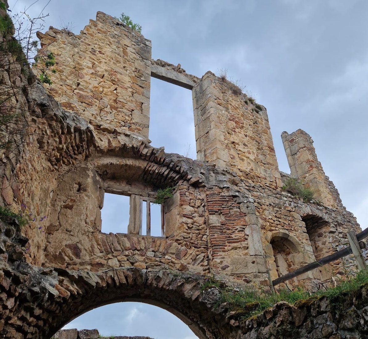
A large rectangular hall was added southwest of the Damas Tower around 1279. Its southern section was substantially changed in 1355 and converted into a large square tower. The five-storey Saint Anthony Tower projects from the building’s northwestern facade. Dendrochronology, which dates timber through its annual growth rings, places its construction around 1387.
Notre-Dame-de-Couzan chapel
North of the fortified area stands Notre-Dame-de-Couzan, formerly the parish church of Saint Saturnin. Its position outside the fortified enclosure reflects its parish function, since it served both the castle inhabitants and the surrounding population. The building is a small, single-nave Romanesque church made from granite blocks. Investigation in 2001 found that most of its present fabric dates from the eleventh century.
The interior has a single-bay barrel vault. A second bay was destroyed during the second half of the fourteenth century in the Hundred Years’ War. At the eastern end, a semicircular apse is reinforced by massive buttresses. The east gable is formed by a bell wall with two openings, now without bells. The former nave was destroyed during the war, and the choir was walled up in the sixteenth century with an entrance framed by a pointed, ornamented surround.
Carved stone vessel
A stone vessel inside the chapel is locally identified as a thirteenth-century holy-water basin, although it may originally have been a tithe stone, a container or measure associated with collecting a customary portion of agricultural produce owed to a lord or religious institution. Each face carries a carved human face surrounded by a sun. Local tradition interprets the smiling and grimacing faces as signs of good harvests and famine years. The stone is also said to have served as a grain measure into which peasants placed the share of their harvest owed to the lord. Its design inspired the “sun head” emblem adopted by Sail-sous-Couzan in 1971.
Nearby sites