Schalberg Ruins: A Medieval Castle Near Pfeffingen, Switzerland


Visitor Information
Google Rating: 4.4
Popularity: Very Low
Official Website: www.kulturkarte-bl.ch
Country: Switzerland
Civilization: Medieval European
Site type: Military
Remains: Castle
History
The Schalberg Ruins are located near the municipality of Pfeffingen in Switzerland. This hilltop castle was built during the late 13th century by the noble Schaler family of Basel, specifically by Peter Schaler or his son Rudolf, to establish a residence for their “von Schalberg” lineage.
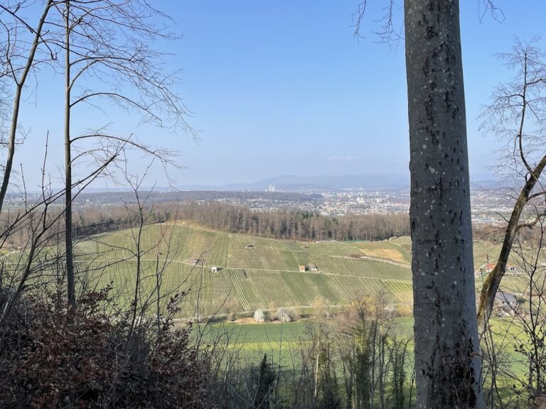
Constructed on land owned by the family, the castle occupied a commanding position above the narrow Aescher Klusertal valley. Its placement overlooked a key medieval passage toward the Plattenpass, and its proximity to other castles like Münchsberg and Engenstein indicates that the site served more in the context of noble competition than as a checkpoint for tolls. Early in the 14th century, the Schalers transferred ownership of the fortress to the Bishop of Basel but retained it as a fief, a move typical of the period intended to secure ecclesiastical protection.
The castle suffered damage during the significant earthquake of 1356 but was restored afterward. By the early 15th century, however, changing political dynamics favored cities over castles, leading to Schalberg’s abandonment. Following the extinction of the Schaler family line in 1437, the ownership passed to the Counts of Tierstein. Their interest lay mainly in rights connected to the land rather than the deteriorating structure itself. The final historical record mentioning the castle dates back to 1452.
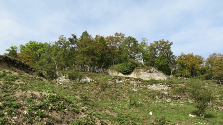
Remains
The remains of Schalberg extend along a narrow limestone ridge, rising to about 444 meters in elevation. The castle complex stretches roughly 100 meters and comprises two main sections: the larger upper castle (Oberburg) and a smaller lower portion (Unterburg) positioned to the northwest. The upper castle is marked by thick defensive walls measuring up to two meters, enclosing a notable round tower with an external diameter close to seven meters and an inner space about three meters wide.
Terraced areas reveal the footprint of the lower castle, offering evidence of several building foundations, though their original purposes remain undetermined in the absence of detailed excavation. Natural defenses are provided by steep rock faces flanking the ridge’s long sides, while an approaching depression to the southeast adds another layer of protection. On the northwest side, two artificially dug neck ditches functioned as barriers to prevent easy access along the ridge.
The original entryway to the castle came from the east, routing south of the round tower but outside the main enclosure walls. This path crossed a small gate ditch to the west of the surrounding ring wall, a feature currently supported by wooden beams spanning the gap. The south-facing wall of the upper castle contains multiple window openings whose age and purpose are not precisely defined. A doorway, now sealed with bricks, likely led to a battlement walkway, once held aloft by wooden beams as signaled by surviving beam holes in the stonework.
Stone excavated from the defensive neck ditches was repurposed in constructing the castle itself, an example of practical reuse during the building phase. Situated within a dense forest, the ruins remain accessible through a nearby hiking trail, preserving the site as a heritage landmark and a historical meeting place.
Nearby sites