Château de Mielmont: A Medieval Fortress in Jemeppe-sur-Sambre, Belgium


Visitor Information
Google Rating: 4.5
Popularity: Very Low
Google Maps: View on Google Maps
Official Website: www.mielmont.be
Country: Belgium
Civilization: Unclassified
Remains: Military

History
The Château de Mielmont is located in Jemeppe-sur-Sambre, Belgium, and was originally established during the medieval period by the local feudal society. It first appears in historical records in 1125, identified as the property of Renier de Merlemont within the County of Namur. At this time, the château functioned chiefly as a defensive stronghold positioned to guard against threats from the neighboring Duchy of Brabant. Its earliest phase centered on the construction of a keep, a fortified tower serving as the main defensive and residential structure.
For over two hundred years, the Merlemont family maintained control of the estate. Ownership changed hands in the mid-1300s when it passed to the Dave family, who continued to oversee the property through the subsequent centuries. In the 17th century, the domain came under the stewardship of the Sainte-Aldegonde family. The following century saw further transitions as the Roose de Leeuw and then the Coloma families assumed possession, reflecting shifting noble affiliations in the region.
During the 18th century, the château gained strategic importance under the Austrian Netherlands authority. In 1742, amid the conflict between France and the Austrian Netherlands, French forces led by Marshal Maurice de Saxe used the château as their headquarters during an invasion ordered by King Louis XV. This military occupation highlighted the château’s continuing role in regional power struggles.
The 19th century brought another change of ownership when the Beauffort family acquired the estate in 1831. In the turbulent years of the Second World War, the château assumed a new function as a center of resistance against occupying forces, known by the codename “Refuge Jaguar.” This episode connected the château to the broader narrative of European wartime resistance movements. Since September 1997, both the château and its associated structures have been officially recognized as classified heritage of Jemeppe-sur-Sambre, acknowledging their historical and cultural significance.
Remains
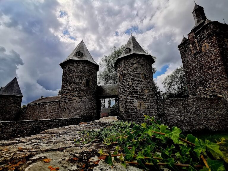
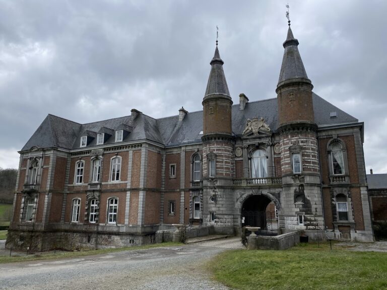
The Château de Mielmont stands predominantly constructed from limestone rubble, organized around a nearly triangular courtyard measuring about 800 square meters. This enclosed space is formed by two substantial wings along with a smaller eastern wing that features a square tower. This tower contains the main entrance, which historically was approached via a drawbridge spanning moats that have since been filled in. The château is positioned on a rocky limestone spur approximately 40 meters above the nearby Orneau river, providing commanding views of the valley below.
The southern wing incorporates the original medieval keep, a four-story tower rising one story above the adjoining buildings. This keep is square in plan and retains a cellar window lintel carved with the inscription “Desir Na Repos Davre 1570,” a dated marker linking to the château’s 16th-century history. At the southwest corner of this wing stands a circular tower that closes off the structure. The northern wing underwent significant alteration during the 20th century, with much of its façade rebuilt in brick. It extends across fifteen bays on two levels, reflecting both preservation efforts and architectural evolution.
Close to the main residence, about 40 meters to the south, lies a farmstead arranged in a square layout, constructed of limestone. This farm originates from a 16th-century quadrilateral building and includes two circular turrets positioned at its southwest and southeast corners. The presence of these turrets mirrors defensive architectural features found in the château itself, indicating the farm’s historical role within the estate’s broader fortified complex.
Together, these buildings form a cohesive ensemble that retains considerable evidence of medieval origins as well as adaptations made across subsequent centuries. Their arrangement around the courtyard and the use of robust local materials illustrate both defensive priorities and later residential modifications. The site’s elevated location above the river and near the modern E42 highway situates it within a landscape that has seen continuous occupation and strategic use across nearly a millennium.
Nearby sites