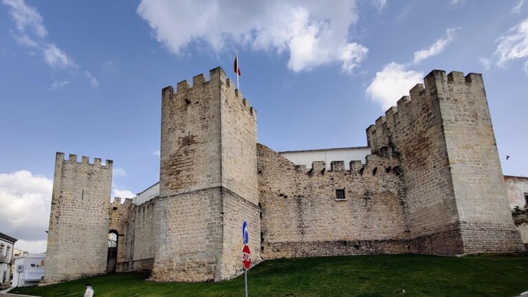
Castle of Tavira: A Historic Fortress in Portugal


Visitor Information
Google Rating: 4.3
Popularity: High
Google Maps: View on Google Maps
Official Website: www.monumentos.gov.pt
Country: Portugal
Civilization: Unclassified
Remains: Military
History
The Castle of Tavira is situated in the town of Tavira in Portugal. Its origins trace back to early settlers who established a presence at the mouth of the Gilão River, taking advantage of the strategic and economic potential offered by this maritime location.
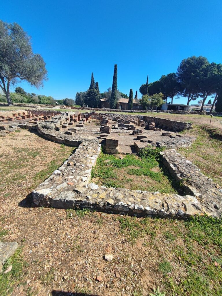
Human occupation in the area dates from prehistoric times, and archaeological discoveries, including a segment of a Phoenician wall dating to the 8th century BC, confirm that the site was an important early settlement. Under Roman rule, the settlement known as Balsa gained prominence due to a bridge crossing the river, which made it a significant point along Roman roads. Although no Roman fortifications have been identified, it is likely that a military force protected this route.
From the 11th century, Tavira was controlled by Muslim rulers and was known as at-Tabira. The town became an important center in the Algarve region within Al-Andalus and was fortified during the Almoravid and Almohad periods, reflecting its strategic value during the internal conflicts among Muslim dynasties.
Christian forces captured Tavira on 11 June 1239, led by D. Paio Peres Correia, the Master of the Order of Santiago. This conquest reportedly followed an ambush near Tavira in which seven knights were killed. Shortly thereafter, King Sancho II donated the town and its church patronage to the Order of Santiago around January 1242, a grant later confirmed by Pope Innocent IV in 1245.
In 1252, Alfonso X of Castile took possession of Tavira, but after diplomatic agreements involving his son’s birth, the region was returned to Portugal in 1264. By August 1266, Tavira had received its first formal charter (foral), marking its integration into the Portuguese kingdom.
During the reign of King Dinis (1279–1325), the castle and town walls were repaired and expanded, with further privileges granted to inhabitants in the early 14th century. In turbulent times such as the 1383-1385 Portuguese interregnum crisis, Tavira was entrusted to Fernão Álvares Pereira, a significant noble figure.
The Age of Discoveries enhanced Tavira’s maritime role. However, by 1475 the castle was reported to be in a state of disrepair. Under King Manuel I, Tavira was granted a new charter in 1504 and promoted to city status in 1520, during which Vasco Eanes Corte-Real held the position of Alcaide-mor, or castle governor.
King Sebastian visited Tavira in 1573 while the Forte de Santo António, located near the river’s mouth, was under construction to improve coastal defenses. During the Portuguese Restoration War in the mid-17th century, King João IV ordered modernization efforts to adapt the castle’s defenses for artillery warfare. Later, the Fortaleza de São João da Barra de Tavira was built between 1672 and 1717, further strengthening the town’s defenses.
The devastating earthquake of 1755 caused extensive damage to the castle, contributing to the gradual dismantling of much of its defensive walls in the following centuries. Recognizing its historical value, the castle walls were declared a National Monument in 1939, with the castle itself gaining this status in 2014.
Remains
The Castle of Tavira reveals a layered history through its varied construction phases, some of which remain visible today. Its layout encompasses an oval-shaped fortified area, covering roughly five hectares, reflecting the town’s medieval importance.
Initial fortifications date back to the Almoravid period in the late 11th or early 12th century. These early defenses likely included a small alcáçova—a term used for the citadel or core stronghold—positioned at the southeast corner. Surrounding this citadel was a modest enclosure aligned roughly along a north-south axis, forming the earliest known walled perimeter.
Subsequent work during the Almohad period introduced significant architectural elements still identifiable today. Among these is a section of rammed-earth walls, known locally as taipa, which were constructed using compacted layers of earth to provide sturdy, defensive barriers. Near what is now Praça da República, close to the Banco Nacional Ultramarino building, archaeologists uncovered an old horseshoe-arched gate. This entrance once belonged to a medieval defensive tower and reflects typical Islamic architectural influences of the time.
Within the alcáçova area, there survives a distinctive albarrã tower—a detached defensive tower positioned outside the main walls—facing southward. This multi-sided tower would have served as a vantage point and an additional layer of defense.
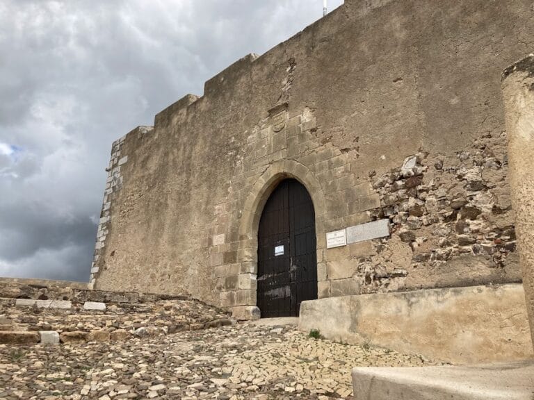
Following the Christian reconquest, the castle was reshaped into the oval plan recognizable today. The medieval walls, which included seven named gates—Fernão Mendes, Mouraria, Postigo, Feição, Vila Fria, D. Manuel, and Porta Nova—enclosed the town’s expanded footprint. Of these, the D. Manuel Gate stands out for its Gothic architecture, featuring a broken arch and bearing the heraldic arms of King Manuel I. This gate served as the principal access point through the walls.
The fortification evolved further in the 17th century to respond to the challenges posed by artillery warfare. Defensive structures were modernized accordingly, though much of the perimeter was removed in later years. Despite these losses, surviving elements still convey the castle’s significant military adaptations over time.
Nearby sites