Cerro da Vila: A Roman Rural and Port Settlement in Portugal



Site at a Glance
- Rating
- 4.2
- Popularity
- Low
- Country
- Portugal
- Primary era
- Classical
- Eras represented
- Classical, Medieval
- Civilizations
- Roman, Umayyad, Visigothic
- Site type
- Domestic
- Remains
- Villa
On this page22 sections
History
Cerro da Vila, also known as the Roman Villa of Vilamoura, is a Roman archaeological settlement in Portugal, near Vilamoura in the municipality of Loulé. Built within the Roman world of the Algarve, it began as a rural estate during the transition from the Late Republic to the early Empire and later became a port-connected centre for agriculture, fishing, fish processing, and the production of purple dye. Its territory was administered from Ossonoba, the Roman city at modern Faro, and its position beside a lagoon allowed the estate to participate in maritime trade.
From farmstead to Roman estate
The area was occupied from the Late Republican period, when a compact farmstead with a principal building was established. An associated cistern belongs to the reorganization of the territory under Augustus. The settlement was a villa rustica, a rural estate combining a landowner’s residence with agricultural, industrial, and service facilities. Its port and surrounding coastal landscape connected the estate with prosperous agricultural and fishing properties associated with Roman elites.
From the late Flavian period through Late Antiquity, the original farmstead expanded into a substantial settlement. The second century brought major residential and bathing facilities, while further enlargement and reorganization took place especially during the third and fourth centuries. Commercial activity continued during the third-century Roman economic crisis. Purple dye made from marine molluscs appears to have helped sustain the settlement when some other fish-sauce and maritime industries declined.
Late Roman transformation
During the later Roman period, Cerro da Vila underwent extensive rebuilding. Between the Tetrarchy and the first half of the fifth century, residential areas were enlarged, although some parts of the complex were subsequently reduced and fortified. Toward the end of the settlement’s Roman use, rooms that had served domestic purposes were partly converted to production, with basins and storage pits inserted into them.
Occupation continued after Roman rule. During the Visigothic period, approximately the fifth and sixth centuries, former industrial areas were reused for burials, while the villa building was reconstructed and occupied again. A probable Christian cult building may also have been established within the settlement. Occupation continued into the seventh century and then through the Islamic period, from the eighth century to the early eleventh century.
Islamic occupation and abandonment
The strongest evidence for Islamic prosperity belongs to the ninth and tenth centuries. Cerro da Vila functioned as an important rural community and retained much of the former Roman settlement area. Former industrial buildings were divided into residential units by rammed-earth walls, while pottery production and glazed ceramics indicate a changed economic base.
The settlement was probably abandoned by the eleventh century and may have been fully deserted before the Christian reconquest of the Algarve in 1249. After abandonment, agricultural activity and the removal of walls by successive landowners damaged many structures. The shallow covering of agricultural soil contributed to the loss of higher walls, while buildings near the reed-filled channel survived somewhat better. Later development around Vilamoura placed additional pressure on the archaeological area, including the proposed Cidade Lacustre project, which threatened environmentally sensitive land around Cerro da Vila and the Ribeira de Quarteira basin. Portions of the area were also raised with construction debris and fill.
Rediscovery and archaeological work
Estácio da Veiga first identified the archaeological site, and the results of his investigations were published after his death in 1910. Archaeological attention resumed in 1963, when José Martins Farrajota saw Roman mosaic fragments being exposed by a tractor. Systematic excavations began in 1964 and continued until 1968 with a team that included Farrajota, Fernando de Almeida, and Manuel Afonso do Paço.
Excavations directed by Fernando de Almeida in 1969 and 1970 revealed villa rooms, fish-salting tanks, a bath building with two pools, and a columbarium, a funerary structure containing niches for cremation urns. José Luís Martins de Matos worked at the site in 1971 and led further excavation, cleaning, consolidation, and restoration campaigns in 1972 and from 1979 to 1989. António Manuel Dias Diogo joined the work in 1990 and 1991, when the fish-processing area and a shell deposit were investigated.
Later projects included mosaic recording in 1994, excavations and soundings in 1997 and 1998, and a complete survey of structures, mosaics, and opus sectile pavement in 1999 and 2000. Architectural research by Felix Teichner followed in 2001, with further mosaic studies in 2002 and geophysical prospecting in 2007. Research from 1999 to 2003 examined the settlement’s building phases, industrial facilities, and economic activities. Archaeometric analysis confirmed purple-dye production in industrial unit J, while landscape research from 2006 to 2011 reconstructed changes in the lagoon environment from the Neolithic period to the present.
The ruins opened to the public in 1988, and a museum and interpretation centre were established beside the archaeological site. The interpretation centre, designed by Fernando Galhano, opened in 2000. Cerro da Vila was classified as an Imóvel de Interesse Público, a Portuguese protected-property category, under Decree 129/77 of 29 September 1977. The Portuguese state is the current owner, and the site is maintained as a partially musealized open-air archaeological site.
Remains
Setting and settlement layout
Cerro da Vila occupies a hill about six metres high on the eastern bank of the Ribeira de Quarteira, beside a former lagoon and roughly half a kilometre from the modern coast. The archaeological area measures approximately 107 metres from north to south and 147 metres from east to west, while early excavation estimates placed the ancient settlement at more than three hectares. The principal residential complex stood on the hilltop, industrial buildings occupied the eastern and northeastern sectors, and port facilities lay to the west near the lagoon.
The settlement brought together a central villa, smaller residential and service buildings, industrial installations, water-supply works, a port, and funerary areas. Roman ceramic finds include lamps, amphorae, and tableware made locally and elsewhere. The site has also produced Visigothic funerary objects, Islamic ceramics, a coin hoard from inside a silo, pottery and glass fragments, and human and animal remains from Roman and Islamic contexts.
Residential buildings
Building A
Building A, the central residential complex, developed through several phases. Its earliest form was a partly excavated rectangular farmstead measuring approximately 18 by 20 metres, probably built during the transition from the Late Republic to the early Empire. In the late Flavian period it became a symmetrical peristyle house. A peristyle is a courtyard enclosed by columns or covered walkways. The court contained a shallow basin, garden areas, and mosaic surfaces, and rooms around it served for reception, dining, sleeping, cooking, and service activities. A covered gallery, or cryptoporticus, was also included. The eastern entrance opened through a square vestibule with a polychrome mosaic floor, and parts of the house may have risen to two storeys.
Dining room and garden court
The northern part of the house contained a representative dining room measuring about 7.8 by 7.85 metres. It was richly decorated with mosaics and was arranged as a biclinium, a dining room designed for two groups of diners. The central court’s basin measured approximately 1.1 metres wide, 3.2 metres long, and 80 centimetres deep. It formed part of the formal garden and occupied a central position in the peristyle.
Later extensions and bath suite
During the third and fourth centuries, the main house was enlarged again. A long corridor was added along the southern front, with features at its western and eastern ends. The eastern end included a projecting hexagonal structure, while the western arrangement may have been another projecting structure or a polygonal building. A private bath suite, or balneum, was incorporated into the western wing. A basement lay beneath this area, and the main house was eventually connected by a developed passage to the separate large bath complex.
Buildings E, F, and G
Smaller residential buildings known as E, F, and G stood north of the large baths. Some contained covered atria, and their independent plans and mosaic decoration indicate comfortable accommodation distinct from the principal rooms of Building A. In the settlement’s later history, Building A was reduced and fortified, and some residential rooms were converted to production areas with new basins and storage pits.
Bath complex
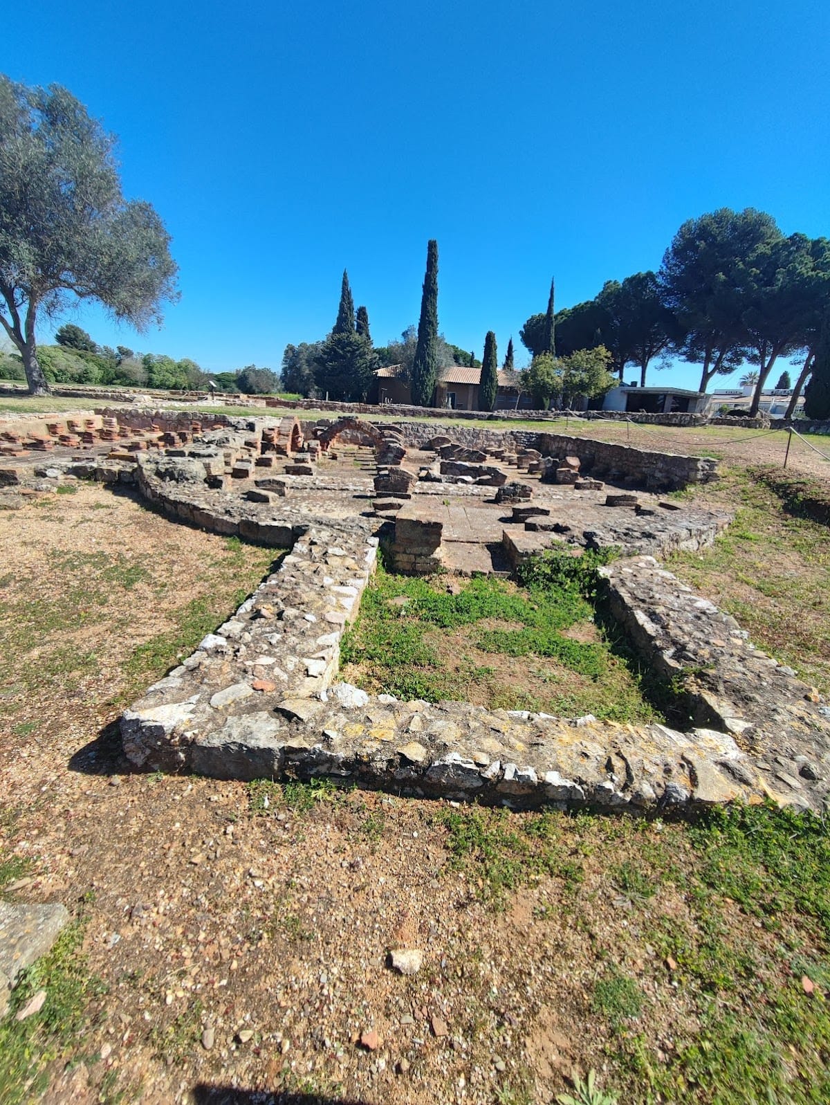
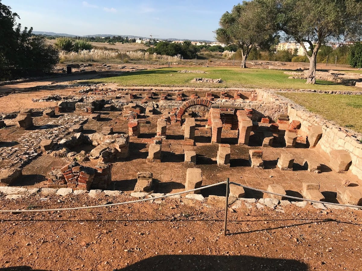
Building C, the large bath complex, stood northwest of the main house. It followed the linear sequence customary in Roman bathing buildings, with an apodyterium for changing, a frigidarium for cold bathing, a tepidarium for warm bathing, and a caldarium for hot bathing. Furnaces serving the underfloor heating system were positioned in the northern and western parts of the complex.
The baths were enlarged after their initial construction in the middle imperial period. Additions included a palaestra, an exercise court, an outdoor swimming pool or natatio, a large water reservoir, and another representative caldarium in the southern sector. The frigidarium was exceptionally large and has been regarded as one of the largest rooms of its type in Portugal. During Late Antiquity, the used floor area was reduced and the southern wing was extensively altered.
Industrial installations and purple-dye production
Seafood-processing complex
Industrial buildings, or fabricae, occupied the eastern and northeastern parts of the settlement. They contained tanks for processing seafood and producing fish derivatives, including garum, a fermented Roman fish sauce. A major complex between Building A and industrial unit J covered more than 1,000 square metres. Its L-shaped plan contained several halls, some divided into multiple aisles. The earliest phase included a cistern, while a later phase added three large halls and basins associated with seafood processing.
Industrial unit J
Industrial unit J stood beside a lagoon channel that served as an anchorage in antiquity. Archaeometric analysis identified the unit as a facility for making purple dye from marine molluscs, a product used in textiles. In Late Antiquity, large industrial rooms were divided into smaller compartments, and evidence for non-ferrous metalworking was found. Small, poorly preserved structures later appeared north of Building A, using dry-stone construction unlike the earlier Roman masonry.
Other working areas
Another possible industrial building in the north contained a tile-bordered working surface, sunken storage jars, and amphorae for a liquid product. It was probably used from the first to the third century and demolished in the fourth. A pottery kiln was found about 49 metres east of the villa’s main entrance, and further possible Islamic-period kilns were located south of the modern museum. During the Islamic period, one former industrial building was divided into rectangular houses by rammed-earth walls. Rooms were arranged around internal courtyards containing silos.
Port and water supply
West of the main building, beside former channels of the Ribeira de Quarteira, a two-phase port remained in use from the Flavian period into Late Antiquity. Its surviving foundation included a stone structure about 40 metres long, built with opus caementitium, Roman concrete suitable for hydraulic construction, and supported on wooden piles driven into the ground. The port included a quay, a covered portico, and other installations. Its remains show that the lagoon was navigable and connected the settlement with the sea. Imported pottery and other objects indicate long-distance maritime exchange.
A dam at Vale Tesnado, approximately two to three kilometres away, supplied water to Cerro da Vila. An aqueduct carried the water to the settlement, where ceramic and lead pipes distributed it to the residential buildings, baths, and industrial installations.
Funerary areas and later burials
Roman cemeteries
Roman funerary areas lay southeast and east of the villa and industrial zone. One eastern area contained two mausoleums, substantial commemorative tombs, in different forms and probably associated with the villa owner’s family. One had interior niches for cremation urns and resembled the funerary temple at Milreu. It was used approximately during the second and third centuries. A large tomb tower marked the eastern end of the Roman cemetery.
Later cemeteries
A northeastern cemetery contained simple graves of varying forms, used mainly for less affluent inhabitants, and remained in use approximately until the fourth or fifth century. Other graves were cut into areas previously occupied by industrial structures. These varied burials include evidence of Visigothic use during approximately the fifth and sixth centuries. A late antique or Visigothic cemetery also occupied the area between industrial unit J and a mausoleum. Late wall alignments within unit J may represent a Christian church or another multi-aisled cult building.
Mosaics, wall decoration, and interpretation
Most surviving mosaics are polychrome and use geometric or plant-based designs. They may have been produced by itinerant workshops that also worked at Milreu and Ossonoba, possibly by artists connected with Carthage in North Africa, although this attribution remains probable rather than certain. A mosaic panel at the bottom of a tank is the only known figurative and two-colour panel among the site’s mosaics. Against a white ground, it depicts two fish, a shell, a bivalve, an octopus, and a dolphin in dark outlines, with a trident directed toward the dolphin’s head. The scene may refer to the capture of marine animals and the settlement’s fishing economy.
Another pavement used opus sectile, a technique that assembles cut stone pieces into patterns. Walls carried vividly coloured frescoes with floral and geometric designs, together with statues, particularly male figures and deities. The archaeological park includes reconstructed wall sections, modern concrete stabilization, and a marked interpretive route. The museum displays material from the Bronze Age, Roman, Visigothic, and Islamic periods, including medieval stelae. The Islamic ceramic assemblage is among the largest and most varied found in southern Portugal.