Castillo de Solera: A Nasrid Fortress in Spain


Visitor Information
Google Rating: 4.6
Popularity: Very Low
Google Maps: View on Google Maps
Country: Spain
Civilization: Unclassified
Remains: Military

History
Castillo de Solera stands near the modern town of Solera in Spain, built by the Nasrid Kingdom during the late 13th century. Its location on the rocky slopes of Cerro Morrón allowed it to serve as a strategic fortress overseeing a crucial valley route.
In the mid-13th century, the area known as Solera was first recorded in Christian documents, described as a Muslim rural settlement or alquería rather than a fortified place. At that time, nearby fortifications changed hands as the Christian King Alfonso X’s forces, led by the noble Don Sancho Martínez de Xódar, briefly captured the region. However, the Nasrid rulers of Granada quickly retook it, maintaining control through much of the late medieval period. Notably, the castle itself emerged later in the 13th century after the Nasrids lost other close fortifications, reflecting a shift in territorial control and economic activity.
During the 15th century, the border between Granada and Castile fluctuated frequently, with Solera passing between powers multiple times. In 1433, the settlement fell back under Castilian control through Fernando de Quesada’s efforts. By the mid-century, the castle was firmly held by Juan de la Cueva, a member of a local noble family that gained royal privileges to form a small lordship centered on Solera. Despite this, by the early 16th century, the area became increasingly depopulated and the fortress lost its military importance. It never transitioned into a noble residence, contributing to its gradual ruin in the following centuries.
Remains
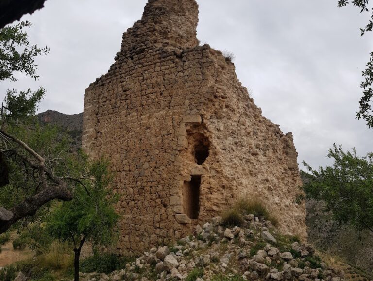
The castle is constructed directly on an uneven rocky outcrop, adapting its design to the natural shapes of the promontory. Its layout suggests a defensive focus, taking advantage of the difficult terrain for surveillance and protection. The structure reveals at least two main phases of building.
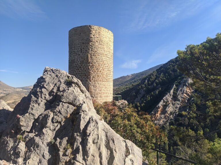
At the top of the site, a small plateau is surrounded by walls made of roughly shaped stones, enclosing a limited space. Within this summit enclosure sits a cistern, or water reservoir, featuring a pointed vaulted ceiling and traces of red plaster inside, indicating careful finishing. Later modifications introduced steps and a small window, showing the cistern was reused after the initial construction phase.
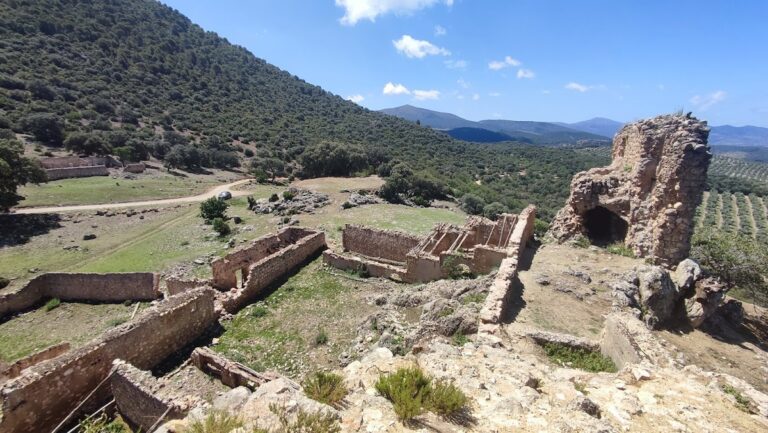
Below the summit area lies a broader section of the castle with remains of larger constructions. This area includes corner towers constructed from finely cut ashlar stones, linked by walls built with various masonry techniques. A vaulted passageway, recognizable by its semicircular arch, connects the higher enclosure with this lower defensive zone. The passage walls still show remnants of plaster, hinting at efforts to protect or decorate the interior surfaces.
Material evidence, such as ceramics found on-site, dates mainly to the late medieval Christian period, aligning with the castle’s final stage of occupation. Today, the original walls have suffered deterioration over time and are partially concealed by more recent, fragile repairs. The castle’s elevated and hard-to-reach position emphasizes its original role as a lookout rather than a residence, with its defensive features adapted thoughtfully to the rugged landscape.
Nearby sites