Castulo: An Iberian and Roman City in Spain


Site at a Glance
- Rating
- 4.4
- Popularity
- Low
- Country
- Spain
- Primary era
- Classical
- External website
- Open
- Eras represented
- Stone Age, Bronze Age, Iron Age, Classical, Medieval
- Civilizations
- Carthaginian, Iberian, Roman, Umayyad
- Site type
- City
On this page25 sections
History
Castulo is an ancient Iberian and Roman city in Spain, near modern Linares in Jaen, whose occupation extended from the end of the third millennium BC until its abandonment in the fifteenth century. It became the capital of Oretania, the region of the Oretani people in the Upper Guadalquivir and parts of the Sierra Morena, and developed into a major political, mining, and urban center.
Origins and Bronze Age development
Activity in the surrounding area reaches back to the Middle Paleolithic. The lowest layers of the city contain Final Neolithic settlements, when village communities were developing an agricultural economy. During the second millennium BC, in the Middle Bronze Age, Castulo grew into a regional center in the foothills of the Sierra Morena. Mining and the production of copper, lead, and silver supported this development, while contacts with metallurgical communities in the southeast Iberian Peninsula brought social changes associated with specialized mining.
At La Muela, a Late Bronze Age settlement extended down the southeastern slope toward the Guadalimar. The community stood on the edge of the Tartessian cultural sphere, an Iron Age tradition of southwestern Iberia, and received early Greek and Phoenician interest connected with mining in the Upper Guadalquivir. A temple-palace built between the eighth and sixth centuries BC may have served as an aristocratic residence, indicating a society with substantial social organization.
The Iberian city and Carthaginian alliance
In the seventh and sixth centuries BC, a local aristocracy emerged, iron technology was introduced, and links with the Lower Guadalquivir weakened. These changes helped produce a distinct regional Iberian culture. The settlement at La Muela moved onto the hilltop, where the walled oppidum, a fortified indigenous urban center, developed. Castulo became the principal population center of Oretania and the largest indigenous oppidum on the Iberian Peninsula. It also operated a mint that issued its own coinage.
During the Second Punic War, the conflict between Rome and Carthage from 218 to 201 BC, Castulo was allied with Carthage. A local tradition records a marriage between Hannibal Barca, the principal Carthaginian commander, and Himilce, a princess of Castulo, as part of the marital alliances linking the city with Carthage. Castulo was also the scene of a major victory by Hasdrubal Barca, a Carthaginian commander of the Barca family, over a Roman army.
In the final years of the third century BC, Castulo’s aristocracy made a pact with Scipio Africanus, the Roman general who defeated Carthage in the war. The city broke with Carthage while retaining its traditional governing institutions. It became a free and immune Roman community, accepted a Roman garrison, and could provide troops. This agreement began Castulo’s Romanization.
Roman municipal development
During the imperial period, Castulo became a municipium of Latin right, a Roman municipality whose inhabitants held a defined form of Roman legal status. Public works transformed the city and included water-distribution facilities, a theatre, baths, and public or religious buildings. The city’s territory also contained substantial rural establishments and was connected to the wider road system of Roman Hispania by the Via Augusta.
The urban villa of the Olivar remained in use into Late Antiquity. Its later remodelling added apsidal rooms and appears to have transformed the complex into the eastern end of the forum, possibly in response to changing religious requirements. By this period, the city was losing population. Burials placed within the walls over layers dating from the first and second centuries AD indicate that depopulation had begun.
Christian and Jewish communities
A bishopric was established at Castulo around AD 350 from territory separated from the diocese of Tucci. Its bishops participated in the Councils of Elvira and Sardica, and the bishopric may later have been reabsorbed into Tucci. It reappeared under Visigothic rule as a suffragan, or subordinate bishopric, of Toledo. A bishop of Castulo attended the Third Council of Toledo in 589, while later bishops took part in Visigothic councils through the Tenth Council of Toledo in 656. Castulo was subsequently replaced as a bishopric by the Diocese of Baeza.
Excavations have also clarified the presence of a Jewish community in Roman Castulo. Two ceramic lamps bearing menorah designs, the menorah being a seven-branched Jewish lampstand, date to the third and fourth centuries AD. They are among the earliest Jewish remains of this type known from the Iberian Peninsula and have been considered possible evidence for a synagogue, perhaps in a building previously interpreted as a church.
Islamic and medieval Castulo
During the Islamic period, settlement shifted from La Muela to the hill of Plaza de Armas, where the fortress of Santa Eufemia was established. The settlement was then known as Qastuluna. A substantial settlement also developed at Fontanar, north of the archaeological zone, with evidence beginning in the Emirate period. Fontanar may have become the most important urban nucleus of the Islamic-period site.
In the thirteenth century, Ferdinand III of Castile conquered Castulo during the campaign of Baeza, and the settlement entered the municipal jurisdiction of Baeza. By the middle of the fourteenth century, it had passed under the jurisdiction of Linares. During the fifteenth century, the defenses of Santa Eufemia Castle and the remaining standing buildings were demolished to prevent their use as refuges by bandits and highway robbers. Two attempts to repopulate the site failed, and Castulo was definitively abandoned.
The hermitage of Santa Eufemia was built soon afterward and remained standing until the eighteenth century, when Castulo’s lands were distributed among residents of Linares. In the nineteenth and twentieth centuries, the territory became a rural area containing cortijos, or farmsteads, and hamlets that reused architectural elements from the ancient city.
Archaeology and protection
Investigations, surveys, and excavations took place from 1969 to 1983, notably under José María Blázquez, and continued intermittently until 1991, when they stopped for administrative reasons. Excavation resumed in 2011 with the creation of the Archaeological Complex of Castulo and the Forum MMX research project, directed by Marcelo Castro. Work since then has exposed public buildings, including a possible second-century AD imperial temple, and has strengthened interpretations of Castulo’s Roman, Jewish, and Christian communities.
Castulo is protected in Spain as an archaeological zone and national monument within the country’s historical heritage system. Measures dated 1985 and 2012 formalized this protected status. The continued archaeological work has also brought to light evidence for changing religious practices, including the possible relationship between the menorah-marked lamps and a building previously identified as a church.
Remains
The archaeological city occupies terraces and slopes around La Muela and Plaza de Armas, at about 300 metres above sea level near the Guadalimar. The elevated, walled plateau provided a broad view over the river valley and the surrounding territory. La Muela preserves evidence of successive settlements, while Plaza de Armas retains the medieval fortress associated with the later phase of the site.
La Muela settlement and defenses
Bronze Age settlement
The Late Bronze Age settlement of La Muela extended from the southeastern hillside toward the Guadalimar and contained several habitation areas. Its temple-palace, dated to the eighth through sixth centuries BC, may have been an aristocratic palace. The building belongs to the period when Castulo stood on the periphery of the Tartessian cultural sphere and maintained connections with mining interests from the Mediterranean world.
Iberian oppidum
The Iberian oppidum occupied the summit of La Muela. Its walls followed the contours of the plateau, although visible sections include later remodelling. Part of the fortification on the summit and northern slope was excavated in the 1970s. The surviving walling is about 1.5 metres thick and consists of roughly dressed stone blocks bonded with mud. Quadrangular bastions reinforced the wall where its direction changed, while earlier fortifications were demolished in some places.
Funerary areas
Iberian funerary activity is represented by the necropolises of Casa Blanca, Baños de La Muela, Los Patos, Estacar de Luciano, Cerrillo de los Gordos, Los Higuerones, Puerta Norte, Molino de Caldona, and Estacar de Robarinas. These cemeteries were used from the fourth century BC to the first century AD. Cremation continued until the middle of the first century AD, when inhumation began to appear. Graves were often grouped around a principal tomb containing exotic prestige objects.
Roman waterworks and public buildings
Reservoirs and aqueduct
The principal Roman reservoirs stood at the northwestern end of La Muela. An aqueduct supplied the city, and its pillars remain identifiable north of the walls. Distribution points extended from the area of Cortijo de Santa Eufemia toward the castle and supplied different parts of the urban settlement. A large cistern from the early imperial period has also been found at Castulo.
Theatre
South of the reservoirs, a semicircular depression is bounded on one side by concrete piers. The feature is interpreted as the seating base of a theatre, one of the public buildings associated with Castulo’s Roman development.
Olivar complex
The urban villa of the Olivar occupies the central and eastern part of the walled plateau. Its early imperial rooms, possibly public in function, were associated with baths and included a hypocaust, an underfloor heating system, together with several courtyards. One courtyard has a central fountain and retains its original opus spicatum pavement, a herringbone arrangement of small bricks or stones.
Later alterations added several apsidal rooms and appear to have connected the complex physically or functionally with the eastern end of the forum. This remodeling gives the surviving building a form that reflects the city’s changing use during Late Antiquity.
Imperial buildings and mosaics
A possible imperial temple dating to the second century AD has stuccoed walls decorated with geometric motifs and a mosaic pavement in exceptionally good condition. Another mosaic, laid in the first century AD, belonged to a public building devoted to the imperial cult, the Roman practice of honoring the emperor and imperial household through public religious observances, and may have honored Emperor Domitian. The building was destroyed in the second century after Domitian’s death. Its strongly colored pavement uses red, blue, gray, white, and ochre tesserae arranged in four large octagons, each containing smaller central octagons.
Mosaics and sculptural remains
Mosaic of the Lovers
The so-called Mosaic of the Lovers is a floor pavement made from more than 750,000 tesserae and dated approximately to the second or first century BC. White, black, and ochre pieces form grids of straight and oblique squares, rectangles, circles, and other geometric shapes. The central panel adapts a compass-scheme design. Instead of one central circle surrounded by semicircles and quarter-circles, it contains two central circles, six lunettes, six additional quadrangular fields, two semicircles on the short sides, and four quarter-circles at the corners.
The corner quarter-circles contain allegorical busts of the four seasons. Spring appears as a crowned woman with flowers, while summer is a young figure wearing a necklace and carrying ears of grain. Autumn has androgynous features associated with Bacchus, a pardalis, and clusters of grapes. Winter is a sorrowful draped woman carrying millet branches and an olive branch.
The semicircular fields contain Erotes, childlike figures associated with erotic love. Some offer grapes to partridges and pheasants, while others hunt a hare with a lagobolon, a hunting stick. The figures are nude and generally wingless, and their discarded bows and quivers reinforce the mosaic’s associations with love and desire. The six quadrangular fields contain a boar, lion, horse, tigress, deer, and lioness. Mythological scenes show the Judgment of Paris and Selene and Endymion, the Moon goddess and the beautiful mortal shepherd placed in eternal sleep. Together, the imagery combines people, animals, wine, hunting, and erotic themes in a moralizing treatment of destructive or excessive love.
The mosaic’s figures change their apparent orientation according to the viewpoint. Seen from the short sides, they face inward, while from the long sides they face outward. The seasonal busts also vary in coloring and lighting, from the bright tones of spring to the intense darkness of summer, the softer treatment of autumn, and the opaque appearance of winter.
Other finds
A monumental stone lion measures 1.20 by 0.90 metres and weighs about one tonne. The complete sculpture shows the animal driving its paw into the body of an individual. It probably stood with a similar lion at a northern entrance that may have operated from the Carthaginian period until the beginning of the first century AD.
Two ceramic lamps with menorah designs were recovered from an area identified as the market. Their third- and fourth-century dates provide material evidence for a Jewish community at Roman Castulo. A 16-millimetre rock-crystal jewel from Area 4 dates to the first century AD. Its engraving shows an Erote reaching toward tree branches with a rod while standing beside a ladder.
Christian glass vessel
Fragments of a fourth-century glass paten preserve about 80 percent of a greenish vessel measuring 22 centimetres in diameter and 4 centimetres in height. Its engraved decoration shows a beardless, curly-haired Christ in an Alexandrian style, holding a jewelled cross and the Scriptures. Two apostles, possibly Peter and Paul, flank him between two palm trees. A chi-rho, an early Christian monogram formed from the first two letters of Christ, and the letters alpha and omega also appear.
Later fortress and settlements
Santa Eufemia Castle
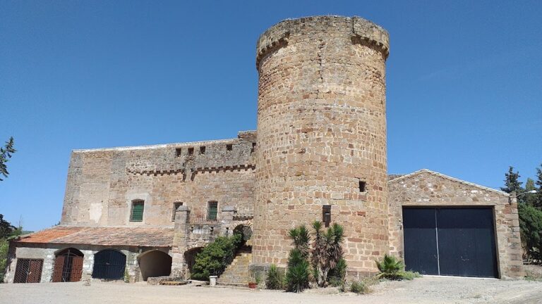
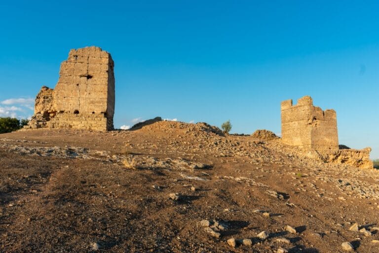
Santa Eufemia Castle on Plaza de Armas retains a central rectangular tower built of mortar. Fragments of the outer wall survive with the remains of six towers. The fortress represents the shift of settlement toward Plaza de Armas during the Islamic period and the later medieval occupation of Castulo.
Fontanar and the rural territory
North of the archaeological zone, Fontanar contains the remains of a medieval settlement whose earliest evidence dates to the Emirate period. The area may have formed the most important urban nucleus of Islamic-period Castulo. Outside the plateau, the substantial villa at Torrubia stood beside what appear to be remains of the Via Augusta, the principal Roman route through Hispania that linked Castulo with the Lower Guadalquivir and the northeastern peninsula.
Burials and domestic evidence
Excavations in 2015 uncovered two child burials covered by pitched roof tiles in Area 3, known as the Iberian House. Another child burial was found in Area 4, where a Punic-period tower occupies the highest part of the city. These discoveries add evidence for burial practices within the urban archaeological complex and for the continued reuse of spaces through different periods.