Castell de Camarasa: An Andalusian Fortress in Spain


Visitor Information
Google Rating: 4.2
Popularity: Very Low
Google Maps: View on Google Maps
Country: Spain
Civilization: Unclassified
Remains: Military

History
Castell de Camarasa is an Andalusian fortress located in the municipality of Camarasa in Spain. Constructed as a “hisn,” or fortified site, it served as a strategic point controlling access along the Segre River valley and the route leading to the Llorenç plains and the nearby settlement of Cubells.
The origins of the castle trace back to the period of Islamic rule in the region, as suggested by its function and some architectural elements, though no direct medieval Islamic texts mention it by name. The toponym may derive from the phrase “kum ruàsa,” which could refer to the residence of local rulers, indicating its importance as a power center during that era.
A recorded milestone in its history appears in 1050, when the castle was handed over to Count Ramon Berenguer I of Barcelona. Soon afterward, it was granted to Arnau Mir de Tost, the lord of Àger, marking the beginning of its integration into the Christian feudal structure during the Reconquista. In 1056, the castle became part of a marriage settlement when it was assigned to Almodis de la Marca as a dowry in her union with Ramon Berenguer I.
Arnau Mir de Tost left the castle in 1072 to his descendants, his grandson Guerau II de Cabrera and daughter Letgarda, acknowledging the original grant from Ramon Berenguer I. Throughout the 12th century, the castle maintained feudal ties to the counts of Barcelona, who were recognized as overlords by local viscounts, including Ponç Guerau III. A notable document from 1196 records Ponç Guerau III’s promise to King Alfonso I to surrender the castle if demanded.
Further evolution occurred in the 14th and 15th centuries when King Alfonso III created the Marquisate of Camarasa as a hereditary title for his son Ferran in 1330. This marquisate incorporated the castle along with several others nearby, reinforcing its importance within the regional nobility. Later, in 1414, following a territorial reorganization by Ferran d’Antequera, the site was granted to Jofre de Barcelona, reflecting continued shifts in ownership associated with court politics.
Today, the castle is recognized as a monument of national cultural interest in both Catalonia and Spain, preserving a layered history that spans from Islamic rule to medieval Christian lordship.
Remains
The ruins of Castell de Camarasa preserve three main structures that correspond to different phases in its historical development, each located in separate, isolated parts of the hilltop where the castle once stood.
The oldest remains are thought to represent the initial Muslim fortress, situated on the northeastern section of the hill. These include a wall segment stretching 22.5 meters and a rectangular tower measuring approximately 8.7 meters across the front and between 1.95 and 2.9 meters on the sides. The building technique uses irregular stone blocks bound with mortar and internally filled with rammed earth and rubble, typical of early fortifications aimed at rapid construction. This section likely served as a defensive stronghold controlling river access.
At the summit, atop the hill, lies a rectangular building with a single nave ending in a semicircular apse. Though this appears to be a later addition, it seems to reuse the foundations of an earlier structure. Its position suggests it functioned as a lookout post overseeing the Segre River corridor, emphasizing the castle’s role in regional surveillance.
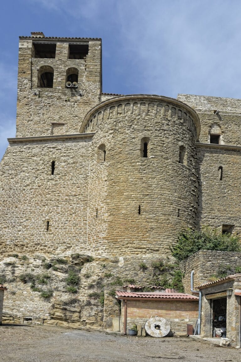
A second identified feature lies 30 meters west of the nearby Church of Sant Miquel and consists of a rectangular tower approximately 7.8 by 6.2 meters in size. Its walls originally measured 1.3 meters thick but are now reduced to about 0.9 meters due to time and alterations. The tower employs limestone masonry bonded with lime mortar, constructed from irregular blocks. This tower is embedded within a cluster of houses, making it unclear whether it originally stood within the main defensive wall or served as an “albarrana” tower—an exterior defensive tower connected by a bridge—common in medieval fortifications.
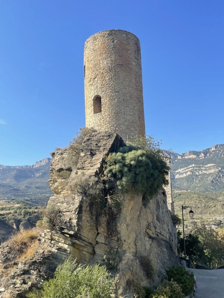
The third and best-preserved element is an albarrana tower located at the western end of Carrer del Castell, oriented along a north-south axis. Measuring nearly square at around 6 by 5.8 meters, this tower rises to 12 meters in height and features walls 1.5 meters thick. It retains three distinct levels, each marked by carefully shaped rectangular limestone blocks for the exterior surfaces, doors, and narrow arrow slits designed for defense. The interior core comprises irregular stone masonry held with lime mortar.
On the first floor, there is a doorway on the north side topped with a semicircular arch made of wedge-shaped stones (known as a voussoired arch), complemented by a smaller opening to the south and several narrow arrow slits. The second level repeats a similar north-facing arched opening, along with two complete arrow slits and one partial one. Marks in the stone indicate former wooden beams and vaulted ceilings that once separated the floors, as well as holes used to support scaffolding during construction. The style and uniformity of masonry suggest this tower dates to the 13th century, reflecting a period of enhanced military architecture in the region.
Taken together, these structures illustrate the castle’s continuous adaptation through centuries of Islamic and Christian rule, blending earlier fortification styles with later medieval defensive innovations.
Nearby sites