Burg Neuenburg: A Medieval Castle Ruin in Durach, Germany


Visitor Information
Google Rating: 4.1
Popularity: Very Low
Country: Germany
Civilization: Unclassified
Site type: Military
Remains: Castle

History
Burg Neuenburg is a medieval castle ruin located in the municipality of Durach, Germany. It was built shortly after 1300 by a branch of the noble Sulzberg family as their residence. This branch had separated from the main Sulzberg line, which continued to occupy the nearby Burg Sulzberg. The castle replaced an older fortification that once belonged to the Kempten Abbey, known as the “Alte Burg” or Old Castle. Historical records also mention the castle by names such as “Neue Burg” and “Neusulzberg,” while some earlier, less substantiated accounts speculated about a Roman military tower (burgus) on the site.
By 1380, the male Sulzberg line residing at Neuenburg came to an end with the death of Konrad Schenk von Sulzberg. Ownership then transferred to the Schellenberg family, who were related to the Sulzbergs. Starting in 1408, the Prince-Abbey of Kempten exercised direct control by appointing a vogt, meaning a bailiff or steward, who managed the castle on behalf of the prince-abbot, acting as both administrator and representative. The Schellenberg family sold the fiefdom to the abbey in 1421, a sale later confirmed by Emperor Sigismund in 1436, securing the castle under ecclesiastical authority.
In 1455, the castle’s function shifted from noble residence to a penal and correctional facility. It gained historical prominence during the German Peasants’ War of 1525, when several rebel leaders were imprisoned and subjected to torture within its walls. The castle also saw military occupation in the mid-16th century; troops from the Schmalkaldic League occupied it in 1546. Two years later, local women and children found refuge there amidst ongoing conflicts. In 1552, cavalry forces representing northern German princes captured the castle after the vogt refused to surrender. Following their departure, repair efforts restored the castle.
The castle’s administrative role ended in 1642 when the last vogt vacated the premises, leaving it abandoned. Over time, the structure was quarried for building materials by locals. Around 1893, a large tower known as the bergfried was deliberately demolished by a farmer, who searched for stone to reuse. Excavations many years later uncovered the tunnel created for this explosion. In the late 20th century, preservation efforts by the municipality of Durach focused on securing the remaining bergfried ruins, although much of the castle remains in poor condition. Today, the site is recognized and protected as a medieval monument by the Bavarian State Office for Monument Preservation.
Remains
Burg Neuenburg is perched on a wooded hill spur southeast of Durach, naturally shielded on three sides by a loop of the Durach River. The castle’s layout incorporates two defensive ditches cut into the terrain, separated by a rampart that shields the hilltop from the connecting ridge to the north. One of these ditches, especially deep, follows the course of what was originally a natural erosion channel that was later adapted to serve as a moat-like barrier.
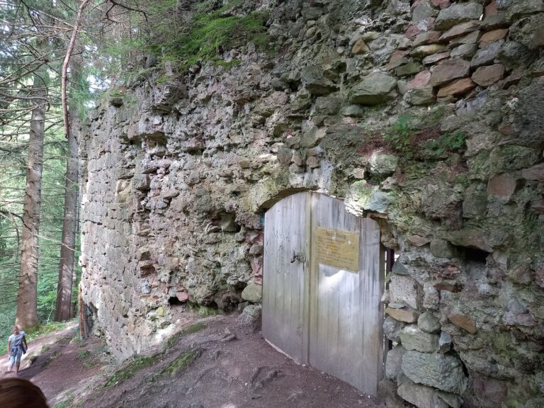
Access to the castle is provided by a narrow path approaching from the east. This route passes by the ruins of a tower or possible gate defense, leading into the rectangular outer bailey, which served as an open courtyard area before the main keep. Within the southwest corner of this outer bailey, remnants of walls and rubble mounds reveal the footprint of a large, nearly square building measuring about 16 by 18 meters. This structure likely played a significant role in the castle’s daily operations.
From the hilltop, slopes descend steeply to the Durach valley on the northern and southern sides, providing a natural defense. The southwestern flank, less steep, is reinforced by two short transverse ditches, and a marked trail follows this ascent from the valley. The main area of the castle extends westward from the outer bailey on its own spur, where partial remains of a ring wall mark the boundary of the inner ward. At the southwest corner of this section, visible foundations outline a semicircular shell tower, which was typical in medieval fortifications for providing wide fields of fire along the walls.
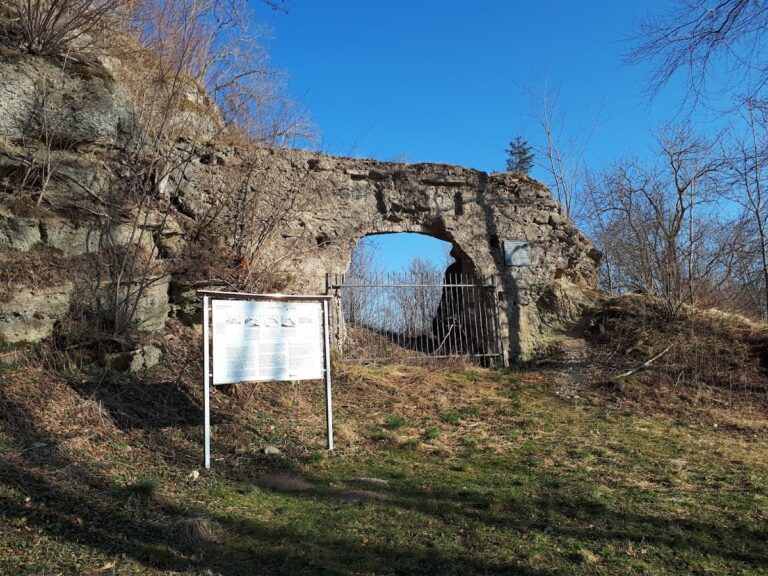
The most prominent surviving feature is the stump of the bergfried, or main tower, standing about six meters tall. Measuring roughly 9.8 by 9.4 meters, this tower sits somewhat raised at the northeast corner of the inner ward. Its original entrance was situated above ground level on the west wall but has since been sealed with brickwork. An embedded stone plaque on this wall commemorates its 1926 installation, honoring Otto Merkt, a mayor of Kempten and castle researcher who helped bring attention to the ruins.
In 1893, the bergfried’s north and east walls were destroyed during an explosion carried out by a local farmer intent on harvesting stone. The remaining walls, approximately two meters thick and constructed from rubble stone, show the robust medieval masonry typical of defensive towers. To the west of the bergfried, a long section of wall still rises over three meters, once protected by an additional narrow outer enclosure resembling a zwinger—a defensive corridor intended to trap attackers.
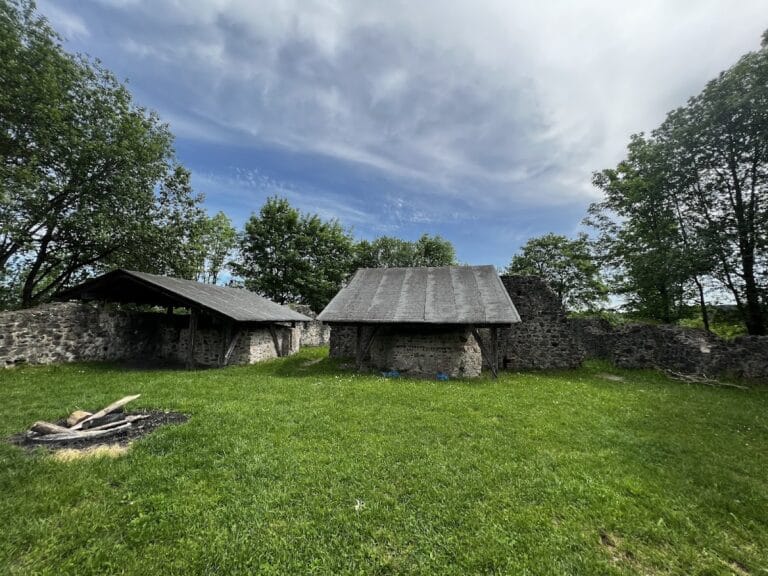
While the bergfried ruins have undergone careful stabilization by the Durach municipality, other wall fragments scattered across the site continue to deteriorate. About 400 meters to the northeast lies a farmstead, marking the former location of the castle’s service or economic yard, which supported the household and everyday functions of the castle’s inhabitants. Together, these physical remains provide valuable insight into the castle’s layout and defensive strategies developed during the medieval period.
Nearby sites