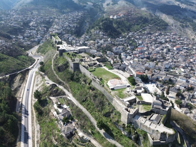
Borsh Fortress: A Historic Stronghold in Southern Albania


Visitor Information
Google Rating: 4.6
Popularity: Low
Google Maps: View on Google Maps
Official Website: bizz.al
Country: Albania
Civilization: Unclassified
Remains: Military
History
Borsh Fortress is located above the village of Borsh in southern Albania, within the municipality of Himarë. This historic site was originally established by ancient peoples during the Bronze Age, around the 12th century BCE, as a defensive stronghold against the invading Dorians.
By the 4th century BCE, the area around the fortress had developed into a small settlement. Over the following centuries, particularly from the middle of the 4th century to the middle of the 1st century BCE, the community expanded considerably, spreading over terraces and slopes encircling the hill and eventually covering about 57 hectares. The fortress was constructed following the outline of an ancient acropolis, symbolizing its long-standing importance in the region.
During the early Byzantine era, the fortress underwent significant rebuilding, with further reconstruction phases occurring up through the late medieval period. It was recognized as a military site of note in the 6th century CE when Emperor Justinian I included it among his documented fortifications.
In medieval times, the location was commonly known as Sopot, a name of Slavic origin that appears in Byzantine records as Sopoton or Sopotos. Greek nautical charts referred to its harbor as Gazopolis. The fortress is mentioned in several historical sources from the 12th century, including Byzantine texts and the writings of al-Idrisi, an Arab-Muslim geographer.
Throughout the medieval period, the fortress changed ownership several times due to shifting political powers. It was incorporated into the Despotate of Epirus before being handed as a dowry to Manfred of Sicily in 1258. Soon after, control passed to the Angevins starting from 1266, with later periods of rule by Venice and eventually the Ottoman Empire.
The Ottomans conquered the fortress and surrounding territory in 1417. Records from a 1431 Ottoman tax register describe the site as a hill with 60 households, serving as a local administrative center known as a nahiye. The fortress saw active resistance against Ottoman control, including uprisings in 1488 and further rebellions in the 16th century supported by Venetian forces.
By the late 18th century, Borsh Fortress was under the control of Ali Pasha of Janina, a powerful local ruler. After his death in 1822, the fortress was abandoned and ceased to be used for military or administrative purposes.
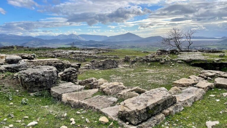
Archaeological investigations began in the 20th century, with initial surveys in the 1930s, detailed mapping carried out in 1971, and excavation campaigns spanning from 1976 to 1990. These efforts revealed the complex historical layers and extensive occupation phases of the site.
Remains
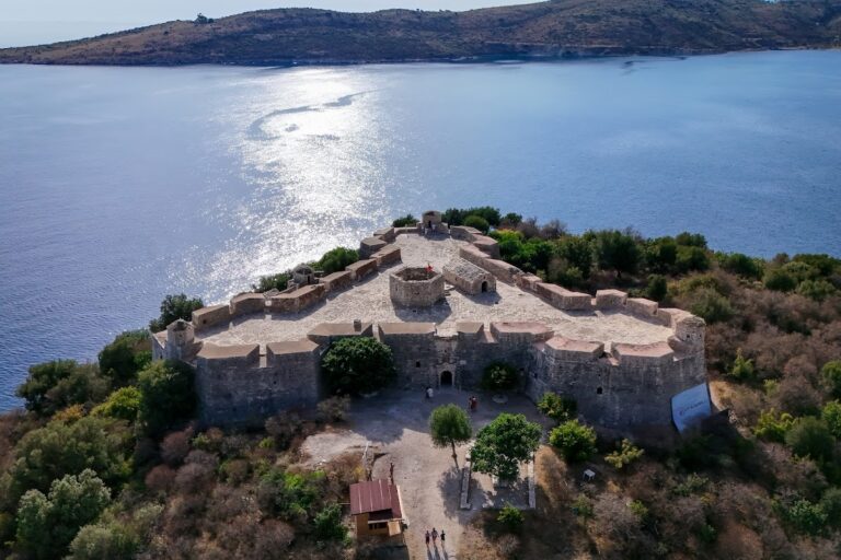
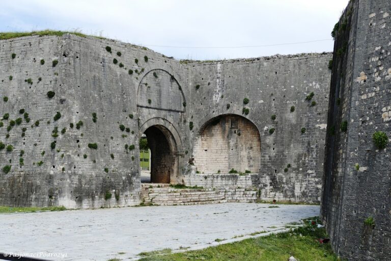
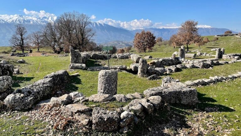
The fortress occupies a rocky hill rising between 326 and 500 meters above sea level, commanding views over coastal access routes. Its defensive walls stretch almost 1,000 meters, preserving the ancient layout shaped by original fortifications. Within the medieval period, the enclosure was internally divided by a wall into two separate sections. Triangular towers, likely added during the middle Byzantine period, punctuate these defensive lines.
Archaeological features include remains of walls and towers dating from various construction phases, alongside medieval residential buildings carefully arranged upon the terraced slopes of the hill. These terraces allowed inhabitants to make practical use of the steep terrain. Inside the fortress, several cisterns have been documented, designed to collect and store water for those living within the enclosure.
On the southwestern side of the hill, remnants of ancient walls measure roughly 10 meters in length and stand about 1.33 meters high. These fragments reflect the earliest construction phases and contribute to understanding the long history of fortification at the site.
The one standing building inside the fortress today is the Haxhi Bendo Mosque. Constructed likely in the late 17th century from locally sourced materials, this mosque is square in plan and features a single dome, each side measuring about eight meters. A northern porch with three stone arches, roofed with bricks, leads into the prayer space. The mosque retains a mihrab, a niche indicating the direction of Mecca, located on the south wall. In the northwest corner, the remains of a minaret are still visible. The dome, currently covered with concrete, has not been restored since communism ended in Albania, distinguishing it from many Byzantine churches in the region that have undergone renovation.
Outside the fortress, to the south of the village, archaeological research has uncovered an ancient necropolis, indicating that the area held importance for local communities well beyond military activities, including as a burial site in antiquity.
Nearby sites