Aguntum: A Roman Municipium in the Eastern Alps of Austria
Table of Contents


Visitor Information
Google Rating: 4.6
Popularity: Low
Google Maps: View on Google Maps
Official Website: www.aguntum.at
Country: Austria
Civilization: Roman
Remains: City

Context
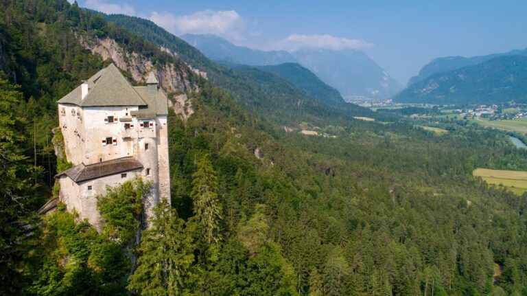
Aguntum is situated near the present-day municipality of Dölsach in East Tyrol, Austria, within the Drava River valley. This location lies amid the Eastern Alps, a mountainous region that historically served as a corridor linking northern Italy with the Danube basin. The valley floor provides a relatively level terrain suitable for settlement, contrasting with the surrounding alpine topography. The proximity to the Debantbach stream and access to mountain passes made Aguntum strategically positioned for controlling transit routes and exploiting natural resources.
Archaeological investigations have established that Aguntum emerged as a Roman settlement during the early Imperial period, developing into a municipium that functioned as a local administrative and economic center. The site’s occupation extended into late antiquity, reflecting broader regional dynamics in the Eastern Alps. Although the city declined after the 5th century CE, the precise factors contributing to its abandonment remain incompletely understood due to limited documentary evidence and archaeological data.
Systematic excavations began in the 19th century and have continued intermittently, revealing substantial urban remains including public buildings, residential complexes, and infrastructure. Conservation efforts prioritize stabilizing exposed ruins and facilitating scholarly research, contributing to a nuanced understanding of Aguntum’s role within the Roman provincial framework and its interaction with the alpine environment.
History
Aguntum’s historical trajectory exemplifies the integration and transformation of a local Alpine settlement within the Roman Empire and its subsequent evolution through late antiquity into the early medieval period. Initially inhabited by the Noric Laiancer tribe, the area was incorporated into the Roman provinces of Noricum and Raetia following a largely peaceful annexation around 15 BCE. Elevated to municipium status under Emperor Claudius in the 1st century CE, Aguntum became a regional center with administrative, economic, and religious functions. Its decline and eventual destruction in the early 7th century reflect the broader political and military upheavals that reshaped the Eastern Alpine region during the transition from Roman to post-Roman rule.
Pre-Roman and Early Roman Period (Before 1st century CE)
Prior to Roman incorporation, the territory around Aguntum was occupied by the Noric Laiancer, a Celtic-speaking tribe whose presence is etymologically linked to the modern city of Lienz. The settlement likely originated as a Roman road station (mansio) on the Via Julia Augusta, a principal transalpine route facilitating movement between northern Italy and the Danube provinces. Archaeological evidence includes a mid-1st century BCE two-room wooden structure beneath the later bath complex, indicating early Roman activity predating urban development. The peaceful Roman annexation of Noricum around 15 BCE integrated the region into the imperial system, establishing the administrative context for Aguntum’s subsequent growth.
Roman Municipal Development and Imperial Roman Period (1st–3rd century CE)
In the 1st century CE, under Emperor Claudius, Aguntum was formally recognized as a municipium, adopting the official name Municipium Claudium Aguntum. This status conferred local self-governance and integration into the Roman provincial administration. The city underwent significant urban expansion, including the construction of a city wall on its eastern side, enclosing key civic and residential areas. The wall, built of river stones and mortar, featured a main gate flanked by towers; however, its defensive purpose remains debated, with some scholars suggesting a primarily symbolic or flood-protection function.
The urban fabric included a large forum complex serving administrative and commercial roles, a rare circular macellum market building specialized in perishable goods, and the largest known Roman thermal bath in Austria. The bath complex, initially constructed under Tiberius, was rebuilt and expanded after a late 1st-century CE fire, featuring marble decoration, mosaic floors, hypocaust heating, and wall paintings. An artisans’ quarter east of the baths contained workshops and residential spaces, indicating a mixed-use industrial and domestic area. Excavations in 2018 uncovered a marble-adorned assembly hall with underfloor heating, interpreted as a venue for legal or civic gatherings. A 1st-century temple within the forum area attests to organized religious activity.
Aguntum’s economy was closely linked to mining and metalworking, exploiting local deposits of iron, copper, zinc, and gold. Its strategic location along major Roman roads facilitated trade, including the export of mountain crystals and dairy products. Inscriptions document local magistrates and cults, reflecting a structured civic society.
Late Roman and Early Christian Period (4th–5th century CE)
From the 3rd century CE onward, Aguntum experienced increasing external pressures amid the decline of Roman authority in the region. The nearby hilltop settlement of Lavant gained prominence due to its defensible position, attracting some inhabitants away from the valley floor. Aguntum suffered at least two major sackings: one by barbarian forces under Radagaisus and Alaric, evidenced by ash layers and human remains in the bathhouse, and another by Attila the Hun around 452 CE, confirmed by a coin found in a higher ash stratum.
Despite these disruptions, the city remained inhabited, though its social and economic structures contracted. The political landscape shifted as Aguntum came under Ostrogothic control and was contested by Franks, Byzantines, and Bavarians. Around 500 CE, the city was established as a Catholic bishopric subordinate to the Archdiocese of Aquileia, marking its role in the early Christian ecclesiastical hierarchy and reflecting the religious transformation of the region.
Early Medieval Period and Destruction (6th–7th century CE)
By the early 6th century, Aguntum’s population had declined significantly, and its bishopric was suppressed circa 600 CE, with ecclesiastical authority transferred to Lavant. The city’s urban infrastructure deteriorated, and many inhabitants retreated to fortified hilltop refuges, signaling a shift from urban to rural defensive settlement patterns. In 610 CE, a decisive battle near Aguntum between Bavarian forces led by Garibald II and invading Avars resulted in a Bavarian defeat and the destruction of the city. Lavant also suffered a major fire around this time.
Following these events, the remaining Roman population dispersed, with Slavic and other groups settling the valleys. The abandonment of Aguntum as a significant urban center marked the end of its role in regional political and economic networks. The site’s ruins remained visible into the 16th century, inspiring local legends but no longer functioning as a living settlement.
Post-Roman Period and Rediscovery (16th century to Present)
After its abandonment, Aguntum’s ruins persisted as low vaults and hypocaust corridors, giving rise to folklore such as the “dwarf city” myth. Archaeological interest began in the 18th century, with systematic excavations initiated in the early 20th century by Austrian institutions including the University of Vienna and the Austrian Archaeological Institute. Since 1991, the University of Innsbruck’s Institute of Classical and Provincial Roman Archaeology has overseen ongoing research and conservation, developing the site into an archaeological park.
Today, the site preserves substantial remains of the city wall, atrium house, thermal baths, craftsmen’s quarter, macellum, forum, and assembly hall. A modern museum exhibits artifacts such as painted tombstones, pottery masks, bronze objects, and coins, and an observation tower provides panoramic views of the site and surrounding landscape, linking the ancient city’s history with its alpine environment.
Daily Life and Importance by Period
Pre-Roman and Early Roman Period (Before 1st century CE)
Before Roman annexation, the population around Aguntum consisted primarily of the Noric Laiancer tribe, a Celtic-speaking group indigenous to the Eastern Alpine region. Their settlement pattern was rural and kinship-based, typical of Noric society. With the peaceful incorporation of Noricum into the Roman Empire circa 15 BCE, Aguntum began to transform from a tribal settlement into a Roman road station (mansio) on the Via Julia Augusta, facilitating imperial connectivity across the Alps.
Economic activities at this stage were modest, focusing on servicing travelers and exploiting nearby natural resources, notably the Tauern gold deposits accessed via the Möll Valley. Archaeological evidence of a mid-1st century BCE wooden structure beneath the later bathhouse suggests early Roman architectural influence and administrative or lodging functions. Diet likely combined local alpine staples such as dairy and game with Roman-introduced cereals and wine, though direct evidence is limited. Clothing would have reflected a blend of indigenous and Roman styles, with woolen tunics common in alpine environments. Religious practices remained largely Celtic, with no clear evidence yet of Roman cults.
Roman Municipal Development and Imperial Roman Period (1st–3rd century CE)
Following its elevation to municipium status under Emperor Claudius, Aguntum developed a structured civic hierarchy with local magistrates, including duumviri, overseeing administration and religious cults. The population comprised Roman settlers, local Noric descendants, and artisans, with social stratification evident between elite landowners, skilled craftsmen, and likely slaves or laborers. Gender roles aligned with Roman norms, with men occupying public offices and women managing domestic affairs.
Economic life centered on mining and metalworking, exploiting local deposits of iron, copper, zinc, and gold. Workshops in the artisans’ quarter produced metal goods, while agriculture in surrounding areas supplied dairy products and wood. The circular macellum indicates a specialized market for perishable goods such as meat, fish, and imported oysters, demonstrating active trade networks extending to distant cities like Cologne and Mainz. Transport relied on well-maintained Roman roads facilitating movement by carts and pack animals.
Diet included bread, olives, fish, and locally produced cheese, consistent with Roman provincial cuisine. Clothing comprised woolen tunics and cloaks suited to alpine climates, with sandals and leather goods produced locally. Domestic interiors featured mosaic floors, painted walls, and marble decoration, particularly in elite houses such as the atrium-style residence. Hypocaust heating in baths and some homes indicates sophisticated comfort standards.
Religious life centered on a 1st-century temple within the forum and local cults blending Roman and indigenous deities. Public buildings like the forum and assembly hall hosted legal and civic gatherings, fostering community cohesion. Aguntum’s role as a municipium made it a regional administrative hub linking mountain resource exploitation with imperial markets.
Late Roman and Early Christian Period (4th–5th century CE)
From the 3rd century onward, Aguntum’s population faced increasing insecurity due to barbarian incursions and political instability. Despite sackings by forces under Radagaisus, Alaric, and Attila the Hun, the city remained inhabited, though its social fabric and economy contracted. The nearby hilltop settlement of Lavant gained defensive prominence, attracting some inhabitants away from the valley floor.
Economic activities shifted toward subsistence and local trade, with mining and metalworking declining but artisanal production persisting on a smaller scale. The bath complex and public buildings show signs of damage and partial repair, indicating reduced municipal resources. Dietary evidence suggests continued reliance on local agricultural products supplemented by limited imports.
Christianity became increasingly significant, with Aguntum established as a Catholic bishopric around 500 CE under the Archdiocese of Aquileia. Ecclesiastical leadership introduced new social roles and religious practices, including liturgical services and Christian instruction, though specific educational activities remain undocumented. Pagan cults likely diminished, replaced by Christian worship centered in the episcopal church.
Civic organization adapted to the changing political landscape, with Ostrogothic and later Frankish influences. The city’s administrative functions persisted but weakened, reflecting broader imperial decline. Aguntum remained a regional religious center but lost much of its earlier economic vitality.
Early Medieval Period and Destruction (6th–7th century CE)
By the early 6th century, Aguntum’s population had significantly declined, and its bishopric was suppressed circa 600 CE, with ecclesiastical authority transferred to Lavant. The city’s urban infrastructure deteriorated, and many inhabitants retreated to fortified hilltop refuges, signaling a shift from urban to rural, defensive settlement patterns. Social structures became less formalized, with diminished civic institutions.
Economic life was minimal, focused on local agriculture and pastoralism, with little evidence of organized craft or trade. The decisive battle in 610 CE between Bavarian forces and invading Avars near Aguntum led to the city’s destruction and the displacement of its remaining population. The subsequent settlement of Slavic and other groups in the valleys further transformed the demographic and cultural landscape.
Religious practice continued under Christian auspices but was localized and less institutionalized. The loss of municipal status and destruction of public buildings ended Aguntum’s role as a regional center. The site’s abandonment marked the end of its urban importance, with daily life reverting to small-scale rural subsistence in the surrounding region.
Post-Roman Period and Rediscovery (16th century to Present)
Following abandonment, Aguntum’s ruins persisted as visible remnants, inspiring local folklore but lacking permanent settlement. No continuous population or economic activity existed on the site. Archaeological interest beginning in the 18th century uncovered the city’s layout, revealing insights into its former urban life.
Remains
Architectural Features
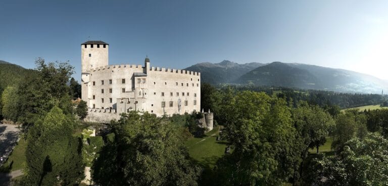
Aguntum’s archaeological remains predominantly date from the 1st to the 3rd centuries CE, reflecting its development as a Roman municipium. The urban layout is oriented along the Decumanus Maximus, the principal east-west street connecting the main city gate to the urban core. Construction techniques include the use of river stones (Bachsteinen) bonded with mortar, particularly in the city wall. The wall, approximately 400 meters in length and originally about 7 meters high, enclosed the eastern portion of the settlement. Its construction date is debated, with evidence favoring a 3rd-century CE origin, possibly serving flood protection or symbolic purposes rather than strict military defense.
The site preserves a range of civic, residential, industrial, and religious buildings, some exhibiting multiple phases of use and reconstruction over several centuries. Preservation varies from well-maintained walls and foundations to fragmentary remains obscured by debris or natural deposits.
Key Buildings and Structures
City Wall and Main Gate
The city wall, primarily constructed in the 3rd century CE, extends about 400 meters with a thickness of 2.45 meters. Built from river stones and mortar, it originally reached approximately 7 meters in height, with current reconstructions standing 5 to 6 meters tall. Excavations have revealed sections extending 30 meters north and 75 meters south of the main gate, though the full circuit remains untraced, likely due to sediment from the nearby Debantbach stream.
The main gate measures 9.5 meters in width and features two passageways. It is flanked by towers with doors opening outward, a design indicating a primarily symbolic or representative function rather than a defensive military role. The gate’s architectural style and construction materials align with the wall’s 3rd-century date, though some hypotheses suggest an earlier Augustan origin, which lacks archaeological confirmation.
Atrium House
Dating from circa 100 to 400 CE, the Atrium House is the largest known residential building at Aguntum, covering approximately 6,000 square meters. It functioned as a residential and representational complex with multiple rooms for living and sleeping. The building’s Mediterranean architectural style is unique within the Alpine region. Over three centuries, it underwent several reconstructions reflecting changing ownership or use.
A marble basin discovered in the central garden area is now exhibited in the site museum. To protect the structure from flooding and landslides caused by the Debantbach stream, a modern shelter was constructed over part of the Atrium House beginning in 1999 and renewed from 2006, covering its central section.
Thermal Bath Complex
Located in the northwest of the excavation area, the thermal bath complex is the largest Roman bath discovered in Austria. Initially built in the first half of the 1st century CE during Emperor Tiberius’s reign, it underwent multiple rebuilding phases after a fire in the late 1st century CE. The bath was rotated 180° in its second phase, situating the entrance on the west side near the Debantbach stream.
The complex includes marble door thresholds, marble-clad walls, warm water basins, mosaic floors, and wall paintings. It functioned as a public facility for hygiene and social activities. Further expansions occurred in the 2nd and 3rd centuries CE. Archaeological excavations recovered valuable jewelry from the bath’s drainage channels, indicating the wealth of some users. The bathhouse also contains evidence of violent destruction, including ash layers and human remains linked to barbarian sackings.
Macellum (Market Hall)
Uncovered in 2006 at the western edge of the site, the Macellum is a circular market building dating to the 1st century CE. Its architectural design combines a square outer form with an inner circle and a central decagon. The interior circle is subdivided into multiple chambers, with floors paved in multicolored marble slabs.
Initially debated, the building is now identified as a market hall for perishable foodstuffs such as meat, fish, and oysters. The Macellum is rare in northern Roman provinces but common in Italy, Africa, and the Orient. It is situated near the forum and along the Decumanus Maximus, forming part of the northern commercial complex.
Forum
The forum lies north of the Decumanus Maximus and covers approximately 3,000 square meters. Constructed in the 1st century CE, it served as a trading center and possibly housed public administration offices. In 2019, excavations revealed a stone wall measuring 6 by 5 by 1 meters within the forum, interpreted as the remains of a 1st-century temple, indicating religious activity within the civic center.
Decumanus Maximus
The main east-west street, the Decumanus Maximus, runs through the main city gate and is lined on its northern side by covered sidewalks. Key buildings such as the Atrium House, Macellum, and forum are located along this street, which formed the urban spine of Aguntum.
Assembly Hall (Versammlungssaal)
Discovered in 2018, the assembly hall covers an area of 360 square meters and dates to the 1st century CE. It features marble decoration and an underfloor heating system (hypocaust). The hall likely served judicial or legal functions, as suggested by its architectural features and layout.
Craftsmen District
East of the thermal bath complex lies the craftsmen’s quarter, extending over two building complexes. Excavations uncovered three buildings containing workshops for various industries. These structures include tiled roofs, attics, underfloor heating, living rooms, and kitchens. Large boulders placed at building corners appear to have protected them from damage by wheeled vehicles navigating narrow streets.
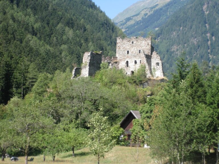
Burial and Religious Structures at Lavant
The nearby village of Lavant, southeast of Aguntum, became increasingly populated from the 4th century CE onward. Archaeological remains there include a castle with an episcopal residence, a Roman temple with tombs and votive altars dating to the 2nd and 3rd centuries CE, a fortified gate flanked by two towers, and an early Christian church constructed in four phases from the 4th century.
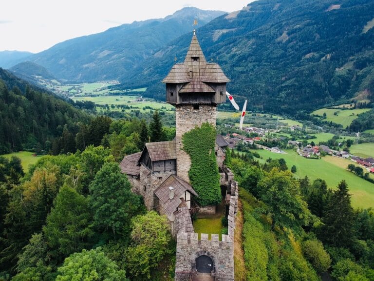
Observation Tower
A modern steel observation tower, 18.9 meters tall, was erected in 1997 in the northern part of the excavation area. It has 91 steps and five intermediate landings leading to a platform 15 meters above ground level, providing views over the archaeological site and surrounding landscape.
Museum
The Museum Aguntum, opened in 2005, is located across the road from the excavation site. It occupies a 1,250 square meter building constructed over the Atrium House to protect it from flooding and landslides caused by the Debantbach stream. The museum received the Austrian Museum Quality Seal in 2021.
Other Remains
The oldest Roman remains at Aguntum include a two-room wooden structure beneath the bathhouse, dated to the mid-1st century BCE. No military camp has been identified at the site. Layers of ash and human remains found in the bathhouse correspond to barbarian sackings by forces under Radagaisus and Alaric in the late 4th or early 5th century CE. A coin dated to 452 CE was found in a higher ash layer, indicating a second sacking by Attila and the Huns.
The city was destroyed after a battle in 610 CE between Bavarian and Avar forces, after which no further bishops were ordained. Ruins remained visible until the 16th century, when only low vaults and hypocaust corridors were discernible, inspiring local legends of a “dwarf city.” Numerous inscriptions found on site confirm the official name Municipium Claudium Aguntum and mention cultores Genii municipii Agunti (worshippers of the city’s protective spirit).
Archaeological Discoveries
Excavations at Aguntum have yielded a variety of artifacts spanning from the mid-1st century BCE through late antiquity. Pottery includes locally produced tableware and imported amphorae, reflecting trade connections. Numerous inscriptions provide official names and references to local cults and magistrates. Coins from multiple emperors, including a coin dated to 452 CE, have been recovered, aiding chronological frameworks.
Tools related to metalworking and agriculture have been found primarily in the craftsmen’s quarter. Domestic objects such as lamps, cooking vessels, and bronze items appear throughout residential areas. Religious artifacts include votive altars and statuettes, especially at Lavant. Painted tombstones and pottery masks have also been uncovered, contributing to understanding funerary practices.
Preservation and Current Status
The city wall and main gate are partially reconstructed, with sections standing up to 6 meters high. The Atrium House is protected by a modern shelter to prevent damage from flooding and landslides. The thermal bath complex retains substantial architectural elements, including marble cladding and mosaic floors, though some areas are fragmentary. The Macellum and forum foundations are preserved at ground level, with visible marble flooring in parts.
Other structures, such as the assembly hall and craftsmen’s district, survive as foundations and partial walls. The site is subject to ongoing conservation and excavation by the University of Innsbruck’s Institute of Classical and Provincial Roman Archaeology. Environmental threats include erosion and sedimentation from the Debantbach stream. Stabilization efforts focus on preserving exposed ruins while limiting reconstruction to essential protective measures.
Unexcavated Areas
Significant portions of Aguntum remain unexcavated, particularly beyond the known city wall circuit, which has not been fully traced due to debris from the Debantbach stream. Surface surveys and geophysical studies suggest buried remains may exist in these areas, but modern land use and conservation policies limit extensive excavation. Future research aims to expand understanding of the city’s full extent and peripheral structures, though excavation is constrained by environmental and logistical factors.
Nearby sites