Montfort Castle: Teutonic Headquarters in Israel
Site at a Glance
- Rating
- 4.7
- Popularity
- Medium
- Country
- Israel
- Primary era
- Medieval
- External website
- Open
- Eras represented
- Medieval
- Civilizations
- Crusader, Kingdom of Jerusalem, Mamluk, Teutonic Order
- Site type
- Military
- Remains
- Castle
On this page15 sections
History
Montfort Castle is a Crusader fortress in Israel near Eilon, established in the mid-twelfth century by the French noble de Milly family as a fortified agricultural estate. Centered on the Galilean lordship of Mi’ilya, the estate formed part of a network of 36 villages and farms. Its buildings were later enlarged, decorated, and more strongly defended as the property passed into the hands of powerful nobles.
From agricultural estate to noble possession
In 1179, the estate was inherited by Joscelin de Courtenay through his marriage to Agnes de Milly, heiress of the de Milly family. Under the new ownership, the fortified farm grew in importance. The buildings were expanded and embellished, while the defenses were reinforced.
Saladin’s victory over the Crusaders at the Battle of Hattin in 1187 led to the capture of Jerusalem and the transfer of many Crusader possessions to Muslim control. The Mi’ilya estate and the future Montfort site passed into Muslim hands. Because the inland property stood away from borders and major roads, it had limited strategic value to its new rulers, who made little effort to repair the ruins.
The Crusaders recovered the region during the Third Crusade, after which the Mi’ilya estate was divided among Joscelin de Courtenay’s daughters. Otto of Henneberg, one of his sons-in-law, received Montfort. Acre had by then become the capital of the reduced Kingdom of Jerusalem, the principal Crusader state in the Holy Land, and this change increased the castle’s political importance even though its military value remained limited.
The Teutonic Order at Montfort
During the early thirteenth century, the de Milly estate was transferred to the Teutonic Order, a German military-religious institution that combined warfare, administration, charitable work, and property management in the Crusader states. The knights began renovating the former fortified farm and soon converted it into their principal headquarters in the Holy Land.
Conflicts with the Templars and Hospitallers in Acre encouraged the Teutonic Order to move part of its administration to the more isolated Montfort site. At the request of Grand Master Hermann von Salza, Pope Gregory IX obtained financial contributions from pilgrims and European residents for the renovation and strengthening of the castle. By 1229, the order had transferred its headquarters, archive, and treasury there.
This change transformed Montfort from an agricultural estate into a full-scale castle and administrative center. The order used it from approximately 1230 until its surrender in 1271. Montfort was designed chiefly as a secure refuge for the Teutonic Knights and their administrative resources, rather than as a major stronghold intended to resist a large Muslim army. Its isolated position and limited capacity made it unsuitable for a large garrison or a prolonged siege.
Names and changing associations
The castle’s name changed over time. It was first known as the New Castle of the King and later as Castellum Novum. The name Montfort, meaning “strong mountain,” appears in a document of 1229. Under German ownership it was rendered as Starkenberg. During the Ottoman period, the site was called Qal’at al-Qurain, or “Castle of the Little Horn,” a name also used for nearby Nahal Kziv.
Some scholars associate Montfort with a settlement mentioned in the Talmud whose name meant “fortress of Galilee.” This remains an interpretation rather than an established identification.
The sieges of 1266 and 1271
In 1266, two emirs serving the Mamluk sultan Baibars led an army against Montfort. The defenders forced the attackers to withdraw. Baibars, a Mamluk ruler who conquered many Crusader strongholds during the thirteenth century, returned in 1271 after most Crusader positions in Galilee had fallen.
Mamluk military engineers breached the southern outer wall during the siege, forcing the defenders into the keep. After the castle’s defenses collapsed, the Teutonic leaders negotiated with Baibars. The garrison was allowed to leave with its possessions and return to Acre. Johann von Sachsen, the last commander of Montfort, directed the defense.
The Teutonic archive was transferred intact to Acre. After the end of the Crusader kingdom, it was moved to Tyrol in Austria, where it remains an important resource for studying the Crusader presence in the Holy Land. Baibars ordered Montfort demolished to prevent its reoccupation. Most of the complex was destroyed, while the strongly built keep survived largely intact.
Abandonment and archaeological investigation
The ruins remained abandoned from the late thirteenth century onward, apart from a short period of repairs during the rule of Dahir al-Umar, the Bedouin governor of Galilee under the Ottoman sultans. Horatio H. Kitchener surveyed the site in 1877 for the British Survey of Western Palestine.
The first archaeological excavations took place in 1926 during an expedition organized by Bashford Dean of the Metropolitan Museum of Art, with William L. Calver directing the work. Excavations resumed in 2011 in a campaign organized by Adrian Boas of the University of Haifa and supported by the Society for the Study of the Crusades and the Latin East. Annual summer work followed, with students from Royal Holloway, University of London, participating in 2015 and 2016.
Surveys and excavations revealed activity dating from the Roman period through the end of the Byzantine period in the seventh century. Later investigations also identified destruction associated with Baibars’s Mamluk campaign. Montfort is now an archaeological site and national park within the Nahal Kziv Nature Reserve, where continuing investigation and protection have shaped the interpretation of its remains.
Remains
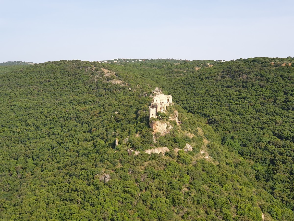
Montfort is a spur castle, a fortified site built on a narrow ridge projecting from higher ground, on the southern bank of Nahal Kziv in the Upper Galilee. The ridge is steep, narrow, and isolated from major routes, with its exposed position dominated topographically by the surrounding hills. The castle extends along a long site whose broadest sections measure no more than about 30 metres. Rather than leveling the ridge, the builders fitted the wings, towers, and walls to its natural contours.
Upper castle and defenses
The keep
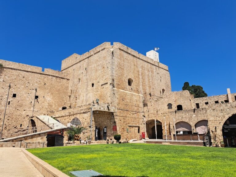
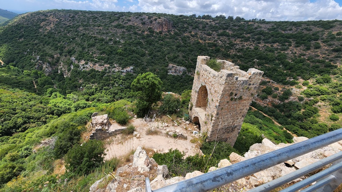
The upper ward, or castle proper, stretches between the eastern keep and the western entrance defenses. The keep is a large D-shaped tower built from substantial limestone blocks. It was the first major part of the castle to be constructed and stood at the highest and most exposed eastern point. The tower served as the lord’s residence in peacetime and as an inner fortress and final refuge during war. Its small dimensions limited its usefulness as a defensive position for a large garrison.
A second high tower stood at basement level on a retaining wall and formerly overlooked the northern slopes of the ridge. Two artificial dry ditches cut across the eastern approach, where the spur joined higher ground and the defenses faced their most vulnerable side.
Domestic and administrative buildings
West of the keep was an elongated two-storey building, probably the principal domestic structure. It extended toward a three-storey administrative building at the lower western end of the main castle. The administrative building retains two tall vaulted halls on its ground level. Its second storey has been interpreted as a ceremonial hall, while the third contained the castellan’s living quarters. A castellan was the officer responsible for administering and defending a castle.
A small vaulted building was added at the western end of the complex and is now badly ruined. The main entrance passed through a well-preserved, three-storey half-tower. From there, the approach entered a gate zwinger, a confined defensive passage between walls. Its enclosing wall ran westward, curved south in a semicircle, and joined the castle at the westernmost vaulted building.
A second elongated zwinger appears to have followed the northern side of the domestic and administrative buildings. Its route led to a gate opening onto a vestibule at the eastern end of the domestic building, between that structure and the keep.
The outer ward
The outer ward lay about 50 metres below the main castle on the northern slope. A defensive wall curved up the western slope and ended southwest of the castle. Auxiliary structures, including stables, stood within this lower enclosure. The wall survives mainly on the northern and western slopes, while an outer stone wall and the southern ditch formed the castle’s first defensive line.
Montfort’s masonry is predominantly limestone and often rough in appearance. Some stones were reused from Roman-period quarried and dressed masonry, probably taken from an ancient quarry and a small Roman fortification south of the Crusader castle. The earlier agricultural estate extended from the castle toward the slopes of Nahal Kziv and was enclosed by several walls. After the Teutonic Order made Montfort its headquarters, activity became concentrated within the central fortified complex.
Religious, domestic, and service buildings
Church and refectory
North of the administrative area stood a church, of which the southern part survives. A stairway descended from it to the knights’ hall, or refectory, a communal dining room in a religious institution. The refectory had a roof carried by two rows of octagonal piers. Two piers remain, indicating the hall’s elaborate original construction.
The refectory floor also formed the roof of the castle cellars, where food and other goods were stored. The cellars may also have held treasures belonging to the Teutonic Order. Excavations in 1926 uncovered sculptures and fragments of stained glass associated with the Teutonic church, together with weapons and armor fragments.
Valley building and waterworks
A comparatively well-preserved three-storey building stands in the valley beside Nahal Kziv. It contains several halls and functioned as a flour mill. During the thirteenth century, its upper floor was converted into a guest house. Another interpretation identifies the structure as a hospital used by the knights after Montfort became the order’s headquarters.
A dam beside the valley building collected water from Nahal Kziv. The resulting pool supplied water for the estate’s inhabitants and agricultural land, and also powered the flour mill.
Associated remains and archaeological finds
Less than one kilometre from Montfort toward Mi’ilya, a fortified courtyard building with a tower stood beside a stone quarry. It may have been the rabad, or outer settlement, that Baibars captured first in 1271. Crusader records give the place several variant names, including Tarphile, Trefile, and Tertille.
The 1926 excavation exposed the keep and Crusader-period buildings below it, probably connected with workers who cultivated the estate when it was still an agricultural farm. Later work added evidence of daily and elite activity. Board games and a luxury dining room were uncovered in 2017, while archaeologists identified a decorated Gothic hall beneath the castle in 2018.