Hunin Fortress: A Crusader Stronghold in Upper Galilee


Site at a Glance
- Rating
- 4.2
- Popularity
- Low
- Country
- Israel
- Primary era
- Medieval
- Eras represented
- Medieval, Early Modern
- Civilizations
- Ayyubid, Crusader, Kingdom of Jerusalem, Ottoman
- Site type
- Military
- Remains
- Castle
On this page15 sections
History
Hunin Fortress is a Crusader fortress in Israel beside Margaliot in Upper Galilee. Built probably around 1107 during the early Crusader Kingdom of Jerusalem, it stood on the road from Damascus to Tyre and formed part of the Seigneurie of Toron, a northern lordship whose capital lay south of the Litani River. The fortress guarded a frontier landscape and helped protect one of the region’s major routes for trade and movement.
A Crusader frontier fortress
During the early years of the Crusader Kingdom of Jerusalem, the Hula Valley marked a boundary between Crusader and Muslim-controlled territories. Crusader rulers established fortifications along the roads crossing this frontier, and Hunin was probably built as part of that defensive network. Its strategic importance was also linked to the struggle for Banias, a settlement and stronghold controlling approaches through the northern region.
In 1157, Humphrey II of Toron sold part of the lordship of Banias and Chastel Neuf, another name for Hunin Fortress, to the Hospitallers. This medieval Catholic military-religious order held and defended fortifications in the eastern Mediterranean. In 1167, the Muslim commander Nur al-Din captured the fortress. Its Crusader garrison set the stronghold on fire before withdrawing, and the destruction reached the foundations.
Rebuilding and Ayyubid destruction
Humphrey of Toron rebuilt Hunin in 1179, although his death in battle that year probably prevented the work from being completed. The fortress remained active under Ayyubid rule after the Battle of Hattin, the 1187 defeat that weakened Crusader control in the region and enabled Saladin’s dynasty to expand across much of Syria and the surrounding lands.
In 1220, al-Mu’azzam Isa, the Ayyubid ruler of Damascus, destroyed Hunin together with other Crusader fortresses in Galilee. The stronghold was then abandoned and left unrepaired until the eighteenth century. The decline of the northern road from Tyre to Damascus, which passed through Banias, further reduced the site’s importance. Traffic shifted to a southern route from Safed through the Daughters of Jacob Bridge toward Damascus.
Later records and uncertain Mamluk use
Crusader and Mamluk records mention Hunin as part of the estate of Toron. In 1266, the place was recorded as having passed to the Mamluk sultan Baybars, who ruled the Mamluk Sultanate of Egypt and Syria from 1260 to 1277. The fortress’s use during Mamluk rule remains uncertain. The name may have preserved the memory of the former boundaries of the Toron estate rather than indicating that the fortress itself was still in use.
The fortress and its surroundings contain evidence of settlement from Iron Age I and II, the Persian, Hellenistic, Roman, Byzantine, and Fatimid periods. These earlier phases place the Crusader stronghold within a much longer history of occupation on the ridge.
Ottoman rebuilding and abandonment
Under Ottoman rule, probably in the late seventeenth or early eighteenth century, a Shiite Mutawali notable renovated the fortress as part of the development of the Mutawali village of Hunin. The Ottoman Empire ruled the region from the early modern period until the twentieth century, while the Mutawali were a Shiite Muslim community associated particularly with the Beqaa and northern Levant.
The abandoned fortress was associated with the Arab village of Hunin, which stood south of it from the medieval period. Villagers dismantled parts of the walls for building material. The village had 1,075 inhabitants in 1931 and 1,620 in 1945. Hunin Fortress was probably finally abandoned after the earthquake that struck the region in 1837.
During the War of Independence in May 1948, Jewish forces captured the village of Hunin, and its inhabitants fled. The village buildings were demolished apart from the former elementary-school building, which remained in poor condition. The Jewish moshav of Margaliot was later established on the site of the displaced village.
Archaeological investigation
The site was surveyed by the Galilee Survey team led by Rafi Frankel and by the Israel Antiquities Authority as part of the Metulla map. Cleaning and trial excavations took place in the southern part of the fortress from January to April 1994 under the direction of archaeologist Idan Shaked. Conservation accompanied the excavations, including work to restore the Ottoman vault on the western side of the gatehouse.
Remains
Setting and overall layout
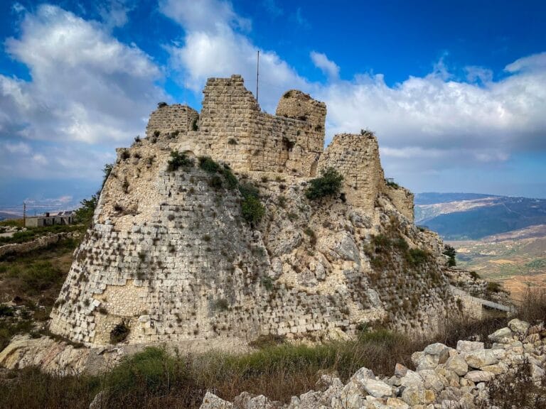
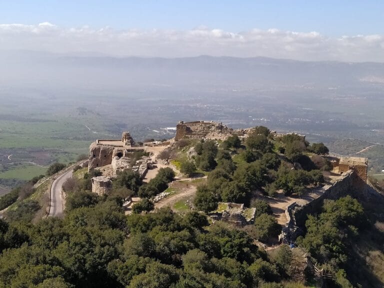
Hunin Fortress occupies about 5.5 dunams, or approximately 90 by 70 metres, on a wooded ridge of the Naphtali Mountains near Margaliot and the Lebanese border. The ridge stands about 690 metres above sea level, while the ground falls roughly 400 metres eastward toward the Hula Valley. A rock-cut moat about 12 metres wide surrounds the fortress on the north, west, and south. On the east, the steep descent toward the valley provided natural protection.
The surviving complex combines Crusader, Ayyubid, and Ottoman construction. Its defenses were repeatedly altered after destruction and rebuilding, leaving walls, towers, vaulted spaces, water installations, and reused materials from earlier periods.
Crusader and Ayyubid defenses
First-phase towers
The first Crusader fortress included two substantial towers linked by a wall. Their walls were about 3 metres thick and built from dressed ashlar, masonry made from regularly cut stone blocks, with drafted margins. The western tower has been exposed almost completely and measures about 13 by 13 metres; the eastern tower has been excavated only in part. A silver coin from the reign of Baldwin III, king of Jerusalem from 1143 to 1163, was found at the eastern tower’s southwestern corner. The towers and connecting wall are poorly preserved, probably because the fortress was burned and destroyed to its foundations in 1167.
Later southern wall
A second Crusader-Ayyubid phase included a southern wall made of roughly dressed stones and reused ashlar blocks. It appears to have been built after the first-phase towers were destroyed, and the moat belongs to this later defensive arrangement. Service latrines stood at both ends of the wall. Cleaning the western latrine produced a rich group of Ayyubid pottery and coins dating the destruction of this phase to the time of al-Mu’azzam Isa, around 1218. Similar coins were found in rooms between the fronts of the earlier towers and the later southern wall.
Ottoman structures and water systems
Rebuilt walls and gatehouse
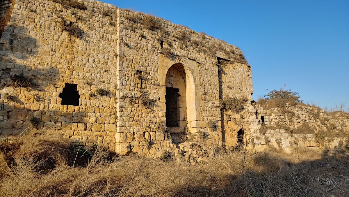
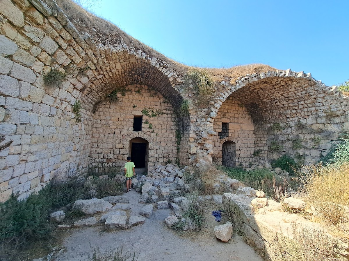
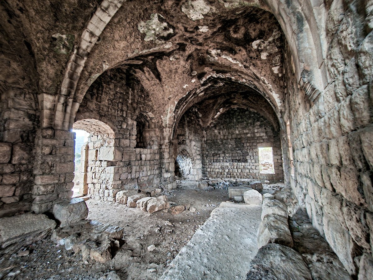
The Ottoman fortress was rebuilt in the eighteenth century on the foundations of the Crusader-Ayyubid wall. The later wall incorporated loopholes, and a gatehouse was constructed. Vaulted spaces were added in the southern part of the complex, while the walls and towers were repaired or completed. The gatehouse contains Ottoman barrel-vaulted construction, reflecting the later phase of the fortress’s physical form.
Cisterns and reused materials
Behind the central barrel vault in the northern part of the gatehouse is a cross-shaped cistern, a reservoir for collecting and storing water, that still holds water. Other prominent rock-cut cisterns survive within the fortress. Earlier water cisterns were cut through when the moat was quarried, and Byzantine olive-press weights were incorporated into the fortress facade.
Village remains and cemetery
The Ottoman village cemetery of Hunin lies on the northern part of the hill, beyond the moat. The fortress and its immediate surroundings also preserve remains of the abandoned village, including the former school building that survived the demolition of the village buildings after 1948.