Beaufort Castle: A Medieval Fortress Overlooking the Litani River in Lebanon
Site at a Glance
- Rating
- 4.6
- Popularity
- Low
- Country
- Lebanon
- Primary era
- Medieval
- Eras represented
- Medieval
- Civilizations
- Ayyubid, Crusader, Kingdom of Jerusalem, Knights Templar, Mamluk
- Site type
- Military
- Remains
- Castle
On this page12 sections
History
Beaufort Castle is a medieval Crusader fortress in Lebanon, built after the capture of the site in 1139 on a rocky outcrop above the Litani River. Known in Arabic as Qalaat ash-Shaqif or Shaqif Arnoun and to the Crusaders as Beaufort or Belfort, meaning “beautiful fortress” in Old French, it formed part of the defensive system of the Kingdom of Jerusalem.
Crusader Foundation and Defence
Little is known about the site before the Crusader conquest, although the hill was probably fortified earlier. A Roman-period watchtower or fortification may have occupied the outcrop. In 1139, Fulk V of Anjou, king of Jerusalem from 1131 to 1143, captured the fortification and transferred it to the lords of Sidon. Crusader building probably began soon afterward, and the castle was rebuilt or enlarged during the thirteenth century.
The fortress guarded an important position above the Litani valley and helped protect the eastern Mediterranean territories of the Kingdom of Jerusalem, a Crusader state established after the First Crusade. In 1179, survivors of the Battle of Marj Ayoun took refuge at Beaufort. After the Crusader defeat at Hattin in 1187, the castle was among the last strongholds to resist Saladin, the Muslim commander who defeated the Crusaders and founded the Ayyubid Sultanate.
Saladin besieged Beaufort from 1189 into 1190. Reynald of Sidon defended the fortress and used a promised delay in the negotiations to repair its fortifications and gather supplies. The garrison eventually surrendered in April 1190 in return for Reynald’s release, and Beaufort passed into Saladin’s control.
Recovery and Mamluk Transformation
The Crusaders regained Beaufort in 1240 through a treaty negotiated by Theobald I of Navarre. In 1260, Julian of Sidon sold the castle, together with Sidon and the surrounding lands, to the Knights Templar. This medieval military-religious order defended Crusader territories and protected pilgrims.
On 15 April 1268, the Mamluk sultan Baibars captured Beaufort after ten days of intensive bombardment by twenty-six siege engines. The Mamluks were the sultanate that defeated the remaining Crusader strongholds. Under their rule, the castle’s purposes changed. Its main hall became a mosque, a hammam, or Islamic bathhouse, was added, and the fortress became a regional administrative centre. Under later local rulers, it served as the headquarters of the governors of Jabal Amel.
Ottoman and Local Rule
After the Ottoman conquest of Syria in 1516, military benefices around Beaufort were granted to cavalrymen. The Shiite Sa’b family held the castle for the Ottoman authorities from at least 1571, while Shiite feudal families controlled the surrounding area until 1769.
In the early seventeenth century, Fakhr al-Din II, a Lebanese Druze emir who sought to expand his autonomous rule, incorporated Beaufort into his network of fortifications. After the Ottomans defeated him, they destroyed the upper parts of the castle. The Sa’b family later regained control.
Jazzar Pasha, the Ottoman governor of Acre, besieged and captured Beaufort in 1782, destroying much of the remaining fortifications. The Galilee earthquake of 1837 caused further extensive damage. The ruins were subsequently used as a quarry and as shelter for sheep.
Archaeological Study and Modern Conflict
Investigations in the late nineteenth century included surveys by Victor Guérin in 1880 and by Claude Reignier Conder and Herbert Kitchener in 1881. Archaeological study and restoration were renewed during the French Mandate. In 1936, the historian Paul Deschamps and the architect Pierre Coupel organised the clearance of the inner enclosure with sixty-five soldiers. Deschamps published the results in 1939. Restoration had begun in 1920 and continued after Lebanon became independent in 1943, while the clearance and study provided an important basis for later understanding of the castle.
Military activity subsequently caused further damage, and the site was later neglected because of limited interest and resources. The Palestine Liberation Organization, a Palestinian political and military organisation, held Beaufort from 1976. Israeli forces repeatedly attacked its positions between 1976 and 1980, while artillery was fired from the site toward northern Israel.
On 6 June 1982, at the beginning of the Lebanon War, Israeli forces heavily shelled the PLO positions. They captured the castle on 7 June in the Battle of Beaufort, using Golani reconnaissance and engineering forces. Goni Harnik, commander of the Golani reconnaissance unit, and five other soldiers were killed, while several soldiers, including Moshe Kaplinsky, were wounded. Menachem Begin later visited the castle with Ariel Sharon.
After its capture, the Israel Defense Forces used Beaufort and built a large military base beside the western wall. The castle and base were repeatedly shelled by the PLO and Hezbollah during the eighteen-year occupation. Hezbollah is a Lebanese Shiite political and armed organisation that fought Israeli forces in southern Lebanon. The occupation made Beaufort a major symbol in Israeli, Palestinian, Lebanese, and local memories of the conflict.
Israeli forces withdrew from southern Lebanon in May 2000 and demolished the adjacent base during the evacuation of 23 and 24 May. The demolition was intended to prevent Hezbollah from using the installation. The Lebanese state later promoted Beaufort as a site associated with occupation and national reunification, while Palestinians regarded it as a memorial and pilgrimage site connected with the 1982 fighting. These interpretations were contested by the Lebanese Ministry of Culture and many local residents.
Restoration and tourism-related rehabilitation proceeded slowly after the withdrawal. A planned programme included structural support, clearance, rainwater protection and drainage, reconstruction of the main tower and entrances, and lighting. During the 2024 Lebanon War, UNESCO granted Beaufort enhanced protection as one of thirty-four Lebanese cultural sites.
During the 2026 Lebanon War, Israeli forces struck the castle, directly damaging its remains, and captured it on 31 May 2026 in an operation that included forces from the Golani Brigade. The Israeli military stated that control of the site was intended to help control the surrounding area and a tunnel purportedly used by Hezbollah. Hezbollah subsequently attacked the site. In July 2026, Beaufort was inscribed as part of the “Mount Amel Castles” on the UNESCO World Heritage List and simultaneously classified as World Heritage in Danger. The site near the castle was extensively dynamited by Israeli forces during the night of 31 July 2026.
Remains
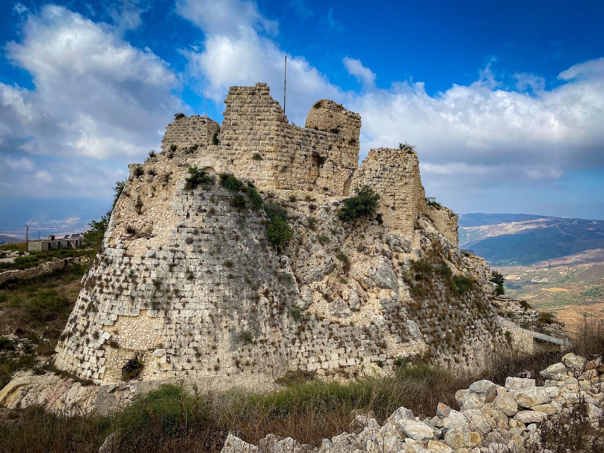
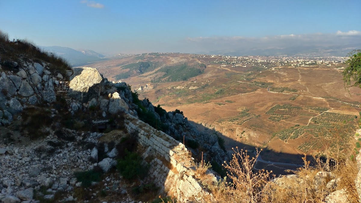
Beaufort occupies a high rocky outcrop above the Litani River. The cliff extends for approximately 500 metres, while the eastern drop toward the river is about 300 metres. The fortress stands at roughly 670 to 717 metres above sea level. Its position overlooks southern Lebanon, northern Israel, the Litani valley, the Levantine coast, and several other castles. The complex has a roughly triangular plan measuring about 150 by 100 metres, with a fortified base of about 90 metres that rises approximately 170 metres when the ditches are included.
Fortress Layout
The castle is divided into an upper castle to the west and a lower castle to the east, with the upper section controlling the lower one. Both extend broadly from north to south. The northern side benefits most from the natural defenses of the outcrop, while a slightly lower rocky shelf to the east was incorporated into the fortress and eliminated one approach route. Ditches and defensive walls enclose the complex.
Upper Castle and Principal Defences
The Crusaders built the upper castle. Its southern side is strengthened by an internal shield wall, a heavily reinforced wall protecting an exposed side, with Tower 6 on the west and Tower 5 on the east. A central ramp leads toward the principal keep, while a chapel stands east of it. A second principal tower at the southern end has a hexagonal plan.
Keep
The keep, or principal tower and main stronghold of the castle, stands against the western wall of the upper ward. It has a square plan measuring approximately 12 by 12 metres. Its entrance is at ground level, following a regional Syrian building practice rather than the European arrangement of entering a keep through the first floor.
Gate and Lower Castle
The entrance stands on the southern side at the junction of the upper and lower castles, between upper-castle Tower 5 and lower-castle Tower 1. Restoration plans prepared by architect Jean Yasmine for Lebanon’s Directorate General of Antiquities identify it as Gate A. The Ayyubids, the dynasty founded by Saladin, constructed the principal gate and the lower castle. The Templars later added the southern section, a Gothic hall, and a chapter house, a meeting room used by a religious order.
The lower castle contains a large vaulted hall in its southern section, protected by southern Towers 1 and 2. Farther south are Tower 3, a projecting section before Tower 4, casemates, or fortified chambers and firing positions, and Building H at the southern extremity. These parts form the lower defensive and internal arrangement beneath the upper castle.
Water Systems and Islamic Additions
Traces of a basin remain on the northern side of the complex. Cisterns stored rainwater, while channels carried wastewater away from the fortress. The Mamluks added a hammam and converted the main hall into a mosque, physical changes that reflect the castle’s transformation from a Crusader stronghold into a regional administrative centre.
Twentieth-Century Military Structures
The military base built beside the western wall in 1982 was separate from the medieval castle. It contained concrete casemates, bunkers, tunnels, observation posts, and firing positions. The base and its associated military structures were demolished during the Israeli withdrawal in 2000. Shelling and military use damaged the medieval remains, particularly during the 1982 battle and the occupation from 1982 to 2000. Israeli forces struck the remains again during the 2026 war, causing direct physical damage.