Ansignan Aqueduct Bridge: A Historic Roman and Medieval Structure in Southern France
Visitor Information
Google Rating: 4.8
Popularity: Very Low
Google Maps: View on Google Maps
Official Website: www.ansignamuse.fr
Country: France
Civilization: Medieval European, Roman
Remains: Infrastructure
History
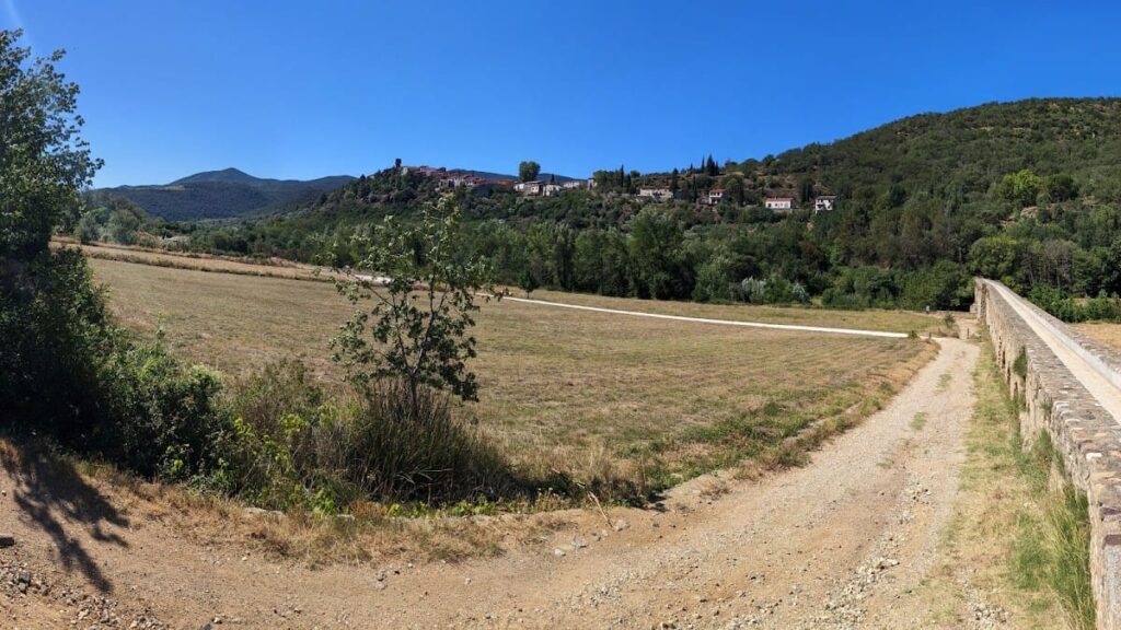
The Ansignan Aqueduct Bridge is situated just north of the village of Ansignan in the Pyrénées-Orientales department of southern France. Its origins trace back to the 3rd century CE, a period when the region was under Roman influence. It likely served agricultural estates or a rural villa, providing irrigation through an aqueduct system.
In the 9th century, the original Roman bridge underwent transformation. A medieval aqueduct was added above the existing structure, converting the lower level into a tunnel-like passage. Further modifications occurred in the 13th and 14th centuries, extending the aqueduct to its present length and reinforcing its dual function as both water channel and crossing.
Throughout its history, the aqueduct has remained in use, primarily for irrigating fields across the Agly river. Local traditions have woven various legends around its construction, attributing it to Gauls, monks, or the Knights Templar. Some stories even connect the site to biblical or mythical origins, though these remain unverified by archaeological evidence.
In the early 20th century, around 1906, a hydroelectric turbine was installed in a mill building adjacent to the aqueduct on the left bank. This mill operated until the 1970s when it was demolished during restoration efforts. Despite the removal of the mill, its foundations and water channels are still visible today. The aqueduct was officially recognized as a historic monument in 1974 and received heritage restoration funding in 2023 to address structural repairs and preservation.
Remains
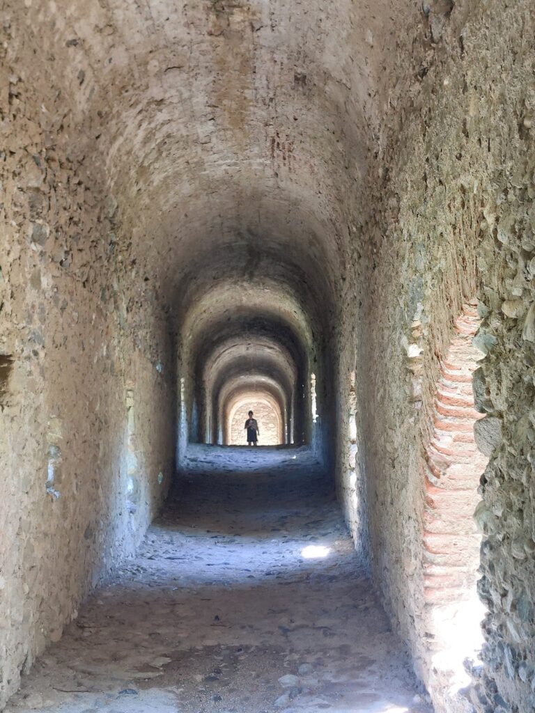
The Ansignan Aqueduct Bridge extends approximately 170 meters across the Agly river, featuring 29 arches that increase in height toward the river’s center. It is built on two levels: the lower level serves as a covered passage for pedestrians, riders, and small carts, while the upper level carries water through the aqueduct channel. The lower section resembles a tunnel with a curved, barrel-vaulted ceiling and is illuminated by side openings.
Construction materials vary across the structure. Most of the aqueduct consists of rubble stone held together with mortar. The two large arches spanning the river and other major arches are made from precisely cut ashlar blocks, providing strength where needed. Smaller arches away from moisture exposure incorporate brick elements. The left bank approach, about 150 meters long, uses unworked stones on brick arches, while the right bank includes two large 3rd-century arches alongside medieval additions from the 13th or 14th centuries.
The aqueduct reaches up to 15 meters in height at its tallest points. Its irregular shape reflects multiple phases of medieval remodeling and extension, including the addition of the upper water channel above the original Roman bridge. The remains of the early 20th-century hydroelectric mill are located on the left bank near the downstream end. Foundations and water discharge channels from the mill remain visible, marking the site’s continued adaptation over centuries.
Today, the aqueduct remains functional, still channeling water for irrigation and serving as a passageway. Restoration efforts have focused on waterproofing, removing vegetation, repairing cracks, and restoring arches to preserve this historical monument.
