Kurzętnik Castle: A Medieval Fortress in Poland


Visitor Information
Google Rating: 4.5
Popularity: Low
Google Maps: View on Google Maps
Country: Poland
Civilization: Unclassified
Remains: Military
History
Kurzętnik Castle stands in the municipality of Kurzętnik, Poland, and was established by the Chełmno bishopric chapter during the late 13th or early 14th century. Its construction began sometime after 1331 and was completed before 1361, as indicated by the earliest record of Teutonic officials residing there. Serving as a fortress and administrative center for the bishopric, the castle’s location on Kurnik Hill offered control over the surrounding Drwęca River valley.
In July 1410, the castle became strategically important during the buildup to the Battle of Grunwald. Teutonic troops gathered in its vicinity while Polish forces under King Władysław Jagiełło avoided engagement at this site by retreating. Following the battle, Polish forces briefly occupied Kurzętnik Castle, led by Jan Kretkowski, yet it reverted to Teutonic control after the Peace of Thorn in 1411. The castle endured serious damage during the 1414 Hunger War.
Kurzętnik faced further devastation in October 1454 during the Thirteen Years’ War when mercenaries loyal to the Teutonic Order captured and set fire to it, taking many prisoners and inflicting heavy casualties. After the Second Peace of Thorn in 1466, the castle came under Polish sovereignty. Its military importance continued to wane, with significant damage occurring during Swedish military campaigns in 1659. By the 19th century, the remaining ruins were dismantled for local construction materials. Archaeological efforts in the late 20th century, along with later supervision during modern developments, have helped document its past.
Remains
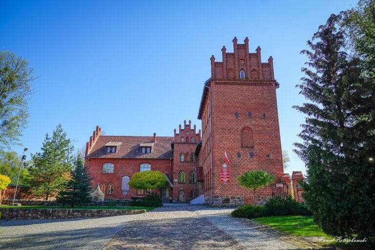
Kurzętnik Castle was constructed on an uneven hilltop adapted to its sloping terrain, resulting in an irregular layout stretching about 110 meters in length and 42 meters in width. The site occupies a plateau that overlooks the town of Kurzętnik and the Drwęca valley, offering wide views over the surrounding lowlands. The enclosure roughly forms a quadrilateral with a trapezoidal courtyard inside.
The main residential structure dates to around 1340 and originally rose several stories high. Measuring approximately 25 by 28 meters, its surviving walls reach 6 to 8 meters in height on two facades. The fortress’s walls were built from granite blocks reinforced in the upper sections with brick, yielding a thickness near 1.5 meters. Defensive elements included two towers incorporated into the longer curtain walls and a southern gate approached by a drawbridge, which connected to the road from the nearby town of Brodnica.
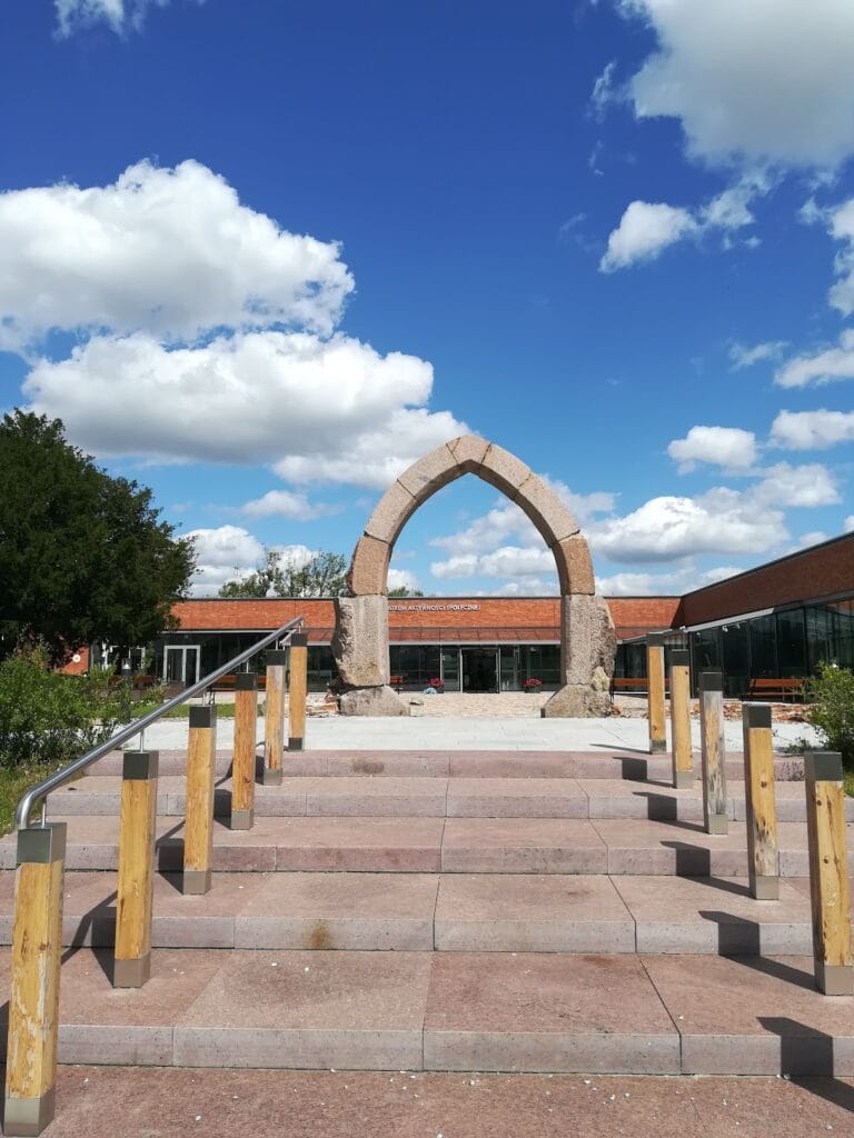
On the northern side, the courtyard was closed off by a chapel dedicated to the Holy Cross. This chapel also likely functioned as a barrier to the outer eastern bailey, controlling access within the castle complex. Today, only fragments of the external walls and foundation stones remain, outlining the original footprint of the buildings and courtyard. Near the former site of the chapel, a modern telecommunications tower has been established, reflecting the ongoing use of the hilltop while preserving key archaeological features.
Nearby sites