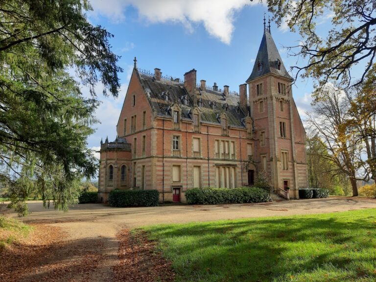
Château de Fontariol: A Fortified Manor in Theil, France


Visitor Information
Google Rating: 4.8
Popularity: Very Low
Official Website: www.chateau-de-fontariol.com
Country: France
Civilization: Medieval European
Site type: Domestic
Remains: Palace
History
The Château de Fontariol stands in the commune of Theil, France, and traces its origins to a period spanning the late 15th century and the early 16th century. This fortified manor was constructed during the transition from the late Middle Ages into the early modern era by the local feudal society inhabiting the region.
Its location along a historic thoroughfare, which follows the route of an ancient Roman road linking Avaricum (now Bourges) to Lugdunum (today Lyon), suggests the site’s strategic importance in controlling and monitoring movement between key Roman settlements. Although the château itself postdates the Roman period, the presence of this road hints at continued significance of the area through successive centuries.
During the 18th century, ownership of the château passed through several hands within the aristocracy. Marguerite Louan de Fontariol, the designated owner in the mid-1700s, transferred the property in 1775 to her nephew, the Marquis de Tilly. Shortly after, by 1779, the estate changed ownership once more when Gilbert de Boucaumont des Garennes acquired it. While these transitions reflect patterns of inheritance and property exchange common among noble families, the château remained linked to local gentry throughout its known history.
On February 10, 2010, the château, along with its surrounding structures and enclosed courtyard area, received official protection as a historic monument. This designation recognizes its architectural and historic value within the context of French cultural heritage.
Remains
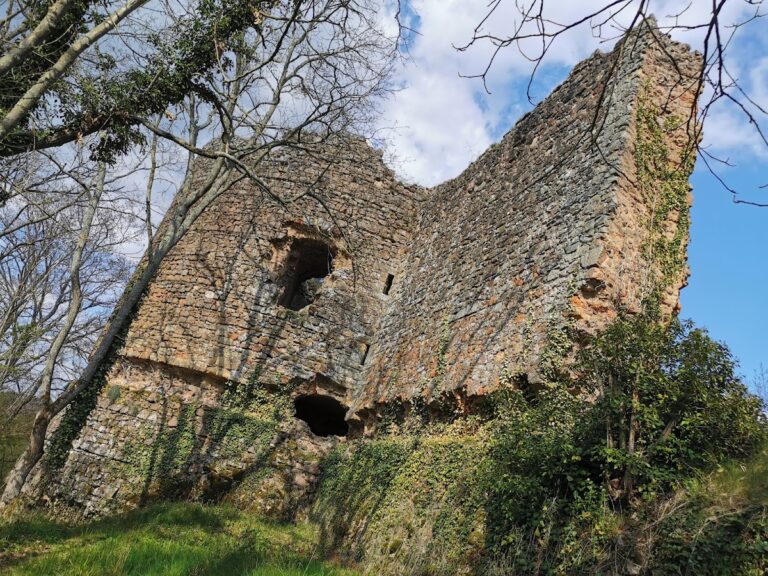
The château’s structure exemplifies a fortified manor characteristic of the Bourbonnais region at the close of the medieval period. Positioned on a hillside about 450 meters above sea level, it overlooks the route connecting Saint-Pourçain-sur-Sioule to Le Montet, a location affording both defense and oversight of the surrounding landscape.
The main building forms a square residential block arranged on the northern side of a private courtyard. This courtyard is enclosed by defensive walls and is further surrounded by agricultural outbuildings, indicating the estate’s mixed residential and agrarian functions. The solidity of these walls and the presence of agricultural constructions reflect a manor designed for both protection and estate management.
Prominent among the structural elements is a round tower projecting from the southern façade. This tower rests on a battered base—a design where the lower portion slopes outward for stability—and houses a spiral staircase within. Crowning this tower is a dovecote, a structure traditionally used for housing pigeons or doves, which often signified status and resource provision in rural estates.
Another circular tower strengthens the building’s northwest corner and also projects outward from the main block, serving defensive and structural roles. Along the southern and eastern façades, the château preserves a number of arrow slits, narrow vertical openings through which defenders could shoot arrows while remaining protected. Nearby, two stone windows divided by a central upright stone mullion offer a contrast with the defensive apertures, flooding interior rooms with light while maintaining the building’s sturdy appearance.
Together, these surviving features highlight the château’s role as a fortified residential manor typical of the border area between the Berry and Bourbonnais regions. Its construction techniques and defensive attributes exemplify the regional architectural responses to the challenges of late medieval life while integrating elements suited for noble habitation. The site remains largely preserved, retaining its main masonry structures and layout within the enclosed courtyard setting.
Nearby sites