Apollonia: An Ancient Greek and Roman City in Albania



Site at a Glance
- Rating
- 4.6
- Popularity
- Very Low
- Country
- Albania
- Primary era
- Classical
- Eras represented
- Classical, Medieval
- Civilizations
- Ancient Greek, Roman
- Site type
- City
On this page30 sections
History
Apollonia is an ancient Greek colony and later Roman city in Albania, near Pojan in southern Illyria. Founded by Corinthian colonists, probably with participation from Corcyra, around 600 BC, it became one of the most important cities of the Adriatic basin while retaining a strongly Greek cultural character.
Foundation and Greek development
The settlement was established on the territory of the Taulantii, an Illyrian people whose communities were already present in the region. Newer interpretations place the foundation in the 610s BC or no later than about 600 BC, while the traditional date is 588 BC. Ancient tradition names Gylax as the leader of the colonists and says that the settlement was first called Gylakeia before being renamed Apollonia in honour of Apollo, the Greek god associated with prophecy, healing, music, poetry, and order.
Apollonia developed at a meeting point between the eastern Adriatic coast and the interior of Illyria and Macedonia, as well as between the northern Adriatic and the Aegean. Its river port on the Aoos, later known as the Vjosë, connected the city with the coast and helped make it a major commercial gateway. Agriculture, pastoralism, crafts, trade, shipping, the slave trade, and the exploitation of local bitumen or asphalt all contributed to its prosperity. Apollonian coinage circulated widely, including in the Danube region.
The colony coexisted with the indigenous population rather than replacing it. Archaeological, inscriptional, and bioarchaeological evidence points to substantial continuity, cultural interaction, and probably intermarriage between Illyrians and Greeks. The city remained Greek in language and culture, but its connections with the surrounding Illyrian hinterland produced a distinctive local society.
Apollonia was governed through an oligarchic system in which descendants of the original Greek colonists held privileged status over a much larger local population. Over time, Illyrians increasingly appeared among civic officials and political leaders, indicating changes in the city’s social and political order. Its institutions included a council, a prytanis, an official responsible for public contests known as an agonothete, a chief priest, and other civic and religious offices. Aristotle’s discussion of Apollonia is relevant to its political organization.
Territorial expansion and cultural importance
About 450 BC, Apollonia defeated Thronion and expanded its territory. The victory brought additional agricultural land, control over the Nymphaion sanctuary, and access to nearby bitumen resources. It was commemorated by a monument at Olympia, indicating the importance the city attached to the achievement.
During the Classical and Hellenistic periods, Apollonia became a centre of philosophy, rhetoric, astronomy, military training, sculpture, and literary learning. Its academy and library formed part of a wider cultural life that attracted attention beyond the region. Cicero later described Apollonia as a great and important city.
Roman protection and autonomy
Roman forces used Apollonia as a military base during conflicts in Illyria and Macedonia. In 229 BC the city came under Roman protection. Roman forces landed there again in 219 BC during the Second Illyrian War, and the city served as a base during later campaigns against Macedonia and the Seleucid kingdom. Apollonia entered the Roman provincial system in 148 BC while retaining substantial autonomy.
Under Roman rule, the city preserved its Greek language, culture, coinage, local institutions, and forms of self-government. Augustus, originally Gaius Octavius and later Rome’s first emperor, confirmed or expanded its privileged status as a civitas libera et immunis. This status allowed internal autonomy and exemption from certain taxes, although Rome controlled foreign policy. Apollonia also remained a military station, commercial centre, and western starting point of the Via Egnatia, the major Roman road linking the Adriatic with the eastern Roman territories and Byzantium.
Julius Caesar occupied Apollonia during the Roman civil war and used it as a headquarters after his defeat near Dyrrachium. In 45 or 44 BC, Gaius Octavius studied rhetoric and military subjects at the city, accompanied by Marcus Vipsanius Agrippa. While there, Octavius received news of Caesar’s assassination. The city continued to prosper under Roman rule, although Roman religious and cultural influence became stronger from the late second century AD.
Decline, Christianity, and abandonment
Apollonia began to decline from the third century AD. An earthquake conventionally dated to AD 234 damaged the city, while the gradual silting of the harbour altered the course of the Aoos and separated the urban centre from its river and maritime access. Economic changes, the decline of the slave trade, social disruption, Gothic incursions, and the expansion of malaria-prone wetlands added to the pressure. Other centres, especially Dyrrachium and Avlona, increasingly assumed Apollonia’s regional role.
Christianity reached the city during the Roman period, and Apollonia was an episcopal see by the fifth century. Bishops associated with the city attended the Councils of Ephesus in 431 and Chalcedon in 451. During the fifth century the bishopric was transferred to nearby Byllis, and Apollonia was largely or completely abandoned by the sixth century.
Medieval reuse and modern archaeology
The abandoned urban area was reused in the medieval period. A fortified monastery dedicated to the Virgin Mary was established there in the thirteenth century. Its church was probably built around 1220, with further monastic buildings added or altered later. A Greek-language school operated at the monastery in the seventeenth century and still existed with fewer students in 1880.
From the seventeenth to nineteenth centuries, local inhabitants and regional authorities removed ancient stones and architectural fragments for new construction. Ancient sculptures and other finds were also taken from the site before the twentieth century. European travellers and antiquarians had described Apollonia from the fifteenth century onward, including Ciriaco de’ Pizzicolli in 1435, but the ruins were investigated more systematically during the nineteenth century.
Systematic excavation began in 1916 under Camillo Praschniker, with Arnold Schober participating. Leon Rey and Hasan Ceka led further work from 1924 to 1938, followed by an Italian mission directed by Pellegrino Claudio Sestieri in 1941. These campaigns examined the city walls, cemeteries, sacred enclosure, civic square, theatre, gymnasium, and other structures.
Albanian archaeological work resumed in 1948 under Hasan Ceka and Skënder Anamali. Albanian-Soviet excavations from 1958 to 1960 investigated the eastern fortifications, the sanctuary of Artemis, the civic executive building, residential areas, and 136 tombs dating from the sixth to fourth centuries BC. Further work continued in the 1960s and 1970s, resumed systematically in 1992 through an Albanian-French expedition, and was extended by geophysical surveys and excavations in the 2000s and 2010s.
The site also suffered serious modern damage. During the Second World War, excavated objects were removed to Rome, military installations were established at Apollonia, and buildings on the acropolis were destroyed. In 1967, heavy machinery and the construction of about 400 concrete military bunkers damaged the archaeological area. The archaeological collection was later looted during the unrest following the collapse of communist rule, and some finds were transferred to Tirana. An archaeological museum was established within the monastery complex in 1961, and a replacement museum opened in 2011. The site became the Archaeological Park of Apollonia in 2003 and was placed on Albania’s UNESCO World Heritage Tentative List in 2014.
Remains
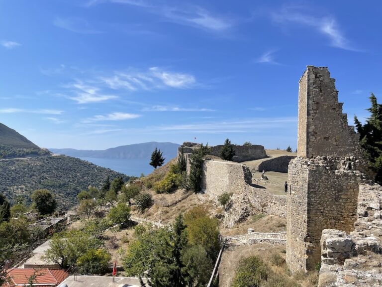
Apollonia occupies a hilly plateau and adjoining slopes overlooking the Myzeqe plain, the Mallakastra hills, and the Adriatic. The highest point is about 104 metres above sea level. In antiquity, the shoreline and the Aoos lay closer to the city than they do today. Geological and archaeological studies place the ancient coast about two kilometres away and the harbour roughly 720 metres south of the urban area.
The city covered approximately 80 to 140 hectares during different phases of expansion. Fortifications enclosed two hills and extended for more than three kilometres, with some reconstructions indicating a perimeter of more than four kilometres. Walls were generally two to three and a half metres thick and were built largely from large squared stone blocks, sometimes laid without mortar. The street plan followed an orthogonal arrangement adapted to the slopes by means of terraces. Right-angled streets formed blocks of about 120 by 60 metres, while the main avenue ran from the southern gate towards the agora. Civic, commercial, and religious buildings occupied the eastern part of the city, and residential districts extended across much of the terraced western area.
Fortifications and burial grounds
City walls and gates
The fortifications were strengthened during the Classical and Hellenistic periods. After Cassander of Macedon occupied Apollonia in 314 to 312 BC, sections of the defences were raised with brick, a large eastern artillery bastion was added, and circular and rectangular towers reinforced vulnerable points. Two principal gates stood on the southern and eastern sides, with at least three smaller gates and a concealed passage through the walls. Drainage channels collected rainwater and also contributed to the water supply. Much of the circuit was later quarried for building stone, although substantial stretches survive in the south, and parts of the northeast were rebuilt in brick during the Roman Republican period.
Necropolises
Large burial grounds lay to the east and west of the city, while a Roman cemetery occupied the western side of the urban area. The earliest known burial groups include tumuli from the seventh and sixth centuries BC along the road leading east towards the Illyrian territories. Excavations have recovered Corinthian and Attic pottery, figurines, and other grave goods from the earliest colonial phases.
Agora and civic buildings
The agora, the principal political, commercial, and social gathering area, lay near the eastern wall, north of the medieval monastery. Its axis measured about 75 metres. The complex included stoas, the theatre, odeon, library, council house, executive civic building, triumphal arch, temples, and other public structures dating from Greek and Roman phases.
Northern and eastern stoas
The large northern stoa, a roofed colonnade used for circulation, gathering, commerce, and public activity, measured about 78.2 by 9.2 metres and had two levels. The lower level combined Doric columns with an internal colonnade, while Ionic columns formed the upper walkway. Seventeen semicircular niches in the rear wall held statues of mythical or historical figures. A smaller eastern stoa was partly demolished during the Roman period, when buildings including the library were constructed over part of it. The larger structure influenced stoa design at nearby Illyrian cities such as Byllis and Dimalë.
Odeon and library
The Roman odeon was a roofed performance or assembly building with brick walls, smoothed exterior plaster, and marble revetment inside. Its audience seating held about 600 people in thirteen rows and faced a smaller marble-lined auditorium used for performances or political speeches. A small sanctuary with an apsidal end stood on its western side. The building was reconstructed between 1984 and 1987.
The rectangular library stood beside the smaller stoa. Stone consoles along its interior walls may have supported cupboards for books or papyrus rolls, although the building’s precise function is not completely certain.
Bouleuterion and prytaneion
The bouleuterion, or meeting house of the city council, is also called the Monument of the Agonothetes. The rectangular building measured about 19 by 15 metres and could hold approximately 160 people. Its reconstructed entrance portico has six Corinthian columns supporting a pediment, with a stepped approach from the agora. An inscription names Quintus Villius Crispinus Furius as the builder and says that the structure commemorated his brother. Both brothers had held the office of agonothete, which involved organizing public games or contests. The building was reconstructed between 1974 and 1978.
The prytaneion, a civic building associated with executive officials and public institutions, stood beside the council house. Its remains were excavated during the twentieth-century campaigns. Foundations of a small temple of Dionysus lie west of the council building, while remains of a second-century AD triumphal arch stand in front of it.
Sacred enclosure and hill sanctuaries
Temenos entrance and ritual features
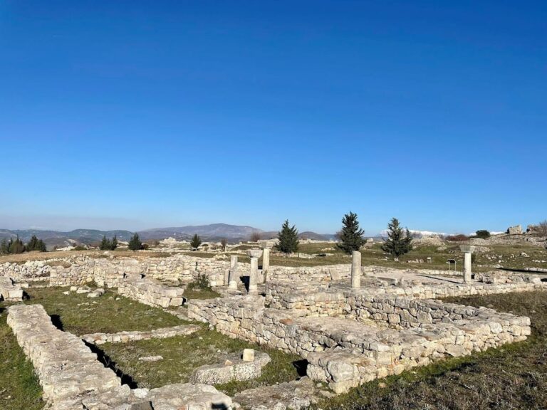
The temenos, the city’s principal sacred enclosure, occupied the higher hill north of the agora. Its substantial ashlar retaining wall, built from regularly cut blocks laid in even courses, and its monumental entrance belong mainly to the late fourth century BC. The entrance structure, or propylon, rises about four metres and has a pointed false-vaulted opening. Letter marks on some blocks indicate construction under civic authority. A drainage channel ran outside the wall.
Near the entrance stands a stone column or omphalos-like monument associated with Apollo. Its surviving lower cylindrical section is about 0.47 metres in diameter and 0.80 metres high, while the upper section is approximately 1.70 metres tall and ends in a conical form. A comparable omphalos was found near the southern walls. Brick foundations nearby may belong to altars, and large quantities of third-century BC pottery may indicate a storage area for ritual amphorae.
Artemis sanctuary
The principal surviving sanctuary in the sacred enclosure dates approximately to 525 to 520 BC. It is identified as a temple of Artemis, although another interpretation identifies it as a temple of Apollo. The small east-west building is of Doric type. Its architrave carried sculptural friezes combining Doric and Ionic features, including a sandstone relief almost two metres high showing the Amazonomachy, the mythical battle between Greek heroes and the Amazons. A circular altar stood before the temple. Other remains include column bases decorated with rosettes, fragments of early fifth-century BC friezes, and inscriptions addressed to Artemis and Gaia.
Acropolis and other sanctuaries
A monumental colonnaded passage separated the sacred enclosure from the acropolis and the city’s secular areas. The acropolis contained at least one additional sanctuary, although many of its buildings were destroyed during the Second World War and replaced by military structures. Excavations recovered bronze statues of a javelin thrower and Zeus of Dodona, dated approximately to 460 BC. Another temple, probably a second sanctuary of Artemis, stood in the valley between the temenos and acropolis hills. A separate sanctuary in the temenos was dedicated to Asclepius.
Shtyllasi temple
The Shtyllasi temple stood on a hill outside the main city. Its date is uncertain but is generally placed around 480 BC, within the period from the early fifth to early fourth century BC. The peripteral Doric temple, surrounded by a colonnade, measured about 40 by 19 metres. Its superstructure reached approximately 13 metres and was surrounded by eleven columns along each long side and six along each short side. Only the foundations and one column survive. The remaining column is about nine metres high and 1.53 metres in diameter. An east-facing entrance led through a vestibule into the principal sanctuary room. The temple may have been dedicated to Apollo, although its orientation towards the ancient river mouth, coast, and harbour has also led to its identification as a sanctuary of Poseidon.
Theatre and residential quarter
Greek theatre
The Greek theatre lies northwest of the agora and dates from the third century BC, possibly the late fourth century BC. Its semicircular seating occupied a west-facing slope and originally accommodated approximately 8,000 to 9,000 spectators. A diazoma, or passage dividing seating levels, separated the upper and lower sections, while seven stairways created fourteen seating sectors.
The complex included the main entrance, seating area, orchestra, stage building, front stage, portico, and architectural sculpture. The orchestra measured about 30 by 16.6 metres and had a marble floor. The front stage was eight metres wide and stood on twelve Ionic columns whose bases remain visible. Painted scenic panels, known as pinakes, decorated it, while the Doric stage building had five doors. Roman alterations were made during the first and second centuries AD, but much of the theatre was later quarried for stone.
Roman house and paved street
A Roman peristyle house, a residence arranged around a colonnaded courtyard, stood immediately west of the theatre. Its entrance portico had a geometric mosaic floor containing a scene of Achilles holding the Amazon queen Penthesilea. The mosaic is covered with sand for conservation. A paved main street beside the house was constructed in the fourth or third century BC and remained in use until the sixth century AD.
Water installations and bathing buildings
Nymphaeum
The Nymphaeum, a monument or sanctuary associated with springs and the nymphs, lies about 100 metres north of the theatre on the northwestern slope. Built in the third century BC, or possibly at the end of the fourth century BC, it served both religious and practical purposes. Water from five springs entered the complex through pipes. Retaining walls reached approximately 50 metres in height, and channels carried water to an open basin and then to a cistern holding about 55 cubic metres. One basin supplied the city, while another was accessible to residents, travellers, and refugees.
The water hall had a ten-metre-wide facade decorated with statue niches and was approached through a portico with five Doric columns. The building was probably destroyed by the earthquake that altered the course of the river.
Gymnasium and Roman baths
The southern part of the city contained a two-part Greek gymnasium measuring approximately 20 by 30 metres. It was probably built in the sixth century BC and altered in the third century BC. Finds from the building included two female head sculptures, a decorated black kylix, and a silver drachm of Metapontum. The Hellenistic building received an opus signinum floor, a waterproof Roman-period surface made from lime and crushed ceramic material, and contained a terracotta bath.
A Roman bath complex near the gymnasium contained two apsidal rooms with mosaic floors and suspended floors heated by a hypocaust, an underfloor system in which hot air circulated beneath a raised floor. Immersion baths occupied the apses, and additional smaller bathing rooms may have been added later.
Sculpture and mosaics
Local workshops produced sculpture influenced by Greek traditions. Finds include statues, portrait heads, stelae, a portrait of Demosthenes, a bust probably representing Hadrian, and figures of Dionysus, the Muses, veiled or draped women, and Roman citizens. The large stoa contained numerous sculptures, particularly from the Roman imperial period.
Residential excavations have revealed Hellenistic and Roman houses with well-preserved mosaics. Roman floors include a marine scene showing a Nereid riding a dolphin among fish and other sea creatures, as well as a 4 by 4.5 metre mosaic depicting the battle of Achilles and the Amazons. The latter was made from approximately 180,000 coloured tesserae.
Medieval monastery and museum
Church of the Virgin Mary
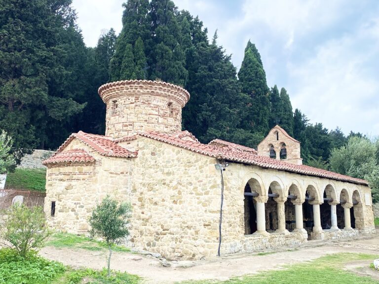
The medieval monastery stands near the eastern city wall and incorporates reused ancient stones, architectural fragments, and funerary monuments. Its church, probably built around 1220 and dedicated to the Virgin Mary, has a northwest-facing entrance opening through an outer vestibule, a narrow entrance hall, a domed nave supported by four columns, and a polygonal apse. The outer vestibule has a colonnade carved with animals, sirens, and monsters. It also contains a well surround made from a Doric capital.
Fragments of fourteenth-century frescoes survive in the church complex, including a procession of Byzantine emperors on the eastern wall of the outer vestibule.
Refectory and monastic buildings
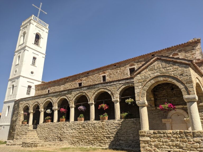
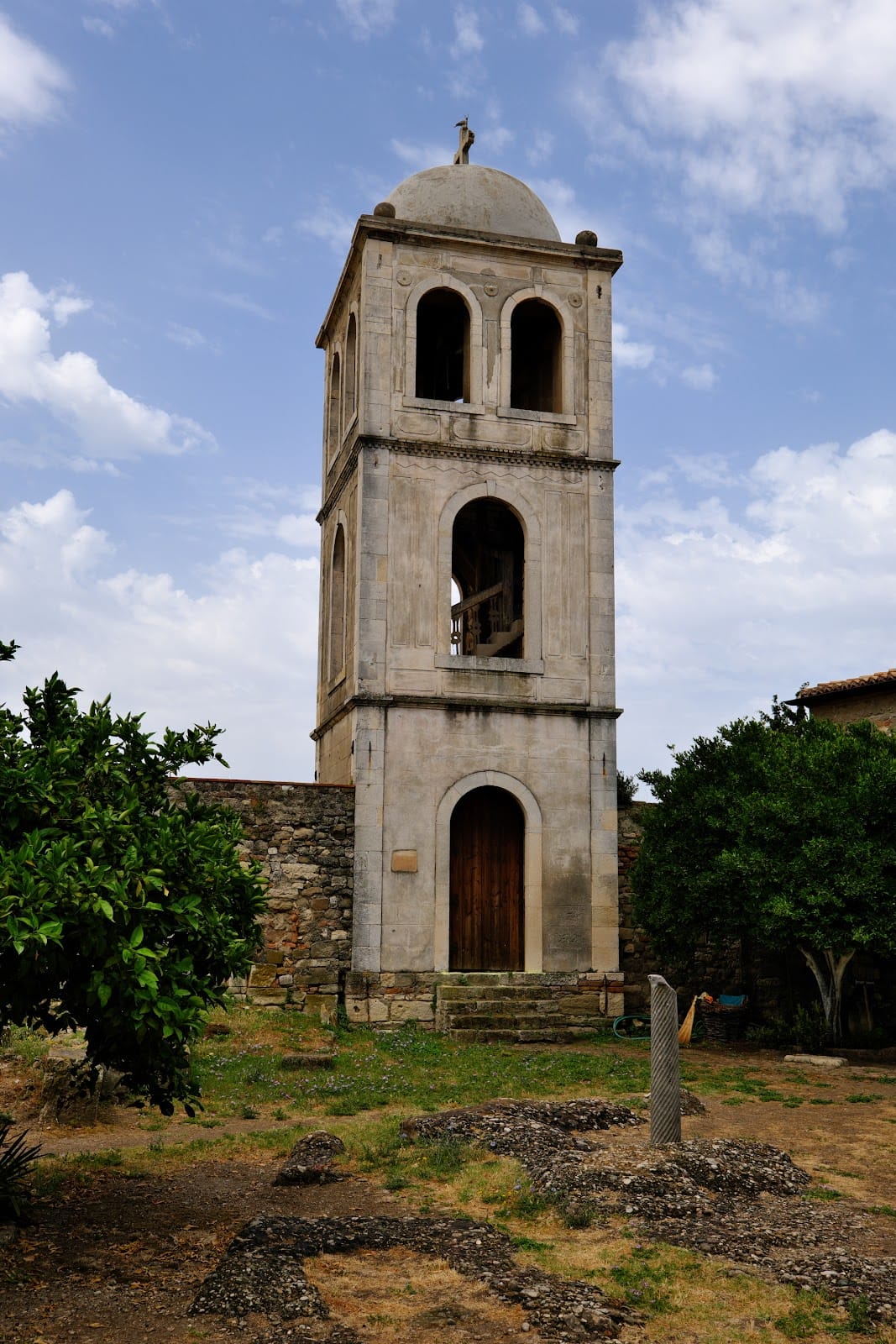
The monastery refectory was built in the early fourteenth century. Its three-apsed plan has projections on the eastern, southern, and western sides. Surviving frescoes depict the Wedding at Cana, the Washing of the Feet, the Deesis, Elijah in the Cave, apostles, prophets, and episodes from the Miracles of Christ. The complex also includes the lower part of a tower, former monastic living quarters, later buildings, a perimeter wall, and a bell tower.
Archaeological museum
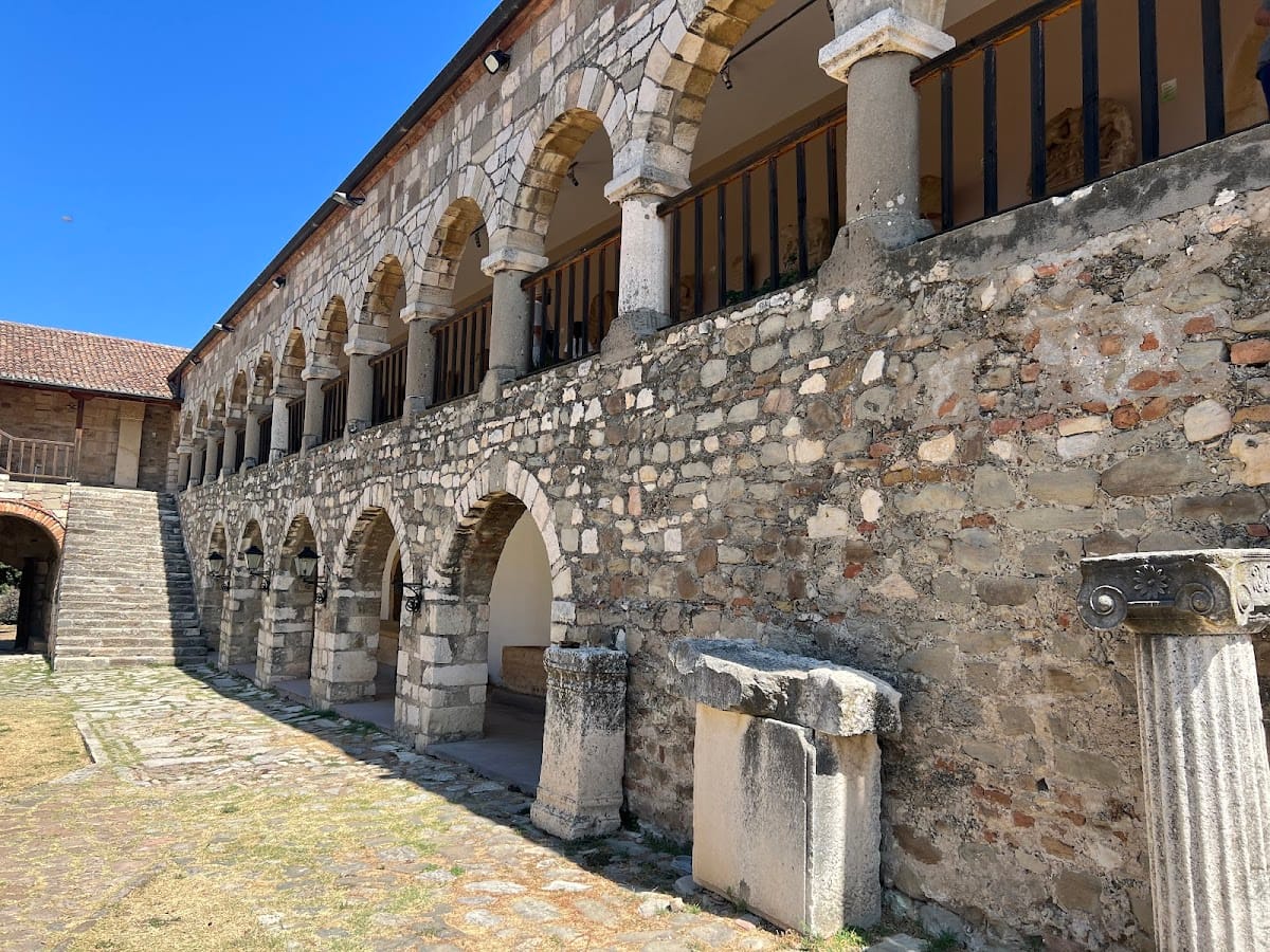
The monastery houses the Archaeological Museum of Apollonia, whose displays include sculptures, busts, stelae, weapons, and other objects recovered during excavations. Much of the ancient city remains unexcavated, while the archaeological area survives as an extensive, largely ruined urban landscape.