Lattara: An Ancient Fortified Port Settlement in Southern France
Table of Contents
Visitor Information
Google Rating: 4.5
Popularity: Low
Google Maps: View on Google Maps
Official Website: museearcheo.montpellier3m.fr
Country: France
Civilization: Celtic, Greek, Roman
Remains: Burial, City, Civic, Domestic, Economic, Entertainment, Infrastructure, Military, Religious, Sanitation
Context
The archaeological site of Lattara is situated near the contemporary town of Lattes in the Hérault department of southern France. Positioned close to the Mediterranean coastline, it lies near the mouth of the Lez River within the Rhône-Saône deltaic region. The site occupies a low-lying alluvial plain characterized by marshlands and coastal lagoons, which historically influenced settlement patterns, resource exploitation, and accessibility.
This geographic setting provided abundant natural resources, including fisheries, salt marshes, and fertile lands suitable for agriculture, shaping the economic activities of its inhabitants. Lattara’s location at the interface between inland river routes and maritime access points established it as a strategic node for trade and cultural exchange in the western Mediterranean basin.
Initial occupation dates to the late Iron Age, around the 6th century BCE, by the indigenous Celtic group known as the Volcae Arecomici. Over subsequent centuries, the site experienced increasing influence from Mediterranean civilizations, notably Etruscan, Greek (Massalian), and Roman cultures. Archaeological excavations, initiated in the 1960s, have benefited from the waterlogged conditions of the site, which have preserved organic materials such as wood, textiles, and food remains, offering exceptional insights into ancient lifeways. Current conservation efforts aim to protect the site from urban encroachment and environmental threats while supporting ongoing research and public education.
History
Lattara’s historical trajectory reflects the complex interplay of indigenous and Mediterranean influences in southern Gaul from the late Iron Age through the Roman period. Founded in the late 6th century BCE, the settlement developed as a fortified trading center that integrated local Celtic populations with Etruscan maritime commerce. Over time, the site underwent significant political and economic transformations, including a shift from Etruscan to Greek dominance and eventual incorporation into the Roman provincial system. Its strategic coastal position facilitated its role as a port city, while its decline in late antiquity corresponds with broader regional changes in the Western Roman Empire.
Late Iron Age and Etruscan Foundation (6th century BCE – early 5th century BCE)
In the late 6th century BCE, the Rhône-Saône delta region was inhabited by Celtic groups such as the Volcae Arecomici. Within this context, Lattara was established as a fortified settlement on a raised knoll overlooking the lagoon and river valley. Archaeological evidence indicates that the foundation involved the consolidation of several dispersed communities under a single enclosure of approximately 3.3 hectares. This fortification comprised a substantial stone rampart, varying between 2.5 and 3.7 meters in thickness, likely surmounted by unfired mud-bricks. Defensive features included a large corner tower, multiple gates, and bastions oriented toward the port, underscoring the settlement’s strategic maritime role.
The construction of these fortifications coincided with the establishment of an Etruscan trading post, marking Lattara as a significant node within Etruscan commercial networks. Imported artifacts, such as wine amphorae from Vulci and Caere and tableware inscribed in Etruscan script, attest to active trade relations. The rampart was built directly on sandy substrates and underwent rapid repairs around 475 BCE following a destructive fire that affected Etruscan residential areas. This phase reflects the integration of local and Etruscan cultural elements in the town’s early development.
Massalian (Greek) Influence and Urban Reorganization (mid-5th century BCE – early 4th century BCE)
Following the destruction of the Etruscan quarter by fire circa 475 BCE, Lattara experienced a marked shift in political and economic orientation toward Greek influence, particularly from the Massalian colony of Marseille. Massalia had established a dominant trade monopoly in the northwestern Mediterranean, and Lattara increasingly imported Greek goods, including wine amphorae, tableware, and lamps. Some of these items were locally reproduced by indigenous artisans, indicating cultural and technological exchange.
This period was characterized by a comprehensive urban restructuring. The archaic rampart was replaced by a more uniform dressed stone curtain wall approximately 2.5 meters thick, featuring salient angles (redans) on the interior face and a southern access ramp to the wall’s summit. The construction spanned several decades and coincided with the introduction of a formal road network comprising three principal streets that regulated access and circulation. Housing blocks were arranged in elongated east-west orientations, separated by cart paths and drainage alleys. Streets were paved with local pebbles and served both public and drainage functions, reflecting an organized urban plan that persisted until the end of the Iron Age.
Mediterranean Integration (4th century BCE – early 2nd century BCE)
During the 4th and early 3rd centuries BCE, Lattara’s integration into Mediterranean trade intensified, with Massalian imports dominating domestic assemblages. Goods from Iberia and Carthage became less frequent, while indigenous ceramic traditions remained diverse and abundant. The rampart was reinforced with square towers built against its interior face, a feature reflecting Mediterranean architectural influences distinct from local rounded tower designs.
The southern façade facing the lagoon and port was continuously maintained and repaired, including the addition of a new gate connecting the original town with expanding districts beyond the ramparts. These fortifications symbolized the settlement’s cohesion and economic significance as a port city. The urban area expanded gradually, with the rampart enclosing a settlement that had accumulated centuries of habitation layers, indicating sustained occupation and growth.
Roman Period and Urban Transformation (2nd century BCE – 4th century CE)
The 2nd century BCE marked the onset of Roman influence in southern Gaul, culminating in the establishment of the province of Gallia Narbonensis. Lattara’s protohistoric rampart was progressively dismantled to accommodate urban expansion beyond the original enclosure. The northern gate was repurposed as a water collector, and new breaches were created to facilitate access. Foundations of the rampart supported utilitarian buildings associated with the port’s expanding economic role.
Two seawalls constructed southwest of the town contained lagoon waters and enabled further urban extension. By the early 1st century CE, the Roman town center shifted northward, signaling the end of the rampart’s defensive and symbolic function. Archaeological evidence documents Lattara’s integration into Roman provincial structures, with urban development reflecting Roman architectural and administrative models. Monumental religious structures, including temples and votive shrines dedicated to deities such as Priapus and Mercury, appeared during the late Republican and early Imperial periods. Coinage became widespread in the 1st century BCE, with local minting attested from the late 3rd century BCE, facilitating economic transactions and market integration.
Late Antiquity and Decline (4th century CE – 5th century CE)
In the 4th and 5th centuries CE, Lattara experienced a gradual decline in occupation and urban maintenance, consistent with broader regional transformations in the Western Roman Empire’s southern provinces. Archaeological layers reveal reduced habitation density and abandonment of public and private structures. The population likely contracted, with diminished economic activity and fewer specialized crafts. The port’s prominence waned, and trade and transport networks diminished accordingly.
Religious practices persisted but shifted toward smaller-scale or rural expressions, with no evidence of new monumental construction. The site’s civic role diminished, and there is no clear indication of continued municipal administration or ecclesiastical leadership. Political instability from barbarian incursions and administrative reorganization contributed to the decline. No substantial post-Roman occupation has been identified, marking the end of Lattara as a significant urban center.
Modern Rediscovery and Archaeological Research (20th century – present)
Although referenced in ancient texts and early modern writings, Lattara’s precise location was identified only in the early 20th century through systematic field surveys. Intensive archaeological excavations commenced in the 1960s, revealing well-preserved remains due to the site’s waterlogged conditions. These investigations confirmed Lattara’s significance as a fortified port settlement with complex cultural interactions spanning indigenous, Etruscan, Greek, and Roman influences.
Subsequent research has focused on urban organization, fortifications, port infrastructure, and environmental context. The establishment of the Henri Prades Archaeological Museum and Regional Archaeological Documentation Center in 1986 reflects sustained institutional commitment to the study and preservation of Lattara’s heritage. Excavations continue with triennial campaigns, refining understanding of the site’s stratigraphy, construction techniques, and historical trajectory within the broader Mediterranean and Gallic frameworks.
Daily Life and Importance by Period
Massalian (Greek) Influence and Urban Reorganization (mid-5th century BCE – early 4th century BCE)
Following the destruction of the Etruscan quarter, Lattara underwent demographic and cultural shifts with Greek influence, particularly from Massalia, becoming predominant. The population likely comprised indigenous peoples and Greek traders or settlers, fostering a multicultural environment. Urban life was reorganized with the construction of a dressed stone rampart and a formal street network of three main streets and elongated housing blocks. Domestic architecture diversified to include one- to four-room houses and courtyard dwellings, with interiors featuring hearths, ovens, and benches reflecting both practical and social functions.
Economic activities intensified around maritime trade, with Massalian imports dominating household assemblages. Local artisans produced imitations of Greek ceramics, indicating technological transfer and economic adaptation. Craft production became more specialized, with emerging metalworking workshops. Markets likely offered a variety of imported and local goods accessible via the port and road network. Transport continued to rely on boats and land routes connecting Lattara to Massalia and inland settlements. Religious practices remained primarily domestic, but exotic items such as Egyptian scarabs suggest participation in wider Mediterranean cultural currents. The town’s civic role expanded as a fortified trading hub within Massalia’s maritime monopoly.
Mediterranean Integration (4th century BCE – early 2nd century BCE)
During this period, Lattara’s population maintained indigenous roots while increasingly integrating Mediterranean cultural influences. The settlement expanded beyond its original ramparts, which were reinforced with square towers reflecting Mediterranean architectural styles. Housing blocks retained their elongated east-west orientation, with domestic spaces adapted for cooking, craft production, and storage. Archaeological evidence indicates a diverse diet including locally produced cereals, olives, fish, and imported wine, consistent with the lagoon environment and trade connections.
Economic life centered on the port’s growing importance, with Massalian imports dominating and Iberian and Carthaginian goods declining. Specialized workshops for iron and bronze working appeared along main streets, indicating labor specialization and economic diversification. Household production coexisted with trade in luxury and everyday goods, facilitated by well-maintained streets and access points. Transport remained primarily maritime, supplemented by land routes linking Lattara to surrounding settlements. Religious life included domestic rituals and hero cults, with public religious architecture still absent. Social organization likely featured elites controlling trade and craft production, although explicit evidence of civic officials is lacking. Lattara functioned as a prosperous port city within Massalia’s economic sphere.
Roman Period and Urban Transformation (2nd century BCE – 4th century CE)
With Roman annexation and the establishment of Gallia Narbonensis, Lattara’s population became increasingly Romanized, integrating settlers, local Gallic inhabitants, and traders. The dismantling of the protohistoric rampart allowed urban expansion northward, where the Roman town center developed with typical Roman architectural features. Houses included multi-room dwellings with interior courtyards, paved streets, and public buildings. Interiors featured mosaic floors and painted walls, reflecting Roman domestic aesthetics.
Economic activities diversified and intensified, encompassing maritime trade, agriculture (notably viticulture and olive cultivation), and specialized crafts such as metalworking and pottery production. The port’s infrastructure expanded with seawalls and utilitarian buildings supporting commerce. Coinage was widespread, with local minting attested from the late 3rd century BCE and increasing in the Roman period, facilitating market transactions. Markets likely offered a variety of imported goods, including wine, olive oil, ceramics, and luxury items. Religious practices became more public and institutionalized, with monumental temples and votive shrines dedicated to deities such as Priapus and Mercury. Inscriptions reference civic officials, possibly duumviri, indicating organized municipal governance. Social life included religious festivals and communal gatherings, although specific educational activities remain undocumented. Lattara functioned as a Roman provincial town integrated into Gallia Narbonensis’s administrative and economic systems.
Late Antiquity and Decline (4th century CE – 5th century CE)
During late antiquity, Lattara experienced a gradual decline in population and urban maintenance, reflecting broader regional instability in the Western Roman Empire’s southern provinces. Archaeological evidence shows reduced habitation and abandonment of public and private buildings. The population likely contracted, with diminished economic activity and fewer specialized crafts. Household structures may have become simpler, focusing on subsistence needs.
Trade and transport diminished, with the port losing prominence. Religious life persisted but shifted toward smaller-scale or rural practices; no new monumental constructions are evident. The site’s civic role waned, with no clear evidence of continued municipal administration or ecclesiastical leadership. Political instability from barbarian incursions and administrative reorganization contributed to Lattara’s decline. No substantial post-Roman occupation is documented, marking the end of its role as a significant urban center.
Modern Rediscovery and Archaeological Research (20th century – present)
Modern archaeological interest in Lattara began in the early 20th century, following fieldwalking surveys that identified the site’s location. Intensive excavations commenced in the 1960s under Henri Prades, who uncovered evidence of the town’s port activity and Etruscan foundations. Subsequent research has focused on urban organization, stratigraphy, construction techniques, fortifications, port structures, Roman transformations, and environmental context.
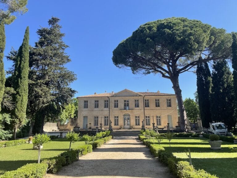
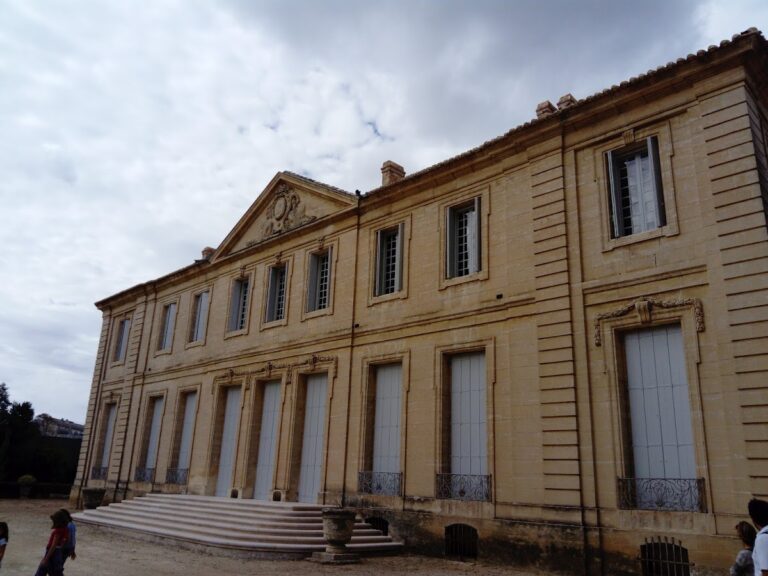
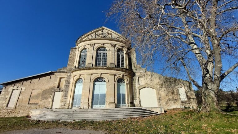
The Henri Prades Archaeological Museum and Regional Archaeological Documentation Center, inaugurated in 1986 adjacent to the site, reflect ongoing institutional commitment to research and preservation. Excavations continue with triennial campaigns led by CNRS and affiliated institutions, contributing to a nuanced understanding of Lattara’s historical development and its role within Mediterranean and Gallic history.
Remains
Architectural Features
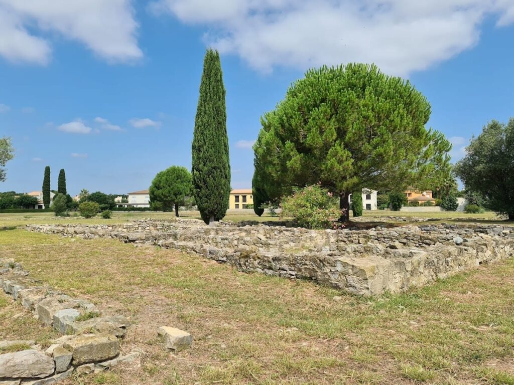
Lattara preserves extensive remains of a fortified settlement originally enclosed by a rampart constructed at the end of the 6th century BCE. This rampart enclosed approximately 3.3 hectares in a roughly triangular plan with a rounded southeast corner. Built directly on sandy alluvial deposits, the rampart varied in thickness from 2.5 to 3.7 meters and likely consisted of one to three parallel stone walls, possibly topped by unfired mud-bricks. Defensive elements included a large corner tower, bastions, and multiple gates oriented toward the port and inland routes.
In the mid-5th century BCE, the original rampart was replaced by a dressed stone curtain wall approximately 2.5 meters thick. This reconstruction, executed over several decades, incorporated salient angles (redans) on the interior face and a southern access ramp to the wall’s summit. Concurrent urban reorganization introduced a formal road network with three main streets and housing blocks arranged in elongated east-west orientations. Streets were paved with local pebbles and served both drainage and public functions.
Between 300 and 250 BCE, the rampart was further reinforced by the addition of square towers built against its interior face, reflecting Mediterranean architectural influence. The southern fore-wall facing the lagoon and port was maintained and repaired into the late 2nd century BCE, including the construction of a new gate connecting the original town with expanding districts beyond the ramparts. From the 2nd century BCE onward, the protohistoric rampart was gradually dismantled to allow urban expansion, with gates repurposed for water management and new passageways created. Two seawalls constructed southwest of the town contained lagoon waters and facilitated further development. By the early 1st century CE, the rampart had lost its defensive prominence as the Roman town center shifted northward.
Key Buildings and Structures
Rampart and Fortifications
The earliest fortifications date to the late 6th century BCE, coinciding with the establishment of an Etruscan trading post. The rampart enclosed the settlement with a thick stone base, possibly surmounted by mud-brick superstructures. Surviving elements on the southeast side include a large corner tower (T1), a main gate (P1), a bastion (T2), and a small postern gate (P3) providing pedestrian access between the shore and town. A northern gate (P5) likely led inland. Following destruction by fire around 475 BCE, hasty repairs were undertaken.
From circa 450 BCE, a major reconstruction replaced the archaic rampart with a single-thickness dressed stone curtain wall approximately 2.5 meters thick. This wall incorporated redans on the interior face and retained gates P1 and P5. A southern access ramp allowed movement atop the curtain wall. This phase coincided with broad urban restructuring that introduced a formal street network and housing blocks. Between 300 and 250 BCE, square towers were added against the interior face, enhancing structural complexity.
In the late 2nd century BCE, the fore-wall on the southern side was maintained and repaired, including the addition of a new gate (P4) linking the original town with newly developed districts beyond the ramparts. Starting in the 2nd century BCE, the rampart was progressively dismantled to accommodate urban growth. Gate P5 was converted into a water collector, and breaches were made in the wall to create new access points. Rampart foundations supported utilitarian buildings related to the port economy. Two seawalls constructed southwest of the town contained lagoon waters and facilitated urban extension. By the early 1st century CE, the rampart no longer served a defensive function as the Roman town center expanded northward.
Streets and Urban Layout
The town’s street system dates back at least to the mid-5th century BCE, linked to the rampart reconstruction around 450 BCE. The layout combined concentric and elongated organizational principles, with a triangular central core mirroring the rampart’s shape. Three main streets formed primary axes, controlling access and distributing housing blocks arranged in elongated east-west orientations. Dead-end streets abutted the rampart, serving houses built against the fortifications, with limited north-south connectivity.
Streets were public and regularly maintained, mostly paved with local pebbles. They were periodically refilled and raised to accommodate changes in housing levels. The street network also functioned for wastewater drainage and sometimes accommodated private activities such as kitchens and workshops extending beyond domestic spaces. Open spaces resembling squares were located near gates rather than the town center and were used for cattle pens, maneuvering, or cart storage.
Housing Blocks and Domestic Structures
The urban area within the rampart was divided into housing blocks dating to the mid-5th century BCE. The town’s triangular shape was reflected in the arrangement of blocks along the base of the triangle, where single-width blocks alternated with double-width blocks. Some double-width blocks narrowed to single-width at their western ends, indicating variability in layout and house arrangement over time. The distribution of housing blocks reflects a traditional architectural and social pattern observed in other protohistoric settlements of the region.
Houses replaced earlier Bronze and early Iron Age huts with domestic units exhibiting new construction techniques. All houses had square floor plans fitting within urban blocks. Five house types have been identified: one-room, two-room, three-room, four-room, and houses with interior courtyards. One-room houses date from the 4th to 1st centuries BCE, while two- and three-room houses were the most common from the late 5th century BCE to the mid-2nd century CE. Four-room and courtyard houses are rarer and characteristic of 250–150 BCE, sometimes formed by merging smaller older houses. Differences in house types may reflect social distinctions.
Construction materials included earth, stone, wood, and plant materials such as reeds. Foundations were often built with undressed stones raised about 50 cm above ground by several rows of stone blocks. Walls were constructed from unfired rectangular or square mud-bricks, rammed earth, daub, or mixed techniques. Earthen plaster was applied externally for waterproofing and internally on walls. Wood was widely used for beams, rafters, posts, mezzanines, lean-tos, shelves, and doorways.
Interior arrangements included doors with sills made of potsherds, stone blocks, or wood. Floors were coated with clay and sometimes paved with adobe bricks or pebbles. Cooking structures such as hearths and ovens were common. Hearths typically had a base of potsherds topped by smoothed clay, sometimes decorated, and were usually centrally located in rooms. Basin-shaped and lenticular hearths were also found. Ovens, often for baking bread or rolls, were located in open spaces or room corners and covered by clay domes. Benches made of packed earth, adobe, or stone were common and often associated with hearths, serving for sleeping, eating, or storage. Stone-built square structures, sometimes called “coffee table” arrangements, may have been used for meal preparation or craft activities like milling or hide preparation. Pits in houses likely stabilized ceramic containers for food or water. Some floors were decorated with shells; no cloth or painted decorations have been identified.
Ritual Spaces
No clear public ritual sites have been identified for the Late Iron Age. Evidence points mainly to domestic magico-religious practices around hearths and ritual deposits beneath house floors. The oldest possible ritual evidence is a statue of a warrior dated around 500 BCE, likely part of a sculptural group in a temple contemporary with Etruscan occupation. Public religious practices appear only in the 1st century BCE, including a votive shrine located in a public square. This shrine featured a sculpted pedestal flanked by two posts and was surrounded by a rectangular ditch containing coins as offerings.
Fragments of columns and carved lintels from the first half of the 1st century BCE have been found in various parts of the settlement, possibly deriving from temples and indicating a phase of monumental religious architecture during Romanization. Henri Prades excavated a votive shrine probably dedicated to Priapus, located at a crossroads of three streets. This shrine was surrounded by dressed stones and contained a statue base and three phallus representations associated with the Priapus cult. A structure dedicated to Mercury, god of trade, was also discovered; Mercury’s cult appears popular, supported by finds in the Roman-era cemetery.
Metalworking Structures
Metalworking facilities date back to the 4th century BCE, with forges located both outside houses and inside rooms. These forges were built in rectangular spaces with solid earth floors and mud-brick sidewalls, closed by earth mounds. Workshops appear in the late 3rd century BCE, reflecting labor specialization in iron and bronze working. Several workshops were situated along main streets; for example, a workshop in block 72 dated to around 100 BCE contained multiple forges and hearths, large stone anvils, and amphorae embedded in the floor. This workshop space shows evidence of long-term use with successive modifications.
Other Remains
The site includes a port area connected to the rampart’s southeast side, evidenced by the presence of the large corner tower (T1), main gate (P1), and bastion (T2). A small postern gate (P3) allowed pedestrian access between the shore and town. The fore-wall on the southern rampart side was maintained and repaired into the late 2nd century BCE, linked to port expansion and urban growth beyond the ramparts. Two seawalls constructed southwest of the town contained lagoon waters and facilitated urban extension. Gate P5 was converted into a water collector during the 2nd century BCE urban changes.
Statue of a Warrior
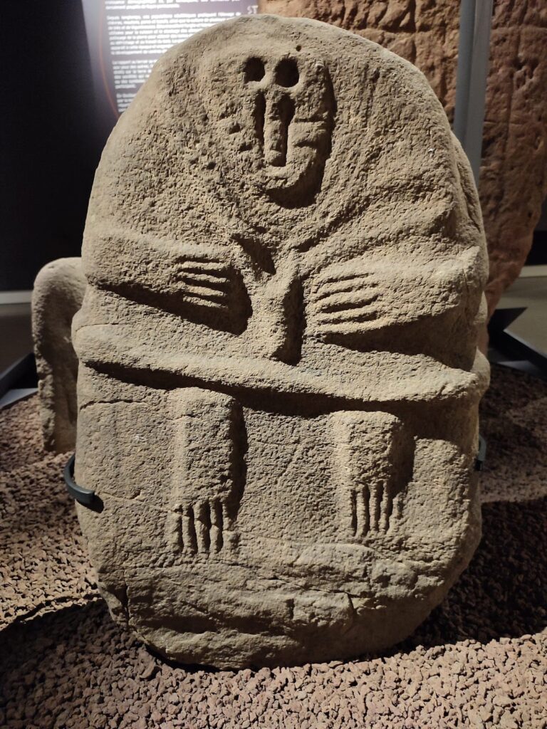
Discovered in 2002, this statue was reused as a doorjamb in a mid-3rd century BCE wall. It depicts a warrior wearing a short skirt and detailed military equipment, including a cardiophylax with straps, shoulder protectors crossing the back, a crested helmet, a wide belt with a triple-hook buckle, and greaves. Stylistically dated to around 500 BCE, it is one of the oldest free-standing sculptures found in France. The warrior is shown kneeling on his right leg with his torso rotated to the right, an unusual posture compared to other regional warrior depictions. The equipment resembles Iberian and Ibero-Languedocian finds but also shows Italic and Etruscan influences, situating it within the northwest Mediterranean cultural sphere. It likely formed part of a sculptural group in a temple, which was destroyed and stripped of religious significance when Massalians took control.
Archaeological Discoveries
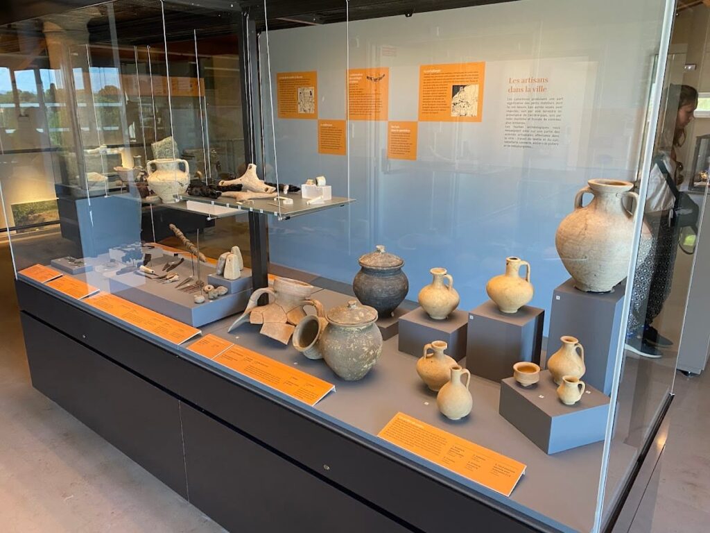
Excavations at Lattara have uncovered a variety of artifacts spanning from the late Iron Age through the Roman period. Pottery assemblages include imported amphorae from Etruria and Massalia, local imitations of Greek tableware, and indigenous non-wheel-thrown ceramics. These finds reflect the settlement’s integration into Mediterranean trade networks, especially during the 5th to 3rd centuries BCE.
Coins minted locally from the late 3rd century BCE onward have been found, with widespread circulation in the 1st century BCE. Domestic objects such as lamps, cooking vessels, and tools have been recovered from housing blocks and workshops. Metalworking tools and remains, including anvils and hearths, attest to specialized craft production. Religious artifacts include statuettes, votive offerings, and dedicatory altars associated with cults of Priapus and Mercury, particularly from the late Republican and early Imperial periods.
Inscriptions are limited but include dedicatory formulas linked to religious structures. The statue of the warrior, a rare sculptural find, provides insight into artistic and cultural influences during the early occupation phases. Organic materials such as wood, textiles, and foodstuffs have been preserved due to waterlogged conditions, offering detailed evidence of daily life and craft activities.
Preservation and Current Status
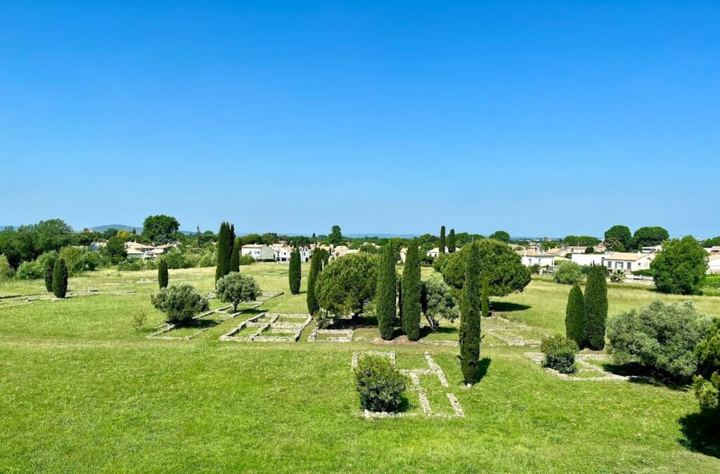
The remains of Lattara are well-preserved in part due to the waterlogged conditions of the alluvial plain. The rampart foundations, stone curtain walls, towers, gates, and port-related structures survive in varying states of completeness. Streets and housing blocks have been excavated and documented, with foundations and floor surfaces preserved. Domestic structures retain evidence of construction techniques and interior arrangements, including hearths and ovens.
Some architectural elements, such as the votive shrines and metalworking workshops, survive as archaeological features without standing walls. The statue of the warrior was found reused in later construction, indicating reuse of materials. Conservation efforts have stabilized exposed remains, and some areas have undergone partial restoration using original materials. The site faces environmental challenges such as water table fluctuations and urban encroachment, which are managed through ongoing archaeological and heritage protection programs.
Unexcavated Areas
Significant portions of the ancient town remain unexcavated, particularly in the expanding districts beyond the original ramparts. Surface surveys and geophysical studies suggest buried remains of residential, economic, and port-related structures. Some areas are inaccessible due to modern urban development or protected for conservation reasons. Future excavations are planned but limited by preservation policies and land use constraints. Research continues to focus on refining the understanding of the site’s stratigraphy, urban organization, and environmental context.
