Fréjus Roman Aqueduct: Ancient Water Supply in Southern France
Visitor Information
Google Rating: 4.5
Popularity: Very Low
Google Maps: View on Google Maps
Country: France
Civilization: Roman
Remains: Infrastructure

History
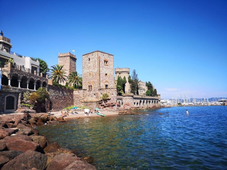
The Roman aqueduct of Fréjus is located in the municipality of Fréjus, France. It was built by the Romans in the middle of the 1st century AD to supply water to the city then known as Forum Iulii.
Forum Iulii was established as a colony by Emperor Augustus to settle veterans of the VIIIth Legion. After the city’s defensive walls were constructed, the aqueduct was developed to meet the growing water needs of this strategically important settlement. The city held military significance, housing a fleet after the battle of Actium, and featured other Roman urban structures such as an amphitheatre, theatre, and harbour facilities.
Initially, the aqueduct drew water from the La Foux spring near Fontdurane. As demand increased, it was extended to tap the more abundant Neïssoun spring in the Siagnole valley. This adaptation reflects the evolving requirements of the city over several centuries. The aqueduct remained in use for about 450 years, continuing to supply water until the 5th century AD.
In the 19th century, parts of the ancient aqueduct were repurposed for irrigation and later adapted to provide water again to Fréjus and neighboring towns. Its capacity was expanded in 1874, during the early 20th century, and after World War I. The aqueduct was officially recognized as a Historic Monument in 1886, and it has undergone restorations notably in 1941 and 2018.
The region’s vulnerability to natural disasters was highlighted in 1959 when the Malpasset dam disaster caused damage to several sections of the aqueduct. Archaeological and historical research, including studies by Vito Valenti and C. Gébara, have documented the aqueduct’s construction phases, water sources, and structural challenges, providing valuable insight into its long history.
Remains
The aqueduct stretches approximately 42 kilometers, descending nearly 481 meters from its highest water source to the city’s distribution basin. Most of the water channel, known as the specus, runs underground. It measures about 1.60 meters high and 0.70 meters wide, built with regular stone blocks and concrete. The base is roughly 0.40 meters thick, with sidewalls about 0.45 meters thick, and a vaulted roof constructed on wooden formwork.
Along its course, the aqueduct crosses several valleys and rivers, including the Siagnole, Biançon, Reyran, and Gargalon. To span these, it incorporates 36 bridges, with 28 located in the Reyran Valley. These bridges vary in height from 2 to 16 meters and typically feature arches about 5.4 meters wide, equivalent to 18 Roman feet. Many pillars have sloping buttresses forming a cross-shaped section, a design responding to local geological instability and the strong Mistral winds. Some bridges were doubled to ensure the water supply remained uninterrupted.
One remarkable feature is the Roche Taillée, a rock-cut canal about 12 meters deep and 30 meters long, which includes a central rock arch. The large Gargalon bridge originally extended 234 meters with 14 arches reaching up to 12 meters high; some of its pillars were reinforced with buttresses. Approaching the city, the aqueduct passes through a monumental arcade stretching 710 meters with 87 arches up to 16 meters tall. This section is notable for its alternating red and green stone facing, known as petit appareil, and the conduit runs along and atop the city ramparts for nearly 700 meters.
The water distribution basin, or castellum aquae, was situated near the Moulin à Vent quarter in Rue du Bel-air. While modern construction has altered this area, an open section of the internal city water conduit remains preserved there. Decorative elements on the aqueduct include double sets of voussoirs—wedge-shaped stones forming the arches—with an inner ring of thin, elongated blocks and outer rows of small stones. Some pillars display tile courses called opus vittatum, a Roman masonry technique.
Archaeological discoveries include a bas-relief of a legionary carved on the central pillar of the Bouteilliere bridge, linking the VIIIth Legion to the aqueduct’s construction. Several bridges and conduit sections remain well preserved and accessible today. The Esquine (Bonhomme) bridge retains five arches, the double Senequier bridge features two sets of six arches with cross-bracing arches between them, and the Bouteilliere bridge has three arches reaching 12 meters in height.
Parts of the aqueduct now lie beneath reservoirs such as St-Cassien, while others stand as enduring examples of Roman engineering adapted to the varied terrain and climatic conditions of the region.