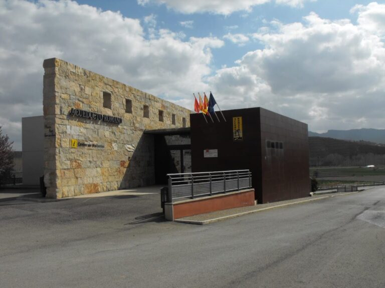
Acueducto Romano Albarracin-Gea-Cella: Roman Aqueduct in Gea de Albarracín, Spain


Visitor Information
Google Rating: 4.6
Popularity: Low
Google Maps: View on Google Maps
Country: Spain
Civilization: Roman
Remains: Infrastructure

History
The Acueducto Romano Albarracin-Gea-Cella, including the section known as Tramo IV at Barranco de los Burros, is located in the municipality of Gea de Albarracín, Spain. This aqueduct was built by the Romans during the 1st century AD as part of a large-scale hydraulic project to supply water to the settlement of Cella.
Constructed in the early Roman Imperial period, the aqueduct was designed to transport water from an aquifer near Albarracín, drawing from the Guadalaviar river basin, across a distance of approximately 25 kilometers. Its creation reflects the Roman emphasis on infrastructure to support urban centers and agriculture. The aqueduct’s capacity to provide water for up to 95,000 people suggests that beyond meeting the needs of Cella’s inhabitants, it played a crucial role in irrigating surrounding farmland, supporting the local economy.
Throughout its use, the aqueduct adapted to the challenging terrain of the region, including the ravine at Barranco de los Burros, where the structure curves dramatically to follow the natural landscape. Over time, the aqueduct fell out of use but remains a significant example of Roman engineering in the Iberian Peninsula.
Remains
The remains of the Acueducto Romano Albarracin-Gea-Cella are notable for their extensive length and the variety of construction techniques adapted to the terrain. The aqueduct primarily consists of galleries, or cuniculi, which are tunnels carved directly into the limestone rock. These galleries measure between 170 and 220 centimeters in height and 80 to 125 centimeters in width, allowing water to flow through a protected channel underground.
Along the galleries, regularly spaced ventilation windows known as spiramina or lumina were created. These openings served dual purposes: they facilitated the excavation process and later allowed for maintenance activities such as cleaning sediment and debris from the water channel. From the area called Cañada de Monterde onward, the water channel, or specus, runs entirely underground, reaching depths averaging 25 meters and descending as far as 60 meters in some central sections. Vertical shafts, referred to as putei or spiraculi, are spaced every 20 to 40 meters along this subterranean stretch. These shafts enabled workers to construct the aqueduct simultaneously from multiple points and provided ventilation.
The aqueduct also incorporates hydraulic features designed to regulate water flow. Overflow channels help manage excess water, while diversion canals include structural elements for gates and sedimentation basins, which were likely used to control water distribution for agricultural irrigation. In the La Tejería area, the aqueduct emerges from underground to an open-air channel carved into rock or clay. This channel continues until it reaches the main square of Cella, where it widens and is lined internally with opus signinum, a waterproof Roman mortar that ensured the water was contained and protected from leakage.
One of the most striking features of the Barranco de los Burros section (Tramo IV) is the sharp curve carved into the rock to navigate the ravine. This adaptation demonstrates the engineers’ skill in integrating the aqueduct with the natural landscape, maintaining the gentle gradient of approximately 0.2% (two per thousand) necessary for steady water flow. The entire system was carefully calculated to allow a maximum discharge of 267 liters per second, equivalent to about 23,000 cubic meters per day, underscoring the aqueduct’s capacity to serve both urban and agricultural needs.
Today, the remains of the aqueduct at Barranco de los Burros stand as a well-preserved example of Roman hydraulic engineering, with many sections still visible in situ. The combination of underground galleries, ventilation shafts, overflow mechanisms, and open-air channels illustrates the complexity and sophistication of this ancient water supply system.
Nearby sites