Castellet de Carrícola: A Late Andalusian Fortification in Spain


Visitor Information
Google Rating: 4.6
Popularity: Low
Country: Spain
Civilization: Medieval Islamic
Site type: Military
Remains: Castle
History
The Castellet de Carrícola is a late Andalusian fortification situated near the municipality of El Palomar in modern-day Spain. It was originally constructed by Muslim inhabitants during the period of Islamic presence on the Iberian Peninsula.
The earliest known reference to this site dates back to 1258, when it appears as “castrum Montes” in records from the Royal Chancellery. This name was associated with the alqueria, or rural community, of Muntis, which along with Carrícola, was governed from the castle. A year later, in 1259, documents describe a tower built by the Muslim population of Carrícola and Muntis. This tower was constructed using rammed earth techniques typical of Andalusian architecture, though it also reflected the design of a small feudal fortress with a courtyard and a keep.
Following the Christian Reconquista, the lands including the fortification were granted by King James I of Aragon to Ramon de Timor, a Catalan knight who became the new feudal lord. Although the castle was garrisoned and maintained by Muslim vassals under the authority of Artal de Foces, the royal governor overseeing the castles of Benicadell, its military role gradually diminished. Over time, the ownership passed through various hands, including notable figures such as Na Berenguela Alfonso, a royal mistress, members of the Valencia clergy, Pere Simó, and Admiral Conrad Llança. These lords primarily collected rents from the Muslim community, and the castle came to represent feudal control more than active defense.
By the end of the 13th century, the lordship of Carrícola became part of the barony of Albaida. After this transition, the castle likely fell out of use and endured centuries of exposure to natural decay. Archaeological studies have placed the fortification’s construction between the late 12th and early 13th centuries. Restoration efforts began in the late 2000s and were completed in 2011, preserving the remains of this historic site.
Remains
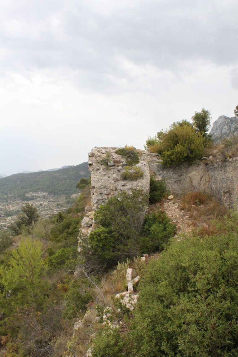
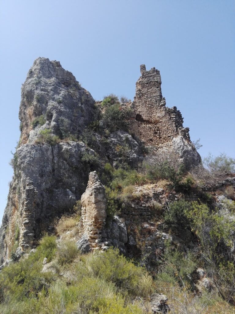
The Castellet de Carrícola occupies a strategic position on the shaded left slope of the Castellet ravine, within the Sierra de Benicadell, at an elevation of around 415 to 420 meters above sea level. The site’s main structure is a small, irregular polygonal tower facing eastward, forming the focal point of the fortification.
This tower measures approximately 7.39 meters along its western side, 6.60 meters on the eastern façade, 5.20 meters on the northern face, and 5.23 meters to the south, rising to a height of 10.6 meters. Originally, the tower was crowned with battlements, known as merlons, which would have served defensive purposes. Its doorway, set within the main eastern façade, is framed by an arch, now in a state of deterioration. A single window also punctuates this principal face of the tower.
Construction employed rammed earth, known locally as tapia, a technique using compacted layers of earth within wooden molds. The masonry was assembled in sections, each measuring roughly 85 centimeters high and 65 centimeters wide. The tower’s upper floor was accessed by a wooden staircase, of which only traces survive, and it featured a wooden floor structure indicated by remaining fragments.
Encircling the tower is a small fortified courtyard, or patio de armas, composed of thick masonry walls enclosing about 195 square meters. These walls incorporate a defensive walkway, called a camí de ronda, which would have allowed defenders to patrol the perimeter. Two access points to this enclosure are recorded: one situated near the tower’s northern side at a higher level, and another located lower down on the more inaccessible and steep slope of the hill.
While there is some variation in measurement reports—with certain sources describing a rectangular tower approximately six by three meters in size and seven meters high—these differences likely reflect alternative assessments of the structure’s remains or refer to specific parts of the fortification.
Following archaeological excavations and structural consolidation that began around 2008-2009, the site was restored by 2011. These efforts have stabilized and preserved the tower and its courtyard, maintaining the fortification’s footprint and allowing for continued study and appreciation of this modest but historically significant fortress.
Nearby sites