Thierstein Castle: A Medieval Germanic Fortress in the Egerland


Visitor Information
Google Rating: 4.4
Popularity: Low
Google Maps: View on Google Maps
Official Website: immobilien.bayern.de
Country: Germany
Civilization: Medieval European
Remains: Military

History
Thierstein Castle, located in the municipality of Thierstein in modern-day Germany, was built during the medieval period by the Germanic noble family known as the Nothafft. Its construction was first recorded in 1340, serving as an administrative center for the imperial forest district, or Reichsforste, within the historical region known as the Egerland.
The castle’s early history is closely linked to Albrecht XI. Nothafft, who established it following his father Albrecht VI.’s appointment as imperial forest master by King Heinrich VII in 1310. This role granted the family authority over the imperial forests in the region, making the castle a key seat of administration. However, in 1340, King Johann of Bohemia granted the forest master office to the nearby city of Eger, precipitating tensions and long-lasting feuds between the Nothafft family and the city. These disputes led the Nothafft to gradually lose their holdings, and by the end of the fourteenth century, they had sold Thierstein Castle and the adjacent market town to new owners.
Ownership later passed to Margrave Wilhelm I of Meissen, and from 1415 the castle came under the control of the Burgraves of Nuremberg, members of the influential House of Hohenzollern. The Hohenzollerns appointed bailiffs to manage the castle and its surrounding lands. A notable episode occurred in 1462 during the Bavarian War, when Friedrich von Dobeneck, the castle’s bailiff, deliberately set fire to the village beneath the castle. This drastic action was taken to deny enemy forces the use of the village as a fortified position.
By 1497, the castle’s central tower, known as a bergfried (a tall, usually round keep common in German castles), was integrated into a larger system of regional watchtowers. This development also designated Thierstein as a local rally point for militias in anticipation of foreign invasions. In the mid-sixteenth century, the castle faced occupation by Bohemian forces during the War of the Estates in 1553. Following this period, administration shifted to the nearby town of Wunsiedel, and Thierstein Castle gradually fell into disuse due to its deteriorating condition.
In the early seventeenth century, Margrave Georg Friedrich officially ordered the abandonment of the castle in 1603. A new administrative building was constructed outside the village to replace it. Still, the castle retained some strategic value, as it underwent repairs during the Thirty Years’ War to serve as a temporary refuge and grain storage. In 1703, amid the War of the Spanish Succession, the castle was briefly refortified but was destroyed by a fire in 1725 that also devastated the market town of Thierstein. Historical images and drawings created between 1612 and the late eighteenth century document the castle’s gradual decay and provide valuable insight into its former appearance.
Remains
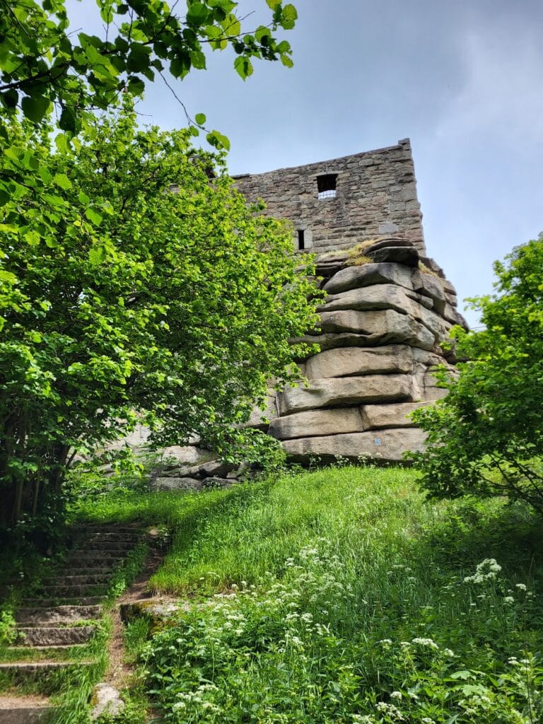
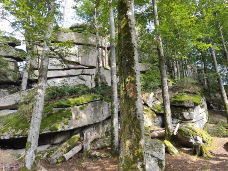
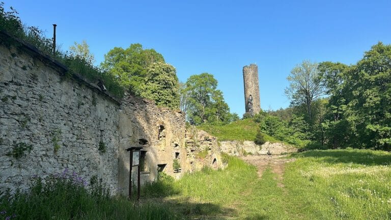
Thierstein Castle is positioned on a narrow basalt ridge approximately 615 meters above sea level, oriented toward the northeast. This natural defensive setting is enhanced by a man-made neck ditch, which isolates the castle from the landward southwest side and inhibits easy access. Originally, a second neck ditch separated the elongated outer bailey—a fortified courtyard surrounding the inner castle—from the inner bailey itself, but this secondary ditch was filled in during the nineteenth century.
Today, only fragments of the curtain wall that enclosed the outer bailey survive. This wall also functioned as a zwinger, a defensive enclosed space between the outer and inner baileys designed to hinder attackers. These surviving portions offer a glimpse of the castle’s layered defenses.
The most prominent architectural feature still standing is the cylindrical bergfried, or keep, which rises approximately 24 meters in height. This tower occupied the castle’s most vulnerable side and served as the principal stronghold and lookout. Eastward of the bergfried lie the remains of the residential buildings within the inner bailey. The enclosing walls of these structures remain, with some sections rising up to three stories tall, marking the space where the castle’s inhabitants once lived and worked.
The ruins stand testament to centuries of use, repair, and eventual decline, maintaining their position atop the basalt spur. From this vantage point, the site commands extensive views over the surrounding Fichtel Mountains and into the Egerland region, reflecting its strategic importance in controlling and monitoring the area throughout its history. Access to the ruins today requires a key, indicating controlled preservation efforts that allow the site to be experienced firsthand without compromising its delicate remains.
Nearby sites