Susa Aqueduct: A Late Roman Aqueduct in Italy


Visitor Information
Google Rating: 4.6
Popularity: Very Low
Google Maps: View on Google Maps
Country: Italy
Civilization: Roman
Remains: Infrastructure

History
The Susa aqueduct was constructed during the late Roman period to provide a reliable water supply to the city and its surroundings.
The aqueduct was built after the initial defensive walls of Susa, as evidenced by its arches resting directly against the city’s fortifications. This relationship indicates that the urban enclosure predated the aqueduct’s construction. The water source is believed to have been near Gravere, where fragments of a related aqueduct have been discovered. From there, the aqueduct extended toward Susa, following a route that was partly underground and partly elevated on arches.
Over the centuries, the structure underwent various modifications and adaptations. These changes were influenced by the expansion of medieval defenses and later building activities, which altered the original form and complicated the identification of specific construction phases. Despite these transformations, the aqueduct remained a significant feature of the urban landscape.
In the late 20th century, specifically during 1983-84, restoration efforts were undertaken to preserve the aqueduct. These works focused on cleaning the structure, stabilizing its masonry, and repairing surfaces damaged by exposure to the elements, ensuring the survival of this important piece of Roman engineering.
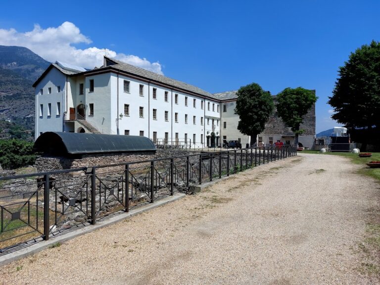
Remains
The surviving section of the Acquedotto Romano measures approximately 16.5 meters in length and just over 2 meters in width. It features two arches of different sizes: the larger arch on the southern side reaches nearly 7 meters in height and spans 4.6 meters, while the smaller arch stands just over 5 meters tall and is about 3.6 meters wide. These arches are integral to the aqueduct’s partly elevated design, which allowed water to flow across varying terrain.
The masonry reveals a clear division between two construction phases or techniques. The lower portion consists of irregularly shaped limestone blocks combined with reused marble pieces, suggesting the incorporation of materials from earlier structures. Above this, a roughly 3-meter-high section is built from a mix of irregular stones, small squared stones, and pebbles held together by mortar. This upper part is capped by a stone band that acts as a string course, a horizontal element that visually separates the masonry layers. This varied construction style reflects a later period in Roman building practices, differing from the more uniform techniques of earlier times.
The aqueduct’s arches are closely connected to the city walls, sealed with a thin layer of mortar where they meet. On the opposite side, the smaller arch is intersected by a round bastion added during later defensive expansions, illustrating how the structure was integrated into evolving military architecture.
At the base of the arches, there are notable rock-cut features predating the aqueduct itself. Beneath the smaller arch lies a well carved into the bedrock, and ancient steps are cut into the stone of the southern central pillar. These elements suggest the site had earlier uses before the aqueduct’s construction.
The channel that carried water, known as the specus, was lined with stratified cocciopesto—a type of waterproof mortar made from crushed pottery and lime—ensuring the aqueduct’s functionality. This lining was revealed during the restoration work in the 1980s.
Restoration efforts included the careful removal of soil and vegetation that had accumulated on the structure, cleaning and washing the stone surfaces, and securing loose blocks with anchors. Large gaps in the masonry were filled with materials compatible with the original stones, and previous repairs using cement were replaced with marble elements sourced from Foresto, maintaining historical accuracy.
Near the aqueduct, archaeologists uncovered remains of a paved road, or basolato, which is linked to the ancient “Via delle Gallie.” This important route passed beneath the nearby Arch of Augustus, connecting Susa to broader Roman road networks and highlighting the aqueduct’s position within the city’s infrastructure.
Nearby sites