Rumelifeneri Castle: An Ottoman Fortress at the Bosphorus Entrance in Istanbul


Visitor Information
Google Rating: 4.4
Popularity: Medium
Google Maps: View on Google Maps
Official Website: www.sariyer.gov.tr
Country: Turkey
Civilization: Unclassified
Remains: Military

History
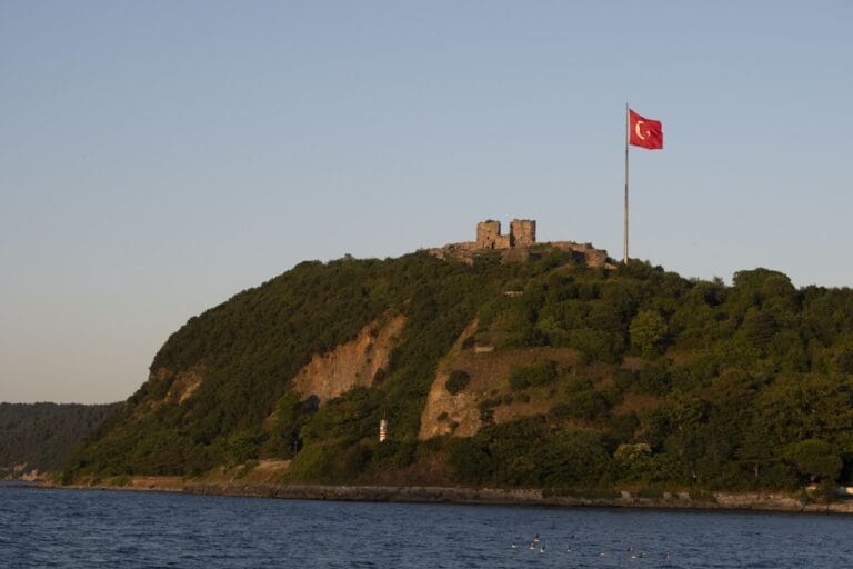
Rumelifeneri Castle is situated in the Sarıyer district of Istanbul, Turkey, overlooking the northern entrance of the Bosphorus Strait. While its precise origins remain uncertain, the fortress represents a significant military installation built under Ottoman rule in the 17th and 18th centuries.
The location held strategic importance long before the castle’s current form, known in antiquity as Panyum Burnu and later as Fanariyan Burnu during Byzantine times. These earlier names reflect the site’s longstanding role as a landmark at the gateway to the Bosphorus from the Black Sea. Fires were traditionally lit here to guide ships safely through the waters, a practice which continued into later centuries and gave the site its modern name, Rumeli Feneri, linking both the nearby village and the lighthouse.
Although local tradition and some historical accounts suggest that Genoese settlers or Byzantines may have first established fortifications at this promontory in the 15th century or earlier, the earliest official Ottoman record mentioning the castle dates from 1769. This document points to the construction or major rebuilding phase undertaken by an unnamed Greek engineer employed by the Ottoman Empire. The castle then underwent several redesigns by French engineers Toussaint in 1783, Latife-Clavé in 1785, and Monnier in 1794, indicating continued military investment in its defenses.
Throughout the Ottoman period, Rumelifeneri Castle functioned as a fortress garrisoned by roughly 300 soldiers. It included housing for troops, storage facilities for ammunition and grain, and a mosque, emphasizing its role as both a military and community hub. The walls suffered damage at one point in 1624 but were repaired by order of Sultan Murad IV. In the 20th century, during the era of the Turkish Republic, the castle was repurposed for military use and maintained as a strategic outpost. Since 2008, the site has been legally protected as a First Degree Natural Site by the regional authorities responsible for preserving cultural landmarks.
Remains
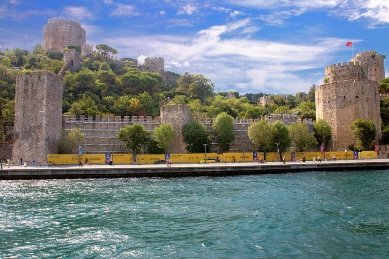
Rumelifeneri Castle occupies a rectangular area measuring around 55 by 70 meters, covering over 46,000 square meters atop ridges that rise 58 meters above sea level. The overall layout presents a fortified enclosure with chamfered corners on the northeast and northwest, designed to enhance defensive coverage. Its outer walls combine various types of stone: rubble masonry forms the bulk of the structure, while roughly hewn stones add strength at corners and key junctures. In addition, bricks are integrated within the walls, creating a layered construction typical of later Ottoman fortifications.
Two octagonal towers stand on the southeast and northwest walls, anchoring the castle’s defensive strategy by providing elevated positions for surveillance or artillery. The main arched gate is placed on the southwest side, serving as the primary entrance and exit point. This gate, like the rest of the castle, was built using heavy stone blocks arranged to withstand attack.
Close to the castle stands a 30-meter-tall lighthouse, which historically used kerosene and later acetylene gas to power its light. This lighthouse has been a vital aid to navigation at the northern Bosphorus entrance, its beam visible as far as 18 nautical miles offshore, continuing the site’s maritime tradition of guiding vessels that began long before the fortress’s construction.
Today, the castle remains in a state of ruin. Its walls and towers still rise from the terrain, giving a clear sense of the original footprint, although no elaborate interior details or decorations have been recorded. The damage and loss of structural elements over time leave the fortress as an evocative remnant of its former military function rather than a fully intact stronghold.