Ruines gallo-romaines des Maselles: A Gallo-Roman Rural Settlement in Central France
Table of Contents
Visitor Information
Google Rating: 3.8
Popularity: Very Low
Google Maps: View on Google Maps
Official Website: www.tasciaca.com
Country: France
Civilization: Celtic, Roman
Remains: City, Civic, Domestic, Economic, Infrastructure
Context
The Ruines gallo-romaines des Maselles are situated at 5 Rue Romaine in the commune of Thésée, within the Loir-et-Cher department of central France. Positioned near the right bank of the Cher River, a tributary of the Loire, the site occupies gently undulating terrain characterized by fertile soils and proximity to freshwater resources. This landscape facilitated agricultural activities and settlement continuity from the Iron Age through the Roman period. The location also lies within the historical boundaries of the Roman province of Gallia Lugdunensis, linking it to major communication arteries that connected regional centers such as Tours (ancient Caesarodunum) and Bourges (Avaricum).
Archaeological investigations have established that the site’s primary occupation dates to the Gallo-Roman era, approximately spanning the 1st to 4th centuries CE. The remains correspond to a rural settlement complex, likely a vicus or estate, reflecting the integration of local Gallic populations into Roman administrative and economic systems. Although the site’s occupation diminished by late antiquity, its preserved masonry and subsurface features provide valuable data on rural settlement organization and construction techniques in central Gaul. Heritage authorities have implemented protective measures to safeguard the ruins, including controlled access and documentation, ensuring their preservation for ongoing research and educational purposes.
History
The Ruines gallo-romaines des Maselles represent the archaeological vestiges of the ancient vicus known as Tasciaca, located within the Roman province of Gallia Lugdunensis. The site’s historical trajectory illustrates the processes of Roman provincial integration, infrastructural development, and rural settlement dynamics in central Gaul from the early Imperial period through late antiquity. Its strategic position near the Cher River and adjacent to a Roman road connecting Tours to Bourges placed it within vital terrestrial and fluvial networks, influencing its administrative and economic functions. The site’s prominence peaked during the 2nd century CE, followed by a decline in the 4th century, reflecting broader regional transformations within the Roman Empire.
Pre-Roman and Early Roman Period
Prior to Roman conquest, the region around present-day Thésée was inhabited by Gallic tribes, whose settlements formed part of the broader cultural landscape of central Gaul. Although direct archaeological evidence from the pre-Roman or early Roman phases at Maselles is limited, the continuity of occupation is inferred from the site’s proximity to known Gallic habitations and the presence of early road networks. The Roman annexation of Gaul in the 1st century BCE brought administrative restructuring under the province of Gallia Lugdunensis, accompanied by the construction of roads that enhanced regional connectivity. These developments facilitated the gradual Romanization of local populations, introducing new economic practices and material culture.
High Roman Empire (1st–3rd centuries CE)
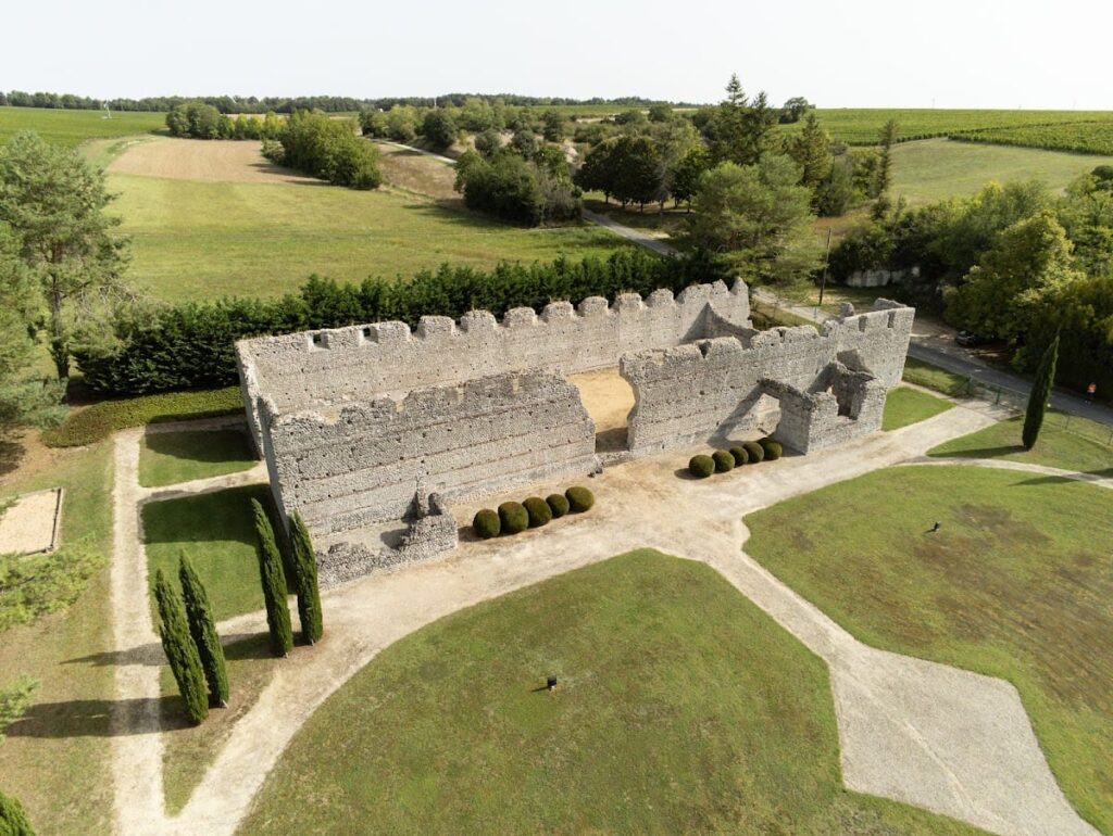
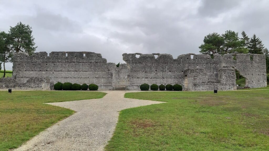
The principal phase of construction and occupation at Maselles dates to the early 2nd century CE, during the reign of Emperor Hadrian (117–138 CE), a period marked by relative peace and imperial consolidation. Archaeological excavations have revealed a monumental complex comprising three main buildings enclosed within a roughly quadrangular perimeter of approximately 7,000 square meters. The northern building, exceptionally well preserved, rises to 7.4 meters and extends over 52 meters in length. Its walls are constructed using a distinctive technique involving small rectangular tuffeau stones arranged in a herringbone pattern (opus spicatum), reinforced by transverse brick courses—a method uncommon in Gaul for buildings of this scale.
This complex likely fulfilled multiple official functions, potentially serving as a mansio (an official stopping place for travelers on the Roman road), an administrative or fiscal center, a judicial venue, or a marketplace. Its location near both the Cher River and the Roman road linking Tours (Caesarodunum) to Bourges (Avaricum) underscores its role within regional communication and transport networks. The presence of putlog holes in the masonry attests to the use of wooden scaffolding during construction, reflecting advanced building techniques. The two additional buildings within the enclosure, located in the southern sector, are less well preserved and exhibit simpler construction, suggesting a hierarchical spatial organization within the site.
Late Roman Period (4th century CE)
By the 4th century CE, the Maselles site experienced a significant reduction in occupation and functional importance, consistent with widespread rural decline in Gallia Lugdunensis during late antiquity. Archaeological data indicate a cessation of major construction or renovation activities, and the site’s administrative and commercial roles appear to have diminished. This decline corresponds with the weakening of imperial authority, shifts in regional communication routes, and economic contraction. The absence of new architectural phases or inscriptions from this period limits detailed understanding of the site’s late Roman status, but it likely transitioned to a marginal rural locality with reduced population and activity.
Post-Roman and Early Medieval Period
Following the collapse of Roman administration in the 5th century CE, the Maselles complex shows no archaeological evidence of continued occupation or reuse. The region came under the control of successive Germanic kingdoms, including the Visigoths and later the Franks, yet the site itself was abandoned as a center of habitation or administration. Nearby settlements adapted to the new political and economic realities, while Maselles’ structures fell into ruin. The lack of early medieval material culture or fortifications at the site suggests that it was not reoccupied or repurposed during this period.
Modern Recognition and Archaeological Investigations
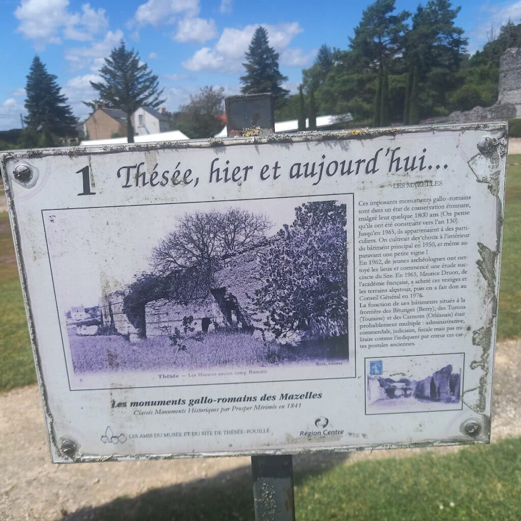
The historical and architectural significance of the Maselles ruins was formally recognized in 1840 when they were classified as Monuments Historiques by Prosper Mérimée. Systematic archaeological investigations conducted between 1962 and 1965 involved clearing overgrowth and undertaking test excavations, which revealed the extent and complexity of the Roman structures. These studies confirmed the site’s importance for understanding rural Roman settlement patterns and construction methods in central France. Subsequent conservation efforts by local heritage authorities have aimed to protect the ruins and facilitate scholarly research and public education. Currently, the site is managed by local associations in conjunction with the archaeological museum of Thésée, although both are temporarily closed for conservation work until mid-2025.
Daily Life and Importance by Period
Pre-Roman and Early Roman Period
Before Roman domination, the inhabitants of the Thésée region were organized in Gallic tribal communities engaged primarily in subsistence agriculture, hunting, and artisanal crafts. Although direct archaeological evidence from Maselles is limited for this phase, the continuity of settlement is probable given the site’s proximity to known Gallic habitations. Dwellings were likely constructed from timber and earth materials, with social organization centered on kinship groups and tribal leadership. Gender roles followed Celtic traditions, with men responsible for farming and defense, and women managing domestic and craft activities.
Following Roman annexation, the area underwent administrative reorganization and infrastructural development, including the establishment of roads that enhanced trade and communication. The local population gradually adopted Roman material culture, including clothing styles such as tunics and cloaks, and dietary elements like olive oil and wine, supplementing indigenous staples. Although Maselles remained a modest rural settlement during this period, improved connectivity facilitated access to broader markets and cultural influences.
High Roman Empire (1st–3rd centuries CE)
The early 2nd century CE saw a marked transformation at Maselles, coinciding with the construction of the monumental complex under Hadrian. The community likely comprised Roman settlers, local Gallic inhabitants, freedmen, and artisans, reflecting a socially stratified population. Elite landowners or imperial officials probably oversaw administrative functions, while laborers and craftsmen supported construction and maintenance. Gender roles aligned with Roman norms, with men occupying public and economic positions and women managing households and domestic production.
Economic activities centered on agriculture, ceramic production, and trade, facilitated by the site’s strategic location near the Cher River and the Roman road connecting Tours to Bourges. Archaeological evidence indicates local pottery workshops producing wares distributed regionally. The diet included cereals, legumes, freshwater fish, and imported goods such as wine and olive oil. Domestic spaces may have featured decorative elements like mosaic floors and painted walls, though preservation is limited. The large halls of the northern building suggest multifunctional use, potentially encompassing administrative offices, lodging for travelers (mansio), or commercial exchange. Religious practices likely combined Roman pagan cults with local traditions, although no dedicated temples have been identified on-site. Civic organization may have involved local magistrates or imperial representatives managing fiscal and judicial affairs.
Late Roman Period (4th century CE)
During the 4th century, Maselles underwent a decline in population and civic function, paralleling broader rural contraction in Gallia Lugdunensis. Many inhabitants likely relocated to more secure or economically viable centers, leaving a reduced community engaged primarily in subsistence farming and limited craft production. Social stratification diminished, and public amenities fell into disrepair. The site’s economic and administrative roles ceased, with no evidence of new construction or renovation. Trade and transportation along the Cher River and Roman roads decreased as imperial control weakened and regional networks fragmented.
Diet and clothing became simpler, relying more on local produce and fewer imported luxuries. Religious life may have shifted toward Christianity, reflecting wider imperial trends, though no direct evidence of ecclesiastical presence at Maselles has been found. The site transitioned from a multifunctional hub to a marginal rural locality amid the empire’s transformations.
Post-Roman and Early Medieval Period
After the fall of Roman authority in the 5th century, Maselles was abandoned as a habitation and administrative center. The region came under Germanic rule, including Visigothic and Frankish control, but the site shows no signs of reoccupation or fortification. Nearby villages adapted to new political and economic conditions, while Maselles’ structures deteriorated. Daily life in the surrounding area involved small-scale agriculture, localized trade, and the gradual Christianization of society. The absence of early medieval material culture at Maselles indicates that the site’s former functions were not revived or transferred.
Modern Recognition and Archaeological Investigations
Although not a period of occupation, the 19th and 20th centuries witnessed renewed scholarly interest in Maselles. Archaeological excavations revealed the complexity of the Roman structures and contributed to understanding rural settlement patterns in central Gaul. Conservation efforts have preserved the ruins, enabling detailed study of construction techniques and site organization. The site remains a valuable case study for provincial Roman life and its subsequent decline, managed by local heritage organizations with ongoing research and preservation initiatives.
Remains
Architectural Features
The Ruines gallo-romaines des Maselles comprise a roughly quadrangular enclosure measuring approximately 7,000 square meters. Situated about 800 meters from the modern village of Thésée and near the right bank of the Cher River, the site lies adjacent to the departmental road D176, which likely follows the course of the ancient Roman road connecting Tours to Bourges. The complex dates primarily to the early 2nd century CE, during Emperor Hadrian’s reign. The masonry employs small rectangular tuffeau stones arranged in a herringbone pattern (opus spicatum) on both interior and exterior wall faces, bonded with mortar and reinforced by transverse courses of large bricks laid in pairs. Putlog holes remain visible in the walls, indicating the use of wooden scaffolding during construction. The tuffeau stone used is a dense, low-porosity variety, contributing to the exceptional preservation of the masonry.
The site’s layout suggests a multifunctional complex with hierarchical spatial organization. The northern building is the largest and best preserved, while the southwestern and southeastern buildings are smaller and survive only as low wall fragments or foundations. No significant architectural modifications after the 2nd century CE have been documented. Additional surface traces and subsurface features of other structures have been identified but remain fragmentary or have been reburied for conservation.
Key Buildings and Structures
Main Northern Building
Constructed in the first third of the 2nd century CE, the main northern building is the principal structure within the Maselles enclosure. It measures approximately 52 meters in length and retains wall elevations up to 7.4 meters. The building contains two large principal rooms, including a hall measuring about 40 by 14.5 meters. Flanking this central space are two lateral pavilions, likely connected by an open lean-to gallery. The walls are built of small rectangular or flat tuffeau stones arranged in a herringbone pattern on both interior and exterior faces. The core consists of mortar mixed with stones, while two rows of large bricks laid transversely across the wall thickness provide structural reinforcement.
Putlog holes (boulins) remain visible in the masonry, attesting to the use of wooden scaffolding during construction. The dense, harder variety of tuffeau stone differs from the more porous Bourré stone common in the region, which has contributed to the walls’ durability and prevented their reuse as building material elsewhere. The building’s precise function remains uncertain but is hypothesized to have served administrative, fiscal, judicial, or commercial purposes, given its size and strategic location near the Roman road and the Cher River.
Southwestern Building
Located at the southwest corner of the enclosure, this building dates to the same early 2nd century CE period as the main northern structure. It measures approximately 12 by 10 meters but survives only to a low height of about three courses of rubble masonry (moellons). The preservation state is considerably poorer than the northern building, and no detailed architectural features or internal divisions have been documented. The function of this smaller structure remains unclear due to its fragmentary condition.
Southeastern Building
Occupying the southeast corner of the Maselles enclosure, this building covers an area of roughly 35 by 18 meters. Like the southwestern building, it dates to the early 2nd century CE but is in a significantly degraded state. It comprises several rooms, though the masonry is less carefully constructed compared to the main northern building. No specific architectural details such as decorative elements or specialized installations have been reported. The building’s purpose is not clearly identified from the surviving remains.
Other Remains
Beyond the three main buildings, surface traces and partially buried remains of additional structures have been recorded within the site boundaries. These include foundations and subsurface features identified through archaeological surveys. Some of these remains have been reburied after study to ensure their preservation. Nearby, a fanum (a small Gallo-Roman temple) is visible at Pouillé, though it lies outside the immediate Maselles enclosure. No further detailed descriptions or identifications of minor structures within the Maselles site have been published.
Archaeological Discoveries
Excavations conducted primarily between 1962 and 1965 uncovered architectural elements and material culture dating from the 1st through 4th centuries CE. Artifacts include fragments of locally produced pottery typical of Gallia Lugdunensis during the Roman Imperial period, domestic objects, and tools consistent with rural habitation and agricultural activity. Coins and small finds correspond to the 2nd and 3rd centuries CE, supporting the dating of the main occupation phase. No inscriptions or dedicatory texts have been reported, limiting direct evidence for the buildings’ functions. No significant religious artifacts or monumental statuary have been documented within the enclosure, indicating the site functioned primarily as a rural estate or vicus rather than an urban center.
Preservation and Current Status
The main northern building remains the most intact structure, with walls standing to considerable height and masonry largely preserved in situ. The southwestern and southeastern buildings survive only as low wall fragments or foundations. Conservation efforts initiated in the mid-20th century included clearing vegetation and stabilizing masonry. Some restoration and landscaping were undertaken by Maurice Druon before the site was transferred to local authorities. The ruins are protected under French heritage law as Monuments Historiques since 1840.
Vegetation growth and environmental exposure continue to pose challenges to preservation. Certain areas have been reburied to prevent further deterioration. The site is managed by local heritage organizations, which have implemented controlled access and documentation measures. No extensive modern reconstruction has been carried out; existing masonry remains are original. The site is currently closed for exceptional reasons until mid-2025, with ongoing conservation and study planned.
Unexcavated Areas
Several portions of the Maselles enclosure remain unexcavated or only partially investigated. Surface surveys and geophysical studies suggest the presence of additional buried structures within the site perimeter. Modern infrastructure, including the departmental road D176 and the Tours-Vierzon railway line, likely overlies parts of the Roman road and associated remains, limiting excavation possibilities. Future archaeological work is constrained by conservation policies and modern land use. No detailed plans for further excavation have been publicly announced.
