Lycian Way: An Ancient Trail Connecting the Lycian Civilization in Turkey


Visitor Information
Google Rating: 4.8
Popularity: Medium
Google Maps: View on Google Maps
Official Website: www.likyayolurehberi.com
Country: Turkey
Civilization: Roman
Remains: Infrastructure

History
The Lycian Way is a long-distance trail located in Turkey.
The Lycians developed a distinctive culture centered around a federation of city-states, including Xanthos, Patara, Myra, Pinara, Tlos, Olympos, and Phaselis. These cities formed the Lycian League, an early example of democratic governance where member cities shared political power.
Over the centuries, control of the region shifted through several empires. Initially under Persian rule, Lycia later came under the influence of Ancient Greece, followed by incorporation into the Roman Empire. The Roman period is well documented by inscriptions such as the Stadiasmus Patarensis, dated to AD 43, which lists roads and cities in the province of Lycia. After Rome, the area was governed by the Byzantine Empire, then the Seljuk Turks, and finally the Ottoman Empire, each leaving layers of cultural and administrative influence.
The routes that now form the Lycian Way were originally used by the Lycians for trade, military movements, and communication between their city-states. In modern times, the trail was conceived and marked in 1999 by British expatriate Kate Clow, with support from Garanti Bank and volunteer efforts. Since its initial length of around 509 to 520 kilometers, the trail has been extended to approximately 760 kilometers by 2023, preserving the ancient pathways through coastal and mountainous landscapes.
Remains
The Lycian Way is not a single archaeological site but a marked trail that connects numerous ancient ruins and natural landmarks across roughly 760 kilometers from Hisarönü near Fethiye to Geyikbayırı near Antalya. The trail follows ancient roads constructed and used by the Lycians and later civilizations, passing through a variety of terrain including coastal cliffs, valleys, and high hills.
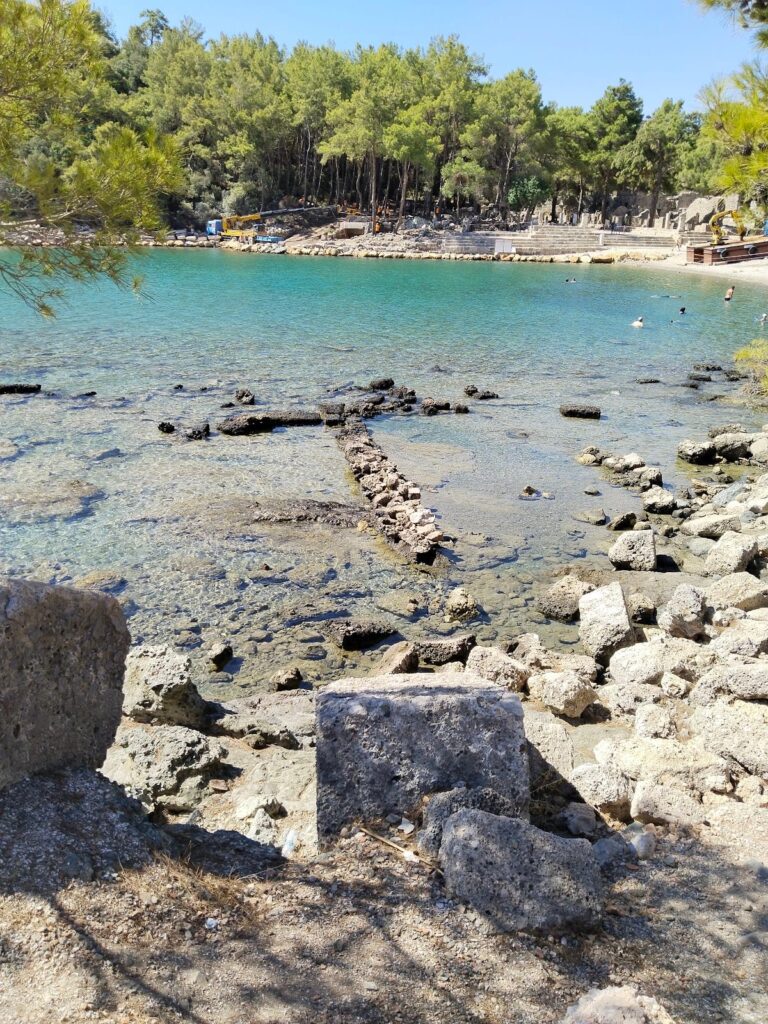
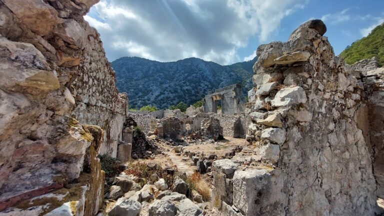
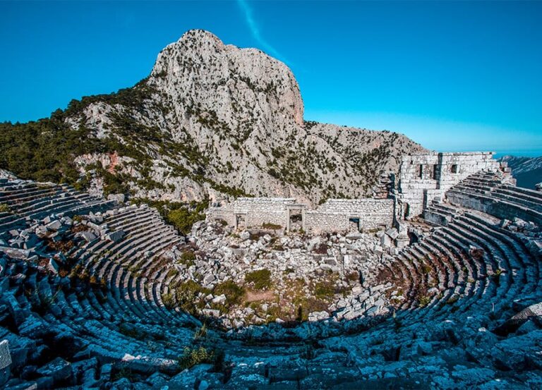
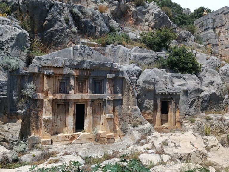
Along the route, hikers encounter the remains of several Lycian city-states, each featuring distinctive archaeological elements. These include rock-cut tombs carved directly into cliffs, sarcophagi with elaborately sculpted reliefs, and the ruins of urban centers such as Letoon, which is recognized as a UNESCO World Heritage Site. Letoon served as a religious center with temples dedicated to the Lycian gods. Other cities like Xanthos, Patara, Myra, and Phaselis offer remnants of their ancient urban fabric, including city walls, gates, and public buildings.
The trail also passes notable landmarks such as the lighthouse at Cape Gelidonya, which marks the southernmost point of ancient Lycia. İncegeriş Hill, rising to 1,811 meters, provides a high-altitude vantage point along the route. Natural features like Butterfly Valley and Yanartaş (known as the Chimaera) are also part of the landscape, blending natural phenomena with the historical environment.
Trail markings follow the French Grande Randonnée system, with red and white stripes painted on rocks and trees to guide travelers. Yellow directional signs appear at intersections, while red crosses mark paths that are not to be taken. These markings are maintained by volunteers and help preserve the continuity of the ancient routes.
Accommodation along the trail includes a mix of traditional village houses converted into guesthouses, hotels, motels, and campsites located at places such as Kabak Bay, Patara, Olympos, and Çıralı. Water sources are limited in some sections, with taps connected to above-ground pipelines providing access, though hikers are advised to treat water before drinking.
Nearby sites