Château de Mâlain: A Medieval Fortress in Burgundy, France


Visitor Information
Google Rating: 4.5
Popularity: Low
Google Maps: View on Google Maps
Official Website: www.entre-ouche-et-montagne.fr
Country: France
Civilization: Unclassified
Remains: Military
History
The Château de Mâlain is a medieval fortress located in the municipality of Mâlain in modern-day France. It was originally constructed around the year 1000 by local feudal lords within the landscape shaped by the early medieval Duchy of Burgundy.
The earliest known lord connected to the castle was Guido de Mediolano, documented circa 1075. During the late 12th century, specifically in 1197, a charter involving the nearby abbey of Saint-Seine made provision for the local clergy to receive a portion of the revenues from both the church of Mâlain and the chapel within the castle grounds. This reflects the intertwining of religious institutions and feudal authority at the site during this period.
By 1230, the castle was under the control of Hervé, lord of Sombernon, who held it as a fief granted by the King of France but pledged loyalty to the Duke of Burgundy. This dual allegiance illustrates the complex layers of feudal loyalty and political structure in medieval France. Later, in 1285, King Philip IV, known as Philip the Fair, transferred ownership of Château de Mâlain along with the château of Courtenay to Robert II, marking a significant royal intervention in the castle’s possession.
In the early 15th century, inheritance passed the castle to Jeanne and Catherine de Montagu in 1422. Jeanne’s share was eventually held by the lords of Sée and Rougemont, indicating a division of property common in feudal succession. By 1522, the property was inherited by Jacques de Mâlain, who succeeded his brother Guillaume. This period corresponds with modifications visible on the castle, reflecting ongoing occupation and adaptation.
The late 16th century saw military conflict impacting the fortress. On May 12, 1593, forces affiliated with the Catholic League, a coalition involved in the French Wars of Religion, pillaged and caused damage to the castle. This event highlights the castle’s vulnerability during religious and political turmoil.
In 1686, Nicolas II Brûlart, Marquis de la Borde and president of the Burgundy parliament, acquired the castle. However, by the mid-18th century, as recorded on the Cassini map from 1763, the castle had fallen into ruin. Efforts to preserve the structure began much later, with the Groupe archéologique du Mesmontois initiating restoration work in 1985. Since 2006, the Fondation du patrimoine has provided ongoing support, conducting a series of restoration phases aimed at conserving this historic site.
Remains
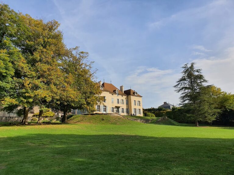
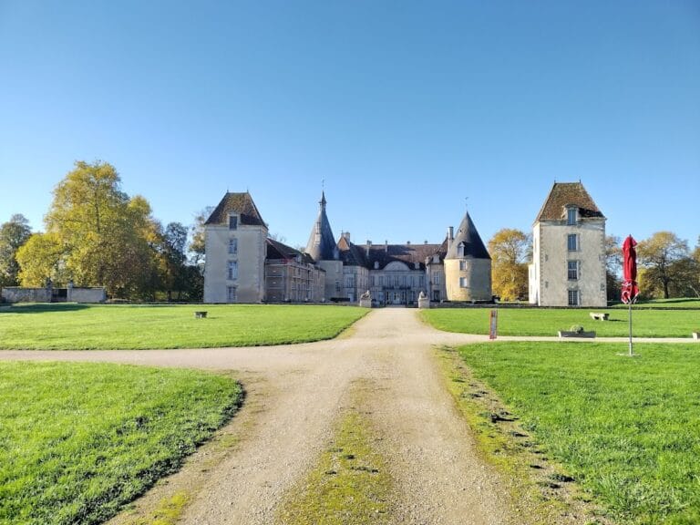
The Château de Mâlain crowns a rocky ridge that lies detached from the nearby geological fault line, offering elevated views over the village to the northwest. The castle’s layout reveals a concentration of structures arranged on the ridge, spanning multiple centuries of construction and adaptation.
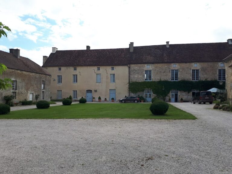
Access to the lower courtyard is provided by winding pathways on the northwest slope of the hill, paths that date back to the 16th century. The courtyard itself is divided by a substantial transverse wall, creating a clear separation between the eastern and western sectors of the castle grounds.
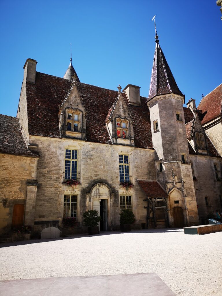
The eastern portion of the site was rebuilt in the early 1500s and still preserves walls standing to significant heights from that period. At the summit on this side stands a large residential building commissioned by Guillaume de Mâlain. This edifice features a single main floor plus attic space beneath a south-facing roof covered with glazed tiles, a distinctive feature that incorporates a medieval watchtower dating from around the year 1200. Flanking this building, a semi-circular tower projects to the west, while to the east lie the remains of the Saint-Georges chapel, now in a collapsed state. This arrangement suggests the building’s central role in habitation and surveillance during the Renaissance period.
The western half of the castle, repurposed as a garden during the 16th-century rebuild, conserves only the ground-level traces of earlier fortifications and buildings from the 12th and 13th centuries. Here lies a monumental staircase carved directly into the rock face, historically providing access to the medieval donjon (a fortified tower) on the left side and a grand reception hall on the right. This staircase reflects the integration of natural terrain into the fortress’s defensive design.
Further uphill on the northern edge, structures built against the rock likely served as private chambers, indicating residential use tucked into the natural landscape. Along the southern edge, buildings constructed on the curtain wall were probably dedicated to kitchen facilities, key to the castle’s domestic functions.
At the extreme end of the ridge, a flattened terrace, created artificially by human intervention, marks the probable location of the original castle constructed around the year 1000. This early fortification was strategically sited above a natural feature known as the “Devil’s Hole”, a karstic cave notable for its use since Neolithic times and as a sheepfold during the 12th century. The presence of this cave adds a layer of long-standing human activity and landscape interaction beneath the castle’s foundations.
Nearby sites