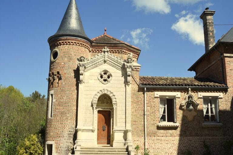
Château de Cornillon: A Medieval Fortress in Saint-Rambert-en-Bugey, France


Visitor Information
Google Rating: 5
Popularity: Very Low
Country: France
Civilization: Unclassified
Site type: Military
Remains: Castle

History
The Château de Cornillon is located in the municipality of Saint-Rambert-en-Bugey in France. It was established by medieval Christian authorities, specifically linked to the Abbey of Saint-Rambert, which oversaw its initial use.
Constructed in the early 11th century, the castle began as a simple lookout point on a rocky promontory, overlooking both the town of Saint-Rambert and its abbey. Its primary function was to monitor the Albarine route, a key passage vulnerable to hostile incursions. The name “Cornillon” itself comes from Latin origins, signifying a projecting promontory, reflecting the site’s dominant position in the landscape.
By the late 12th century, the castle gained significance through a treaty signed on November 30, 1196, which placed it under the permanent control of Thomas I, Count of Savoy and Maurienne. The agreement included strict terms that the fortress remain part of the County of Savoy and could not be transferred as a dowry or alienated from the domain. The count was responsible for its upkeep and military garrison, marking the start of a new phase as a fortified stronghold.
Throughout the 13th century, the castle was rebuilt with stone and underwent further fortification efforts, integrating it firmly into the Savoyard territorial network alongside Saint-Rambert. In 1258, a brief testamentary transfer handed Cornillon to Béatrice de Savoie, spouse of the Dauphin of Viennois, but the castle soon reverted to the Count of Savoy’s control. By the early 14th century, Cornillon emerged as the last Savoyard bastion guarding the route toward Pont-d’Ain. This period saw Saint-Rambert fortified as a military garrison used to stage expeditions into neighboring Dauphinois lands, including the nearby town and castle of Saint-Germain.
Military activity from this time is well documented. In 1310, Arthaud de Montfaucon, the castle’s castellan, led a raid in the area, demonstrating Cornillon’s role as a base for offensive operations. The castle also contributed forces during the 1321 siege of Saint-Germain, highlighting its strategic importance in the regional disputes between Savoy and Dauphiné.
Following the Delphino-Savoyard war, the Treaty of Paris in 1355 ended hostilities, and Cornillon’s military relevance slowly diminished. Over the 15th and 16th centuries, the castle’s maintenance became irregular, reflecting a gradual decline in its strategic function.
The political landscape shifted dramatically in 1601 when the Treaty of Lyon transferred the Bugey region from Savoyard to French control. Soon after, Marshal Biron ordered the dismantling of both Cornillon and Saint-Germain castles to prevent them from serving as future military strongpoints, leading to their ruin.
In modern times, the remnants of Château de Cornillon have been preserved and studied primarily through surveys conducted by the Association des Amis du Canton de Saint-Rambert. Archaeological excavation remains limited, but historical records and structural surveys provide insight into the site’s layered past.
Remains
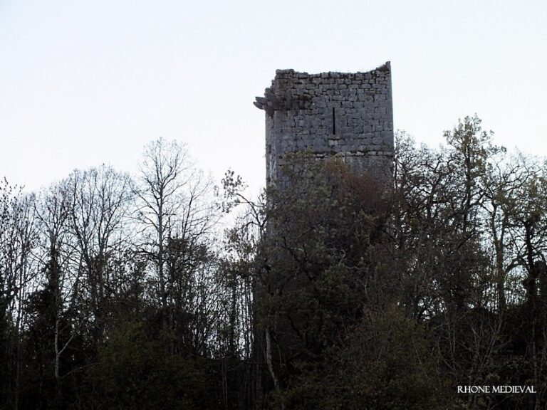
The ruins of Château de Cornillon occupy a rocky promontory, consistent with its original purpose as a surveillance post. The surviving structures reflect the castle’s medieval stone construction and hillside fortification techniques.
One of the most prominent remains is a restored tower that stands partway up the slope. This tower features a statue of the Virgin Mary set at mid-height, a later addition that suggests some religious or symbolic significance incorporated during or after periods of occupation. Near the summit, the donjon or main keep remains visible, sitting atop the promontory and once functioning as the castle’s central defensive stronghold.
Besides these, fragments of other buildings are scattered around the site. Early 20th-century observations describe the castle as bordered by vineyards and relatively free from dense vegetation, with portions of the enclosing walls still standing and revealing corner chainage. Chainage refers to the reinforcing of corners, often achieved by interlocking stonework to strengthen the structure, a detail visible in surviving masonry.
Photographic documentation from the late 20th century captures the extent of the ruins, emphasizing the solid stone masonry and the layout of the defensive walls. While no inscriptions or decorative elements have been recorded, the construction style and positioning of architectural features adhere to the castle’s known centuries of military use.
Throughout its remains, the castle retains the commanding viewpoints over the town and abbey that originally justified its placement. Today, these ruins serve as tangible evidence of the site’s evolving role from a simple watchtower into a significant fortified site within the Savoyard domain before its abandonment and dismantlement in the early 17th century.
Nearby sites