Château de Quirieu: Medieval Fortress and Administrative Centre in France


Site at a Glance
- Rating
- 4.6
- Popularity
- Low
- Country
- France
- Primary era
- Medieval
- External website
- Open
- Eras represented
- Medieval
- Civilizations
- French
- Site type
- Military
- Remains
- Fortified Town
On this page12 sections
History
Origins and the Dauphiné frontier
Château de Quirieu is a medieval fortress in France, at Bouvesse-Quirieu, built at the end of the twelfth century and remodelled during the thirteenth and fifteenth centuries. It stood in the Dauphiné, a historical principality in southeastern France that later became part of the French kingdom, on a fortified frontier facing Savoy, the neighbouring power east of the Rhône and the Alps.
Quirieu is documented in 1141. A testament made in 1190 by Albert II of La Tour du Pin names Amblard of Quirieu as a castellan, indicating that a castle existed by then, although it is uncertain whether this was the Dauphinal castle or another stronghold. Quirieu became the administrative centre of the Quirieu mandement, a territorial jurisdiction governed from a castle. Its position above the Rhône was reinforced by a port below the site, where commerce was subject to a toll. The settlement also possessed the privilege of operating a mint.
Religious and urban references point to an established community around the fortress. A papal bull issued by Urban III, pope from 1185 to 1187, lists the church “Sancte Marie de Serreriis juxta castrum Quirieu,” meaning Saint Mary of Serrières beside Quirieu Castle. This probably corresponds to the church of Notre-Dame de l’Isle shown between Serrières and the castle on the Cassini map. Thirteenth-century records refer to the “castrum et burgum de Quiriaco,” or the castle and town of Quirieu.
Conflict with Savoy
Quirieu’s frontier position drew it into the third conflict between the Dauphiné and Savoy. In 1289, Dauphin Humbert I of Viennois, a medieval ruler of the Dauphiné, besieged and captured the fortress. On 5 December that year, he transferred Quirieu’s lands and castle to his son Jean. Savoyard forces recovered the site in 1291, but in 1293 Amadeus V, Count of Savoy, gave it to Humbert I of La Tour du Pin in exchange for another possession.
The fortifications continued to require organised maintenance. On 22 April 1326, the dauphin established the vingtain, a tax imposed for the upkeep of walls and defences, to support Quirieu’s ramparts. The castle formed part of a fortified centre that also included the dependent medieval town and, later, a fifteenth-century fortified house.
Decline and military dismantling
The settlement’s population changed sharply during the later Middle Ages. In 1393, the Quirieu châtellenie, an administrative district governed by a castellan, was held by Guichard, and the town contained 376 households. By 1429, under the castellan Pierre Noir, the number had fallen to 80 households.
On 3 April 1454, Dauphin Louis granted the land of Quirieu to Robert de Malortie. Charles Emmanuel I of Savoy later bought it from the lord of Saint-Jullin for 50,000 écus, a sum expressed in écus, historical French gold or silver coins and monetary units. The Treaty of Lyon in 1601 reduced the fortress’s military importance. Around 1630, Cardinal Richelieu, a French cardinal and chief minister, ordered its dismantling.
Religious buildings also reflected the upheavals of the period. In 1562, during the Wars of Religion, the church of the new town was destroyed. Sainte-Catherine Chapel then became the parish church. The surviving remains of Quirieu bring together the former castle, its medieval fortified town, and the fifteenth-century fortified house.
Remains
The castle plateau
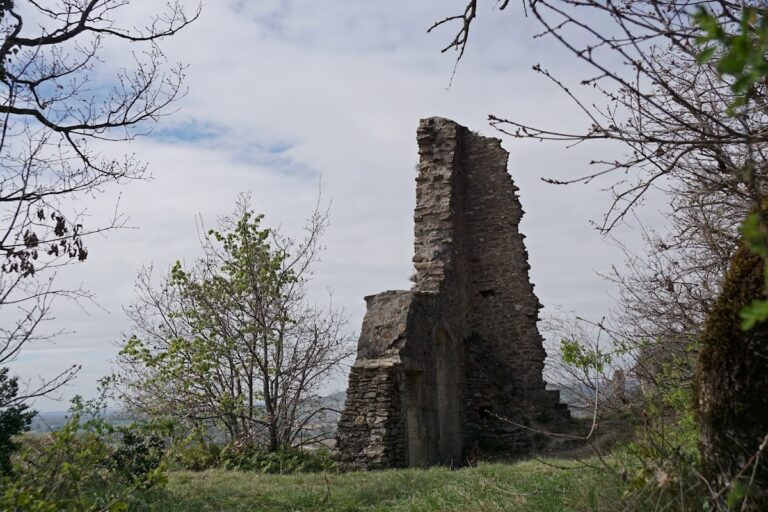
The site occupies the full four-hectare plateau of a limestone hill about 300 metres above sea level, overlooking the Rhône. The castle itself has been completely razed, leaving a broad esplanade that is partly wooded. Its former plan consisted of a square keep and three towers connected by fortified curtain walls, with small projecting watch turrets used for observation and defence. Inside were a courtyard with an oven and a mill, together with granaries, chambers, stables, and a kitchen.
Ratier Tower
Ratier Tower contained a prison cell. It measured 11 toises in height and had a circumference of 25 toises. The traditional French toise was approximately 1.95 metres, and the tower stood more than 22 metres high. It had two storeys.
Great Tower
The Great Tower rose 13 toises, or 26 metres, and had a circumference of 30 toises. Its interior was arranged over three storeys.
Oratory Tower
The Oratory Tower stood 12 toises, or 24 metres, high and contained a vaulted chapel.
The medieval town
Traces of the dependent medieval town survive around the former castle. A surrounding wall had two gates, and the settlement included houses, shops, workshops, market halls, and possibly a Dauphinal mint. Its principal street was the straight, cobbled grande charrière, or main street. Houses once lined it, but only sections of their stone walls remain.
Sainte-Catherine Chapel
Sainte-Catherine Chapel is the only building in the medieval town that remains almost standing. It became the parish church in 1562 after the church of the new town was destroyed during the Wars of Religion.
Fifteenth-century fortified house
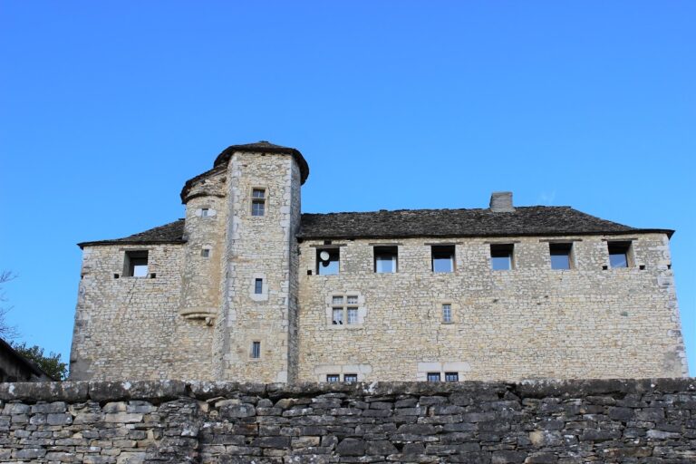
The fifteenth-century fortified house is the best-preserved building in the former village. Most of its walls survive, distinguishing it physically from the largely vanished castle and the fragmentary remains along the town’s main street.
Nearby sites