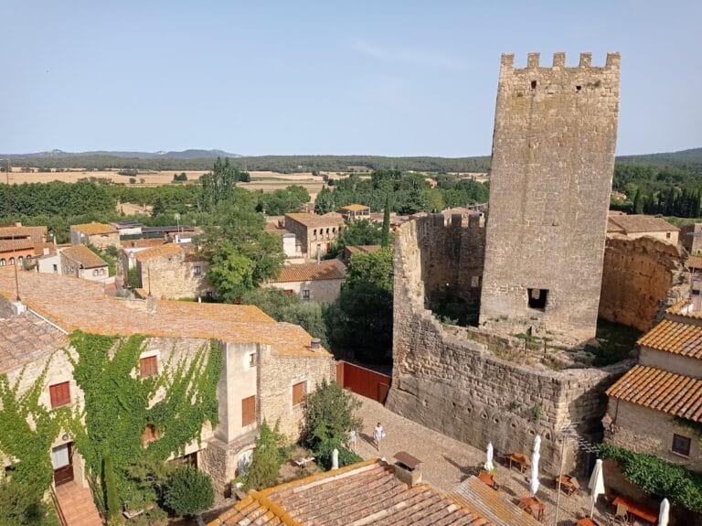
Castell de Begur: A Historic Fortress in Begur, Spain


Visitor Information
Google Rating: 4.4
Popularity: Medium
Google Maps: View on Google Maps
Country: Spain
Civilization: Unclassified
Remains: Military

History
The Castell de Begur is situated in the municipality of Begur, Spain, and its origins trace back to a site first settled before Roman times. Built atop a natural rock formation, the fortress occupies a commanding position overlooking the town and surrounding landscape. Its initial construction is attributed to early medieval Catalan powers rather than Roman builders.
The castle appears in historical records as early as 1019, with Arnust de Begur identified as its earliest known feudal lord. By the mid-11th century, control had shifted to Artal Guadall. Following this, Countess Ermessenda acquired the castle and in 1057 sold it to the Counts of Barcelona, Ramon Berenguer I and his wife Almodis. These rulers then granted the fortress as a fief to various noble families, initiating a period of feudal stewardship.
Between 1057 and 1059, Amat Elderic, who served as steward and almoner for Countess Ermessenda, pledged allegiance for the castle to Countess Almodis. Documents from 1062 mention the Peratallada family in connection with the fortress. This family line evolved into the Cruïlles-Peratallada clan, which played a prominent role in the region for centuries.
From the 12th through the 14th centuries, a family known as Begur likely acted as castellans, or castle keepers, under the authority of the Peratallada lords. In 1309, King James II elevated the status of the area by granting the town of Begur and its surrounding castles to Bernat de Cruïlles, bestowing upon him the title Baron of Begur. Subsequent royal acts in 1360 confirmed Gilabert de Cruïlles as holder of the castle and extended jurisdictional powers including criminal authority.
The 15th century saw Begur redeem its feudal duties, regaining certain freedoms. However, the castle suffered heavy damage during the conflict against King John II in 1468, when French troops occupied the stronghold and ordered its partial demolition. Despite this, the castle was rebuilt in the decades that followed.
In 1604, the municipality acquired remaining rights from Baron Carles de Viladomat i de Cruïlles, securing local jurisdiction and ending feudal authority, although the Cruïlles family continued to hold the baronial title until the mid-1700s. The strategic importance of the fortress persisted through the late 17th century, but in 1694 the Duke of Noailles deliberately destroyed the castle following the Battle of the Ter during the Nine Years’ War to prevent its further military use.
During the Napoleonic-era Peninsular War, British forces recaptured the castle in 1810, and under Admiral Doyle’s orders, the remnants were further demolished. The significance of these military actions was commemorated with a medal celebrating the capture of Begur. In the early 20th century, new interventions introduced an access path and a viewing platform named the “Balcony of Empordà,” as well as stepped battlements, shaping the castle’s present-day ruined silhouette.
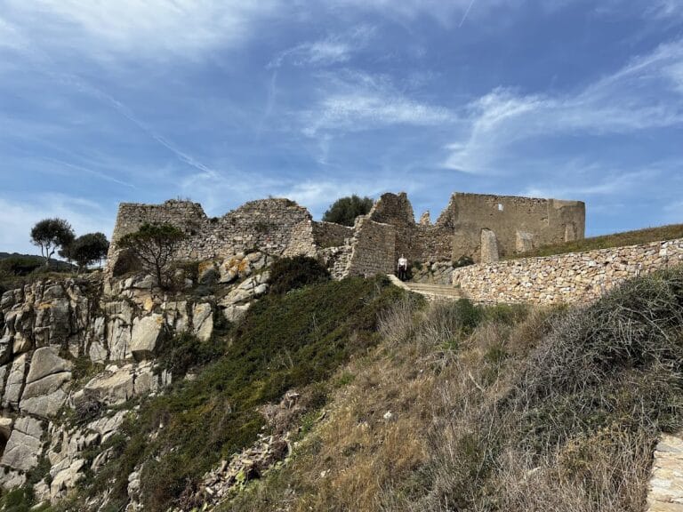
Remains
The Castell de Begur stands as a rocky fortress crowning a conical hill with steep cliffs especially on its southern and western faces, which amplify its natural defensive position. The layout clearly reflects its original use as a stronghold overlooking the surrounding area and town below.
One of the most visible ruins is a cylindrical tower on the northeast side of the site, preserved to about five meters high. Positioned on slightly higher ground relative to the main courtyard, this tower retains a battered base—a construction style where the walls slope inward at the bottom to increase stability. The masonry of the tower consists of small irregular stones interspersed with fragments of terracotta, hinting it was likely built or significantly modified during the late medieval period or somewhat later.
Close to this tower, on the main level of the fortress, are the remnants of three walls which once enclosed a small rectangular chamber. Within these remains are traces of the original vault’s supporting framework, known as centering, showing early techniques of arch construction. The chamber and its walls are constructed from fairly regular small stone slabs, roughly squared and held with mortar, suggesting an earlier building phase dating back to the 11th or 12th century.
On the northwest edge of the fortress, adjacent to the cliff, lie the remains of a rectangular cistern used for water storage. This feature includes three standing walls carved from solid rock, where the natural stone was artificially cut to form vertical surfaces. Inside the cistern, patches of reddish plaster survive, as well as the beginnings of a vault that once covered the water reservoir.
Scattered along the northern slope are foundations and fallen wall fragments, which together with the standing ruins outline the castle’s original arrangement and defensive strategy. Though successive episodes of destruction have left only evocative fragments of the castle, the preserved elements allow a clear understanding of its historic fortress plan and enduring strategic importance.
Nearby sites