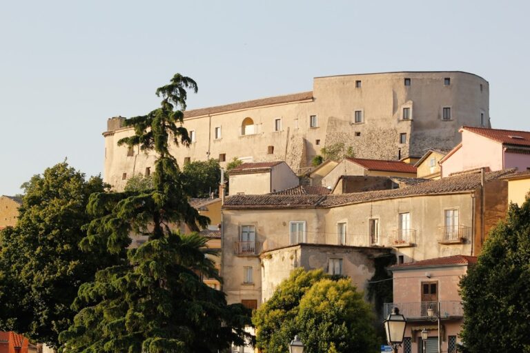
Aeclanum: An Ancient Roman City in Campania, Italy
Table of Contents
Visitor Information
Google Rating: 4.3
Popularity: Very Low
Official Website: cultura.gov.it
Country: Italy
Civilization: Roman
Site type: Burial, City, Civic, Domestic, Economic, Entertainment, Infrastructure, Military, Religious, Sanitation
Context
Aeclanum is situated near the contemporary town of Mirabella Eclano in the Campania region of southern Italy. The site occupies a gently elevated triangular plateau overlooking the fertile valley of the Calore River. This location provided access to vital water resources and arable land, supporting sustained settlement and agricultural activity. Aeclanum’s position along the ancient Via Appia, a principal Roman road linking Rome to southern Italy, established it as a strategic waypoint for military and commercial transit within the region.
Originally inhabited by the Samnite tribe of the Hirpini, Aeclanum was incorporated into the Roman sphere during the 4th century BCE. The settlement evolved through the Republican and Imperial periods, maintaining urban functions into Late Antiquity. Archaeological stratigraphy reveals phases of destruction and decline corresponding to the Gothic Wars and Lombard incursions, which contributed to the city’s eventual abandonment. The site’s partial burial and limited modern disturbance have preserved substantial architectural remains, enabling detailed study of Roman urbanism in Campania.
Systematic archaeological investigations and conservation efforts, overseen by Italian cultural heritage authorities, continue to enhance understanding of Aeclanum’s spatial organization, infrastructure, and historical development. The site remains a significant reference for examining the transformation of Italic settlements under Roman rule and their adaptation through Late Antiquity.
History
Aeclanum’s historical trajectory exemplifies the complex political and military dynamics of southern Italy from the pre-Roman era through the early medieval period. Initially a fortified settlement of the Hirpini, a Samnite people, Aeclanum was strategically located on a defensible hill near the Calore River and along key communication routes. Its incorporation into the Roman state followed military conquest during the Social War, after which it was integrated as a municipium and later elevated to colonia status. The city’s prominence waned amid the upheavals of Late Antiquity, culminating in its destruction in the 7th century and subsequent reduction to a minor settlement.
Samnite and Pre-Roman Period (up to 89 BCE)
Before Roman domination, Aeclanum was a principal town of the Hirpini, a Samnite tribe inhabiting the mountainous regions of southern Italy. The site’s occupation dates back to the Eneolithic (Copper Age), as evidenced by a necropolis at Madonna delle Grazie near Mirabella Eclano. The settlement occupied a naturally defensible promontory adjacent to the Calore River, facilitating control over local routes. Early fortifications consisted of wooden structures, as recorded by Appian, though Aeclanum is not explicitly mentioned in accounts of the Samnite Wars. Its military significance emerged during the Social War (91–88 BCE), when the Roman general Sulla captured the city in 89 BCE by setting fire to its wooden defenses after the inhabitants refused to surrender, awaiting aid from the Lucanians. This decisive action aimed to suppress the Hirpini revolt and deter other allied communities. Epigraphic evidence, including inscriptions in the Oscan language, attests to the persistence of local cultural identity through this period.
Roman Conquest and Republican Period (89–27 BCE)
Following its capture and destruction by Sulla, Aeclanum underwent rapid reconstruction, marked by the erection of stone fortifications employing opus reticulatum masonry. These walls enclosed a roughly triangular plateau of approximately 18 hectares. Around 87 BCE, Aeclanum was granted municipium status, conferring Roman citizenship rights and enrollment in the Cornelia voting tribe, thereby integrating the city into the Roman political system. Its strategic location at the intersection of the Via Appia, Via Aemilia in Hirpinis, and Via Aurelia Aeclanensis facilitated military logistics and commercial exchange. The city’s defensive walls extended approximately 1820 meters, rising over 10 meters in height, and incorporated large square towers and smaller half-towers spaced at regular intervals. This period marked Aeclanum’s transformation from a Samnite stronghold into a Roman administrative center within the province of Campania.
Imperial Roman Period (1st–3rd century CE)
During the reign of Emperor Hadrian (117–138 CE), Aeclanum was elevated to the status of a Roman colonia, adopting the official name Aelia Augusta Aeclanum. This designation reflected the city’s regional importance and conferred privileges typical of Roman colonies. The urban landscape expanded with the construction of significant public amenities, including a large thermal complex situated on a small hill in the northwest sector. Built primarily in opus mixtum, combining limestone and brick, the baths featured calidarium, tepidarium, and frigidarium rooms, as well as spaces designated for massages and musical entertainment. The macellum, a covered market for meat and fish, was located north of the presumed forum area and comprised a central circular tholos surrounded by porticoes and tabernae, with decorative marble flooring and a fountain basin. Residential quarters included trapezoidal insulae with paved streets and large domus featuring peristyles supported by brick columns originally coated with stucco. One such domus was later repurposed as a glass workshop, as indicated by the discovery of substantial glass slag deposits. Additional civic facilities included a gymnasium, theater, and a forum pecuarium (cattle market), documented through inscriptions and archaeological remains. Artistic finds, such as statues of Niobid and Arpocrates—the Egyptian god of silence—attest to the city’s cultural diversity and religious plurality. The local economy combined artisanal production, notably glassmaking, with trade facilitated by the city’s road connections and storage facilities, including large dolia used for foodstuffs.
Late Antiquity and Christianization (4th–7th century CE)
In Late Antiquity, Aeclanum continued as an inhabited urban center and became the seat of a Christian bishopric. Between the 4th and 5th centuries CE, a large paleochristian basilica was constructed within the city walls, characterized by three naves, a semicircular apse, and mosaic flooring. Adjacent to the basilica stood a baptistery featuring a baptismal font shaped as a Greek cross with steps on two opposing arms, designed for immersion baptism and originally clad in marble. The city’s most notable bishop, Julian of Eclanum, consecrated circa 417 CE, was known for his theological opposition to Pelagianism. Aeclanum sustained significant damage from a major earthquake in 369 CE, prompting reconstruction efforts led by local officials such as the senator Umbonius Mannachius. Further destruction occurred during the Visigothic passage under Alaric in 410 CE. The city was embroiled in the Gothic Wars of the 6th century, contested between Ostrogothic and Byzantine forces. Around 570 CE, the Lombards annexed Aeclanum into the Duchy of Benevento. In 662 CE, Byzantine troops under Emperor Constans II captured and destroyed the city during campaigns against the Lombards. Following this event, Aeclanum ceased to function as a significant urban center and was reduced to a small settlement known as Quintodecimo, named for its location fifteen Roman miles from Beneventum.
Archaeological Rediscovery and Modern Excavations (20th century to present)
Systematic archaeological excavations at Aeclanum commenced in the early 20th century, revealing extensive remains of the Roman city, including public baths, the macellum, residential buildings, and fortifications. Excavations during the 1970s and 1980s uncovered additional structures such as a warehouse containing large dolia for food storage and the paleochristian basilica with its baptistery. The discovery of glass slag within a residential area confirmed the presence of a late antique glassmaking workshop. Approximately 400 inscriptions have been documented, providing valuable information on the city’s administrative organization, religious practices, and social life. Artifacts including statues of Niobid and Arpocrates, coins, and architectural fragments are housed in the Museo Irpino in Avellino. The archaeological park currently encompasses between 18 and 22 hectares and is managed by the Italian Ministry of Culture, preserving Aeclanum as a key site for the study of Roman urbanism in Campania.
Daily Life and Importance by Period
Roman Conquest and Republican Period (89–27 BCE)
Following its capture and reconstruction under Roman authority, Aeclanum’s population primarily consisted of the indigenous Hirpini who gradually assimilated Roman citizenship and customs. Epigraphic evidence indicates bilingualism, with Latin inscriptions alongside continued use of the Oscan language. The social hierarchy likely included local elites occupying municipal offices such as duumviri, alongside artisans, farmers, and laborers. Economic activity centered on agriculture, exploiting the fertile Calore valley to produce staples such as grain, olives, and vines. The city’s strategic location at the crossroads of major Roman roads facilitated trade and movement of goods. Fortified with substantial stone walls and towers, Aeclanum functioned as a regional administrative and military waypoint. Domestic architecture featured typical Roman layouts with courtyards and storage spaces, though detailed decorative evidence from this period remains limited. Religious practices combined indigenous Italic traditions with the gradual introduction of Roman deities. Civic life was organized around municipal magistracies and assemblies, reflecting integration into the Roman Republic.
Imperial Roman Period (1st–3rd century CE)
During the Imperial era, particularly after elevation to colonia status, Aeclanum experienced urban growth and enhanced public amenities. The population included Roman colonists and local inhabitants, with social stratification evident in the presence of large domus owned by wealthy families, alongside artisans and a working class engaged in crafts such as glassmaking. Inscriptions attest to civic officials overseeing administrative and religious functions. Economic activities diversified beyond agriculture to include artisanal production, notably glass manufacturing, as confirmed by abundant glass slag. The macellum served as a commercial hub for meat, fish, and other goods, indicating specialized market activity. Facilities such as the gymnasium, theater, and forum pecuarium reflect active civic and social engagement. Dietary evidence suggests consumption of bread, olives, fish, and wine consistent with regional Mediterranean patterns. Clothing likely followed Roman fashions, including tunics, cloaks, and sandals. Transportation relied on the extensive road network, supporting trade and military logistics. Religious life was pluralistic, encompassing Roman gods and imported cults such as that of Arpocrates. Public baths functioned as centers for hygiene and social interaction, while cultural activities included theatrical and athletic events. Aeclanum’s status as a colonia underscored its administrative significance within Campania and integration into the imperial system.
Late Antiquity and Christianization (4th–7th century CE)
In Late Antiquity, Aeclanum transitioned into a Christian episcopal center, reflecting broader religious and political transformations within the Roman world. The population comprised Christian clergy, local elites, artisans, and farmers, with ecclesiastical authority gaining prominence. Bishop Julian of Eclanum was a notable religious figure during this period. Economic activity contracted but remained diverse, with continued artisanal production including glassmaking and sustained agricultural practices. The paleochristian basilica and adjacent baptistery attest to active Christian worship and rites, including immersion baptism. Domestic spaces likely incorporated Christian symbols alongside traditional Roman elements. Dietary and clothing patterns remained consistent with Mediterranean norms, though Christian modesty may have influenced attire. Markets and trade diminished due to political instability, but local exchange persisted. Transportation was increasingly constrained by warfare and shifting control among Ostrogoths, Byzantines, and Lombards. Civic organization shifted from imperial municipal governance to ecclesiastical leadership, with bishops exercising both spiritual and temporal authority. The city endured damage from earthquakes, Gothic invasions, and Lombard conquest, culminating in its destruction by Byzantine forces in 662 CE. Subsequently, Aeclanum’s urban role ceased, reduced to a minor settlement, marking the end of its regional prominence.
Remains
Architectural Features
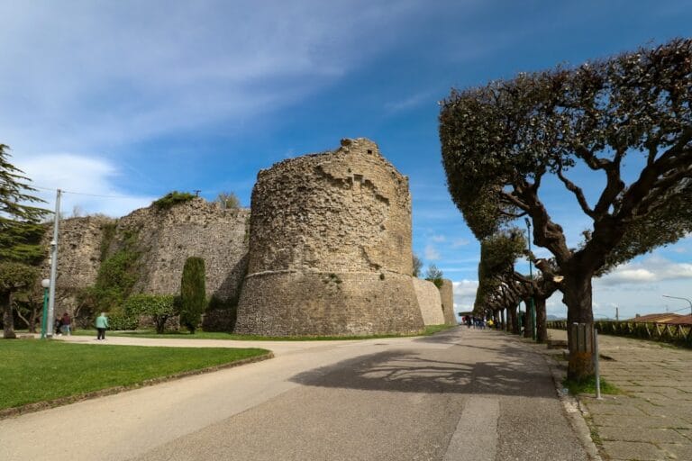
Aeclanum is situated on a triangular plateau enclosed by substantial fortifications rebuilt in stone circa 87 BCE. The city walls, constructed in opus reticulatum masonry using travertine prisms and compact sandstone, originally reached approximately 10 meters in height and measure between 2.1 and 2.4 meters in thickness. The defensive system included at least three main gates, each flanked by large square towers exceeding five meters in width, and smaller half-towers spaced every 20 meters that do not surpass the height of the walls. The western gate provided access from the Via Appia leading from Beneventum, while the eastern gate opened toward the surrounding countryside. Sections of these fortifications remain visible, delineating the city’s defensive perimeter from the Republican and Imperial periods.
The urban layout comprises a central plateau hosting public, residential, and commercial structures. Streets are paved and organized into insulae (urban blocks), with residential quarters located slightly below the hilltop. Construction techniques predominantly feature opus reticulatum masonry, supplemented by brick courses in certain buildings. The city expanded notably during the 1st and 2nd centuries CE, coinciding with its elevation to colonia status, and contracted after the 5th century CE due to warfare and invasions.
Key Buildings and Structures
City Walls and Gates
The original wooden fortifications were destroyed by Sulla in 89 BCE during the Social War. They were promptly rebuilt in stone, following an irregular triangular plan enclosing approximately 18 hectares. The masonry consists of opus reticulatum with travertine and sandstone. Defensive towers include large square bastions and smaller hemiturres approximately 2.5 meters wide, which remain below the height of the walls. The western gate connected the city to the Via Appia from Beneventum, while the eastern gate opened toward rural areas. Portions of the walls survive.
Macellum (Covered Market)
The macellum is located north of the presumed forum area and dates to the Imperial period, likely the 2nd century CE. The remains include a central circular tholos surrounded by a portico and tabernae (shops). Although modest in size compared to other Campanian markets, the structure features decorative marble flooring and a central basin that may have functioned as a fountain. Archaeological excavation and surface remains confirm its identification as a market for meat and fish.
Public Baths (Thermae)
The public baths occupy a small hill in the city’s northwest sector and date to the 2nd century CE, coinciding with Aeclanum’s elevation to colonia under Hadrian. Constructed primarily in opus reticulatum limestone with brick courses, the complex is preserved up to the springing of vaults in some areas. The baths are organized on two levels: the lower level housed bathing rooms including calidarium (hot bath), tepidarium (warm bath), and frigidarium (cold bath), while the upper level accommodated ancillary activities such as massages and musical entertainment. The floors of the hot rooms were supported by suspensurae, a system of raised floors facilitating underfloor heating. Excavations uncovered statues, marble decorations, mosaic fragments, and a rectangular basin lined with colored marble. The baths overlook a belvedere facing the Calore River.
Basilica Paleocristiana
Constructed in the late 4th or early 5th century CE, the paleochristian basilica is a large three-nave structure featuring a semicircular apse and mosaic flooring. Adjacent on the south side is a baptistery with a baptismal font shaped as a Greek cross, equipped with steps on two opposing arms designed for immersion baptism. The baptistery was originally fully clad in marble. The basilica’s remains include elements dating to the 6th century CE, during the reign of Emperor Justinian. It was possibly built over an earlier domus. This complex confirms Aeclanum’s role as a Christian episcopal seat in Late Antiquity.
Domus with Peristyle
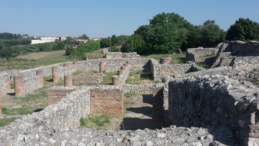
Near the macellum and presumed forum area lies a large mid-imperial Roman domus occupying a trapezoidal insula bounded by four paved streets. The house features a peristyle courtyard supported by brick columns originally coated with stucco and a small central impluvium for rainwater collection. Initially serving as a representational residential space, the peristyle was later repurposed for artisanal production, likely a glass workshop, as indicated by abundant glass slag found during excavations. The domus also contained rooms used for representation and storage.
Other Domestic Buildings and Residential Quarter
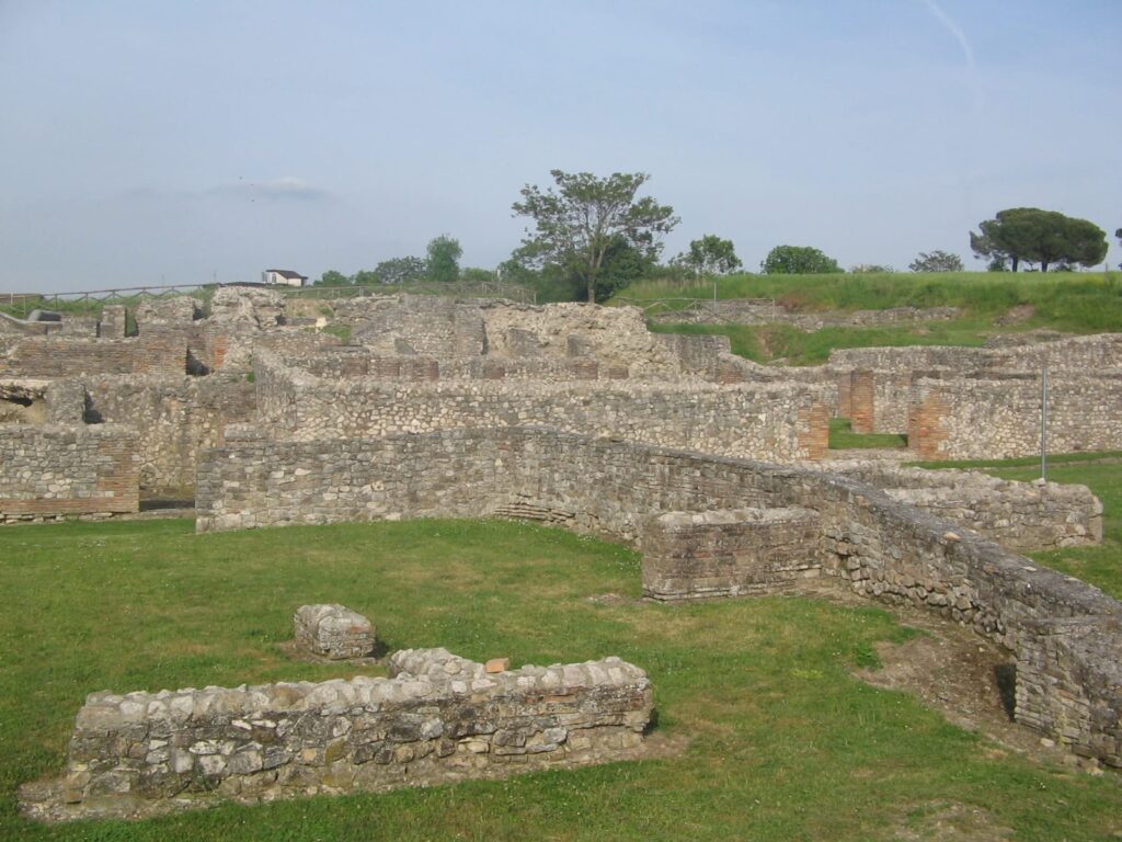
The central urban area includes a residential quarter situated slightly below the hilltop where the forum is presumed to have stood. This quarter contains insulae and houses with visible opus reticulatum walls. The area is organized around paved streets and includes both private homes and commercial spaces. Remains of walls and floor layers are partially excavated, illustrating the city’s domestic architecture and urban organization.
Necropolis
A necropolis dating to the Eneolithic period is located in the Madonna delle Grazie area near Mirabella Eclano. Additionally, a 3rd to 4th century CE eastern necropolis lies along the Via Appia and near the modern SS 90 delle Puglie road. Funerary monuments include altars and arae dedicated to deities such as Mefitis. Some epigraphic evidence from these funerary contexts is preserved in local museums.
Other Public Buildings
The precise location of the forum remains uncertain but is believed to be near the macellum. Inscriptions and archaeological traces attest to the existence of a forum pecuarium (cattle market) and a gymnasium, though these structures have not been fully excavated. Outside the city walls near the church of Santa Maria di Pompei stands a public building of unknown function, constructed in opus reticulatum and brick walls; this structure collapsed following the 1980 earthquake.
Other Remains
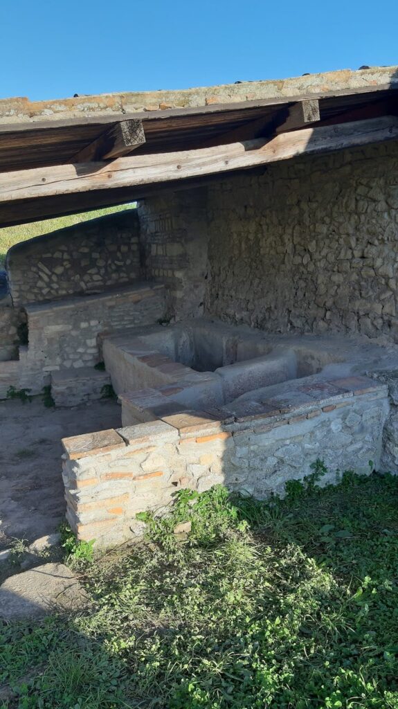
Surface traces of the original wooden fortifications are known from historical sources, though no physical remains survive. The “broken bridge” over the Calore River on the Via Appia is visible near the site. Low walls and floor layers of various buildings are visible in the urban area but remain partially excavated. Four large dolia (storage jars) were discovered buried in a warehouse beneath the basilica, used for food storage. The site also contains numerous inscriptions, altars, and architectural fragments dispersed throughout the urban fabric.
Archaeological Discoveries
Excavations have uncovered nearly 400 inscriptions, including four notable Osco-Samnite epigraphic monuments discovered in the 1930s. These inscriptions record dedications to deities such as Mamers (Mars), Mefite, and Faunus, and document the city’s municipal status and local magistrates. The epigraphic corpus provides valuable insight into Aeclanum’s administrative and religious life.
Artifacts recovered include statues such as a marble Niobid and a 2nd-century CE statue of Arpocrates, the Egyptian child god, both housed in the Museo Irpino in Avellino. Numerous ceramic fragments, amphorae, glass slag, and tools have been found, indicating craft and commercial activities. The glass slag confirms the presence of a late antique glassmaking workshop within the domus. Four large dolia discovered in a warehouse beneath the basilica were used for food storage. Finds span from the Eneolithic through Late Antiquity, reflecting continuous occupation and diverse economic activities.
Preservation and Current Status
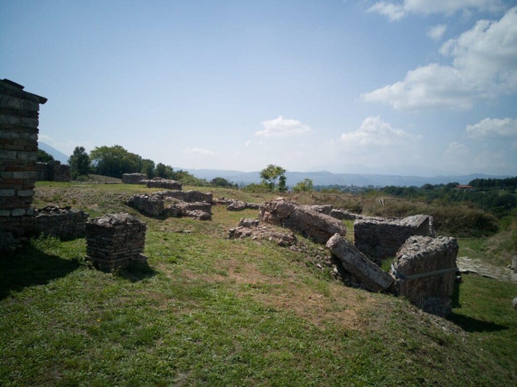
Many structures at Aeclanum survive in varying states of preservation. The city walls and towers remain largely intact, outlining the ancient defensive perimeter. The public baths retain walls up to the springing of vaults, with mosaic and marble decorations partially preserved. The macellum’s foundations and central tholos are visible, though incomplete. The paleochristian basilica and baptistery survive as substantial ruins, including mosaic floors and structural elements. The domus with peristyle is partially excavated, with visible brick columns and floor remains.
Some buildings, such as the public structure near Santa Maria di Pompei, have collapsed or are fragmentary. Archaeological layers and low walls are visible but not fully excavated in residential quarters. Conservation efforts by Italian heritage authorities have stabilized many remains, though some areas remain exposed to environmental factors. Excavations and restorations have been conducted intermittently since the early 20th century, with ongoing work to protect and study the site.
Unexcavated Areas
Several parts of Aeclanum remain unexcavated or only partially studied. The precise location of the forum is not yet confirmed, though it is hypothesized near the macellum. The forum pecuarium and gymnasium are attested epigraphically but lack full excavation. Residential quarters and commercial areas contain buried remains beneath surface layers. Some peripheral structures outside the city walls await further investigation. Modern development and conservation policies limit extensive excavation, but surface surveys and geophysical studies suggest additional buried remains within the archaeological park’s 18 to 22 hectares.
