Castle of Chio: An Almohad Fortress in Llutxent, Spain


Site at a Glance
- Rating
- 4.5
- Popularity
- Very Low
- Country
- Spain
- Primary era
- Medieval
- External website
- Open
- Eras represented
- Medieval
- Civilizations
- Almohad
- Site type
- Military
- Remains
- Castle
On this page12 sections
History
The Castle of Chio is an Almohad fortress in Llutxent, Spain, built between approximately 1178 and 1190 as a military defensive centre within a rural territory of dispersed settlements. The Almohads were a North African Muslim dynasty that ruled parts of the Iberian Peninsula during the twelfth and early thirteenth centuries. The castle protected surrounding alquerias, or rural agricultural communities, which could use it as a refuge in times of danger.
An Almohad defensive centre
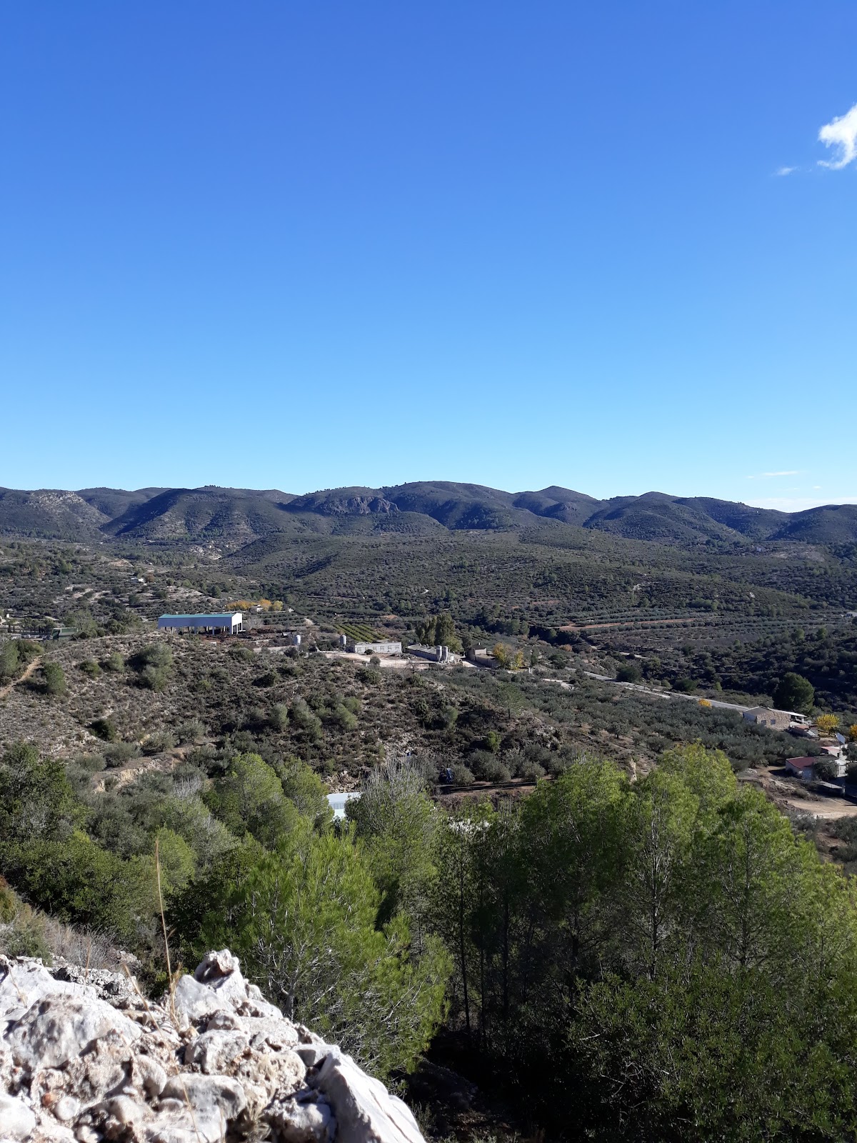
The fortress occupied a position that allowed it to monitor and control movement between the Valencian coast and the interior. It stood along the route linking the areas of Xàtiva, Alcoi, and Dènia, and formed part of a broader defensive network. Signals and warnings could pass between neighbouring fortifications and the rural inhabitants living around them.
The territory associated with the castle included twelve Islamic alquerias across the modern areas of Quatretonda, Llutxent, and Pinet. Paths connected these settlements, many of which stood near springs and rivers. Most disappeared during the fourteenth and fifteenth centuries, while Benicolet and Pinet continued as Muslim settlements under Christian rule. The names Xio, Xiu, and Chio derive from the Arabic term jiwa, meaning a valley, hollow, or low-lying area with water. The name is associated with the nearby Pinet River, a tributary of the Vernisa and ultimately of the Serpis.
Christian conquest and refuge
The siege of Llutxent began on 9 March 1248 during the Christian struggle with the forces of Al-Azraq, a Muslim military and political leader who organized resistance to the Christian conquest in the mountainous areas of southern Valencia. The siege continued at least until 14 April, as Christian forces sought control of the Benicadell route. The victory was followed by the colonization of the surrounding territory under Jaume I, the king of Aragon whose campaigns conquered Valencia for the Christian Crown of Aragon.
In April 1248, land around Xàtiva and Llutxent was divided into 46 allotments covering approximately 380 hectares, and 45 colonists were settled there. The newcomers preferred the more accessible plain to the difficult approach to the Muslim fortress. After the conquest, however, the castle became a refuge for Christian settlers in the new settlement of Llutxent, which initially had no walls or other defences. During the revolts of 1276 and 1277, royal orders specifically instructed the Christian colonists to seek shelter in the castle, showing that the settlement itself was still unfortified.
Abandonment and seigneurial ownership
The construction of a new castle above the town led to the abandonment of the older fortress. It then became known as Castell Vell, meaning “Old Castle,” in contrast to the later Castell-Palace of the Pròxita family. The older fortress soon lost its defensive importance and declined into ruins, retaining mainly a minor supporting role in seigneurial authority.
In the mid-thirteenth century, the Pròxida family acquired the Barony of Llutxent and with it the Castle of Chio and Mont Sant. Maria de Vidaura and Francesc de Pròxita later founded the Corpus Christi Convent at Mont Sant. Pere Maça de Lizana purchased the barony in 1487 and became the castle’s owner. The fortress was disused from the seventeenth century. The expulsion of the Moriscos in 1609 contributed to the abandonment and decline of many Muslim fortresses, including this one, and the Castle of Chio subsequently underwent a prolonged collapse.
Ownership and heritage protection
After the seigneurial system was abolished in 1837, the castle was theoretically transferred to the municipality of Llutxent. Because municipal ownership could not be demonstrated, the state opened an investigation in 1965. After seven years of litigation, a court declared the castle public-domain property, a decision upheld by the Territorial Court of Valencia on 28 September 1972.
Spanish castles received statutory protection under the national decree of 22 April 1949, which treated castles, towers, walls, and other monumental defensive elements as national monuments of the highest importance. On 15 June, the Castle of Chio was declared part of a Historic-Artistic Ensemble together with the Corpus Christi Convent and the Hermitage of the Virgin of Consolation. Legislation of 1985 and the Valencian Heritage Law of 1998 confirmed its status as an Asset of Cultural Interest.
Remains
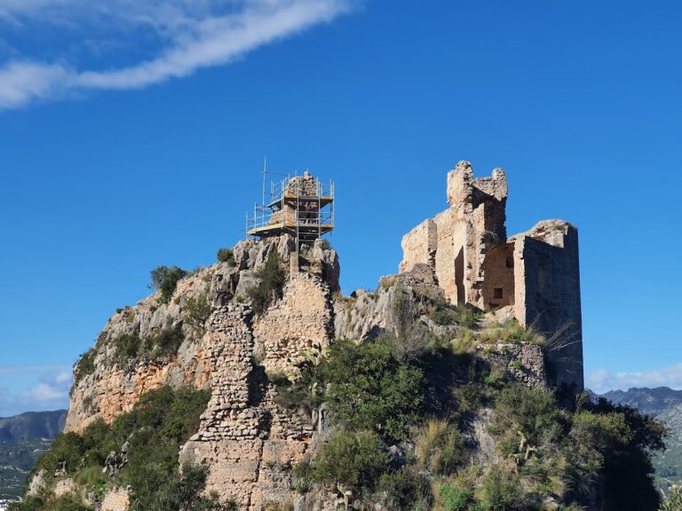
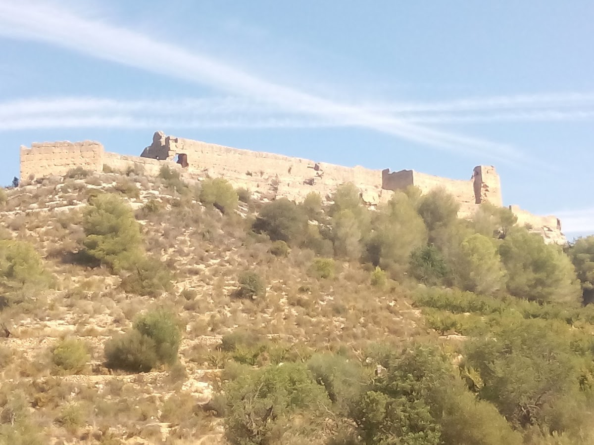
The Castle of Chio stands approximately 1.5 kilometres from Llutxent, beside the Pinet road and the historic Coll del Llautó pass. It occupies a rocky platform about 280 metres above sea level, naturally protected by three steep slopes. The site covers approximately 3,481 square metres and has a triangular plan formed by two walled enclosures. The inner enclosure occupies the highest ground and served residential and refuge functions, while the outer enclosure extended across natural terraces around it. The surviving fabric is largely in ruins, with the cistern, parts of the inner enclosure, and two towers among the principal remains.
Enclosures and defensive towers
Inner enclosure
The inner enclosure retains its complete perimeter. Its walls are sufficiently thick to have supported a wall-walk, allowing defenders to move along the top of the fortification. Three rectangular towers once stood within this enclosure, and two remain standing. They probably contained arrow slits. The eastern tower preserves four openings. Three outward-facing openings are probably original and have lintelled, splayed forms. They are wider on the inside, facilitating the use of bows, and narrower on the outside, restricting the entry of arrows.
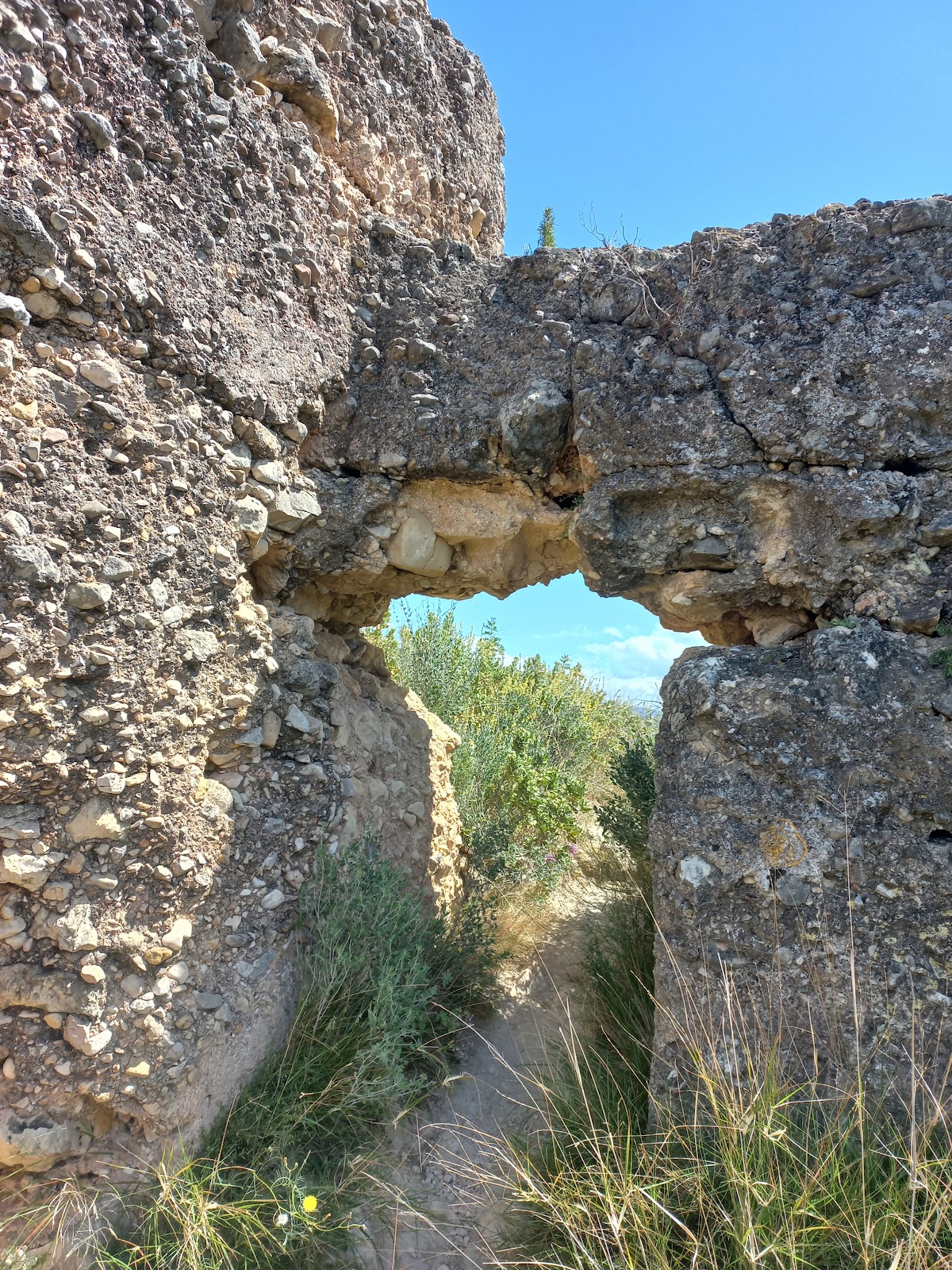
Other openings in the inner enclosure include doors and windows of uncertain date. The entrance may have been on the southern side, where a surviving gap coincides with the junction between two sections of wall. If this was the entrance, it would have been elevated and reached by a ladder that could be removed and stored inside.
Outer enclosure
The outer enclosure occupied the terraces surrounding the higher inner fortification. An albarrana tower, a defensive tower projecting beyond a main enclosure, stood at its south-western end to improve defence and surveillance. The outer wall is heavily deteriorated. Its surviving lines may represent more than one structure, possibly an albacar, an outer enclosure used for refuge or for holding livestock and supplies, or houses belonging to a settlement on the mountain slope.
Water supply and rammed-earth construction
Cistern
A large cistern formed part of the inner enclosure. It lies parallel to the eastern wall and measures approximately 11 metres long by 3 metres wide, with a depth that may have exceeded 3 metres. Three arches and two end walls supported its roof. Channels or an opening in the roof collected rainwater, and the interior was covered by a waterproofing layer. Its size has been interpreted either as provision for prolonged sieges or as evidence that the castle was a residence with its own water supply, possibly serving the wider inhabitants of the hisin, an Islamic fortified settlement or district centre that protected and administered surrounding rural communities.
Rammed-earth walls
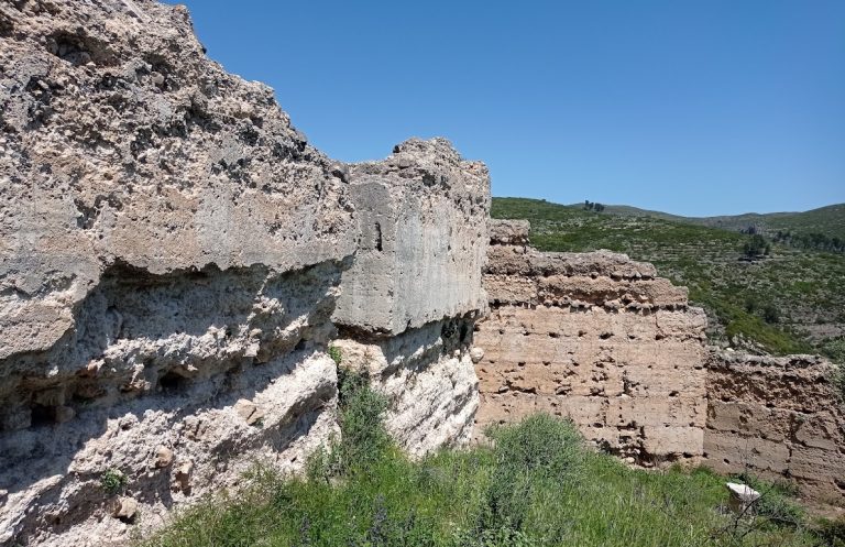
The fortress was built with tapial, a technique in which earth-based mortar is compressed inside temporary wooden formwork to create solid walls. The mortar consisted of moist clay and earth mixed with limestone fragments and, in some cases, broken ceramic material. The surviving walls are described as tapias reales, in which lime strengthened the mortar and improved its durability.
The walls are rectilinear because the mixture was compressed in wooden moulds and left to dry. Transverse wooden supports, known as needles, sometimes remained in place or left holes after removal. These openings usually served as outlets for water. Wall dimensions correspond to the ma’mūní cubit, approximately 0.47 metres, while the moulds were about 0.91 metres high, or roughly two cubits. This construction system remains visible in the ruined walls of the inner and outer enclosures.