Colline du Château: The Fortified Hill of Nice, France

Site at a Glance
- Rating
- 4.7
- Popularity
- Very High
- Country
- France
- Primary era
- Medieval
- External website
- Open
- Eras represented
- Medieval, Early Modern, Modern
- Civilizations
- County of Provence, Duchy of Savoy, French, German
- Site type
- Military
- Remains
- Citadel
On this page17 sections
History
Colline du Château is a fortified limestone hill above Nice, France, whose military works developed from the eleventh to the eighteenth century. Built initially under the Count of Provence as a comital castle, it became a medieval urban center, a strategic Savoyard stronghold, and later a public park shaped by archaeology and modern military reuse.
Medieval Settlement and the Comital Castle
The upper plateau began developing as an urban center during the eleventh century. It contained a castrum, a fortified settlement or stronghold, the cathedral of Sainte-Marie, and various dwellings. A charter dated 20 January 1002 refers to an “ancient wall” near the Paillon, which may have survived from Late Antiquity. By the middle of the twelfth century, a first suburb had formed on the lower northern plateau and was soon enclosed. Until the following century, Nice remained concentrated on the hill.
A document from 1143 records a gate and enclosure serving the new Saint-Pons suburbs at the western foot of the hill. By the early thirteenth century, both the upper settlement and the urbanized lower plateau appear to have been enclosed. The upper settlement was then called a castrum, while the lower area developed as the medieval middle town.
In 1333, the castle complex was described as a palace. It included a guardhouse, a chapel dedicated to Saint Lambert, a bailey, meaning an enclosed outer court within a castle complex, and the offices of the viguier, a medieval judicial and administrative officer in southern France, and the comital judge. A prison and a gallows stood within the complex, the gallows in front of the Great or Bell Tower. In 1397, the garrison under the knight Pons Laugier, lord of Ferres, comprised twelve men-at-arms and a gatekeeper. A hand mill for the garrison is recorded in 1408.
Integration into Savoy
Nice submitted to Savoy in 1388, giving the hill greater geopolitical importance. The castle and its enclosures were altered in 1440, and the cathedral was rebuilt during the same half-century. The hill served as a strategic lookout and protected access to the sea. It also contained a small arsenal and became an important instrument of Savoyard authority.
Military improvements continued through the fifteenth century. Lightning damaged a water conduit leading to a cistern in 1416, and the conduit was repaired. In 1429, a dangerous wooden section of the wall-walk was replaced by a vaulted structure. Major works began in 1436 with an outer projection at the western foot of the castle, followed by a curtain wall descending toward a southwest tower. A curtain wall is a defensive wall linking towers or other fortified points. Houses were purchased and demolished to clear the upper plateau, and the Roquette Tower was added in 1440.
The fortress adapted to early modern artillery when gun ports were opened in the keep in 1506. A very deep well was also excavated to give the garrison an independent water supply. Between 1517 and 1520, an artillery front was built on the northern side of the upper hill, the most accessible approach. As the civilian population left the upper town, the hill became predominantly military.
Citadel, Sieges, and Destruction
Plans made in 1542 proposed clearing the middle town and replacing it with a large bastioned citadel. A bastion is a projecting fortified platform designed to provide flanking fire along adjacent walls. The Franco-Ottoman siege of 1543 damaged the northern suburb. Emmanuel-Philibert, Duke of Savoy from 1553 to 1580, then ordered a major defensive reorganization and the replacement of the suburb by a bastioned citadel. These military changes accelerated the movement of habitation into the lower town and contributed to the transfer of the cathedral from the castle to Sainte-Réparate.
Construction of the modern citadel began in 1577 but was never fully completed. After Nice returned to Savoy under the Treaty of Turin in 1696, additional works, including tenailles and half-moons, strengthened the defenses. A tenaille is a low, angular defensive work placed in front of a fortification, while a lunette is a detached or projecting fieldwork. Around 1640, the defenses toward the lower town had already been reinforced by the Sainte-Croix and Saint-Jean lunettes, connected by a low wall. The fortress was besieged by French forces in 1543, 1691, and 1705.
In 1691, French troops commanded by Catinat captured the city and castle, and the keep was destroyed during the siege. During the War of the Spanish Succession, a European conflict over the succession to the Spanish throne, French forces under La Feuillade besieged Nice in 1705. The city surrendered, but the castle resisted until 4 January 1706, after 54 days of bombardment by 113 cannon and mortars.
Louis XIV, the Bourbon king of France from 1643 to 1715, ordered the complete leveling of the fortifications. Demolition by explosives and manual labor began in 1706 and continued for about six months. The work destroyed the walls to their foundations, ditch revetments, underground passages, and much of the associated urban architectural heritage. The Treaty of Utrecht returned Nice and its county to Victor Amadeus II in 1713. Victor Amadeus II was Duke of Savoy and later the first king of Sardinia, but he abandoned plans to restore the fortifications, leaving the castle in ruins for many years.
From Ruins to Public Park
In 1822, King Charles-Félix granted the hill’s grounds to the city in usufruct for public promenades and plantings, while requiring the preservation of the keep, guardhouse, and battery. Work began immediately with the restoration of terraces, paving of principal paths, construction of a monument to Pope Pius VII, and creation of viewpoints. Pope Pius VII was head of the Catholic Church from 1800 to 1823.
Early nineteenth-century planting included 320 Alpine trees and 5,000 local trees and shrubs. Charles-Félix visited Nice in 1826, inaugurated the first terraces, and took an interest in excavations undertaken by the Count of Cessole. The park project was repeatedly disrupted by damage to the plantings, inadequate water supply, grazing, and other misuse. In 1832, responsibility passed to the Royal Chamber of Agriculture and Commerce, which worked with the naturalist Antoine Risso to introduce 200 acclimatizable or already acclimatized trees. The chamber returned the park to the city in 1858.
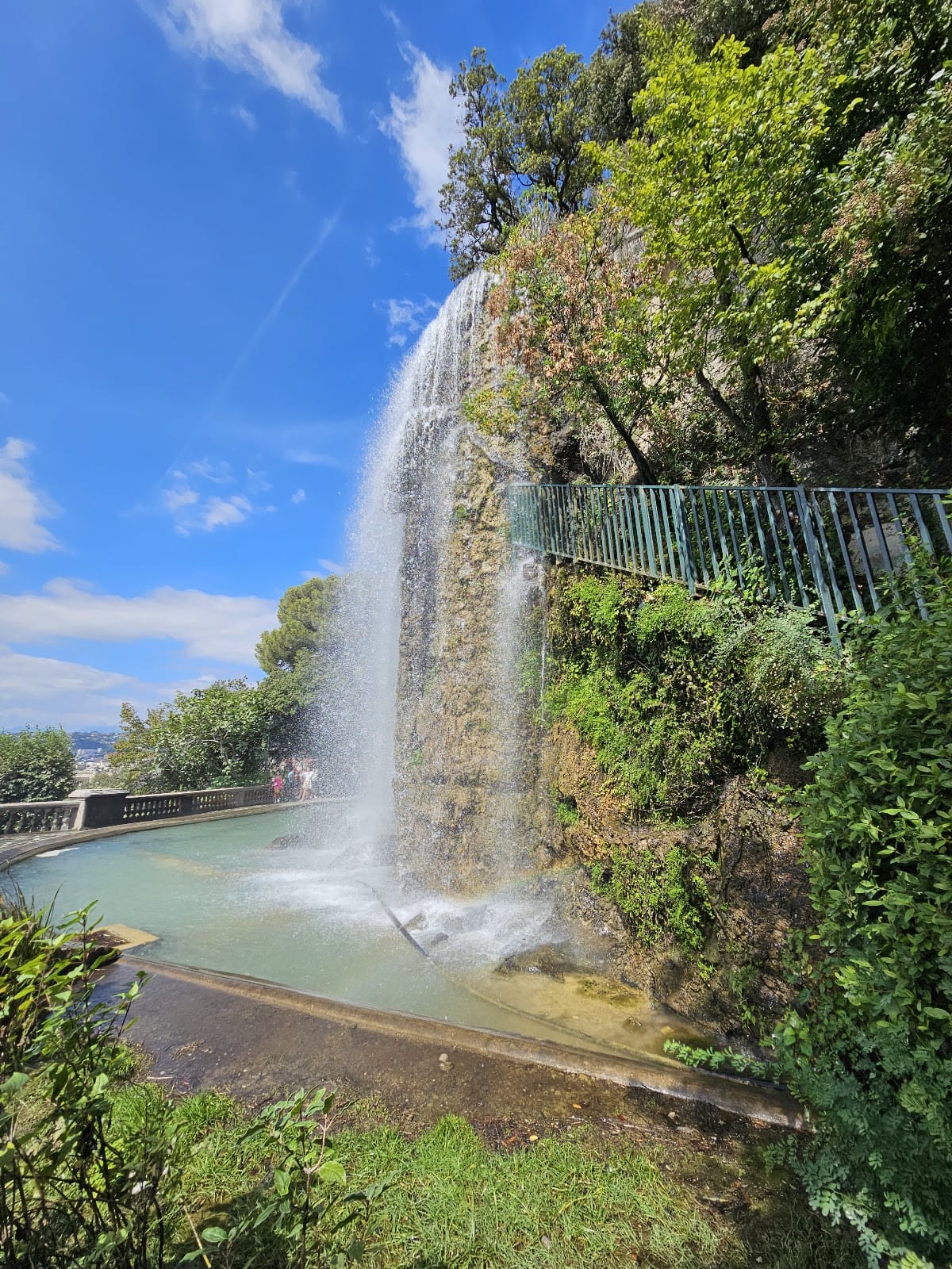
Nineteenth-century excavations revealed the foundations of the first cathedral and temporarily interrupted park development. The former Saint-Elme Tower was reconstructed at the edge of the park in 1844. In 1885, a decorative waterfall was installed over the ruins of the keep. It also functioned as an overflow for Nice’s first water-supply system. Military building restrictions in parts of the park were removed by an agreement between the state and the city on 6 December 1924.
Twentieth-Century Military Reuse and Archaeology
German forces refortified the hill in 1943 and 1944. Low houses that obstructed artillery fire were demolished, guns were installed in the structure now containing the elevator, and barracks and access tunnels were cut into the rock. One tunnel shaft reused a wrought-iron spiral staircase taken from the Jetée-Promenade Casino. Archaeological excavations in 2007 at the foot of the hill revealed defensive remains from several centuries, including the medieval Pairolière Tower and the Saint-Sébastien Bastion. These remains were protected in a visitable archaeological crypt near Place Toja.
Remains
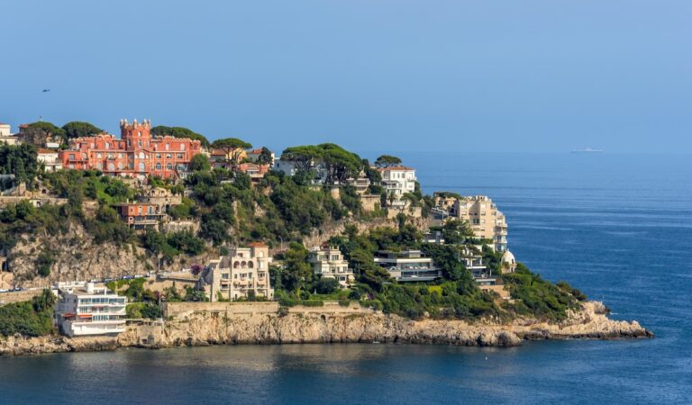
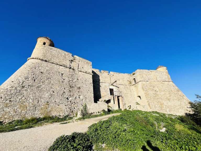
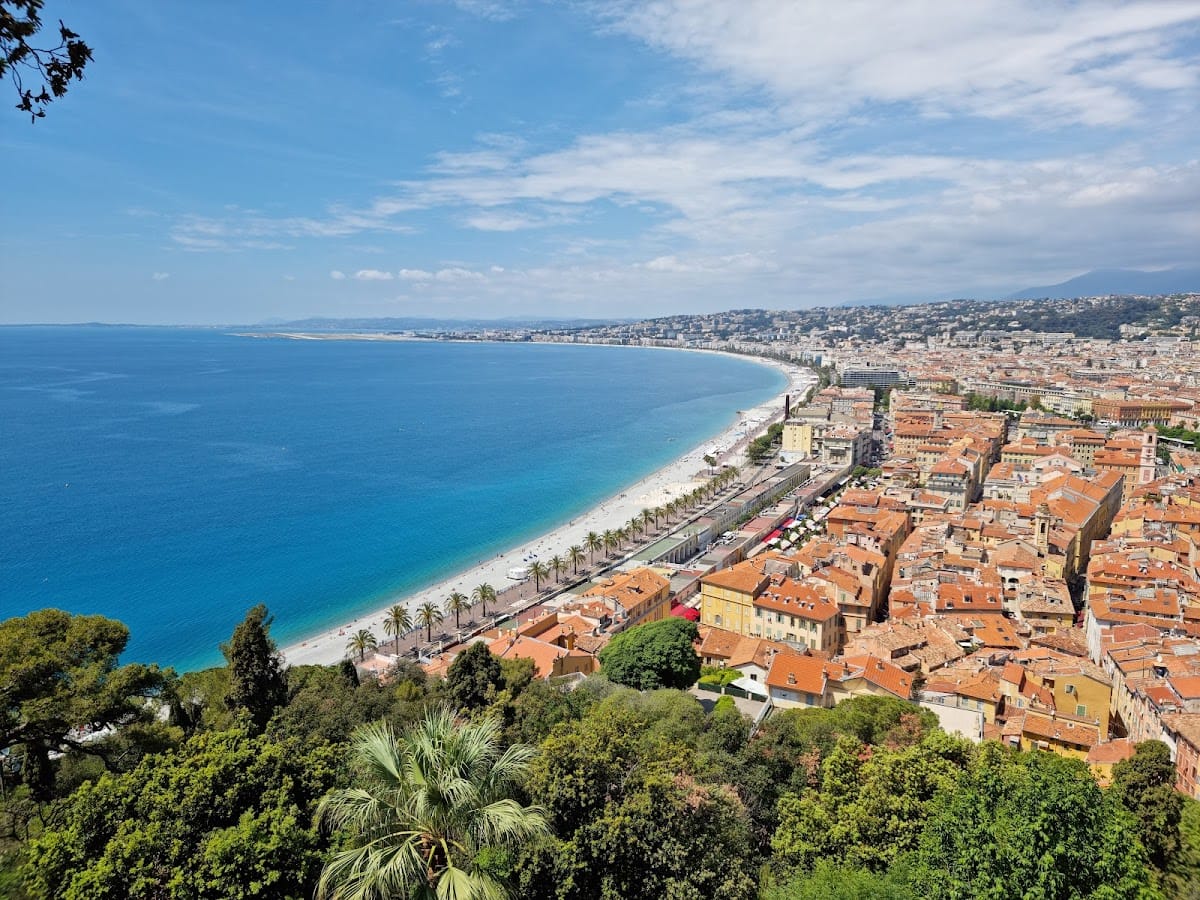
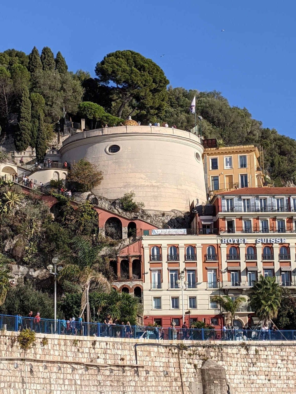
Colline du Château is a limestone rock rising to approximately 92 or 93 metres above sea level. Its base is about 0.71 kilometres wide, and its summit is divided into two plateaus. The higher southern plateau held the castle for roughly seven centuries, while the lower northern plateau contained the early suburbs and later the citadel. Steep rocky slopes border the hill, especially on the eastern side, while the southern side faces the sea. The present park contains terraces, planted areas, promenades, viewpoints, the reconstructed Saint-Elme Tower, the waterfall, and scattered remains of the demolished fortress.
Medieval Castle and Upper Town
The Castle Complex
The medieval upper complex included Sainte-Marie Cathedral, dwellings, an urban enclosure, and probably a castle or keep on the western summit. The pentagonal castle contained the guardhouse, Saint Lambert’s chapel, a bailey enclosed by additional walls, the offices of the viguier and comital judge, a prison, and the gallows. Its keep had four or five towers, including the central square Great or Royal Tower, from which the Savoy flag flew. The entrance had a portcullis, a vertically falling gate used to block a fortified entrance, and machicolations, openings through which defenders could fire or drop objects downward. The Great Tower was also known as the Bell or Campane Tower.
Walls and Western Defenses
The vaulted wall-walk of 1429 replaced part of an earlier wooden circulation route. The works begun in 1436 produced a western spur, a descending curtain wall, and a southwest tower first known as the Mole Tower and later as Saint-Elme Tower. The tower stood on the site of the present Bellanda Tower. On the northern side of the upper town, a rectilinear wall measured about 8 metres high, 2 metres wide, and 60 metres long. An earlier simple wall had been built along the eastern and southern maritime sides in 1361.
Artillery Front and Citadel
Northern Artillery Boulevard
The northern artillery boulevard, built between 1517 and 1520, had broad merlons, the raised sections between openings along a parapet, together with gun ports and three towers. The round Saint-Paul Tower stood to the east, the round Saint-Victor Tower to the west, and the semicircular Saint-Charles Tower protected the central gate.
Citadel Defenses
The modern citadel on the lower northern plateau included two northern bastions forming a tenaille, Il Prencipe to the east and Il Duco to the west. The eastern Il Vitello Bastion faced Lympia, while a square bastion on the town side stood beside Saint-Victor Tower. A planned doubling of the old castle spur was never completed, although Saint-Elme Tower was reinforced and supported by a lower fort. A third lunette, Saint-Jacques, overlooked Lympia, while another tower or bastion and its line of fortification descended toward Rauba-Capeù.
Siege Ruins and Water Supply
During the siege of 1705 and 1706, the citadel and castle stood on a rocky spur enclosed by a wall reportedly measuring about 2,300 metres in perimeter and reaching approximately 8 metres in height in places. A second, higher and more massive wall with towers separated the citadel from the castle. French batteries around the fortress occupied positions near Carabacel, the Avenue des Arènes, Place du Pin, the Scaliero and Orestis streets, Rue de Maeyer, Terra Amata, Boulevard Carnot, Avenue Lympia, the Docks quay, and Boulevard Franck-Pilatte.
Between 11 November 1705 and 4 January 1706, the besieging batteries used 322,148 kilograms of gunpowder, 14,103 bombs, and 39,045 cannonballs. The fortifications were reduced to ruins by this bombardment. Large overturned blocks from the former castle remain near the excavated cathedral, while the base of the keep’s northern wall survives near the overlook above the waterfall and bears the mark of a cannonball impact. The deep well served the garrison’s autonomous water supply, and the former keep’s ruins support the waterfall installed in 1885.
Later Military Works and Archaeological Remains
German Installations
The military works of 1943 and 1944 include rock-cut barracks and tunnels extending from beach level toward the summit. A tunnel entrance is cut into the cliff beside the war memorial. The artillery installation within the present elevator structure could fire across the Bay of Angels.
Excavated Features and Finds
Archaeological remains associated with the hill include the medieval Pairolière Tower, the Saint-Sébastien Bastion, fragments of the former castle, and the excavated foundations of the first cathedral. A cannonball attributed to the Franco-Ottoman siege of 1543 was found on the hill, along with buttons from uniforms dating to the Revolutionary and imperial periods. The defensive remains discovered at the foot of the hill in 2007 are preserved in the archaeological crypt near Place Toja.