Rieti Sotterranea: The Ancient Roman Bridge Beneath Rieti, Italy


Visitor Information
Google Rating: 4.6
Popularity: Low
Google Maps: View on Google Maps
Official Website: www.rietidascoprire.it
Country: Italy
Civilization: Roman
Remains: Infrastructure
History
Rieti Sotterranea is located in the city of Rieti in the Lazio region of central Italy. The site lies beneath Piazza Cavour, near the historic center of the city. Its origins trace back to the Roman Republic period, when the area was part of the ancient Sabine territory before Roman conquest.
The Roman Bridge of Rieti, integral to the site, was built in the 3rd century BCE as part of the Via Salaria. This road was vital for the Sabines to transport salt from the Adriatic coast to Rome. The bridge’s construction followed the Roman conquest of Reate in 290 BCE, coinciding with efforts to reclaim fertile lands under Manius Curius Dentatus, which spurred economic growth in the region.
In the 1st century CE, Emperor Claudius ordered restoration or reconstruction of the bridge, as recorded by an inscription dated 42 CE. This reflects the continued importance of the structure during the early Imperial period.
During the medieval era, the bridge was fortified with defensive towers to control access and collect tolls. A gate-tower was built on the left bank, and a second tower was added in 1312. Both towers were demolished by the late 14th century due to political conflicts and to prevent obstruction of the river’s flow.
The bridge remained in use until the late 19th century. Increased flooding, caused by deforestation and sediment buildup, made the structure unsafe. A new bridge was constructed nearby, and the ancient bridge was demolished between 1932 and 1936. The remains of the original bridge now lie submerged in the Velino River bed beneath the modern city.
Efforts to recover the submerged bridge have been considered, but a fatal accident in the 1990s halted these plans. The site remains a archaeological and historical feature of Rieti’s urban landscape.
Remains
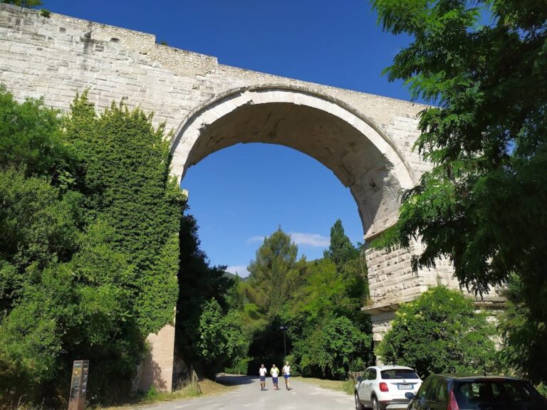
The remains of the Roman Bridge of Rieti consist of a three-arched structure spanning the Velino River. The bridge measured nearly 39 meters in length and just over 6 meters in width. Its design featured a larger central arch flanked by two smaller ones, creating a humpbacked profile.
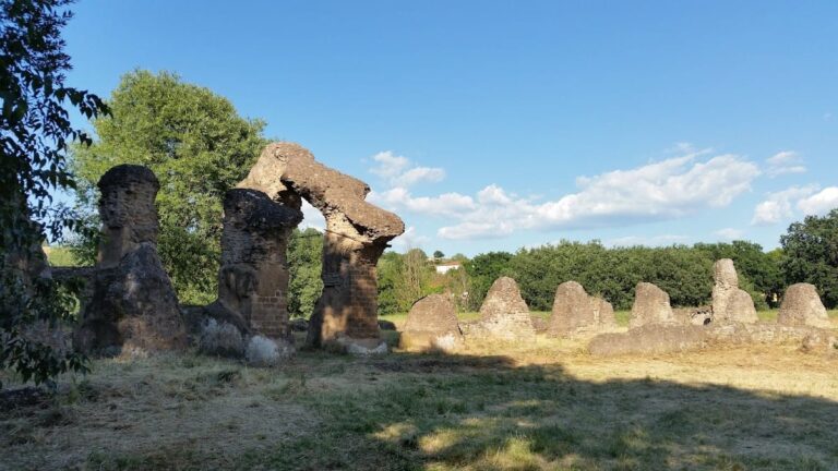
Constructed using the opus quadratum technique, the bridge was built from large blocks of travertine limestone, each about one meter in size. These blocks were laid both lengthwise and crosswise and bonded with mortar, providing strength and durability.
Medieval modifications included the addition of a quadrangular tower on the left bank, which bore a coat of arms and an inscription. This tower was rebuilt in 1439 by the master builder Giacomo da Varese but was demolished in 1883. A second tower, added in 1312, was also removed by the late 14th century.
The bridge connected Via Roma with Piazza Cavour, linking the historic center of Rieti to the Borgo district. It stood adjacent to a viaduct and city gates, forming part of the city’s defensive and urban layout.
After demolition in the 20th century, the bridge’s remains were left in the riverbed. Depending on water levels, parts of the structure are visible from the nearby modern bridge and accessible from the riverbanks via stairways. The site is noted for its rich and uncontaminated riverine wildlife, preserving a natural environment around the ancient ruins.
Nearby sites