Parco Archeologico di Grumentum: An Ancient Roman Municipium in Southern Italy
Table of Contents


Visitor Information
Google Rating: 4.2
Popularity: Low
Google Maps: View on Google Maps
Official Website: museoaltavaldagri.beniculturali.it
Country: Italy
Civilization: Roman
Remains: Burial, City, Civic, Domestic, Economic, Entertainment, Infrastructure, Military, Religious, Sanitation

Context
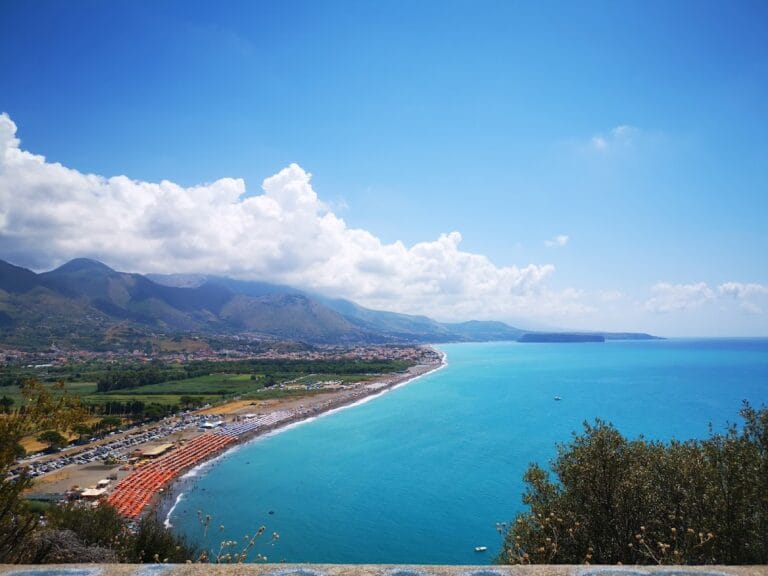
The Parco Archeologico di Grumentum is situated near the contemporary town of Grumento Nova in the Basilicata region of southern Italy. The site occupies a naturally defensible plateau overlooking the valley of the Agri River, providing extensive views of the surrounding landscape. This elevated position afforded strategic advantages for settlement and control over fertile agricultural lands in the valley below. The terrain is part of the southern Apennine mountain range, characterized by rugged hills and a Mediterranean climate, factors that influenced the settlement’s development and urban layout.
Originally established as a Lucanian settlement, Grumentum was later incorporated into the Roman state as a municipium in the 3rd century BCE. The site exhibits continuous occupation through the Roman Republican and Imperial periods, with archaeological evidence documenting urban expansion, public architecture, and infrastructure from the 1st century BCE to the 3rd century CE. Occupation declined during late antiquity, culminating in abandonment by the early medieval era. Excavations have not identified a singular cause for this decline, which appears to have been gradual rather than sudden.
Systematic archaeological investigations began in the 19th century and intensified in the 20th century, revealing substantial remains of the city’s street plan, public buildings, and elite residences. Conservation efforts have aimed to stabilize the ruins and facilitate scholarly study while balancing preservation with public engagement. The site is managed to support ongoing research and educational activities within the broader context of the Parco Nazionale dell’Appennino Lucano.
History
Grumentum’s historical trajectory reflects its transformation from a Lucanian settlement into a Roman municipium and its subsequent evolution through the Roman Imperial period into late antiquity and early medieval decline. Its strategic location in southern Italy made it a significant military and administrative center, particularly during the Roman Republic and Empire. The site’s history encapsulates regional political shifts, military conflicts, and religious developments that shaped Lucania and the wider Italian peninsula.
Pre-Roman and Roman Republican Period (6th–1st century BCE)
Prior to Roman control, the area around Grumentum was inhabited by the Lucanians, an Italic people of southern Italy. The formal establishment of Grumentum as a fortified urban center occurred in the 3rd century BCE, during Rome’s campaigns in the Samnite Wars aimed at consolidating control over Lucania. This foundation was part of a broader Roman strategy to secure key locations by founding military and administrative outposts, contemporaneous with the establishment of Venusia (291 BCE) and Paestum (273 BCE).
Grumentum’s location on important Roman roads, notably the Via Herculea connecting Venusia and Heraclea and a route linking to the Via Popilia on the Tyrrhenian coast, underscored its role as a logistical and military hub. During the Second Punic War, the city was the site of two significant engagements in 215 and 207 BCE. According to Livy, Hannibal camped near Grumentum’s walls in 207 BCE but was defeated by Roman forces under Gaius Claudius Nero, highlighting the city’s strategic military importance. The city remained loyal to Rome during the Social War (91–88 BCE) but suffered destruction and population loss due to attacks by Italic insurgents. Subsequently, Grumentum underwent reconstruction and urban development, likely receiving colonial status under Julius Caesar or Augustus. The city’s urban plan featured an elongated layout adapted to the hilltop, enclosed by walls approximately three kilometers in length with six gates, covering about 25 hectares.
Roman Imperial Period (1st–3rd century CE)
During the Roman Empire, Grumentum experienced significant architectural and civic development. The city’s forum was monumentalized with colonnaded porticoes and surrounded by important public buildings, including temples dedicated to the Capitoline Triad and the imperial cult, a basilica for judicial and administrative functions, and a curia for municipal governance. The urban infrastructure was enhanced by an aqueduct, constructed in the Augustan period, which supplied water to public baths and private residences.
The amphitheatre, originally built in the late Republican period, underwent expansions and repairs during the Severan dynasty, reflecting sustained investment in public entertainment. The Great Baths complex, dating primarily to the imperial period, featured advanced hypocaust heating systems and richly decorated interiors with mosaics depicting marine motifs and mythological figures. Residential architecture included elaborately decorated domus with polychrome mosaics, some renovated into the late 3rd and early 4th centuries CE. The theatre, constructed in the Julio-Claudian period and restored under the Severans, remained in use, indicating ongoing civic and cultural activity. Sculptural finds, such as a marble head of Livia Drusilla near the forum, attest to the presence of imperial cult worship. The city’s water supply system, including a castellum aquae, supported these public amenities and domestic needs.
Late Antiquity and Early Medieval Period (4th–10th century CE)
Grumentum continued to be inhabited into late antiquity, maintaining road connections documented on the Tabula Peutingeriana and through milestones dating to the reign of Emperor Arcadius (late 4th–early 5th century CE). By the late 4th century, the city had become a Christian episcopal seat, with the martyrdom of Saint Laverio in 312 CE marking an early Christian presence. The basilica of Santa Maria Assunta, located near the amphitheatre, was constructed during this period and remained in use with modifications into the medieval era.
Despite continued occupation, the city experienced gradual decline. A necropolis dated to the 7th century CE indicates ongoing community presence. Papal correspondence from the 5th and 6th centuries and medieval chronicles, including the Anonymus Ravennatis and later sources, attest to Grumentum’s continued recognition. However, Saracen raids in the 9th and 10th centuries precipitated abandonment. The population relocated to fortified hilltop settlements in the Val d’Agri, founding the new town of Saponara (later Grumento Nova) in 954 CE, situated on a hill overlooking the ancient site.
Medieval to Early Modern Period (10th–17th century)
Following the abandonment of the Roman city, the surrounding region was repopulated by rural communities inhabiting fortified villages, including Saponara/Grumento Nova. The medieval church of Santa Maria Assunta continued to function, with burials and frescoes dating to the 13th and 14th centuries, indicating sustained ecclesiastical presence. Economic activity centered on subsistence agriculture and viticulture, utilizing the fertile lands once served by Grumentum. The ruins of the ancient city were repurposed for agricultural use, with farmhouses and wine production facilities established on the site from the 16th century onward.
Modern Rediscovery and Archaeological Investigations (16th century–present)
Interest in Grumentum’s ruins began in the mid-16th century with the discovery of inscriptions by Giovanni Antonio Paglia, which initiated scholarly debate regarding the site’s identification. Subsequent excavations in the 18th and 19th centuries, notably by Carlo Danio and Andrea Lombardi, documented visible remains such as the amphitheatre, baths, aqueduct, and city gates, although many decorative elements had been lost or removed. Theodor Mommsen’s visit in 1846 further advanced epigraphic studies.
Systematic archaeological investigations commenced in the 20th century, with significant excavations led by Francesco Paolo Caputi and Pellegrino Claudio Sestieri, who partially excavated the theatre. From 1964 to 1968, under the direction of Dinu Adamesteanu and the Soprintendenza alle Antichità della Basilicata, restoration and excavation efforts stabilized key structures and expanded knowledge of the urban fabric. Excavations have revealed well-preserved public buildings, elite residences with mosaics, and infrastructure. Today, the site operates as a multimedia archaeological park within the Parco Nazionale dell’Appennino Lucano, combining conservation with educational programming that contextualizes Grumentum’s role in Roman and early medieval southern Italy.
Daily Life and Importance by Period
Pre-Roman and Roman Republican Period (6th–1st century BCE)
During its early phase, Grumentum’s population consisted primarily of indigenous Lucanians alongside Roman settlers and military personnel following its foundation as a municipium. The social structure included local elites, Roman magistrates such as duumviri documented epigraphically, artisans, merchants, and enslaved individuals. Households were organized according to Roman patriarchal norms, centered on the domus model featuring atria and peristyles.
The economy was predominantly agrarian, with cultivation of cereals, olives, and grapes supported by the fertile Agri valley. Small-scale workshops produced pottery and textiles, while the city’s position on major roads facilitated trade and military logistics. Commercial activity was integrated into urban life through tabernae lining the streets. Dietary remains and material culture indicate consumption of Mediterranean staples such as cereals, olives, wine, and fish. Religious practices centered on Roman state cults, with temples dedicated to the Capitoline triad and imperial cult reflecting civic integration. Public offices and military functions underscored Grumentum’s role as a fortified municipium securing Roman interests in Lucania.
Roman Imperial Period (1st–3rd century CE)
In the imperial era, Grumentum’s population diversified to include Roman citizens, local elites, freedmen, and slaves. Civic administration and religious rites were managed by documented magistrates, with elite women participating in domestic religious observances. The economy expanded with intensified viticulture and olive oil production, as evidenced by the reuse of frigidaria for wine pressing and fermentation.
Public amenities such as the elaborate Terme Maggiori featured advanced hypocaust heating and richly decorated mosaics depicting marine and mythological themes, reflecting technological sophistication and cultural tastes. Residential domus exhibited polychrome mosaics and frescoes, indicating wealth concentration among elites. The forum functioned as a commercial and administrative center, hosting markets and civic gatherings. Transport infrastructure supported movement of goods and people via well-maintained roads and aqueducts. Religious life incorporated imperial cult worship alongside traditional Roman deities, as attested by the discovery of a marble head of Livia Drusilla near the forum. The amphitheatre and theatre provided venues for public entertainment, reinforcing social cohesion and cultural life. Grumentum’s status as a municipium with a structured urban plan and monumental architecture underscored its regional importance within the Roman Empire.
Late Antiquity and Early Medieval Period (4th–10th century CE)
During late antiquity, Grumentum’s population persisted but gradually declined. Christianization transformed social and religious life, with the city becoming an episcopal seat by the late 4th century. The basilica of Santa Maria Assunta and the martyrdom of Saint Laverio attest to the establishment of Christian institutions. Pagan cults were supplanted by Christian worship, with ecclesiastical authorities assuming civic prominence.
Economic activities shifted toward sustaining local needs amid broader imperial instability. Agricultural production continued, supported by remaining infrastructure. Funerary evidence from the 7th-century necropolis indicates ongoing community presence. Domestic architecture adapted to changing conditions, with some late antique domus showing renovations but overall urban contraction. Markets and long-distance trade diminished, though transport routes were maintained at a reduced level. Religious life centered on Christian liturgy, episcopal governance, and local cults of saints. Educational activities likely included catechetical instruction associated with the bishopric, though direct evidence is limited. The city’s administrative role waned as Saracen raids in the 9th and 10th centuries prompted population dispersal to fortified hilltop settlements such as Saponara (later Grumento Nova), marking the end of Grumentum’s urban function.
Medieval to Early Modern Period (10th–17th century)
Following the abandonment of the ancient city, the region was repopulated by rural communities inhabiting fortified villages. Economic life was localized and modest, centered on subsistence agriculture and viticulture. The medieval church of Santa Maria Assunta continued religious functions, with burials and frescoes indicating sustained ecclesiastical presence and local devotional practices. Household structures reflected rural medieval patterns, with simple dwellings and agricultural outbuildings. Social organization was village-based under feudal or ecclesiastical authority. Trade and transport were limited to regional exchanges via mule paths and rudimentary roads. Religious life remained Christian, with parish churches serving as focal points for community identity and ritual. The reuse of ancient materials and land for agriculture illustrates continuity in land use despite urban decline, while the monumental ruins gradually became integrated into the rural landscape.
Modern Rediscovery and Archaeological Investigations (16th century–present)
From the Renaissance onward, scholarly interest in Grumentum was revived by epigraphic discoveries and antiquarian studies. Archaeological investigations progressively uncovered the urban fabric, revealing details of daily life, architecture, and civic organization. Excavations documented public buildings, elite residences, and infrastructure, enriching understanding of Grumentum’s historical trajectory. Although no permanent population resided on the site, conservation efforts and interpretive programs have highlighted its past social and economic roles. Research has clarified aspects of diet, domestic decoration, religious practices, and urban planning through material culture and inscriptions. While modern activities do not reflect ancient daily life, the site’s study has contributed significantly to knowledge of Roman and early medieval southern Italy, informing comparative analyses of regional urbanism, economy, and cultural transformations.
Remains
Architectural Features
Grumentum occupies an elongated plateau of approximately 25 hectares, enclosed by city walls with a perimeter near three kilometers. These walls, dating primarily to the Republican period, follow the natural contours of the hilltop and are pierced by six gates that controlled access. The urban plan, established in the 3rd century BCE, features a grid layout with three main parallel east-west streets (decumani) intersected by north-south secondary streets (cardines). The principal decumanus, or plateia, is preserved in extensive paved sections lined with monumental buildings. The city’s topography and street arrangement reflect adaptation to the elongated hill shape. Only about one-tenth of the urban area has been excavated, with much remaining uninvestigated but documented through surface surveys and geophysical methods.
Construction techniques include opus incertum (irregular stonework) and opus reticulatum (diamond-shaped stonework), with ashlar masonry employed in key public buildings. The city’s architecture comprises civic, religious, domestic, and entertainment structures, indicating a complex urban character. Public amenities expanded notably during the Augustan and Severan periods, while later phases show signs of contraction and partial abandonment. Water supply infrastructure includes an Augustan aqueduct sourcing springs near Moliterno, feeding cisterns and a castellum aquae within the city. Drainage was managed by cloacae integrated into the street system.
Key Buildings and Structures
Theatre
The theatre, constructed in the Julio-Claudian period (1st century CE) and restored during the Severan era (early 3rd century CE), occupies two city blocks near the archaeological park entrance. Integrated into the urban fabric adjacent to the main road axis, the cavea (seating area) is self-supporting, approximately 46 meters wide, and preserved up to about nine meters high, roughly half its original height. The external façade featured a double row of arches supporting the inclined seating, though original stone seats are largely lost.
Access to seating was via stairways within a covered ambulatory behind the external portico. The cavea is divided horizontally into three sections (infima, media, summa cavea) corresponding to social rank, and vertically into five wedge-shaped sections (cunei) by four staircases (scalaria). Five covered corridors (two parodoi and three vomitoria) provided access to the orchestra and lower seating. The orchestra was partly used by actors and partly as additional seating for elites, separated by a low wall (balteus). The stage (pulpitum) was a wooden platform about 1.5 meters above orchestra level, backed by a two-story scaenae frons with three large exedrae and three doors (porta regia center, portae hospitales sides). Behind the stage was a porticoed square (porticus post scaenam), likely serving as a palestra (exercise area).
Temple A
Temple A is a small Italic-style temple built on a high podium of grey limestone, facing a square near the main street (decumanus maximus). Dating to the early Imperial period, it is located behind the theatre’s stage area and accessible from the main road. Archaeological evidence, including a marble torso of a boy found nearby, suggests dedication to Arpocrates, an Egyptian deity. This temple indicates the presence of Egyptian cult practices within Grumentum.
Domus with Mosaics
This large single-family residence measures approximately 30 by 60 meters and is oriented northwest-southeast, perpendicular to the city’s main decumani. Initial construction dates to the early 2nd century CE, built over Republican structures, with extensive restorations and mosaic additions in the late 3rd to early 4th century CE. The house features a typical Roman layout with an atrium and peristyle, and shops (tabernae) along the street side.
The southern half includes the entrance (fauces), an atrium with an impluvium (rainwater basin), and a porticoed garden (peristilium). Three dining rooms (triclinia) have painted plaster walls and ceilings, with floors decorated by black-and-white and polychrome mosaics featuring geometric and vegetal motifs. The atrium contains an apsidal niche with marble-lined walls and a polychrome mosaic floor, likely serving as a lararium (household shrine). The northern half contains smaller rooms, probably bedrooms (cubicula) in the northeast and service areas such as kitchens, baths, storage, and servants’ quarters in the northwest, accessed via a rear street. Additional reception rooms with opus sectile and mosaic floors lie northeast of the atrium. This domus is among the most prestigious residences excavated at Grumentum.
Forum
The forum is a rectangular public square dating to the Augustan and Julio-Claudian periods (first half of the 1st century CE). Traversed by the main paved street (plateia or decumanus maximus), it is surrounded on all sides by colonnaded porticoes. The west side contains civil and administrative buildings, including a rectangular multi-nave basilica used for public meetings and justice, a tripartite building, and a circular building of uncertain function.
The south side features Temple C, the oldest monument in the forum, identified as the Capitolium dedicated to the Capitoline Triad. Adjacent to Temple C are a fountain and service rooms. A white marble head of Livia Drusilla, wife of Augustus, was found near this temple, likely part of an imperial statuary group. The north side faces Temple D, probably dedicated to the imperial cult, and an adjacent circular monopteral temple currently under excavation. The forum pavement originally consisted of marble slabs, with some traces remaining in the southern corner. Excavations outside the southern portico reveal probable residential buildings. The forum’s monumentalization reflects urban development during the Julio-Claudian era.
Major Baths (Terme Maggiori)
The Major Baths form a large thermal complex comprising 15 to 16 rooms, oriented according to the urban street grid. The complex dates primarily from the Augustan to Severan periods (late 1st century BCE to early 3rd century CE). Interiors are richly decorated with colorful marbles and figurative mosaics. The entrance leads to a mosaic-floored hall, followed by the frigidarium, which contains a large marine-themed mosaic depicting Scylla, Giants, and various aquatic animals in tesserae of white, black, gray, dark blue, turquoise, and green.
The mosaic’s border includes acanthus leaves and volutes, with four male figures representing Giants holding an emblem with numerous fish, thematically linked to water. From the frigidarium, two pools are accessible: a large apsidal pool containing four Roman statues of nymphs, Aphrodite with a dolphin, and Dionysus, made of fine Parian marble. These statues are likely Hellenistic models or Roman copies dated between the 2nd century BCE and 3rd century CE. Heated rooms include a tepidarium, laconicum, and an apsidal caldarium with two side basins, heated by three praefurnia supplying hypocaust systems with suspensurae supporting mosaic floors and tubuli heating the walls. A service corridor leads to latrines and furnace rooms. Water was supplied by two large conduits fed by a cistern southwest of the complex, itself supplied by the city aqueduct. Drainage was managed by a cloaca. Statues found in the apsidal pool were likely destroyed in late antiquity and abandoned in the pool fill.
Republican Baths (Terme Forensi)
Located near the forum along the eastern decumanus, the Republican Baths were built in opus reticulatum masonry and date to the late Republican period. Public funding is attested by an inscription mentioning two duoviri, Q. Pettius and C. Maecius. The complex includes a calidarium divided into two rooms separated by masonry benches, both with white and polychrome mosaics featuring geometric patterns such as Greek key and double-headed braid motifs. Floors were supported by suspensurae, and remains of a heating furnace have been found.
The circular frigidarium contains side benches and was later reused in modern and contemporary times as wine pressing and fermentation vats. Water was supplied by the Augustan aqueduct and a cistern, also reused in modern times. Some rooms currently serve visitor facilities.
Amphitheatre
The amphitheatre is situated on the northeastern periphery of the urban area, near a main access road that allowed spectators to enter without passing through the city. Its construction dates to the second half of the 1st century BCE, with later modifications in the 1st century CE and possible restorations during the Severan period. The structure exploits the natural slope between the central and eastern terraces of the hill; the western side rests on the natural hillside, while the eastern side is supported by artificial masonry substructures.
Initial construction employed opus incertum, with later additions in regular opus reticulatum. The amphitheatre is a hybrid structure, solid on the west side and hollow on the other sides. It features two tiers of stone seating supported by earth embankments and vaulted corridors on the west, and artificial substructures on the east. The arena was carved and leveled from the hillside and lacks underground chambers. A surrounding corridor is interrupted only at the main entrances, which had gates to admit animals through six openings closed by metal grilles; some thresholds survive. Four main entrances are located at the ends of the axes, two of which are monumental on the long axis. Numerous other entrances around the perimeter allowed access to different seating levels. Three external staircases on the east side, similar to those at Pompeii, served as both access routes and buttresses. The amphitheatre was designed to accommodate large crowds from the valley below. Excavations intensified after the 1980 earthquake.
Basilica
The basilica is located on the western side of the forum and dates to the early Imperial period. It is a rectangular, multi-nave building used for public meetings and administration of justice. Only limited remains of the basilica are visible today, consisting mainly of foundational walls and partial masonry.
Church of Santa Maria Assunta
This church is situated in the northern part of the Roman settlement, near the amphitheatre. Originally constructed as a three-nave, three-apse basilica with a narthex, it was later reduced to two naves. Recent excavations uncovered a small hypogeum crypt containing burials. Ceramic finds from the site span from Roman times through the 19th century, indicating long-term use. Wall fresco fragments include a depiction of a saint’s face beneath a larger Madonna figure. The church functioned as a place of worship into the 13th and 14th centuries.
Other Forum Buildings
On the western side of the forum, a tripartite building and a circular building of uncertain function have been excavated. East of Temple D, a circular monopteral temple is currently under excavation. These structures date primarily to the early Imperial period and contribute to the complex architectural ensemble of the forum area.
City Walls and Gates
The city walls, enclosing approximately three kilometers, date to the Republican period and follow the elongated hilltop shape. Six gates pierce the walls, providing controlled access points. The walls were constructed using opus incertum and opus reticulatum techniques. Only a fraction of the walls and gates have been excavated and conserved, with many sections remaining buried or fragmentary.
Other Domestic Buildings
Several domus with mosaic floors have been excavated near the major baths. These residences date from the Republican and early Imperial periods and are partially overlain by later constructions. They exhibit typical Roman domestic architectural features such as atria, peristyles, and decorated floors.
Aqueduct and Water Supply
The aqueduct, built in the Augustan period, brought water from springs approximately five kilometers south near Moliterno. Water was stored in a castellum aquae, of which only limited ruins survive. The aqueduct supplied the baths, cisterns, and private residences. Water drainage was managed by cloacae integrated into the urban infrastructure.
Necropolises and Burial Monuments
Monumental tombs have been found outside the city walls. A necropolis dated to the 7th century CE was excavated near the extra-urban church of San Marco. Medieval burials have also been discovered near the church of Santa Maria Assunta, north of the Roman town.
Other Remains
Remains of a temple traditionally attributed to Serapis are located in the medieval town of Grumento Nova. Various inscriptions, statues, and architectural fragments are scattered throughout the modern town, reflecting the ancient city’s extended influence and reuse of materials.
Preservation and Current Status
The preservation of Grumentum’s ruins varies by structure. The theatre’s cavea remains partially standing, with external façade arches and internal corridors visible. The amphitheatre’s stone seating and structural substructures survive in fragmentary but substantial condition. The forum’s porticoes and temple foundations are preserved to varying degrees, with some marble pavement fragments extant. The major baths retain mosaic floors and hypocaust heating systems, though some rooms are fragmentary.
The basilica and other forum buildings survive mainly as foundational remains. The church of Santa Maria Assunta retains structural elements and fresco fragments. The domus with mosaics is well-preserved in parts, especially floor decorations. City walls and gates are partially conserved, with many sections stabilized but incomplete. Restoration efforts in the 1960s and later decades have stabilized key structures, employing original materials where possible and modern interventions for structural support. Environmental factors such as vegetation and erosion pose ongoing challenges. The site is managed by the Italian Ministry of Culture and the Basilicata Superintendency for Archaeology, with active conservation and excavation programs.
Unexcavated Areas
Approximately 90% of Grumentum’s urban area remains unexcavated. Large portions of the city blocks (insulae), residential quarters, and peripheral zones await systematic investigation. Surface surveys and geophysical studies suggest buried remains beneath agricultural land and modern developments. The eastern and southern sectors, including parts of the forum’s surroundings and additional domestic areas, are poorly studied. Future excavations are planned but constrained by conservation policies and land use. Some areas are preserved in situ to protect archaeological contexts and prevent damage from exposure.
Nearby sites