Fittipaldi Castle: A Historic Fortress in Brindisi Montagna, Italy


Visitor Information
Google Rating: 4.7
Popularity: Low
Google Maps: View on Google Maps
Country: Italy
Civilization: Unclassified
Remains: Military

History
Fittipaldi Castle, known historically as Castello di Brindisi Montagna, is situated in the municipality of Brindisi Montagna in Italy. This fortress was originally constructed around the year 1200 by Norman builders, preceding later modifications during the reign of the Hohenstaufen dynasty.
The first written record of the castle appears in 1240 within the Statuta Officiorum, a decree by Emperor Frederick II. Here, it is referred to as “castrum Brundusii de Montana” and listed among twenty-nine state castles in Basilicata. These fortifications formed a network of military lookout points meant to oversee and secure the Basento valley, a crucial inland route connecting southern Basilicata to the Ionian Sea. The castle’s position on a prominent ridge allowed control over this vital communication corridor, which was especially important during the Middle Ages due to the scarcity of roads.
In 1220, the castle was incorporated into a wider defensive building program initiated by a military and administrative assembly known as “De Novis Aedificiis Diruendis.” This initiative also included other fortresses in nearby towns, highlighting the strategic emphasis placed on the region.
Following the Angevin conquest after 1266, the castle’s military garrison was replaced with knights who came from beyond the Alps. Guidone de la Forest was appointed its first lord under Angevin rule in 1266. His successor, Pietro de Hugot, took control in 1280 through marriage to Isabella de la Forest. However, by 1284, the castle returned to state possession when the last private lord died without heirs. The Angevin period saw heavy taxation imposed on the local population, leading to social unrest including a notable revolt in 1269, in which the castle’s residents actively took part. The uprising was triggered by the demand that sixty corpses be supplied to support the royal army besieging the Saracen stronghold of Lucera.
In the early 15th century, specifically 1414, Baldassarre La Zatta is mentioned as lord of Brindisi Montagna. From 1449 onward, the territory came under the rule of the Sanseverino family. A catastrophic earthquake in 1456 devastated the area, rendering it uninhabited until Albanian settlers repopulated the region around 1535.
By the 17th century, records from 1639 and 1654 indicate that the castle no longer served military purposes and had transitioned into a seasonal noble residence. It was held by the Sanseverino family before passing successively to the Antinori, Battaglia, and finally the Fittipaldi family. The Fittipaldis eventually donated the castle to the local municipality in the early 20th century. Following the abolition of feudalism and subsequent changes in ownership, the castle fell into ruin until restoration efforts culminated in its reopening to the public in 2018.
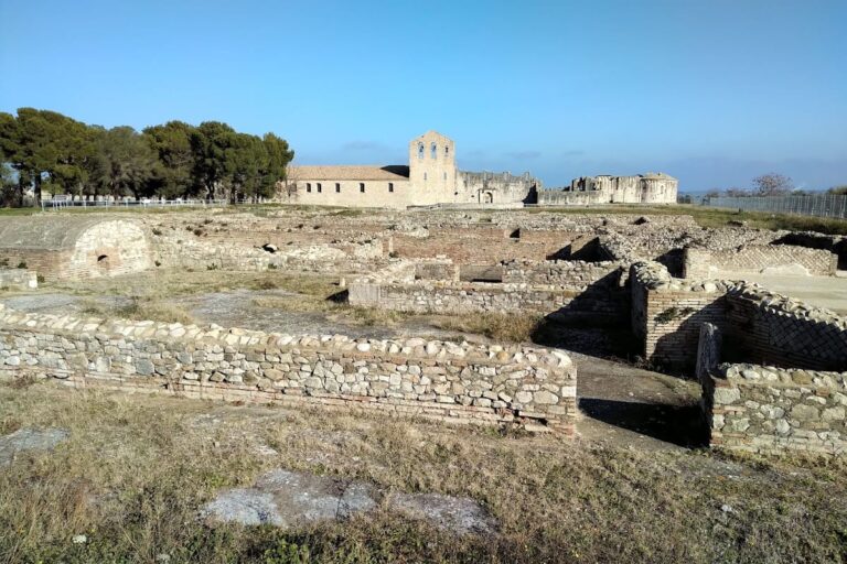
Archaeological discoveries at the site, including Latin inscriptions, confirm that the location hosted a Roman settlement prior to the medieval castle. The name “Brindisi” itself has ancient origins, reflecting linguistic ties to Messapian and other pre-Sabellic languages, suggesting the site’s importance predates the Lucanian conquest.
Remains
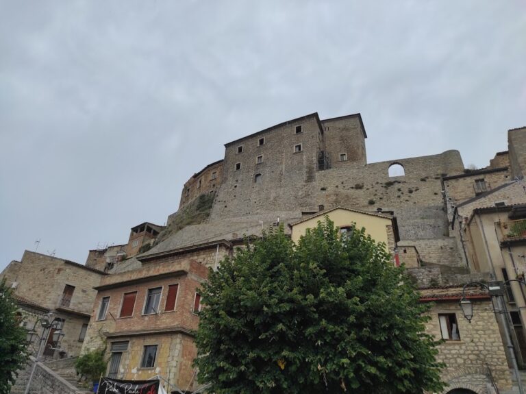
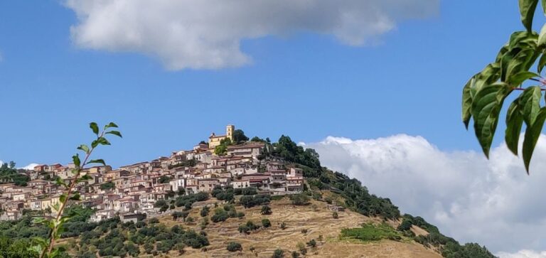
Fittipaldi Castle occupies a broad sandstone ridge, rising between 832 and 877 meters above sea level, overlooking the valley of the Basento river. Its position atop this natural elevation provided a commanding view over the surrounding landscape, while a sheer cliff on the western side served as a natural defensive barrier. Visitors traditionally approach the site by ascending a steep rocky path from the southern vantage point near the village church of San Vincenzo.
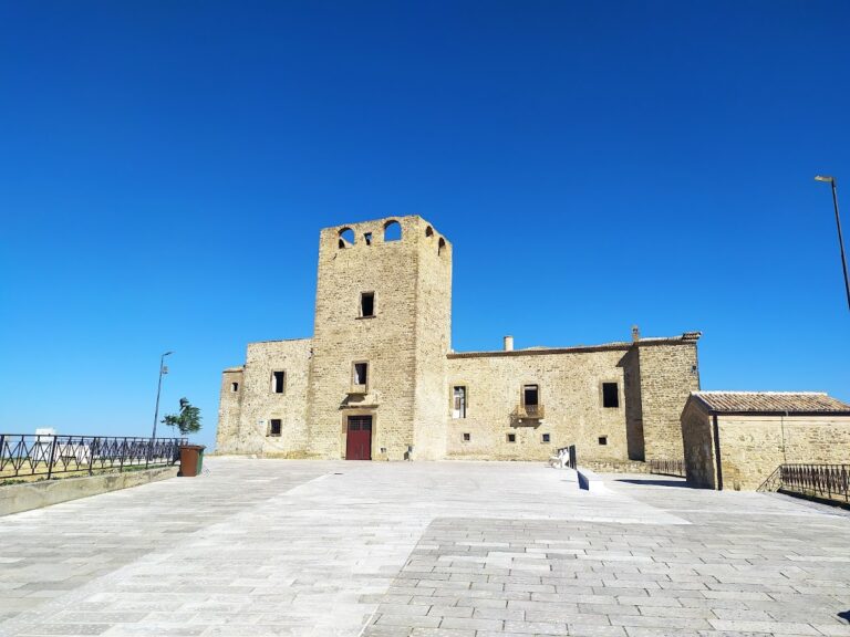
The fortress complex is divided into three primary areas. The central section runs along the ridge and features multiple levels that adapt tightly to the rocky terrain. This is complemented by a northern sector where a watchtower once stood; this tower was later converted into the Chapel of San Michele by the Antinori family. On the southern side, only limited but important remnants of walls survive, embedded directly into the rocky outcrops.
Several defensive elements are evident, such as numerous arrow slits and narrow openings. Particularly notable is a low annex adjacent to the main entrance on the left side, which likely served as an observation post to monitor potential attacks approaching from the south. This annex predates the castle’s main construction phase, as demonstrated by two distinct masonry styles visible in the walls: a lower layer made of rounded stones collected from nearby riverbeds and an upper one that matches the Norman core’s construction techniques. Such evidence suggests that the site may have functioned originally as a lookout before the more extensive Norman fortress was built and subsequently modified under the Hohenstaufen and Angevin rulers.
Further structural elements from the 13th and 14th centuries illustrate an integrated system of watch and defense points. These include the northern watchtower, the main keep or mastio, an adjacent building equipped with arrow slits, the annex near the main gate, a rock-carved annex along the eastern facade, and a building atop a secondary rocky summit that enabled control of the castle’s entrance path. Together, these components allowed vigilant sentinels to monitor north-south movement along the Basento valley, a crucial corridor especially during periods of Saracen incursions beginning in the 9th century.
Conservation and restoration work have stabilized the ruins and made it possible for visitors to appreciate the site’s layout and historical layers. The structural complexity and the adaptation to the natural sandstone ridge remain evident, providing tangible insight into the castle’s evolution from a military stronghold into a noble residence across the centuries.
Nearby sites