Castell de Torelló: A Medieval Fortress in Sant Vicenç de Torelló, Spain


Visitor Information
Google Rating: 4.5
Popularity: Very Low
Country: Spain
Civilization: Unclassified
Site type: Military
Remains: Castle

History
Castell de Torelló is a medieval fortress located in the municipality of Sant Vicenç de Torelló, Spain. It traces its origins to the early medieval period and was constructed by the forces shaping the Catalan counties during the Carolingian era.
The castle appears for the first time in written records in 881 under the name “castro torelonense.” From its earliest days, the fortress served as the administrative center for the surrounding valley, a role that influenced the names of nearby settlements such as Torelló, Sant Pere de Torelló, and Sant Vicenç de Torelló. During the 10th and 11th centuries, the site was held under the authority of the Counts of Barcelona, with the Besora family acting as feudal lords. A significant political alliance resulted from a marriage between the Besora heirs and Mir Geribert of Olèrdola, bringing the Montcada family into possession of several Besora castles.
In 1136, Ramon Berenguer IV, Count of Barcelona, granted the castle to Guillem de Montcada, the count’s seneschal, who pledged loyalty on the same day. By the late 13th century, the castle was part of important noble matrimonial arrangements; in 1291, it entered the dowry of Guilleuma de Montcada as she married Infante Pere of Aragon, son of King Pere the Great. After her death, the ownership of the castle returned to the royal crown.
The 14th century saw changes in the castle’s custodianship under King Pere the Cerimoniós. He granted the site to Bernat de Vilademany and later sold it to Pere de Vilademany in 1347. Nonetheless, the king reserved the right to reclaim the property, which was enacted in 1351 when Bernat III de Cabrera exercised this option. From that point onward, the Cabrera family held full jurisdiction over the castle and its lands, including criminal authority such as capital punishment.
The castle was seriously damaged during the earthquakes of 1427. Later, during the Catalan Civil War (1462–1472), it figured within regional conflicts when peasants aligned with the Generalitat seized and defended the fortress. Concerns over its strategic use led the Viceroy of Catalonia in 1554 to order the castle’s demolition to prevent it from becoming a refuge for bandits. Further destruction was caused by a severe hurricane in 1746, reducing the remnants predominantly to a section of the defensive tower.
From an administrative standpoint, the position of castellan—responsible for overseeing the castle—was held by members of the Torelló family at least since 1131 until 1280. Through marriage, this role passed to the Orís family, who maintained it until 1471 when the office ceased to hold significant importance. Today, the castle is officially protected as a cultural heritage site of national interest.
Remains
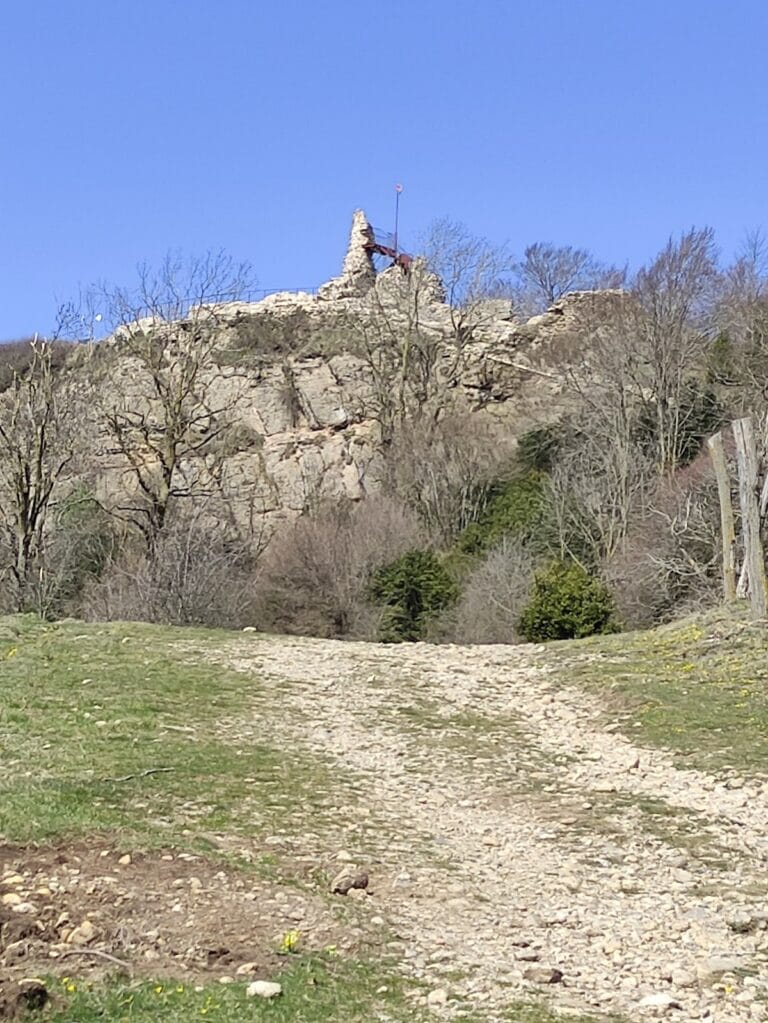
The castle is perched on a marl hill standing at 781 meters above sea level. This hilltop commands a prominent location, the highest along a natural ridge dividing the lower Ges and Ter valleys. Its strategic position provides sweeping views that once allowed for extensive surveillance of the surrounding landscape, including the plains around Vic and the nearby mountain ranges.
The hill itself is shaped somewhat like a leaf, with its pointed southern end serving as the entrance to the castle enclosure. Evidence of early construction includes a series of rock-cut holes thought to have supported wooden beams, a characteristic associated with the earliest Carolingian fortifications.
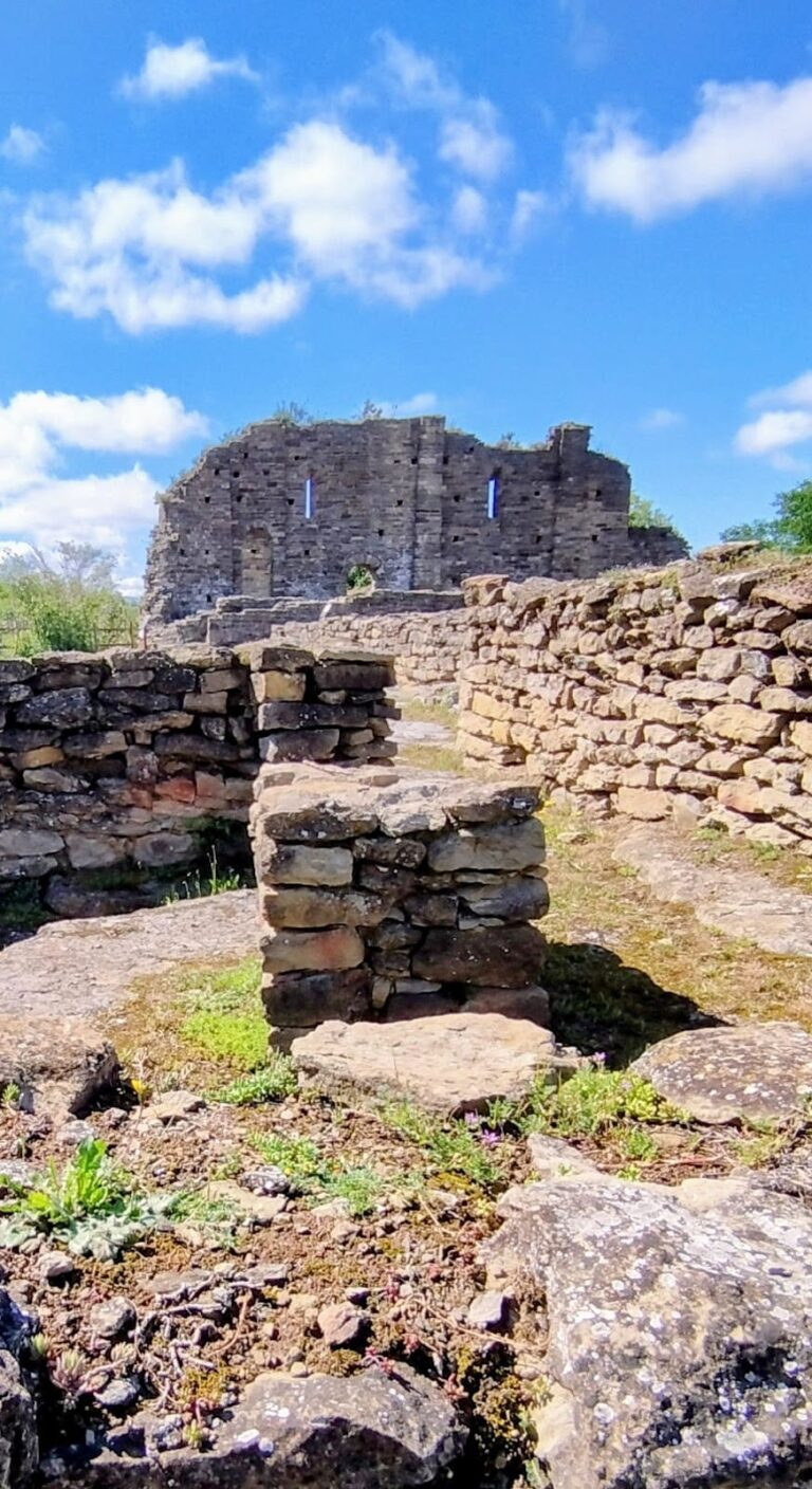
What survives today of the medieval complex is primarily a circular defensive tower situated on the northern third of the hill. The tower’s north side measures roughly 3.6 meters high, while the south side, possibly due to the ground’s slope, rises to about 4.7 meters. Its diameter is approximately 1.65 meters, with the walls nearly 1.6 meters thick. Constructed from small but well-shaped rectangular stones arranged in orderly horizontal layers, the tower rests directly on the exposed marl rock of the hilltop.
Historical Spanish sources provide slightly different dimensions, describing the tower as roughly 5.5 meters tall and 6 meters wide, with 2-meter-thick walls built of fine stone blocks bonded with mortar. These discrepancies likely reflect different measurement points or interpretations but converge on the structure’s compact and sturdy design. The tower is set on a rock outcrop about 25 meters wide and 80 meters long, which rises sharply 4 to 5 meters above steep surrounding slopes.
Surrounding the tower, the castle once featured a defensive wall constructed along the natural ledges of the hill, enclosing the entire rocky summit. This wall was dismantled in the 16th century, with only fragments remaining today. Entry to the enclosure was originally only possible from the western lowest point of the hill, which now can be reached by a modern iron ladder.
Within the castle’s perimeter was a rock-cut cistern carved into the southern third of the hilltop. This basin measures about 2 meters in length and 1.5 meters in width and remains visible. It once collected and stored water for occupants during sieges or dry periods.
The tower’s design included a western opening, but its original access point was a door positioned on the first floor, reachable only by a wooden staircase that could be removed to hinder attackers. Inside the castle area, additional buildings provided space for the garrison, storage of weapons, provisions, and tools, completing the functional layout necessary for defense and daily operations.
Efforts to preserve the remaining tower took place during the late 20th century, partially restoring and stabilizing the structure to maintain its historical presence on the landscape.
Nearby sites