L’Esquerda: An Archaeological Settlement in Catalonia, Spain


Site at a Glance
- Rating
- 4.5
- Popularity
- Low
- Country
- Spain
- Primary era
- Medieval
- External website
- Open
- Eras represented
- Bronze Age, Iron Age, Classical, Medieval
- Civilizations
- Carolingian, Iberian, Visigothic
- Site type
- Military
- Remains
- Fortified Town
On this page13 sections
History
L’Esquerda is an archaeological site in Spain, occupied successively by Late Bronze Age communities, Iberian peoples, Visigoths, Carolingians, and medieval Catalan populations. It lies on a 12-hectare peninsula formed by a meander of the Ter River, where an elevated position between the Vic Plain and the Guilleries supported defense, control of surrounding territory, and access to varied natural resources. Occupation extended intermittently from the eighth century BC to the fourteenth century AD.
Late Bronze Age and Iberian Ausa
The earliest settlement dates to the Late Bronze Age, in the eighth century BC. Several huts stood on the peninsula, and fragmented pottery, including Merlès pottery, points to connections with other communities in central Catalonia. By the fifth and fourth centuries BC, the site had developed into a large Iberian oppidum, a fortified settlement that often occupied a naturally defensible height and served as a regional center.
The settlement is identified with Ausa, the principal center of the Ausetans, an Iberian people whose territory was centered in the region of present-day Osona. Its inhabitants made pottery and worked metal, while links and trade along the Ter connected the settlement with the Empordà coast. The Ausetans allied with the Carthaginians during their wars against Rome.
At the end of the third century or the beginning of the second century BC, during the Second Punic War, a major fire destroyed several structures, including the defensive wall. The settlement was rebuilt a few years later. A new wall was placed farther outward, and its gate moved from the middle of the defenses to the eastern end. This phase continued into the first century BC.
Roman and Visigothic transformations
Romanization, the political, economic, cultural, and settlement changes following the Roman conquest, altered the region’s pattern of habitation. Elevated Iberian settlements lost many of their defensive and territorial functions as communities moved toward plains and cultivated land. Roman Ausa, corresponding to present-day Vic, and the villas around it became more prominent in the regional landscape.
The peninsula was later reoccupied during the Visigothic period. The Visigoths, a Germanic people who established a kingdom across parts of the former western Roman Empire, including the Iberian Peninsula, were associated with a renewed use of defensible high ground. At this stage the settlement was known as Roda Ciutat. A wall built around the fifth century reused the ruined remains of an earlier Iberian wall.
The Muslim invasion in the early eighth century disrupted political and economic control in the region. Muslim armies destroyed the Visigothic center of Ausona and several surrounding fortresses, leading populations to move toward nearby mountains. From the late eighth century, the Carolingians, the Frankish ruling dynasty that extended its authority south of the Pyrenees, incorporated L’Esquerda-Roda Ciutat into a defensive line along the Ter. The settlement became a central contact point in a network protecting routes toward the Pyrenees and the sea through the Guilleries.
Carolingian rule and medieval reorganization
In 826, the revolt of Aissó, a local leader associated with opposition to Frankish rule, destroyed the Carolingian settlement at Roda Ciutat. Aissó and Guillemó, a local leader, then used L’Esquerda as a base of operations, forcing the Carolingians to retreat northward. In 875, Guifré el Pilós, a Catalan count, restored Carolingian administration in the region with the support of a population of newcomers. A document from 927 records a donation of land to the church of Sant Pere de Roda.
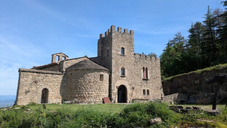
The settlement was reorganized at the beginning of the eleventh century. A new Romanesque church, Sant Pere de Roda, was consecrated in 1042 during the time of Oliba, a prominent Catalan bishop and abbot. Houses, workshops, ovens, and communal areas grew around the church, while the older Iberian defenses continued to be repaired and modified. The settlement expanded steadily until the mid-thirteenth century, when it may have contained about one hundred houses and around five hundred inhabitants.
From the late thirteenth to the early fourteenth century, feudal struggles involving the House of Cabrera, local lords, and the bishopric of Vic, allied with the king, contributed to L’Esquerda’s gradual abandonment. The population moved toward the present settlement of Roda de Ter, which stood closer to the bridge and the main communication routes. Several buildings were burned during this period, and their destruction may be connected with the conflicts. The settlement’s long sequence ended as this shift took place.
Archaeological investigation and preservation
Local enthusiasts began the first interventions at the site in the early twentieth century. Systematic interdisciplinary excavation started in 1977 under Imma Ollich i Castanyer of the University of Barcelona, initially concentrating on the medieval necropolis and the houses around the church. Excavation of the medieval sector continued under Ollich, Oriol Amblàs i Novellas, Albert Pratdesaba, and Esther Travé. Since 2018, the Fundació l’Esquerda has conducted the work in collaboration with the University of Barcelona.
Surveys in 1981 confirmed Late Bronze Age and Iberian remains near the defensive wall, and annual excavation in that area began in 1982 under Montserrat de Rocafiguera i Espona and Imma Ollich i Castanyer. L’Esquerda was declared a nationally important cultural property and a historic monument and archaeological zone in 1988. The site received the title “Favorite Monument of the Catalans” in 2019. Many objects recovered there are exhibited at the Archaeological Museum of L’Esquerda in Roda de Ter.
Remains
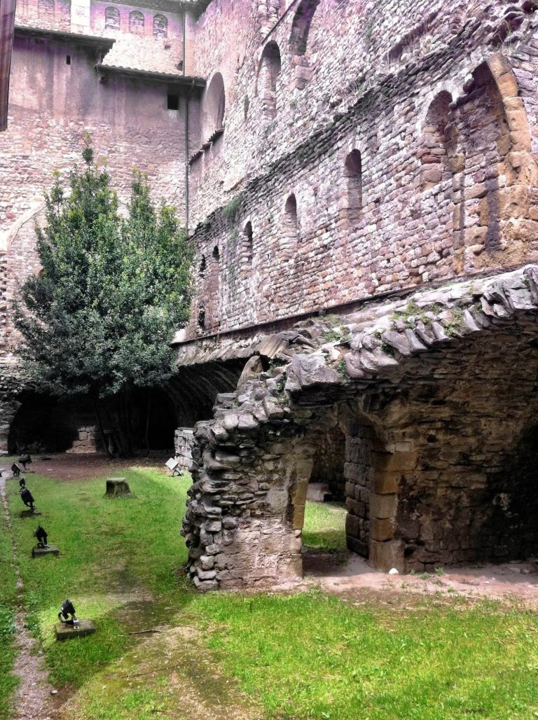
L’Esquerda occupies a raised peninsula within a bend of the Ter River, rising several dozen metres above the water. Its defenses closed the landward approach, while the settlement extended along a north-south axis that began at the principal gate. This street organized the interior of the Iberian settlement and remained in use through the medieval period. Surviving remains represent successive phases of construction, reuse, repair, and alteration across the peninsula.
Defensive works
Iberian walls and entrance
The Iberian oppidum was enclosed by a substantial wall blocking the only possible access to the peninsula. Habitation structures occupied the interior alongside a pottery workshop and a metalworking workshop. After the wall was destroyed by fire during the Second Punic War, a replacement was built several metres farther outward. Its entrance was relocated to the eastern end of the defensive system, changing the arrangement established by the earlier fortification.
Visigothic and Carolingian fortifications
A Visigothic wall built around the fifth century reused the remains of an earlier Iberian wall farther inward. More than 150 metres long, it closes the northern side of the peninsula. During the Carolingian period, large square towers were added against this wall, transforming it into a major fortification. Wooden watchtowers also stood at the highest point of the site, with their supports set into sockets cut in the rock.
Medieval church and settlement
Sant Pere de Roda and the burials
The church associated with the land donation recorded in 927 was smaller than the structure visible today and was probably built with simpler materials. Anthropomorphic tombs cut into the rock were distributed around it. The later Romanesque church of Sant Pere de Roda, built at the beginning of the eleventh century and consecrated in 1042, became the focus of the medieval settlement. A necropolis surrounded the church within its protected sacred area, or sagrera, where ecclesiastical law gave special protection to people and buildings.
Houses, workshops, and communal spaces
Medieval buildings were arranged around the church and its sacred area. Houses stood alongside workshops, ovens, and communal spaces, while the earlier defensive system underwent repeated repairs and modifications. Several medieval buildings preserve evidence of burning associated with the conflicts that accompanied the settlement’s late decline. Together, these remains show how domestic, productive, religious, and defensive functions occupied the same fortified peninsula.
Storage areas and archaeological finds
The northern part of the site contains a field of storage silos associated with the Visigothic and high medieval occupations. Other remains include Late Bronze Age huts, Iberian habitation structures, defensive walls, medieval domestic buildings, and the church with its rock-cut burials.
Recovered objects include bronze fibulae, brooches or clasps used to fasten clothing, and large quantities of locally produced and imported pottery. Among the imports is fifth-century BC Attic pottery, made in the region of Attica around Athens. These materials illuminate the settlement’s daily material culture and its connections with the coastal region, while the pottery workshops and metalworking areas reveal local production within the Iberian settlement.