Castell de Sant Miquel: A Historic Fortified Site in Girona, Spain


Visitor Information
Google Rating: 4.6
Popularity: Medium
Google Maps: View on Google Maps
Official Website: invarquit.cultura.gencat.cat
Country: Spain
Civilization: Unclassified
Remains: Military
History
Castell de Sant Miquel is situated on the summit of Sant Miquel hill, located within the municipality of Girona, Spain. Although the exact builders of the original fortified structure at the site remain unknown, it displays features typical of medieval military constructions in the region.
The earliest known reference to the site dates back to the mid-15th century, when an hermitage was established dedicated to Santa Maria and Saint Michael the Archangel. This religious building likely served spiritual needs in what had been a strategic lookout point. It was inhabited by hermits for about two centuries, from the 16th until the 18th century. During this time, the hermitage underwent expansion, particularly in the eighteenth century, reflecting its sustained religious importance.
In the early 19th century, during the Peninsular War—a conflict involving Napoleon’s French forces and Spanish resistance—the site took on a renewed military significance. French troops occupied the position in 1808 and 1809, fortifying it to defend against attacks by local armed militias. Defensive features such as loopholes, small openings designed for firing weapons, were added to the walls at this time. This indicates the site’s role as a defensive position during periods of active conflict. After the war, the hermitage was destroyed, with the ruins later repurposed.
In 1848, nearly four decades after the war, the remains of the hermitage were adapted for modern military communication needs. Two optical telegraph towers were constructed on and near the ruins, becoming part of a system linking Madrid with the French border. These towers made visual signaling possible across distances by means of semaphore—using mechanical arms and platforms to convey messages. One tower stood on the southern side beside the old hermitage; the other was built directly over the apse of the ruined church. Both were fortified, including a surrounding moat for protection. This telegraph system functioned until 1856, when electric telegraph lines rendered such optical methods obsolete. Control of the site then passed to the Civil Guard.
Over the centuries, administrative ties of the site fluctuated between the municipalities of Celrà and Girona, reflecting local political changes. While it was historically connected to Celrà in medieval and early modern times, governance shifted increasingly toward Girona during Spain’s democratic transition later in the 20th century.
Remains
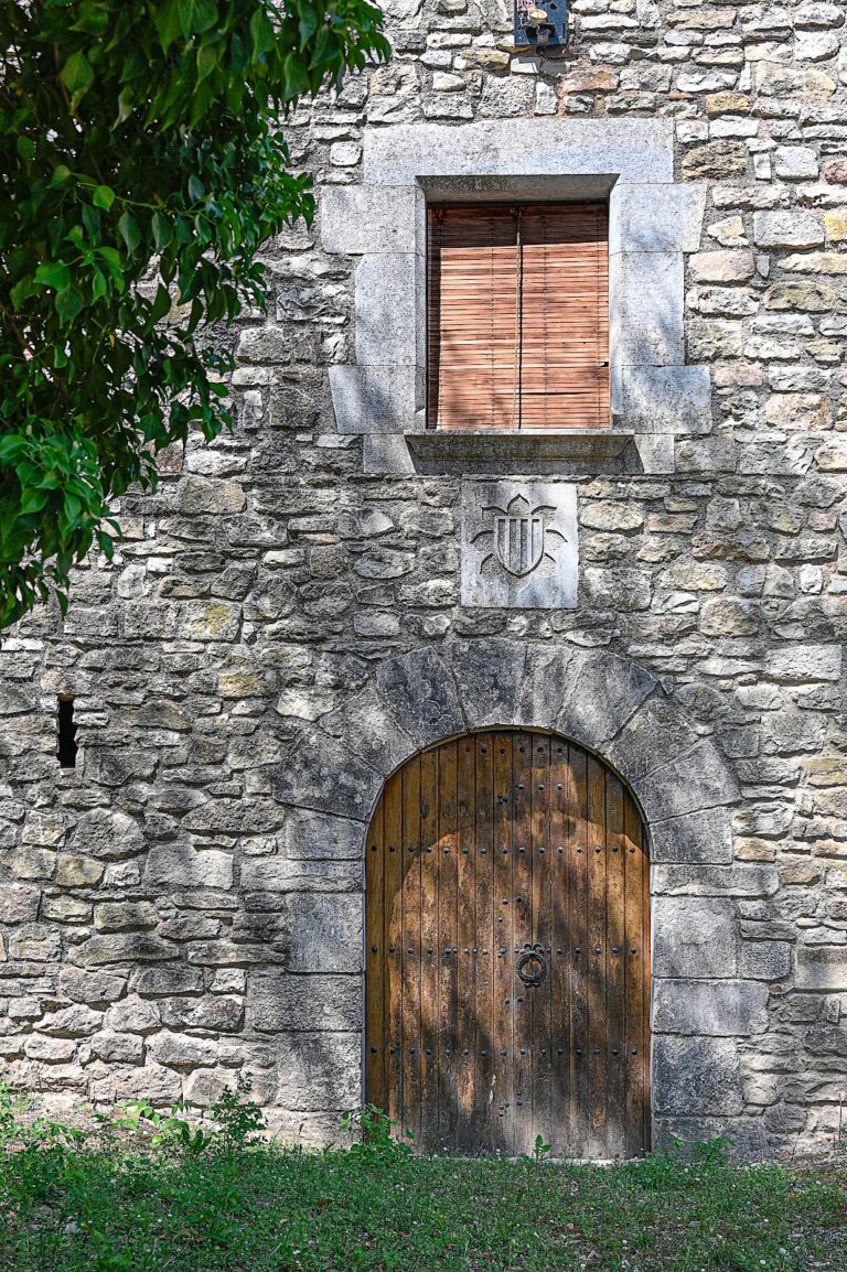
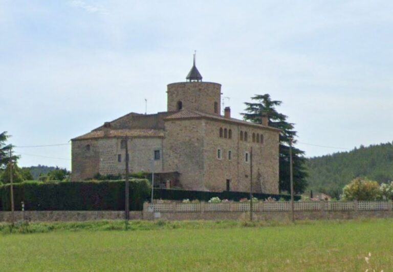
The site’s preserved remains occupy a fortified enclosure surrounded by a moat, which was introduced in the mid-19th century to protect the optical telegraph installations. Within this enclosure lie the remnants of the hermitage of Sant Miquel Arcàngel and a square-base tower associated with the telegraph system.
The hermitage itself has a simple design featuring a single nave leading to a polygonal apse. This apse was constructed on the foundations of an earlier circular tower, evidencing the site’s earlier defensive use. The nave was expanded in the 18th century to accommodate the religious community living there. Originally, the hermitage’s roof was built with brick arches, which were later replaced by a stone vault, indicating architectural modifications through time. A bell gable once crowned the center of the nave’s roof, serving as a call to worship.
Nearby are two large, square-shaped cisterns used to collect and store water. One of these cisterns suffered partial destruction during the construction of the moat but remains visible today. These water reservoirs would have been essential for the occupants, both in religious and military phases.
Adjacent to the hermitage, the optical telegraph tower sits on the southern side of the enclosure. This tower is square in plan with a sloped, or “battered,” base designed to enhance stability and defense. It features multiple loopholes, which allowed signal operators to observe the surroundings while remaining protected. The second telegraph tower was erected directly over the apse ruins. It retains a square footprint with an entrance located on the first floor; a second-floor chamber was used for signaling operations, while the roof terrace held the telegraph equipment that communicated messages visually over long distances.
Military modifications from the early 1800s remain visible, particularly the loopholes carved into the apse and the lateral walls, bearing witness to the site’s use as a defensive post during the Napoleonic conflicts.
The elevated location affords expansive views across the surrounding landscape including the Costa Brava coastline, the Pyrenees mountains, and nearby natural landmarks such as the Guilleries, Montseny, Gironès plain, and the Gavarres mountains. One notable distant peak visible from the site is Puig Alt, home to the Sanctuary of the Angels.
Together, these remains illustrate the layered history of Castell de Sant Miquel, shifting from a fortified lookout and religious hermitage to a military stronghold and communication post, all embedded within the strategic landscape of northeastern Spain.
Nearby sites