Burg Sponeck: A Roman and Medieval Fortress on the Rhine in Germany


Visitor Information
Google Rating: 4.4
Popularity: Very Low
Google Maps: View on Google Maps
Country: Germany
Civilization: Unclassified
Remains: Military

History
Burg Sponeck is situated above the Rhine near the municipality of Sasbach am Kaiserstuhl in Germany. The site was originally established by the Romans as a military fortification during the late 4th century AD.
Around 370 AD, during the reign of Emperor Valentinian I, the Romans built a castellum—a small fort—at this location atop a rocky spur overlooking the Rhine. This fortification formed part of a unique cluster of four late Roman military sites along the Rhine and in nearby Alsace, constructed to guard the river crossing and protect the empire’s borders against incursions by Germanic tribes. The castellum remained active at least until around 401 AD, when the Roman border troops withdrew from the region. Subsequently, the site likely saw occupation by the Alamanni, a Germanic people, and later by Frankish forces before it was eventually abandoned.
In the late Middle Ages, the strategic importance of the location prompted new construction. Following a peace treaty in 1281 involving King Rudolf I and the city of Freiburg, an imperial castle was erected on the site. This castle, known as Burg Sponeck and previously called Spanegge, served as an imperial fief, changing owners among local noble families such as the Spenlin, Württemberg, and Tübingen lines.
During the Thirty Years’ War, the castle underwent brief restoration in 1634, but it was thereafter deserted and gradually fell into ruin. Over time, ownership passed through various hands, including the House of Württemberg, Archduke Ferdinand, and several private individuals. In the 20th century, the artist Hans Adolf Bühler acquired the property and undertook partial restorations, preserving it as a family holding.
Remains
Archaeological investigations have revealed that the original Roman castellum measured roughly 40 by 50 meters and conformed to the uneven terrain of the rocky spur. Its layout was irregular but functional, adapting to the natural topography. Defensive walls about 1.6 meters thick protected the eastern side, the most vulnerable approach, and included two substantial corner towers. A third tower stood on the highest point of the spur, with foundations that have been partially unearthed during excavations.
Inside the Roman fort, timber-framed buildings leaned against the enclosing walls, serving as barracks or support structures. While these interior constructions are known to have existed, their precise floor plans have not been fully determined. The positioning of the castellum allowed for visual signals to be sent to other nearby Roman military strongholds, maintaining communication along key points of the Rhine frontier.
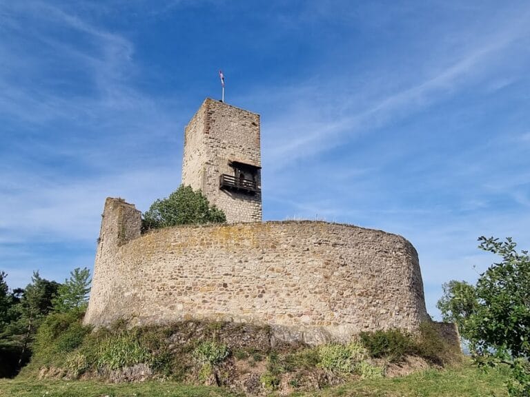
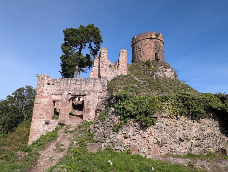
The later medieval castle built over part of the Roman site had a central area approximately 22 by 25 meters in size. Key features included a palas—a primary residential building measuring around 9 by 7 meters—and a bergfried, or main tower, with a large footprint near 12 by 12.5 meters and walls approximately 1.7 meters thick. The castle also comprised an outer bailey containing an additional residential tower.
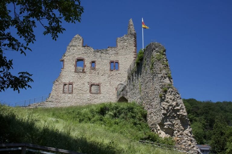
Today, no medieval structures survive in their original form; those visible in the ruin landscape and the main tower are reconstructions or restorations dating from the 19th and 20th centuries. However, the Roman elements have left more tangible traces: the remains of a stone wall and two corner towers have been restored and preserved at the site, providing a direct connection to the ancient military past.
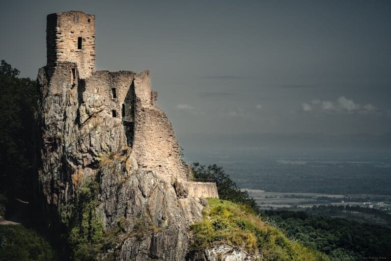
Originally, the castle’s location on a 25-meter-high spur was naturally defended on three sides by the Rhine River. Over time, engineering works known as the Tulla Rhine correction shifted the river approximately 200 meters westward, transforming the site’s setting so that it is now completely surrounded by land.
Nearby sites