Beit Guvrin-Maresha National Park: A Historical and Archaeological Site in Israel
Table of Contents


Visitor Information
Google Rating: 4.7
Popularity: Medium
Google Maps: View on Google Maps
Official Website: www.parks.org.il
Country: Israel
Civilization: Byzantine, Crusader, Early Islamic, Greek, Roman
Remains: City

Context
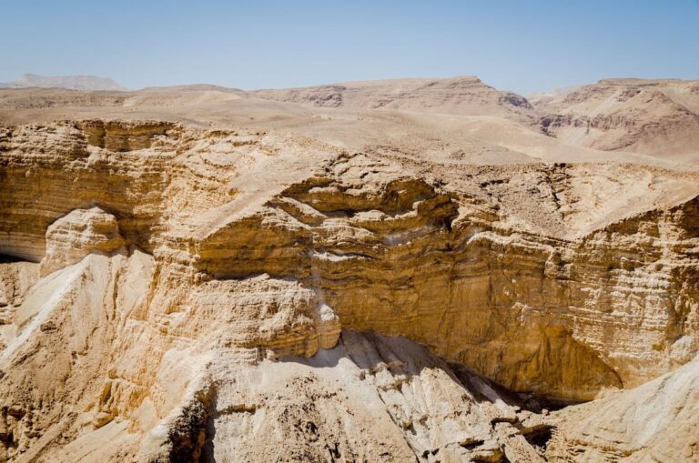
Beit Guvrin-Maresha National Park is situated in the Shephelah region of south-central Israel, near the modern city of Kiryat Gat and the site of the former village Bayt Jibrin. The park occupies a gently undulating chalk and marl plateau characterized by a distinctive geological formation that facilitated the excavation of extensive rock-cut chambers and subterranean complexes. This natural setting provided abundant soft chalkstone beneath a harder limestone cap, enabling the creation of large bell-shaped caves and underground installations.
Archaeological evidence indicates that human settlement at Maresha began during the Iron Age and continued through the Persian and Hellenistic periods, reflecting a complex cultural milieu influenced by local traditions and Mediterranean interactions. The site experienced a major destruction event in the late Hellenistic era, attributed to Hasmonean military campaigns. Subsequently, the nearby settlement of Beit Guvrin emerged in Roman times, persisting into the Byzantine period before a decline in urban activity. The adjacent village of Bayt Jibrin remained inhabited until the mid-20th century.
The park preserves a remarkable combination of surface ruins and an extensive network of subterranean caves, including dwellings, burial sites, and industrial installations. Excavations initiated during the British Mandate and continued by Israeli archaeologists have documented stratified occupation layers, material culture, and epigraphic inscriptions. Recognized for its archaeological significance, the area was designated a national park in 1989 and inscribed as a UNESCO World Heritage Site in 2014.
History
Beit Guvrin-Maresha National Park encapsulates a layered historical narrative spanning from the Iron Age through the Crusader period. The site illustrates the shifting political and cultural dynamics of the southern Levant, shaped by successive empires and local powers. Initially a fortified Judahite town, Maresha evolved into a multi-ethnic center under Edomite and Sidonian influence during Persian rule. It later flourished as a Hellenistic city before its destruction by Hasmonean forces. The nearby Roman settlement of Beit Guvrin subsequently rose to prominence, becoming the Roman colony Eleutheropolis. The city endured military conflicts during Jewish revolts and developed significant Roman and Byzantine urban features. Later, it served as a Crusader stronghold before its decline in the medieval era.
Iron Age and Kingdom of Judah (c. 10th–6th centuries BCE)
During the Iron Age, Maresha was a strategically important fortified town within the Kingdom of Judah, positioned along the kingdom’s southern frontier. It is explicitly mentioned in biblical texts, such as Joshua 15:44, and was fortified by King Rehoboam to defend against Egyptian incursions. Archaeological investigations confirm that Maresha’s occupation commenced in this period, with no evidence of earlier Bronze Age settlement layers. The town’s role was primarily military and administrative, serving as a regional center within Judah’s territorial framework. Following the fall of the Kingdom of Judah in the late 6th century BCE, Maresha came under Edomite control.
Persian and Late Persian Period (6th–4th centuries BCE)
Under Persian imperial administration, Maresha developed into a culturally diverse urban center inhabited by Edomites and a prominent Sidonian community. The Zenon Papyri, dated to 259 BCE, attest to the presence of Sidonian residents, highlighting the city’s multi-ethnic composition. Sidonian burial caves from this period, including the family tomb of Apollophanes, a Sidonian leader, feature painted interiors with mythological and symbolic motifs, reflecting elaborate funerary customs. Maresha functioned as a provincial administrative hub within the Persian system, integrating local traditions with Mediterranean cultural influences.
Hellenistic Period (c. 4th–1st centuries BCE)
Following Alexander the Great’s conquests, Maresha—also known as Marisa or Marissa—transformed into a planned and fortified Hellenistic city. Excavations have revealed city walls, towers, and urban infrastructure dating to this era. The population adopted Greek language and artistic styles, as evidenced by painted burial caves and mosaic floors. Economic activities included industrial-scale olive oil production, extensive pigeon breeding in underground columbaria, and quarrying of chalkstone from bell-shaped caves for construction. The city played a role in regional conflicts during the Maccabean Revolt, serving as a base for attacks against Judea. In 112 BCE, Hasmonean king John Hyrcanus I captured and destroyed Maresha, incorporating the region of Idumea into the Hasmonean kingdom and enforcing Judaization policies on its inhabitants.
Late Hellenistic to Early Roman Period (40 BCE–2nd century CE)
In 40 BCE, Maresha was devastated by Parthian forces and was not rebuilt thereafter. Instead, the nearby settlement of Beth Gabra (later known as Beit Guvrin) emerged as the principal local center. Beth Gabra is documented in Aramaic and Greek sources from the 1st and 2nd centuries CE, including Ptolemy’s Geography and Roman itineraries such as the Peutinger Table. The city was conquered by the Roman general Vespasian during the Jewish War (68 CE) and suffered destruction again during the Bar Kochba revolt (132–135 CE). These events reflect the region’s turbulent military history under Roman rule.
Roman Imperial and Byzantine Period (2nd–7th centuries CE)
In 200 CE, Emperor Septimius Severus elevated the city to the status of a Roman colony with ius italicum privileges, renaming it Eleutheropolis, meaning “city of freemen.” The city developed significant Roman urban features, including a large limestone amphitheater with a seating capacity of approximately 3,500 spectators, constructed in the 2nd century CE to accommodate Roman troops stationed after the Bar Kochba revolt. A substantial Roman bathhouse with sophisticated water channels was also built. During the Byzantine period, Eleutheropolis hosted a mixed population of Christians and Jews, including notable Jewish scholars such as Tannaim and Amoraim. Artistic activity is attested by mosaics depicting birds and animals found on the hilltop. The Church of Saint Anne was originally constructed in this era and later rebuilt by Crusaders. The bell-shaped caves continued to be quarried for building materials, while columbaria were repurposed for storage.
Early Muslim to Crusader Period (7th–13th centuries CE)
Following the Arab conquests in the 7th century, the city became known as Beit Jibrin. During the Crusader period, it was referred to as Bethgibelin or Beit Gibelin and featured a royal castle constructed around 1135 CE. The castle was transferred to the Knights Hospitaller in 1136 CE and remained under their control intermittently until the mid-13th century. The Crusaders rebuilt the Church of Saint Anne and incorporated the walls of the Roman amphitheater and bathhouse into their fortress. The site exhibits continuous occupation and cultural layering from Roman, Byzantine, Muslim, and Crusader influences until its decline after the Crusader period.
Post-Crusader Period and Modern Era
After the Crusader period, urban activity at Beit Guvrin diminished significantly, transitioning into a rural village with reduced population and economic complexity. The nearby village of Bayt Jibrin preserved the historical name and remained inhabited until 1948. Archaeological interest began during the British Mandate, with excavations uncovering stratified remains from multiple periods. Systematic excavations resumed under Israeli archaeologists from 1989 onward, revealing the extensive cave networks and monumental structures. The area was declared a national park in 1989 and inscribed as a UNESCO World Heritage Site in 2014, recognizing its exceptional archaeological and historical significance.
Remains
Architectural Features
Beit Guvrin-Maresha National Park preserves extensive architectural remains spanning from the Iron Age through the Crusader period. The site’s location on a chalk and marl plateau enabled the excavation of numerous rock-cut chambers and underground complexes. Surface remains include fortification walls, towers, and urban layouts primarily from the Hellenistic and Roman periods. Construction predominantly utilized locally quarried chalkstone blocks extracted from bell-shaped caves beneath a hard limestone layer known as “Nari”.
The urban fabric evolved over time, with Maresha initially fortified in the Iron Age and later expanded during the Hellenistic period into a planned city with defensive walls and towers. After destruction in the late Hellenistic period, the nearby Roman settlement of Beit Guvrin (Eleutheropolis) developed, featuring Roman civic and military architecture. Byzantine and Crusader layers overlay earlier remains, including religious and military structures. The site preserves a combination of surface ruins and an extensive network of subterranean installations.
Key Buildings and Structures
Bell Caves
The park contains approximately 800 bell-shaped caves carved into the chalkstone beneath the limestone cap. These caves have narrow circular openings at the surface that widen into large chambers exceeding 18 meters (60 feet) in height. Many caves are interconnected by underground passageways, forming groups of 40 to 50 linked caverns. Quarrying activity in these caves peaked during the Hellenistic, Byzantine, and Early Arab periods. The chalkstone extracted from these caves was used as building material for the city’s structures. Some bell caves were adapted as columbaria for pigeon breeding, featuring thousands of carved niches. The caves’ acoustics, noted in modern times, are utilized for cultural events.
Columbaria
Several well-preserved columbaria from the Hellenistic and Roman periods exist within the park, carved underground from soft chalkstone. One of the largest is located on the west side of Tell Maresha, known locally as Es Sûk. These structures contain multiple tiers of pigeon niches designed to house hundreds of birds. Pigeon breeding ceased by the end of the 3rd century BCE, after which the columbaria were repurposed for storage. These installations reflect specialized economic activities integral to the site’s subterranean complex.
Sidonian Burial Caves (Apollophanes Tomb)
The Sidonian burial caves served as the family tomb of Apollophanes, a leader of the Sidonian community in Beit Guvrin. Dating to the early Roman period (1st century BCE), these caves are notable for their interior wall paintings depicting animals, mythological creatures, and symbolic motifs. Among these are a crowing cock intended to ward off demons, the three-headed dog Cerberus guarding the underworld entrance, and a red phoenix symbolizing life after death. The Tomb of the Musicians, part of this complex, features painted figures of a man playing the flute and a woman playing the harp. These caves reflect the multicultural population of the city during this period.
Cave Dwellings (Mŭghâret Sandahannah / Mavokh)
Near Tell Maresha, numerous cave dwellings were carved from the chalkstone bedrock. These subterranean complexes include networks of passageways, staircases with balustrades, water cisterns, and millstones for olive grinding. The cave dwellings were enclosed within the city walls that surrounded both the tell and its suburbs. The largest cave dwelling, known locally as Mŭghâret Sandahannah (“The Cave of Saint Anne”) and called Mavokh in Modern Hebrew, is situated on the southeast side of the tell. These complexes served residential and economic functions within the urban environment.
Church of Saint Anne (Khirbet Sandahanna)
Originally constructed during the Byzantine period, the Church of Saint Anne was rebuilt by the Crusaders in the 12th century CE. The ruins include well-preserved freestanding remains of the apse. The church is located near Tell Sandahanna (Maresha) and is known in Arabic as Khirbet Sandahanna (“ruin”). The Crusader reconstruction incorporated earlier Byzantine elements and reflects the site’s continued religious use into the medieval period.
Roman Amphitheater of Beit Guvrin
Constructed in the 2nd century CE on the northwestern outskirts of Beit Guvrin, the elliptical amphitheater was built of large rectangular limestone ashlars. It was designed to seat approximately 3,500 spectators. The structure features a walled arena of packed earth with subterranean galleries beneath. Surrounding the arena is a circular corridor formed by connected barrel vaults that support the stone seating above. Access to the seating was provided by staircases from outside and from the corridor. The amphitheater was built to accommodate Roman military units stationed in the region after the Bar Kochba revolt and was used for gladiatorial contests. It remained in use until its destruction, likely in the Galilee earthquake of 363 CE.
Roman Bathhouse
A large Roman bathhouse was uncovered at Beit Guvrin, described as one of the largest found in Israel. It featured a sophisticated water drainage system that directed all water into the complex. The bathhouse included multiple rooms typical of Roman baths, such as heated chambers and water channels. In the Crusader period, the bathhouse was integrated into the fortress complex, with its walls incorporated into the later military architecture.
Crusader Fortress
Built in the 12th century CE, the Crusader fortress incorporated the walls of the Roman amphitheater and bathhouse. Constructed with stone walls, the fortress included an attached church, likely the rebuilt Church of Saint Anne. The fortress was held by the Knights Hospitaller from 1136 until 1187 and again from 1240 to 1244 CE. The structure reflects the reuse of earlier Roman and Byzantine architecture within a medieval military context.
Byzantine Church (Unnamed)
A Byzantine church was discovered on the hilltop of the site, with mosaics depicting birds and animals found during excavations in 1924. The church remains are part of the archaeological record at Beit Guvrin, though the structure is less well preserved than the Church of Saint Anne. The mosaics attest to artistic activity during the Byzantine period.
Olive Oil Press Cave
Cave installations identified as olive oil presses have been found within the cave dwellings. These include millstones used for grinding olives, indicating economic activity related to olive oil production. The presses are integrated into the subterranean complexes near Tell Maresha.
Water Cisterns and Channels
Numerous cisterns and water channels have been discovered within the cave networks. These installations were used for water storage and management, essential for the settlement’s sustainability. Some caves include water channels designed for bathing and ritual purposes, reflecting the complexity of the underground infrastructure.
Residential Caves and Underground Complexes
The site contains interconnected cave complexes used as dwellings, featuring staircases, water cisterns, and storage spaces. These underground rooms are linked by passageways and formed an integral part of Maresha’s urban fabric. The complexes demonstrate the adaptation of natural geology for residential and economic use.
Other Remains
Surface traces and low walls of a planned and fortified Hellenistic city have been uncovered, including town walls and towers documented by early excavators Bliss and Macalister (1898–1900). Remains of a tower and rooms north of Tell Maresha have also been found. Olive presses, columbaria, and water cisterns from the ancient city remain visible on the surface. The site includes a large Jewish cemetery dating to the 2nd and 3rd centuries BCE, with two burial caves open to the public.
Archaeological Discoveries
Excavations at Beit Guvrin-Maresha have yielded a variety of artifacts spanning multiple periods. Pottery from the Iron Age through the Byzantine period includes imported amphorae. Numerous inscriptions have been documented, including dedicatory texts and the Heliodorus Stele, which recounts events in Judaea prior to the Maccabean revolt. Coins from Hellenistic, Roman, and Byzantine eras have been found, aiding chronological frameworks.
Tools related to agriculture and craft activities, such as millstones and grinding implements, have been recovered, particularly within cave dwellings and olive oil press installations. Several hundred astragali (animal knucklebone dice) dating to the Hellenistic period indicate gaming and divination practices.
Preservation and Current Status
The preservation of Beit Guvrin-Maresha’s remains varies widely. The bell caves and columbaria are generally well preserved due to their subterranean nature, while surface structures such as city walls and towers are fragmentary. The Roman amphitheater and bathhouse retain substantial architectural elements, though some parts are collapsed. The Crusader fortress and Church of Saint Anne survive as partial ruins, with freestanding apse remains.
Restoration efforts have stabilized several structures, particularly the amphitheater and fortress walls, using original materials where possible. Some areas have been left in situ without reconstruction to preserve archaeological integrity. Archaeological excavations and conservation are managed by Israeli heritage authorities, with systematic research continuing since the late 20th century.
Unexcavated Areas
Several parts of the site remain unexcavated or only partially studied. Surface surveys and geophysical studies suggest buried remains beneath modern agricultural fields surrounding the tell and cave complexes. Some cave networks have not been fully explored due to conservation policies and safety concerns. Future excavations are planned but limited by the need to balance preservation with research. Urban development near the modern town of Kiryat Gat restricts excavation in certain areas.