Masada National Park: A Herodian Palace-Fortress and Roman Siege Site in Israel

Site at a Glance
- Rating
- 4.7
- Popularity
- Very High
- Country
- Israel
- Primary era
- Classical
- External website
- Open
- Eras represented
- Classical, Medieval
- Civilizations
- Byzantine, Roman
- Site type
- Military
- Remains
- Fort
On this page23 sections
History
Masada National Park is a fortified archaeological site in Israel, developed as a royal palace-fortress by Herod the Great in the late first century BCE on an isolated plateau above the Dead Sea. Its buildings combine Jewish royal traditions with Hellenistic and early Roman architectural forms. The site later became the last major stronghold of the Jewish revolt against Rome and is now associated with both the ancient Jewish kingdom and the contested memory of resistance, sacrifice, and survival.
Early Occupation and Hasmonean Origins
Human activity at Masada reaches back to the Chalcolithic period, when caves on the southeastern cliff were used for plant materials, mats, textiles, and pottery. Pottery from the Iron Age, also called the First Temple period, was found on the plateau. The first fortress is attributed by the Jewish historian Flavius Josephus to the Hasmonean high priest Jonathan, usually identified as Alexander Jannaeus, who ruled from 103 to 76 BCE. Hasmonean pottery and coins, including coins of Alexander Jannaeus, belong to this early phase, as may two of the site’s early cisterns.
Herod’s Palace-Fortress
Herod captured Masada during the political crisis that followed the murder of his father, Antipater. In 40 BCE, after the Parthian invasion of Judaea and the installation of Antigonus Mattathias, Herod left members of his family and about 800 soldiers at the fortress while he travelled to Rome to seek political and military support. During the resulting siege, the defenders’ water supplies fell dangerously low until heavy rain filled the cisterns. Herod returned to Judaea in 39 BCE, relieved Masada, and secured the Judaean throne in 37 BCE with Roman backing.
Herod then reshaped Masada as a desert refuge, palace, and defensive stronghold. It was intended to protect him from rebellion, foreign enemies such as Cleopatra VII of Egypt, and political threats connected with the Hasmonean dynasty. It also offered a luxurious residence for the king, his household, and royal guests. Herodian construction is conventionally divided into three phases, dated approximately to 35, 25, and 15 BCE. These phases created and enlarged the Western and Northern Palaces, added smaller palaces, administrative and service buildings, storerooms, bathhouses, water installations, columbarium towers, and defensive walls.
After Herod’s death, Masada passed to Herod Archelaus, who was deposed in 6 CE. A Roman garrison was probably stationed there afterward. The fortress therefore remained connected to the changing political order of Judaea, first as a royal residence and later as a military position under Roman authority.
The First Jewish-Roman War
In 66 CE, during the First Jewish-Roman War, Sicarii rebels seized Masada by surprise, killed the Roman garrison, and distributed its weapons. The Sicarii were a radical Jewish group whose name came from the Latin word for a small dagger. After their leader Menahem was killed during internal struggles in Jerusalem, survivors fled to Masada under his nephew Eleazar ben Ya’ir. Other refugees, including families and followers associated with Simon bar Giora, also used the fortress during the revolt.
The inhabitants carried out raids in southern Judaea and Idumaea. Josephus specifically describes an attack on En Gedi, although the scale and details of these actions remain debated. After Jerusalem fell in 70 CE, Masada became the last major rebel stronghold. In 73 or 74 CE, the Roman governor Lucius Flavius Silva led the Tenth Legion, auxiliary troops, and other personnel against it. The traditional date of the final capture is 73 CE, while arguments based on Silva’s career support 74 CE.
The Romans built a circumvallation wall, eight camps, roads, and an assault ramp around the plateau. A circumvallation wall was a siege barrier designed to prevent escape and outside assistance. Josephus relates that, after the Roman breach, Eleazar ben Ya’ir persuaded the defenders to kill themselves and their families rather than become slaves. He gives a total of 960 deaths and describes two women and five children surviving in a cistern or gallery. Excavated human remains represent roughly two dozen individuals, and scholars continue to disagree about their identity and about the sequence of the final events. Interpretations include a combination of suicide, fighting, hiding, and fires during confused resistance, while other readings propose further resistance in the Northern Palace complex.
Roman Garrison and Byzantine Monastery
A Roman garrison remained after the capture, first on the plateau and later in the principal camp below it. Masada ceased to function as a major fortress and was probably abandoned by the early second century. A Christian monastic community occupied the site from approximately the fifth century. Probably identifiable with the monastery of Marda, it included a church, communal facilities, cells, and caves. The settlement ended under Islamic rule in the seventh century, after which Masada remained abandoned for more than thirteen centuries.
Rediscovery, Excavation, and Conservation
Edward Robinson and Eli Smith identified the ruins known locally as es-Sebbe with Josephus’s Masada in 1838. Samuel Wolcott and William J. Tipping made the first modern ascent and detailed survey in 1842. Later investigations by Félicien de Saulcy, Charles Warren, Claude Reignier Conder, Alfred von Domaszewski, Rudolf Ernst Brünnow, and Adolf Schulten expanded knowledge of the plateau and its surrounding siege works.
Israeli surveys in 1955 and 1956 mapped the plateau and excavated parts of the Northern Palace. Shmarya Guttman clarified the water system, Snake Path, Northern Palace, and Roman siege complex. Yigael Yadin directed extensive excavations from 1963 to 1965, exposing most of the built area and recovering pottery, coins, ostraca, scroll fragments, textiles, weapons, food remains, and human remains. Gideon Foerster and Ehud Netzer later supervised the study and publication of the results. Limited excavations continued between 1995 and 2000, and Guy Stiebel directed further work from 2017. Current management limits research excavation of the principal site to work required for conservation, maintenance, or restoration.
Conservation accompanied the major excavations and continued afterward. Walls of the Western Palace, synagogue, and storerooms were raised from surviving remains, while frescoes, stucco, mosaics, and other architectural elements were treated. Later work replaced unsuitable early cement and used a prominent black line to distinguish original archaeological levels from reconstructed masonry. A severe rainstorm in 2003 collapsed part of the drainage system and damaged walls, frescoes, and the casemate wall. Conservation subsequently repaired affected areas, moved original fresco fragments to the museum, and used replicas in some parts of the site.
Masada became an Israeli National Park in 1966 and is protected by Israel’s Antiquities Law and national-parks legislation. UNESCO inscribed it as a World Heritage Site in 2001 under criteria iii, iv, and vi. The designated property covers 276 hectares, with a 28,965-hectare buffer zone. From the 1920s, Masada also became an important symbol in Zionist culture. Yitzhak Lamdan’s 1927 poem Masada popularized the phrase “Masada shall not fall again,” while youth movements organized ascents and educational journeys. Israel Defense Forces induction ceremonies took place at the site from 1956 until 1991.
Interpretations of Masada have changed. Earlier national narratives presented the defenders as heroic freedom fighters, while later scholarship has emphasized Josephus’s identification of them as Sicarii, the violence attributed to the group, and the uncertainty surrounding the mass-suicide account. Masada consequently remains a powerful but multivalent symbol of Jewish identity, national renewal, sacrifice, and the tension between liberty and survival.
Remains
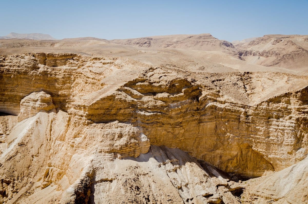
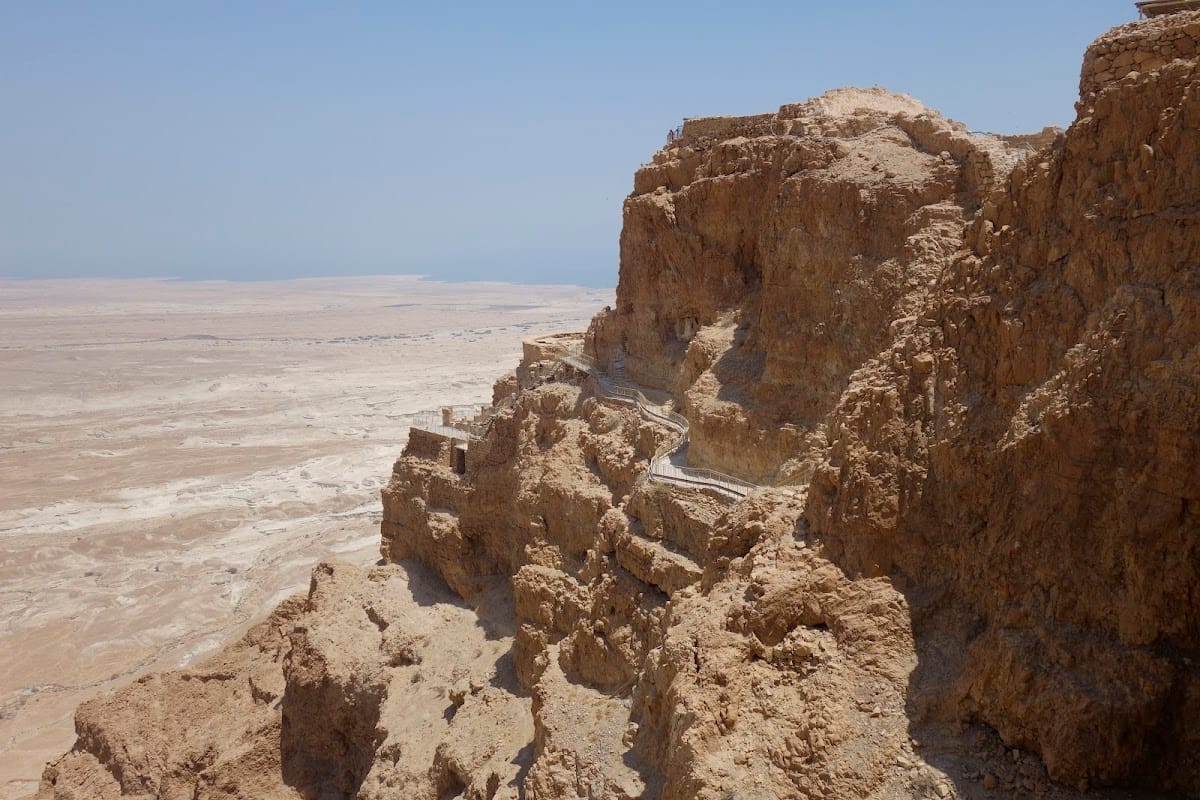
Masada occupies an isolated horst, a block of the earth’s crust uplifted between faults, formed here from Upper Cretaceous marine dolomite and limestone. The roughly diamond-shaped plateau measures about 600 to 645 metres from north to south and 300 to 315 metres across, covering approximately 8 to 9.3 hectares. Steep cliffs and deep wadis surround it, while the western side connects with the Judaean Desert by a saddle. The eastern Snake Path and the western route, later largely covered by the Roman assault ramp, formed the principal approaches.
Herodian Palaces and Royal Buildings
Western Palace
The Western Palace covers about 4,000 square metres and brought together royal residence, ceremonial rooms, administration, workshops, service spaces, and storerooms. Its central courtyard led to reception areas, a possible throne room, residential rooms, kitchens, and a richly decorated mosaic room. The royal sector measured approximately 28 by 23.5 to 24.5 metres. Its reception area had a portico with Ionic columns and stucco-covered pilasters painted black and red. Four floor depressions in the so-called throne room may have supported a throne or canopy, although another interpretation identifies them as fittings for a display table. A mosaic room measuring about 8 by 5 metres contained a decorated floor.
Later additions included a northern service wing about 35 by 22 metres, a northwestern service wing about 20 by 15 metres, and further storerooms. Three storerooms were about 27 metres long, while another reached approximately 56 metres. During the revolt, the Western Palace served mainly as an administrative centre. A workshop for making arrowheads occupied the mosaic room and an adjacent chamber, where more than 200 Roman-type arrowheads were recovered.
Northern Palace
The Northern Palace extended down the cliff in three terraces supported in places by substantial retaining walls. The middle terrace lies about 18 to 20 metres below the plateau, and the lower terrace about 30 to 35 metres below it. The upper terrace contained an oecus, or reception hall, measuring approximately 11.5 by 7.6 metres, along with private rooms, geometric black-and-white mosaics, and wall paintings in the Second Pompeian Style. A semicircular projection about 9 metres in diameter probably served as a viewing portico or pergola, although only limited remains survive.
The middle terrace contained a concentric circular structure with an outer diameter of about 15 to 15.3 metres and an inner diameter of about 10 metres. It has been interpreted as a reception hall, viewing structure, shrine, or tholos, a circular building, but its purpose remains uncertain. A nearby exedra, a partly enclosed recess with five niches, may have displayed objects; its identification as a library is disputed. The lower terrace held a square hall about 17.6 metres wide, surrounded by columns and porticoes. Limestone columns, attached half-columns, stucco, and gold-painted Corinthian capitals formed part of this reception and dining complex.
Bathhouse and Storerooms
The Great Bathhouse south of the Northern Palace followed Roman practice. It included a palaestra, or exercise court, measuring about 18 by 8.4 metres, an undressing room, a cold room, a warm room, and a vaulted hot room. The bath complex measured approximately 17.5 by 11.5 metres, and its hot room was about 6.8 by 6.6 metres. Mosaics, frescoes, stucco, water pipes, and a hypocaust, an underfloor heating system, survive in the building. The hot room contained a quartzite basin and traces of a second semicircular basin, probably a marble water bowl. A large stepped basin in the cold room may also have served as a ritual bath.
North of the bathhouse, long narrow storerooms were arranged in northern and southern groups divided by an east-west corridor. Most measured about 20 to 27 metres long and 3.8 to 4 metres wide. Their vessels held grain, flour, oil, wine, dried fruit, and other foodstuffs. One room had a waterproof floor and three evenly spaced recesses, probably intended to help transfer liquids. Pools, stepped basins, and ritual baths formed part of the palace’s water facilities.
Fortifications, Gates, and Water System
Casemate Wall and Gates
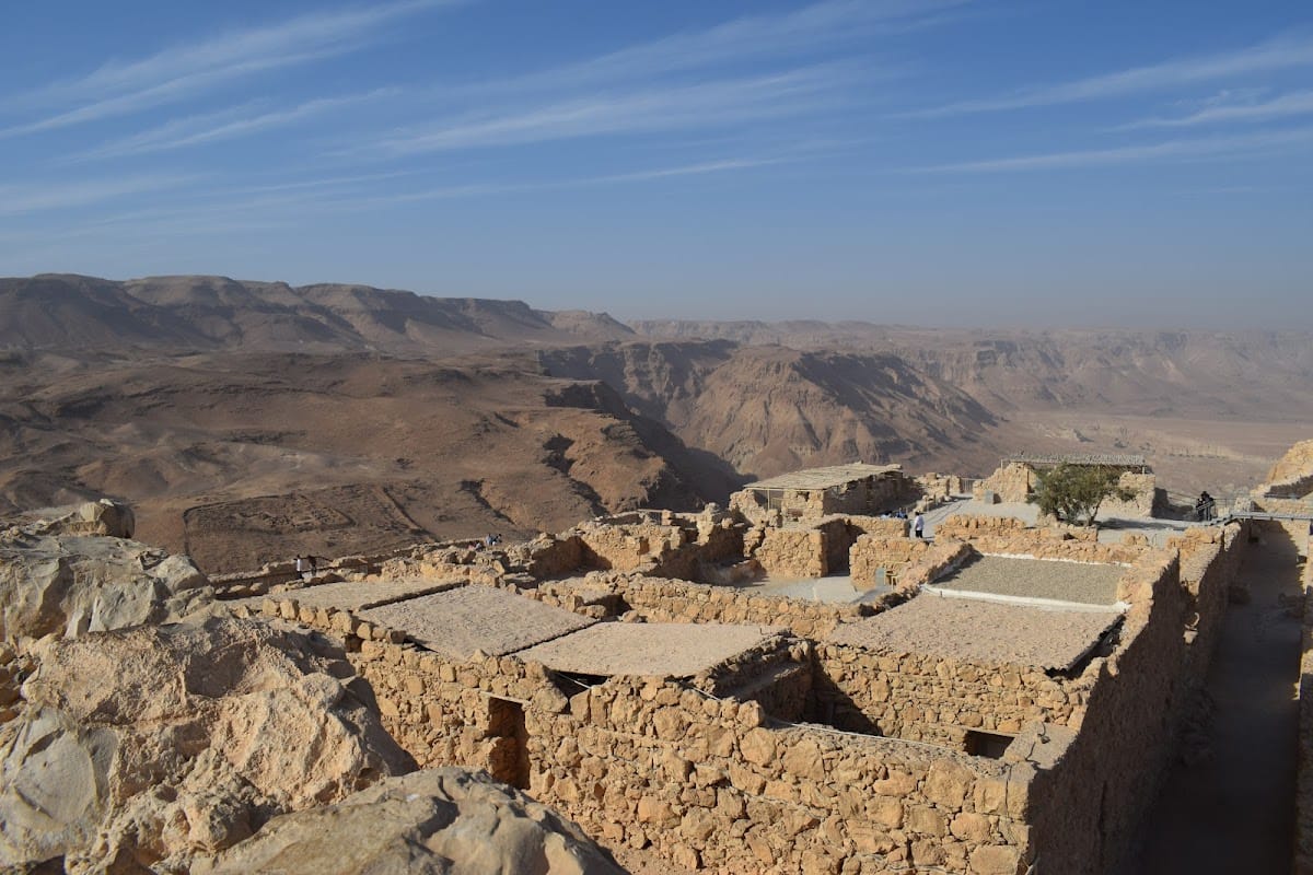
Except for the Northern Palace complex, the plateau was enclosed by a casemate wall, a fortification of parallel walls divided into enclosed compartments. The wall was approximately 1.29 to 1.4 kilometres long and originally about 4 to 5 metres high. Its outer wall was about 1.4 metres thick and its inner wall about 1 metre thick, with a covered space about 4 metres wide divided into roughly 70 casemates. These compartments served as storage rooms, living quarters, and accommodation for soldiers and personnel. Twenty-seven towers stood at intervals of about 40 metres, and a southern bastion contained several levels linked by a spiral staircase.
Four principal gates followed a shared plan, with an outer and inner entrance, an intervening chamber, and benches along the walls. The northeastern Snake Path Gate had plastered and painted walls, a paved floor, and a guardroom. The South or Well Gate provided service access to water installations. The North or Water Gate led to the large cisterns and served as the principal northern entrance. The western gate survives in part and was later used by the Byzantine community. A former gate north of the Water Gate was abandoned during the second Herodian building phase, while three internal gates regulated movement among the water gate, administrative buildings, storerooms, and Northern Palace.
Cisterns and Reservoirs
Masada’s water system collected runoff from the surrounding wadis through dams, channels, and aqueducts. Twelve large cisterns were cut into the northwestern slope in two rows of eight and four. Hydraulic mortar protected their interiors, and separate lower inlets and upper openings controlled the movement and drawing of water. Pack animals and porters carried water from these slope cisterns to the plateau, where channels redistributed it to reservoirs, pools, baths, and smaller cisterns. Total storage capacity is estimated at approximately 40,000 to 48,000 cubic metres, enough under ideal calculations to supply about 1,000 people for extended periods.
Columbarium Towers
Three early columbarium towers contained rows of square niches. Two were rectangular and one was round, with the circular tower measuring about 7.5 metres in diameter. They were probably used to raise pigeons for meat, fertilizer, or communication. An earlier interpretation connected them with ashes belonging to non-Jewish members of Herod’s entourage, but that explanation is no longer generally accepted.
Rebel-Period and Religious Remains
Rebel Dwellings and Communal Spaces
During the revolt, many casemates were divided into living quarters. Refugees built mud-and-stone huts against the walls and around the smaller palaces. Ovens, storage niches, textiles, leather, baskets, glass, bronze objects, coins, and other domestic remains illustrate life during the final occupation. The smaller palaces became family dwellings with kitchens and ovens, while elements of the Northern Palace’s columns and wooden beams were dismantled and reused. A tower once interpreted as a tannery is now generally identified as a laundry.
Synagogue and Ritual Baths
The building identified as a synagogue stands within the northwestern casemate wall. It measures about 12.5 by 10.5 metres internally and contains two rows of three columns, plastered stepped benches, and a separate corner chamber. Some benches were made from reused Herodian architectural fragments. Ostraca, burned glass and bronze objects, and fragments of biblical scrolls, including portions of Deuteronomy and Ezekiel, were found in the chamber. Its identification as a synagogue remains debated, but the building was a communal assembly space and may have been adapted for religious use during the revolt.
Two large ritual baths and numerous smaller purification basins have been identified. The southern bath included a rainwater reservoir, a connected immersion pool, a smaller washing pool, changing rooms, and clothing niches. The northern bath followed a comparable three-pool arrangement. Depending on the criteria used, between sixteen and twenty-one stepped basins at Masada have been interpreted as ritual baths, or mikvaot, Jewish ritual immersion baths.
Ostraca, Scrolls, and Other Finds
More than 700 ostraca, or inscribed pottery fragments, were recovered. Many carry single letters or names and may relate to food distribution, ritual purity, or tithing. Eleven found near the Water Gate and storage area were interpreted by Yadin as lots connected with Josephus’s account of the final killings. One bears the name “Ben Ya’ir,” although the interpretation remains uncertain. Excavations also recovered about a dozen Hebrew biblical scrolls, including passages from Genesis, Leviticus, Psalms, Deuteronomy, and Ezekiel, together with texts from Jesus Sirach, Jubilees, and the Songs of the Sabbath Sacrifice.
Approximately 4,500 ceramic vessels, stone vessels, lamps, textiles, weapons, coins, baskets, food remains, and seeds were found across the site. Thirty-seven vessels identify contents such as dried figs, olives, fish, meat, herbs, and dough. Pomegranate, olive, and fig seeds preserve evidence of stored food. A Latin papyrus containing a verse from Virgil’s Aeneid may have belonged to a soldier of the Tenth Legion, while other papyri record military payments, supplies, clothing, food, and medical materials. A Judean date-palm seed recovered during excavation was germinated in the early twenty-first century into a tree called Methuselah. The seed was approximately 1,900 to 2,000 years old.
Byzantine Church and Monastic Settlement
The Byzantine church northeast of the Western Palace had a central nave ending in an apse, a western entrance hall, northern annexes, and an eastern courtyard measuring approximately 18 by 20 metres. Its plastered walls were decorated with patterns made from embedded Roman pottery fragments. A church annex contained a mosaic panel of sixteen medallions framed by interlacing bands. The designs show geometric forms, plants, fruits, and a basket containing twelve loaves.
A kitchen and dining room occupied part of a casemate about 50 metres west of the church. Approximately thirteen monastic cells were distributed among small buildings, caves, a former cistern, the Great Bathhouse, and a columbarium tower. These remains preserve the physical organization of the Christian community that occupied Masada many centuries after the Roman conquest.
Roman Siege Works
Circumvallation and Camps
The Roman siege complex includes a circumvallation wall, eight camps, roads, watchtowers, and the western assault ramp. The dry-laid stone circumvallation wall survives for approximately 3.5 kilometres. It was about 2 metres thick and originally about 3 metres high, with towers along its course. The camps occupied tactically important positions around the fortress. Camp F, the principal headquarters, measured approximately 168 by 136 metres. Camp F2 was later built inside it from reused stone and probably served as the post-conquest garrison. Coins indicate military presence there into the early second century.
Stone barrack foundations, cooking areas, and arrangements for leather tents survive in the camps. Camp A and Camp C had substantial tower bases that may have supported artillery. Some camps were attached to or incorporated within the circumvallation wall, creating an integrated barrier around the plateau.
Western Assault Ramp
The assault ramp occupied a natural rock spur on the western side, where the cliff was lower and access was possible. Local limestone, earth, and wood formed the ramp, with forced labour used in its construction and Roman soldiers probably directing the principal work. Estimates of its length and height vary because it incorporated the natural spur. The upper surface reached approximately 13 metres below the summit and included a broad platform.
Josephus describes a stone platform carrying a metal-clad siege tower about 30 metres high, equipped with projectile weapons and a battering ram. Excavations have not produced conclusive evidence for the platform or for intensive ballista bombardment, so the ramp’s exact final use remains debated. A separate earthwork north of the Northern Palace measures approximately 20 by 15 metres and contains an estimated 600 to 750 cubic metres of earth mixed with architectural fragments. It may represent a second Roman assault ramp, although its interpretation is uncertain.