Castle of Celorico da Beira: A Mountain Fortress on Portugal’s Beira Frontier




Site at a Glance
- Rating
- 4.3
- Popularity
- Medium
- Country
- Portugal
- Primary era
- Medieval
- External website
- Open
- Eras represented
- Medieval, Early Modern
- Civilizations
- Crusader, Knights Templar, Portuguese
- Site type
- Military
- Remains
- Castle
On this page13 sections
History
Castle of Celorico da Beira is a mountain fortress in Portugal whose surviving enclosure combines Romanesque and Gothic elements. Its origins are uncertain, but the site may have begun as a prehistoric hillfort and later developed within the frontier defenses of the Beira region.
Early origins and Roman associations
Several traditions attempt to explain the beginnings of Celorico. One legend attributes the settlement’s foundation to Brigo, described as the fourth king of Hispania, in 1091 BC. Another tradition places its foundation among the Turduli around 500 BC, when it was known as Celióbriga. These accounts belong to the town’s historical traditions, while the earliest human occupation of the hill remains uncertain.
The fortification is believed to have Roman origins. This interpretation was supported by a Latin inscription found in 1635. The inscription, whose present whereabouts are unknown, reportedly referred to the Roman captains Nigro, Servius, and Junius during the reign of Augustus, who ruled from 27 BC to AD 14.
The Beira frontier in the Middle Ages
During the Christian Reconquest of the Iberian Peninsula, the site was occupied by Muslims before being conquered by Dom Moninho Dola under Afonso Henriques, the first king of Portugal and a leading figure in the Christian expansion southward. Afonso Henriques granted Celorico a charter to encourage settlement and defense, and entrusted the rebuilding of the castle to the Order of the Templars, a religious-military order whose members combined monastic life with military service.
The castle probably shared the fate of nearby Trancoso during the Muslim offensive of 1140. After the attackers were repelled, Afonso Henriques ordered the defenses and the castle of Trancoso to be restored. Celorico, Trancoso, and Linhares then formed part of the Beira frontier defensive line.
In 1198, forces led by Afonso IX of León besieged the castle during hostilities with Sancho I of Portugal. The garrison was relieved by troops from the Castle of Linhares, commanded by its governor Rodrigo Mendes, who was the brother of Celorico’s governor, Gonçalo Mendes.
King Afonso II confirmed Celorico’s charter in 1217. His successor, Sancho II, enlarged the defenses. In 1246, forces of the Count of Boulogne besieged the castle after its governor, Fernão Rodrigues Pacheco, had sworn loyalty to the Portuguese king.
Siege tradition and later medieval changes
A later tradition links Fernão Rodrigues Pacheco with an episode during the 1246 siege. While remaining loyal to Sancho II during a dynastic crisis, he is said to have used bread and a trout dropped by an eagle from the Mondego to persuade the regent to lift the siege. The story is commemorated on Celorico da Beira’s coat of arms as an emblem of the town’s loyalty, courage, and ingenuity.
Castilian forces attacked the castle during the Portuguese crisis of 1383–1385, a period when Castile invaded Portugal during a succession dispute. The fortification was subsequently modernized and strengthened during the reigns of Denis I in the fourteenth century, Ferdinand I in the later fourteenth century, and Manuel I in the fifteenth century. Manuel I granted the town a new charter on 1 July 1512. A passageway linking the castle with the Poço d’El Rei probably dates from this period.
Early modern military use and decline
During the Portuguese Restoration War, the castle was repaired and a bastion, an artillery-oriented projection designed to strengthen defensive fire, was constructed. In 1712, Carvalho da Costa recorded that Manuel I had granted the town to his tutor, Diogo da Silva, the first Count of Portalegre. The property remained with that family until the death of João da Silva, Marquis of Gouveia, after which it returned to the Portuguese Crown.
In 1762, while Manuel Caetano Lopes de Lavre was senior governor, Spanish troops assaulted, plundered, and damaged the castle. During the Peninsular War, the Iberian conflict of 1807–1814 in which Portuguese, Spanish, and British forces fought Napoleonic France, the fortress was used as military barracks. Luso-British troops were housed there in 1810, while a field hospital operated in the nearby Church of Santa Maria.
Demolition, restoration, and protection
Urban expansion led to the progressive dismantling of several defensive structures during the nineteenth century. The outer enclosure, the keep, and part of the castle walls were taken apart, and the municipal authorities sold the stone for paving works in 1835. The passageway to the Poço d’El Rei was demolished in 1857. The separate outer walls of the town had disappeared by the eighteenth century, leaving the structure known as the Clock Tower as their surviving representative.
The castle was consolidated and restored by the Directorate-General for National Buildings and Monuments between 1936 and 1941. Further restoration followed in 1972–1973, with exterior-lighting works in 1981–1982 and 1986. Archaeological investigation and enhancement took place between 1996 and 2001 under the Portuguese Institute of Architectural Heritage. The castle has been classified as a National Monument since a decree of 16 June 1910.
Remains
The fortified enclosure
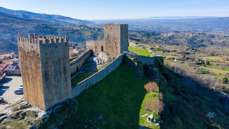
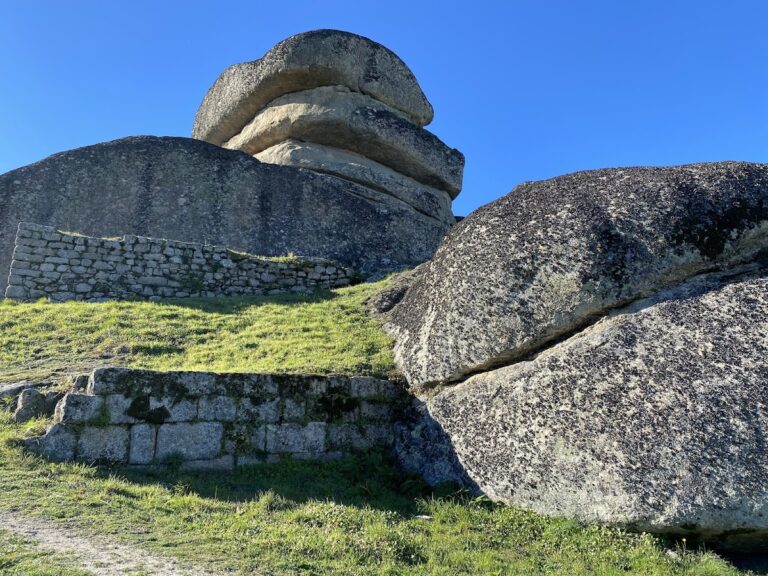
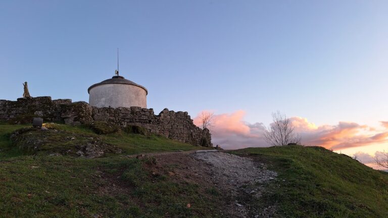
Built on a granite hill at approximately 550 metres above sea level, at the foot of the Serra da Estrela, the castle occupies a commanding position above the town and the Mondego River. Its surviving fortified enclosure defines the citadel. The walls form an irregular oval plan and are reinforced on the west by two projecting turrets, or cubelos, attached to the outer face of the fortification.
Gates and wall-walk
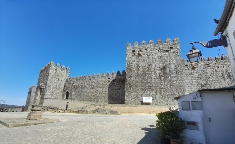
A wall-walk, a protected passage along the top of a defensive wall, survives with its access stairs. Two gates connect the castle with the historic part of the town. The principal gate stands on the south side, while the Porta da Traição is positioned on the west. Both entrances have pointed arches, pointed barrel vaults, and stone sockets for their hinges.
Western turrets
The two western cubelos have different irregular plans. One is quadrangular and the other trapezoidal. Their external attachment to the wall strengthens the western side of the citadel and distinguishes these structures from the continuous enclosure around them.
The surviving tower
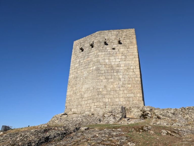
A quadrangular tower stands at the southeastern angle of the citadel and is now called the keep. It has three levels, a low hipped roof sloping on four sides, crenellations, and gargoyles. Its principal elevation faces south. The second level is reached through a straight-headed doorway topped by a pointed relieving arch, which redistributes the weight of the masonry above the opening. Wooden floors and stairs survive inside.
The identity of this tower remains debated. Some interpretations regard it as the original keep because of its position and constructional characteristics. Others identify the original keep as a different tower that stood at the center of the parade ground above the cistern and was demolished during the nineteenth century.
Water supply and associated structures
The castle formerly contained barracks, a cistern, and an aqueduct. These installations were connected by the passageway to the Poço d’El Rei, probably constructed during the Manueline period and demolished in 1857. The surviving citadel therefore preserves part of a larger defensive and service complex whose structures were altered or dismantled over time.
The former town defenses
The town’s defensive enclosure was distinct from the walls of the castle. The Clock Tower is the surviving structure associated with that urban circuit, while the castle enclosure remains the principal fortified group on the granite hill.