Philippopolis: A Roman Colonia in Southern Syria


Visitor Information
Google Rating: 4.6
Popularity: Very Low
Google Maps: View on Google Maps
Country: Syria
Civilization: Byzantine, Roman
Remains: City

History
Philippopolis is located in the modern As-Suwayda Governorate of southern Syria, approximately 87 kilometers south of Damascus. The site was originally a small settlement in the Roman province of Arabia Petraea. It gained prominence during the mid-3rd century CE when it became the native village of Philip the Arab, who rose to the Roman imperial throne in 244 CE.
Following his accession, Emperor Philip initiated the transformation of this modest village into a Roman colonia, a type of city granted special status within the empire. The settlement was renamed Philippopolis in his honor. Scholars believe the city was largely built on undeveloped land, making it the last Roman city founded in the eastern provinces. Philip reportedly intended Philippopolis to resemble Rome itself, aiming to replicate its urban design.
The city served as a Christian bishopric from around 300 CE, subordinate to the metropolitan see of Bostra. Two bishops from Philippopolis are historically recorded: Hormisdas, who attended the Council of Chalcedon in 451 CE, and Basil, who participated in the Second Council of Constantinople in 553 CE. The city is listed in the 6th-century Byzantine ecclesiastical records known as the Notitiae Episcopatuum.
After Emperor Philip’s death in 249 CE, construction in Philippopolis abruptly stopped, leaving the city incomplete. During the Ottoman period, the site was recorded in 1596 as Sahba, a small Muslim village with only a few households paying taxes on agriculture and livestock. In the 18th century, Druze migrants from Mount Lebanon settled in the area, while a Christian community also remained present.
Philippopolis continued to hold religious significance as a Latin titular see, with a succession of titular bishops and archbishops documented from the 17th century through the 20th century. Archaeological excavations have revealed well-preserved Roman ruins, and notable mosaics from the site are displayed in museums, including a richly decorated mosaic called “The Glory of the Earth,” discovered in 1952.
Remains
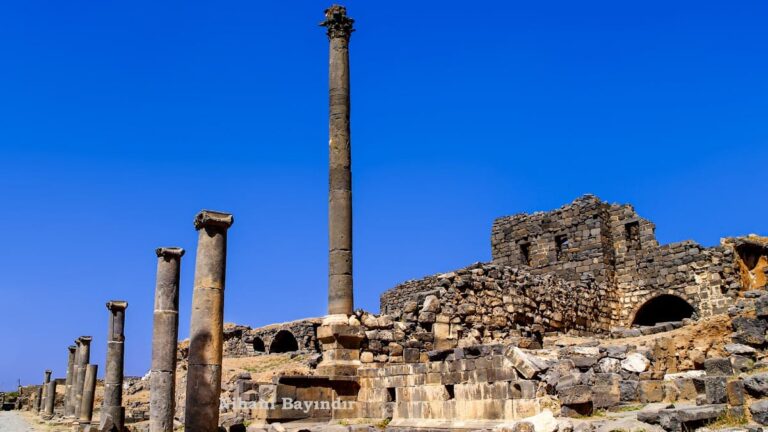
Philippopolis was laid out following a Roman grid plan, featuring two main streets: the Cardo Maximus running north-south and the Decumanus Maximus running east-west. These colonnaded streets intersected near the city center, dividing the urban area into blocks called insulae. Many of these blocks remained undeveloped, reflecting the city’s incomplete status.
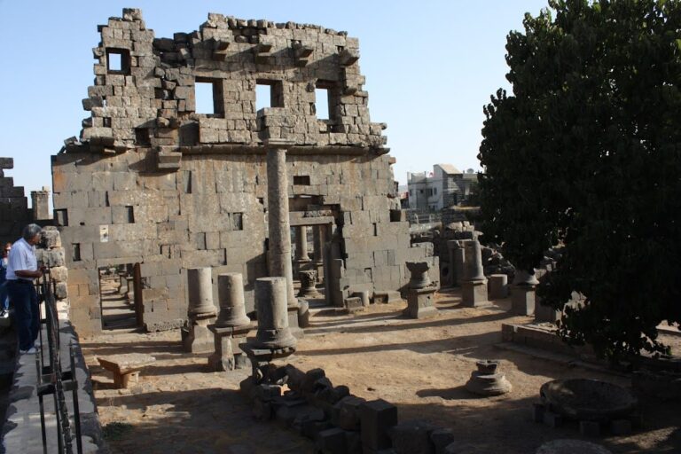
Key public buildings include a hexagonal temple and a kalybe, an open-air sanctuary built in a local architectural style. A triumphal arch and a large basilica-like structure also form part of the monumental core. The theatre, constructed with basalt blocks, is austere and lacks ornamental decoration. These public buildings create an “imported façade” that contrasts with the simpler, vernacular style of the surrounding urban fabric.
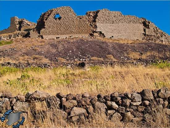
The Philippeion, a ceremonial complex enclosed by a large wall with formal gates, is another significant feature. Construction materials primarily consist of basalt blocks, sourced locally. Due to the city’s remote location, some cut stones were likely reused from abandoned structures within Philippopolis itself.
The ruins are well preserved, benefiting from the site’s isolation. Nearby stands a Roman bridge at Nimreh, which remains relatively intact. Archaeological finds include richly iconographic mosaics, altars, and inscriptions. One notable mosaic, “The Glory of the Earth,” was discovered in a house known as “Maison Aoua” and is now housed in the Damascus museum.