Zamek w Zabrzeży: A Medieval Castle in Poland


Visitor Information
Google Rating: 3.4
Popularity: Very Low
Google Maps: View on Google Maps
Country: Poland
Civilization: Unclassified
Remains: Military

History
Zamek w Zabrzeży is located in the village of Zabrzeż, within the modern territory of Poland. The castle was erected during the 13th century by medieval builders on the site of an earlier fortified settlement linked to the Lusatian culture, an Iron Age community that preceded medieval occupation in this region.
The village of Zabrzeż itself appears in written records from 1312. At that time, Anna, who served as abbess of the Poor Clares monastery in Stary Sącz, reinstated the local lordship, known as sołtysship, to Klemens, son of Swarcon. Klemens had originally received this lordship from Saint Kinga, the wife of Duke Bolesław the Chaste, indicating a connection between religious institutions and secular governance in the area. Later, in 1358, another abbess named Konstancja, also of the Poor Clares in Stary Sącz, sold the sołtysship of Zabrzeż together with the nearby hamlet of Boczów to three brothers—Paweł, Piotr, and Jan—for a sum of ten grzywnas, a medieval currency.
During the Middle Ages, the position of sołtys typically belonged to a nobleman who managed the village’s affairs. It is believed that the knights acting as sołtys of Zabrzeż may have lived in the castle perched on Babia Góra, although no direct evidence confirms this assumption. The castle’s presence suggests a center for local defense and administration, closely tied to the feudal and ecclesiastical authorities operating in the region.
The castle’s destruction remains undated and undocumented in surviving records, but archaeological excavations have uncovered signs of a fire that consumed wooden structures within the site. Oral histories collected in the mid-20th century recall that fragments of the castle walls were still visible on Babia Góra before the outbreak of World War I, indicating a gradual decay rather than sudden obliteration.
In the nearby hamlet of Boczów, remnants of a smaller fortification have been found on the Czubań promontory overlooking the Dunajec valley. This defensive enclosure, roughly eight meters in diameter and surrounded by a ditch, has no precise date of construction, but its strategic location points to local efforts to monitor or control the river valley.
Some scholars have proposed that the castle on Babia Góra might be the same site as the Lemiesz Castle mentioned in the 14th-century “Life of Saint Kinga,” a historical account of the saint’s life. Though this identification is debated, it underscores the castle’s potential significance within regional medieval narratives and religious traditions.
Remains
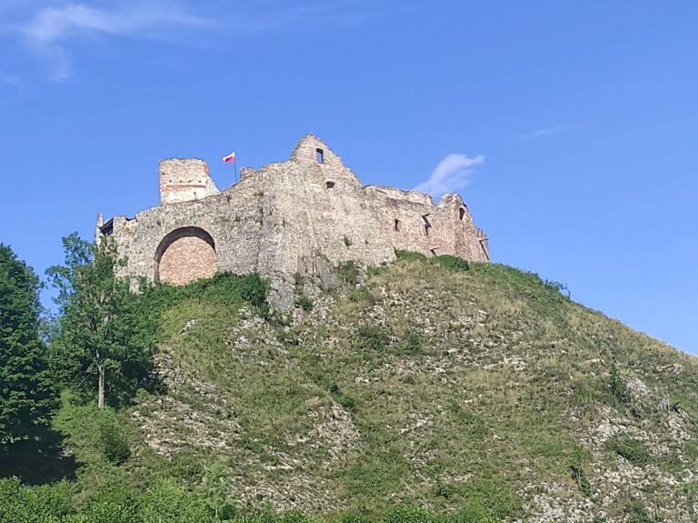
The castle on Babia Góra occupied a strategic position near the confluence of the Kamienica and Dunajec rivers, about 84 meters above the valley floor, giving it a commanding view of the surrounding landscape. Its layout was roughly circular, with a diameter estimated at thirty meters, indicating a compact and defensible plan common in medieval hilltop fortifications.
Surrounding the site was a dry moat, a trench dug around the castle to hinder attackers, and a stone wall built up to 3.5 meters thick. The thickness of the wall suggests a strong defensive purpose, constructed using masonry techniques available in the 13th century. Within the castle, archaeological investigations have revealed evidence of fire damage affecting wooden buildings, which aligns with historical suggestions of destruction by fire.
Today, the remains of the castle are limited to traces of the deep dry moat, which still mark the outline of the fortification. Before World War I, some fragments of the castle walls could still be seen above ground, but no significant masonry stands today, highlighting the gradual deterioration over the centuries.
In addition to the castle itself, the nearby fortification at Boczów presents a smaller and simpler defensive structure. This feature consists of a circular enclosure about eight meters in diameter, surrounded by a ditch that separates it from the edge of the cliff overlooking the Dunajec valley. The purpose and date of this fortification remain uncertain, but its form suggests it was designed to provide protection or serve as a lookout point in a strategically valuable location.
Together, these archaeological features underscore the medieval landscape’s defensive arrangements, reflecting the importance of controlling river routes and the surrounding terrain during the period of the castle’s use.
Nearby sites